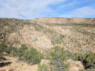
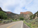
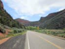
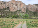
 Eastern Mojave Vegetation
Tom Schweich
|
Eastern Mojave Vegetation
| Colorado State Highway 141 |
|
Tom Schweich |

|
State Highway 141 (SH 141) is a 162.297 mi (261.192 km) long state highway in far western Colorado, United States. Though nominally oriented north–south, SH 141 winds around a considerable amount due to the rugged terrain and ultimately forms a giant S shape. SH 141's southern terminus is at U.S. Route 491 (US 491) near Dove Creek, and the northern terminus is at Interstate 70 Business (I-70 Bus.) in Grand Junction. SH 141 is the longest three-digit state highway in Colorado. | ||||||
|
Other articles:
|
Junction: I-70 Business, US highway 6 | ||||||
|
Other articles:
|
Junction: US Highway 50, west into Grand Junction. | ||||||
|
|
Whitewater | ||||||
|
Other articles:
|
Junction: US Highway 50, east to Pueblo. | ||||||
|
Desert Road | |||||||
|
Coffman Road | |||||||
|
Foster Lane | |||||||
|
Railroad | |||||||
|
Cross the Gunnison River. | |||||||
|
Locations: Unaweep Canyon. |
Enter Unaweep Canyon. | ||||||
|
Other articles:
Locations: North East Creek. |
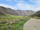
North East Creek, across the canyon.
| ||||||
|
Other articles:
|
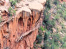
Unnamed rock fin.
| ||||||
|
Other articles:
|
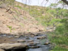
Pretty spot along the road. Not too far from the unnmed fin.
| ||||||
|
Other articles:
Locations: Unaweep Divide. |
Cross Unaweep Divide.
| ||||||
|
Other articles:
Locations: Thimble Rock Point. |
Thimble Rock
| ||||||
|
Other articles:
Locations: Driggs Mansion. |
Driggs Mansion
| ||||||
|
Locations: Unaweep Seep Interpretive Area. |
Unaweep Seep Natural Area Somehow I just drove right past it without seeing it. | ||||||
|
Other articles:
|
West Creek Day Use Site.
| ||||||
|
Other articles:
|
Junction: 4 2/10 Road, west along the north bank of the Dolores River. | ||||||
|
Other articles:
Locations: Gateway. |
Gateway
| ||||||
|
Locations: Dolores River. |
Cross the Dolores River. | ||||||
|
Other articles:
|
Junction: 4 1/10 Road, west along the south bank of the Dolores River. | ||||||
|
Other articles:
|
| ||||||
|
Other articles:
|
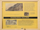
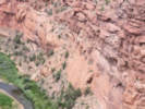
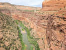
Hanging Flume Overlook | ||||||
|
About half way from Gateway to Naturita the Dolores River enters from the southwest. Colorado State Hoghway follows the San Miguel River from here to Naturita. Colorado Highway 141 will re-cross the Dolores River again at the Slick Rock Bridge. | |||||||
|
Other articles:
|
UravanUravan (a contraction of uranium/vanadium) is a former uranium mining town in western Montrose County, Colorado, United States, which still appears on some maps. The town was a company town established by U. S. Vanadium Corporation in 1936 to extract the rich vanadium ore in the region. As a byproduct of vanadium extraction, small amounts of uranium were also produced, at the time mostly used as a yellow pigment for ceramics.
| ||||||
|
Other articles:
|
Junction: Colorado State Highway 90, west to La Sal, and US Highway 191. | ||||||
|
Other articles:
Locations: Naturita. |
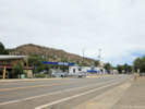
Naturita
| ||||||
|
Other articles:
Locations: Maverick Draw. |
Junction: Colorado State Highway 145, to Telluride and Cortez. | ||||||
|
|
Slick RockBridge over the Dolores River. An old, mostly abandoned mining area (?) | ||||||
|
|
Egnar | ||||||
|
Other articles:
|
Junction: US Highway 491
|
If you have a question or a comment you may write to me at:
tomas@schweich.com
I sometimes post interesting questions in my FAQ, but I never disclose your full name or address.
|
|
Date and time this article was prepared: 10/2/2026 12:41:26 PM |