 Eastern Mojave Vegetation
|
Eastern Mojave Vegetation
| Grand Mesa, Delta County, Colorado. |
|
Gazetteer Query: G.N.I.S. |
||||
|
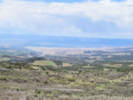
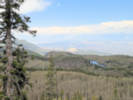
The Grand Mesa is a large mesa in western Colorado in the United States. It is the largest flat-topped mountain in the world.
It has an area of about 500 square miles (1,300 km2) and stretches for about 40 miles (60 km) east of Grand Junction between the Colorado River and the Gunnison River, its tributary to the south.
The north side of the mesa is drained largely by Plateau Creek, a smaller tributary of the Colorado.
The west side is drained largely by Kannah Creek, which is received to the west by the lower Gunnison River.
The mesa rises about 6,000 feet (1,800 m) above the surrounding river valleys, including the Grand Valley to the west.
It reaches an elevation of about 11,000 feet (3,400 m) above sea level.
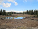
Much of the mesa is within Grand Mesa National Forest. Over 300 lakes, including many reservoirs created and used for drinking and irrigation water, are scattered along the top of the formation.
The Grand Mesa is flat in some areas, but quite rugged in others.
Articles that refer to this location:
| ||||
| No collections made at this location. | ||||
| If you have a question or a comment you may write to me at: tomas@schweich.com I sometimes post interesting questions in my FAQ, but I never disclose your full name or address. |
A, B, C,
D, E, F,
G, H, I,
J, K, L,
M, Date and time this article was prepared:12:56:18 PM, 10/2/2026. | |||