Eastern Mojave Vegetation Summit of the Original South Pass, Fremont County, Wyoming.
 
Gazetteer

Query: G.N.I.S.

See also: South Pass.


Elevation: 7408ft, 2258m.

Articles that refer to this location:


Literature Referring To This Location:

  • Tyrrell, Pat. n. d.. Major Reservoir Information. Green River Basin Water Plan. Cheyenne, WY: Wyoming Water Development Office, no date. {TAS-pdf} Date retrieved: 28 Sept 2018, http://waterplan.state.wy.us/plan/green/techmemos/reservoir.html

Full Size Image
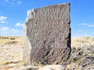
Marker at South Pass.
Full Size Image
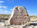
Marker for Old Oregon Trail.
Full Size Image
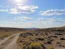
The view west.
Full Size Image
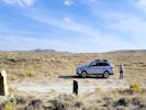
The view east
Full Size Image
A ditch carries Sweetwater River water across the continental divide.
Full Size Image
South Pass
Full Size Image
Interpretive panel for South Pass.
Full Size Image
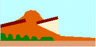
How water gets diverted from the Sweetwater River.

No collections made at this location.
If you have a question or a comment you may write to me at: tomas@schweich.com I sometimes post interesting questions in my FAQ, but I never disclose your full name or address.  


A, B, C, D, E, F, G, H, I, J, K, L, M,
N, O, P, Q, R, S, T, U, V, W, X, Y, Z


[Home Page] [Site Map]

Date and time this article was prepared:3:15:35 PM, 8/1/2026.