Eastern Mojave Vegetation 
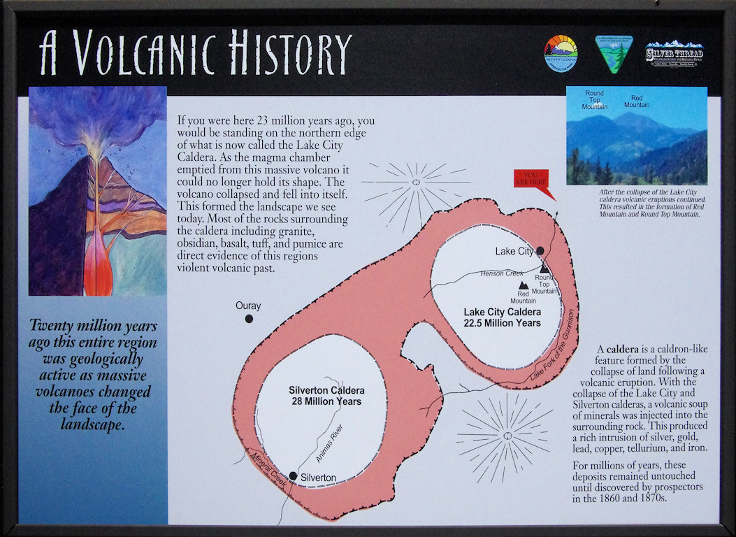
Interpretive panel for Lake City Caldera  


Home Page
If you have a question or a comment about this photograph you may write to me at: tas4@schweich.com I sometimes post interesting questions in my FAQ, but I never disclose your full name or address.
  Colorado, Hinsdale County, Lake City
Photographed 18 September 2017.

A Volcanic History

Twenty million years ago this entire region was geologically active as massive volcanoes changed the face of the landscape.

If you were here 23 million years ago, you would be standing on the northern edge of that is now called the Lake City Caldera. As the magma chamber emptied from this massive volcano it could no longer hold its shape. The volcano collapsed and fell into itself. This formed the landscape we see today. Most of the rocks surrounding the caldera including granite, obsidian, basalt, tuff and pumice are direct evidence of this region's violent volcanic past.

A caldera is a caldron-like feature formed by the collapse of land following a volcanic eruption. With the collapse of the Lake City and Silverton calderas, a volcanic soup of minerals was injected into the surrounding rock. This produced a rich intrusion of silver, gold, lead, copper, tellurium, and iron. For millions of years, these deposits remained untouched until discovered by prospectors in the 1860s and 1870s.

Location records that use this photograph:

Article records that use this photograph:

Other photos about Geography - Hinsdale County, CO or Lake City.


[Home Page]

Date and time this page was prepared: 4/27/2024 3:34:44 PM