Eastern Mojave Vegetation
Tom Schweich
|
Eastern Mojave Vegetation
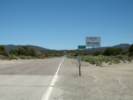
| California Highway 167 |
|
Tom Schweich |

|
California Highway 167 is also known as Pole Line Road. | |||
|
Other articles:
|
Junction: U. S. Highway 395, south to Lee Vining, or north to Bridgeport. | |||
|
Other articles:
|
Junction:
| |||
|
Other articles:
|
Junction: Goat Ranch Cutoff | |||
|
Locations: Wilson Creek. |
Crossing Wilson Creek. | |||
|
Other articles:
|
Junction: Conway Ranch Road | |||
|
Other articles:
|
| |||
|
Other articles:
|
||||
|
Other articles:
|
Junction: Cemetery Road | |||
|
Literature Cited:
Locations: Rancheria Gulch. |
Crossing Rancheria Gulch. The upper portions of Rancheria Gulch are included within Messick's (1982) flora of the Bodie Hills. | |||
|
Other articles:
|
Junction: Forest Road 03N09 “No. Mono Gravel Pit” | |||
|
Other articles:
|
Junction: Cottonwood Canyon Road, to Bodie, | |||
|
Other articles:
|
Junction: Forest Road 03N47 “Waford Springs Cutoff” | |||
|
Other articles:
|
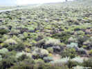
Junction: Forest Road 3N05, to the south gives access to the shore of Mono Lake and the sand dunes. | |||
|
Literature Cited:
Locations: Mono Dunes. |
There are sand dunes on both the north and south sides of California Highway 167 for several miles. A description of the Mono Dunes studied by Pavlik (1985) suggests that he studied the dunes to the north. | |||
|
Other articles:
|
Junction: Forest Road 01N54 “East Shore Road” | |||
|
Other articles:
|
Junction: Forest Road 03N103
| |||
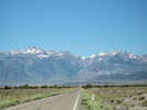
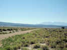
 Looking northwest on Dobie Meadows Road Looking northwest on Dobie Meadows Road
|
||||
|
Other articles:
|
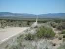
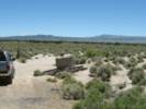
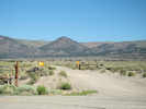
Junction: Dobie Meadows Road, northwest along the base of the Bodie Hills, or southeast and south across Mono Valley to the Adobe Hills Spillway. Caution: this road can be very sandy. | |||
 Looking southeast on Dobie Meadows Road Looking southeast on Dobie Meadows Road
|
||||
|
Other articles:
|
||||
|
Other articles:
Locations:
Cedar Hill.
|
||||
|
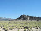
Locations: Cedar Hill. |
Cedar Hill to the north. 3,748 acres of land around Cedar Hill were acquired by the Wilderness Land Trust from developer Mel Arthur in in March 2006. The land will be transferred into public ownership under the jurisdiction of the BLM. | |||
|
Literature Cited:
Other articles:
|
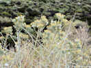
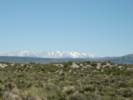
"There is a remarkable stand of Utah juniper east of Mono Lake near the Nevada border. The stand has very little single leaf pinyon, and the Utah juniper trees are very large and have the appearance of very old trees. The stand is growing on wind-eroded volcanic tephra sand with little understory herbaceous vegetation, which may contribute to making the location a fire safe site (Barbour, et al., 2007)." | |||
|
Other articles:
|
||||
|
Literature Cited:
Other articles:
|
Nevada State LineJunction: Nevada State Route 359 | |||
| If you have a question or a comment you may write to me at: tomas@schweich.com I sometimes post interesting questions in my FAQ, but I never disclose your full name or address. |
Date and time this article was prepared: 4/21/2025 8:14:26 PM |