Eastern Mojave Vegetation
Tom Schweich
|
Eastern Mojave Vegetation
| Frequently Asked Questions |
|
Tom Schweich |

Topics in this Article: Geography Geology Botany Gardens Animals Archeology Culture History Highways and Roads Mojave National Preserve and Other Parks Eastern Mojave Vegetation Web Site Politics Literature Cited |
Here are the common questions that I have received through my eastern Mojave Website, and my answers thereto. | |||||||||||||||||||||||||||||||||||||||||||||||||||||||||||||||||||||||||||||||||||||||||||||||||||||||||||||||||||||||||||||||||||||||||||||||||||||||||||||||||||||||||||||||||||||||||||||||||||||||||||||||||||||||||||||||||||||||||||||||||||||||||||||||||||||||||||||||||||||||||||||||||||||||||||||||||||||||||||||||||||||||||||||||||||||||||||||||||||||||||||||||||||||||||||||||||||||||||||||||||||||||||||||||||||||||||||||||||||||||||||||||||||||||||
|
Q: Why won't you answer my email?
A: I try to answer everything I can. But there are some times when my reply may be delayed, or I may not reply at all. Sometimes I don't answer right away. I may be travelling. When travelling, I may not have access to email for a few days. Or, I may need to look at one of my reference books to answer your question. If your question sounds like you're looking for someone to do your homework for you, I may not answer. Try to do your homework first and then, if you still have questions, send me a question that is written in a way to show your thoughtfulness. Finally, I may not answer your question, if you don't supply a simple email address. For example, I won't register for Google+ and join your Circle to answer your question. Nor will I register for an account on your favorite social media application, or reply to your spam filter, to send you a reply. So, if you'd like a reply, send me an answerable question, with a real SMTP reply address. | ||||||||||||||||||||||||||||||||||||||||||||||||||||||||||||||||||||||||||||||||||||||||||||||||||||||||||||||||||||||||||||||||||||||||||||||||||||||||||||||||||||||||||||||||||||||||||||||||||||||||||||||||||||||||||||||||||||||||||||||||||||||||||||||||||||||||||||||||||||||||||||||||||||||||||||||||||||||||||||||||||||||||||||||||||||||||||||||||||||||||||||||||||||||||||||||||||||||||||||||||||||||||||||||||||||||||||||||||||||||||||||||||||||||||||
|
|
Geography | |||||||||||||||||||||||||||||||||||||||||||||||||||||||||||||||||||||||||||||||||||||||||||||||||||||||||||||||||||||||||||||||||||||||||||||||||||||||||||||||||||||||||||||||||||||||||||||||||||||||||||||||||||||||||||||||||||||||||||||||||||||||||||||||||||||||||||||||||||||||||||||||||||||||||||||||||||||||||||||||||||||||||||||||||||||||||||||||||||||||||||||||||||||||||||||||||||||||||||||||||||||||||||||||||||||||||||||||||||||||||||||||||||||||||
|
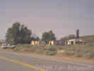
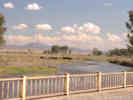
Q: A friend and I are currently in the process of walking across the country. We started in Jacksonville, FL in October, and are now in Flagstaff, AZ. I was doing some internet research about our planned route, mostly for information about where we can expect to find water, and came across your website. We are planning to through Kingman and Bullhead City, AZ, then to Laughlin, NV, and then over to Goffs, CA. I was wondering if you had any info about the route from Laughlin to Goffs. Mapquest lists a few towns along what I guess is Goffs Rd-- Arrowhead Junction, Bannock, and Homer. Do you know if these towns actually exist, in the sense that we can count on getting water there? And even Goffs-- is that a dependable water source? We were then planning to head down to Fenner and Essex. Can we expect to find water in those towns? Sorry to bombard you with all of these questions; any help would be greatly appreciated. I'll be in Flagstaff and able to check email for the next few days, so if you could get back to me soon that would be great. You can check out our website at http://www.amer-i-can.com, if you're interested in our walk. Gidon
A: Following is a map of all the places I know water can be obtained in the eastern Mojave between Laughlin and Barstow.
| ||||||||||||||||||||||||||||||||||||||||||||||||||||||||||||||||||||||||||||||||||||||||||||||||||||||||||||||||||||||||||||||||||||||||||||||||||||||||||||||||||||||||||||||||||||||||||||||||||||||||||||||||||||||||||||||||||||||||||||||||||||||||||||||||||||||||||||||||||||||||||||||||||||||||||||||||||||||||||||||||||||||||||||||||||||||||||||||||||||||||||||||||||||||||||||||||||||||||||||||||||||||||||||||||||||||||||||||||||||||||||||||||||||||||||
|
Q: Do u have any old spanish bull ranch pictures? (Oliver, 23-Jun-03)
A: No, I'm sorry I don't. | ||||||||||||||||||||||||||||||||||||||||||||||||||||||||||||||||||||||||||||||||||||||||||||||||||||||||||||||||||||||||||||||||||||||||||||||||||||||||||||||||||||||||||||||||||||||||||||||||||||||||||||||||||||||||||||||||||||||||||||||||||||||||||||||||||||||||||||||||||||||||||||||||||||||||||||||||||||||||||||||||||||||||||||||||||||||||||||||||||||||||||||||||||||||||||||||||||||||||||||||||||||||||||||||||||||||||||||||||||||||||||||||||||||||||||
|
|
Driving In SpainQ: One more question about the roads in Spain. Are they well kept and fairly easy to drive?A: Anything in red or yellow on the Michelin map are excellent roads. Solid whites are also usually fine. Exercise caution or bravery, as you prefer, for the dashes and dots. | |||||||||||||||||||||||||||||||||||||||||||||||||||||||||||||||||||||||||||||||||||||||||||||||||||||||||||||||||||||||||||||||||||||||||||||||||||||||||||||||||||||||||||||||||||||||||||||||||||||||||||||||||||||||||||||||||||||||||||||||||||||||||||||||||||||||||||||||||||||||||||||||||||||||||||||||||||||||||||||||||||||||||||||||||||||||||||||||||||||||||||||||||||||||||||||||||||||||||||||||||||||||||||||||||||||||||||||||||||||||||||||||||||||||||
|
Q: My only suggestion: don't drive in Seville, Madrid, Barcelona or Toledo. Fabulous cities, amazing driving! (John, 28-Jun-03) A: You have to drive like you mean it. No hesitation or pussyfootin' allowed. | ||||||||||||||||||||||||||||||||||||||||||||||||||||||||||||||||||||||||||||||||||||||||||||||||||||||||||||||||||||||||||||||||||||||||||||||||||||||||||||||||||||||||||||||||||||||||||||||||||||||||||||||||||||||||||||||||||||||||||||||||||||||||||||||||||||||||||||||||||||||||||||||||||||||||||||||||||||||||||||||||||||||||||||||||||||||||||||||||||||||||||||||||||||||||||||||||||||||||||||||||||||||||||||||||||||||||||||||||||||||||||||||||||||||||||
|
Locations: Almaden. |
Almaden | |||||||||||||||||||||||||||||||||||||||||||||||||||||||||||||||||||||||||||||||||||||||||||||||||||||||||||||||||||||||||||||||||||||||||||||||||||||||||||||||||||||||||||||||||||||||||||||||||||||||||||||||||||||||||||||||||||||||||||||||||||||||||||||||||||||||||||||||||||||||||||||||||||||||||||||||||||||||||||||||||||||||||||||||||||||||||||||||||||||||||||||||||||||||||||||||||||||||||||||||||||||||||||||||||||||||||||||||||||||||||||||||||||||||||
|
Locations:
Rio Tinto.
|
Q: I've just read your trip report and was particuarly interested in your visit to the Rio Tinto mines and museum. A couple of days ago I did a web search for the Mines of Almaden after watching a TV program about it and it led me to one of your earlier reports which was also greatly interesting. The TV program suggested the Almaden mine has its own museum and we thought we would perhaps plan a trip that included it this autumn. (Sue, 5/21/2003)
A: Sue, We were in Almaden on a Monday in February. There was no one around, and all the gates were locked. I think I found the place of the museum, but couldn't see much through the cracks in the gate. There is also a small museum at the University. They were a little bewildered when I walked in and asked to see it, but the receptionist grabbed a student out of the library, handed him the key, and instructed him to conduct me to the museum. They have a few artifacts and historic maps of the mines of Almaden, as well as a photo of a man taking a bath in a vat of mercury. | |||||||||||||||||||||||||||||||||||||||||||||||||||||||||||||||||||||||||||||||||||||||||||||||||||||||||||||||||||||||||||||||||||||||||||||||||||||||||||||||||||||||||||||||||||||||||||||||||||||||||||||||||||||||||||||||||||||||||||||||||||||||||||||||||||||||||||||||||||||||||||||||||||||||||||||||||||||||||||||||||||||||||||||||||||||||||||||||||||||||||||||||||||||||||||||||||||||||||||||||||||||||||||||||||||||||||||||||||||||||||||||||||||||||||
|
Locations:
Almaden.
Almaden.
|
Q: I was pleased to find your photos of Almaden on the internet. I was raised in New Almaden, CA. I moved there in 1944 while the mines were still active for WW2. I and my family left Almaden in 1979. I have a good knowledge of the Almaden history. I and my wife are planning a trip to Spain within the next year and we will definitely tour Almaden Spain. It would be of great help to us to know what months are similar in weather as the central Calif. area from Jan. to May. The photo of the area between Almaden Spain and Guadalupe looks like the same area in
Calif. during the above mentioned time frame. Any help that you can provide for our upcoming trip would be greatly appreciated. If I can be of any help with the history of Almaden Calif. feel free to inquire. A: I was in Almaden once in late February, so it's difficult for me to generalize to the entire year. Southern Spain is roughly the same latitude as northern California. For example, Sevilla is about the same latitude as San Francisco. The climate, though, is more like we would find in Sacramento and Redding, i.e., 10° to 15° F. warmer. Were I to return there, I think I would go in March or April, but I would expect May would be getting pretty hot and dry. I would plan to be there later in the week, not Monday, in hopes that the mine museum would be open. I don't think that I would plan to spend more than a half day in Almaden. But I might plan to slowly tour the area south, between Cordoba and Almaden, and northwest, from Almaden to Siruela to Guadalupe. HTH. | |||||||||||||||||||||||||||||||||||||||||||||||||||||||||||||||||||||||||||||||||||||||||||||||||||||||||||||||||||||||||||||||||||||||||||||||||||||||||||||||||||||||||||||||||||||||||||||||||||||||||||||||||||||||||||||||||||||||||||||||||||||||||||||||||||||||||||||||||||||||||||||||||||||||||||||||||||||||||||||||||||||||||||||||||||||||||||||||||||||||||||||||||||||||||||||||||||||||||||||||||||||||||||||||||||||||||||||||||||||||||||||||||||||||||
|
|
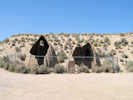
Area 51 | |||||||||||||||||||||||||||||||||||||||||||||||||||||||||||||||||||||||||||||||||||||||||||||||||||||||||||||||||||||||||||||||||||||||||||||||||||||||||||||||||||||||||||||||||||||||||||||||||||||||||||||||||||||||||||||||||||||||||||||||||||||||||||||||||||||||||||||||||||||||||||||||||||||||||||||||||||||||||||||||||||||||||||||||||||||||||||||||||||||||||||||||||||||||||||||||||||||||||||||||||||||||||||||||||||||||||||||||||||||||||||||||||||||||||
|
Q: I can't find a map that shows me where "Groom Lake" is or the "papoose Lake bed". The last might not be spelled correctly. Can you help? (Larry or Hubert, 1-Jul-03) A: I think both Groom Lake and Papoose Lake are in what is also called Area 51. Did you try searching Google for them? QQ: Thanks for the reply and yes they are in area 51......but...google has no maps show the mountains or lakes in that area. On the oposite side of area 51 is a military instalization called "S4" on a sand lake bed at the foot on some mountains. Maybe I'll try National Geographic for maps. Thanks again. You may be interested to know that one photo on your site, taken in 2000, shows a UFO. ( when magnified 800 times.) Here's your original photo, the color enhanced photo, and the enlargemant showing the UFO. You can match the pixels in each photo to see none were altered to add a phoney object. Interesting? The other white object appears to the left, has no shape to it and may be dust on the negative. AA: Uh-huh. | ||||||||||||||||||||||||||||||||||||||||||||||||||||||||||||||||||||||||||||||||||||||||||||||||||||||||||||||||||||||||||||||||||||||||||||||||||||||||||||||||||||||||||||||||||||||||||||||||||||||||||||||||||||||||||||||||||||||||||||||||||||||||||||||||||||||||||||||||||||||||||||||||||||||||||||||||||||||||||||||||||||||||||||||||||||||||||||||||||||||||||||||||||||||||||||||||||||||||||||||||||||||||||||||||||||||||||||||||||||||||||||||||||||||||||
|
Other articles:
|
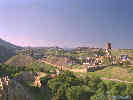
La Alpujarra | |||||||||||||||||||||||||||||||||||||||||||||||||||||||||||||||||||||||||||||||||||||||||||||||||||||||||||||||||||||||||||||||||||||||||||||||||||||||||||||||||||||||||||||||||||||||||||||||||||||||||||||||||||||||||||||||||||||||||||||||||||||||||||||||||||||||||||||||||||||||||||||||||||||||||||||||||||||||||||||||||||||||||||||||||||||||||||||||||||||||||||||||||||||||||||||||||||||||||||||||||||||||||||||||||||||||||||||||||||||||||||||||||||||||||
|
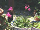
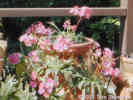
Subject: Photos of La Alpujarra
Dear Jesus, I liked your photos of la Alpujarra. We visited the area in April, and very much enjoyed our stay. I have a commitment to prepare a talk for the University of California at Berkeley Department of Botany about the Spanish countryside and plants. One of your photographs is a nice example of how plants are used for color and to provide shade for a terrace. It is: http://www.geocities.com/jesusramosmartin/alpu2.jpg I wonder if I may use your photograph in my talk, assuming that I will give full credit and copyright to you? A: Dear Tom, Thanks for your interest in my pictures. I do have many more but not uploaded, lack of time I guess. Of course you can make use of the pictures and every content there. My parents are from Almegijar (close to Trevelez) in La Alpujarra, and I feel so atteched to the place that I must go there every year, even though I am from Barcelona. I've seen your wonderful webpage and I felt very proud that you liked our country so much. Spain, and Granada and La Alpujarra are an example, is full of a misterious history that enchants many people. Anyway, talking about the plants, these are "Geranios" which as you say are there for colour. The other one used for shade is usually one variety of grape, so in late august /september you enjoy both grapes and shade, wonderful. We always need this kind of tricks in a so dry place. Regards,
|
| Andalucia
|
Q: Where will be a good place to find a map that will show Andalucia in detail? (Carol, 30-Jun-04) | Michelin Map No. 446 Southern Spain, is available from Amazon.com for $11.95.
|
Other articles:
Locations: Black Canyon.
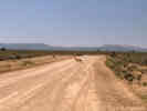
| Black CanyonQ: This may seem a little odd to you but I thought you might have some information on what I am looking for since you know the Black Canyon area. I am trying to find out if there is a federal women's prison camp in the area of Black Canyon that might still be under construction. I have been asked to try and locate some information on this site by a friend who has a relative soon to be incarcerated there. I have looked in the Federal Bureau of Prisons web site and they do not list anything that even comes close to being named that. If you know of or know where I can find information on this camp I would greatly appreciate it . If you have no idea what I am talking about I apologize for taking up your time. Tim, July 25, 1999.A: I know of 2 Black Canyons in the Mojave. One is northwest of Barstow, i.e., straight north of Hinkley. My experience with that area is only a short portion of the road from Copper City Road to the Grass Valley Route. So, there may be a prison south of there and north of Hinkley. There is a prison in the general area, that would be on Highway 395, just north of Kramer Junction. The other Black Canyon is in the eastern Mojave, runs past Hole-in-the-Wall, and I believe entirely within Mojave National Preserve. This road I've covered from end to and there is no prison. It's also possible that there are other Black Canyons, just like there are lots of Cedar Canyons, etc.
|
| Caruthers Canyon
|
Locations:
Caruthers Canyon.
Q: My last name is Caruthers. I've stumbled on your site, and was shocked to find a 'Caruthers Canyon'. I grew up in Redlands, am a graduate of San Berdoo Cal State (second class), even lived in the Coachella Valley for several years, but I never heard of it. Where in heavens is 'Caruthers Canyon'? | A: Caruthers Canyon is on the south side of the New York Mountains in Mojave National Preserve. By road, it is about 200 miles northeast of Redlands.
|
| Cholame
|
Locations:
Cholame.
Q: Thank you for posting this photograph of Cholame. Bill, 19-Mar-05.
|
|
Locations:
Capileira.
Q: Hi,I am "collecting" Cafe Europa, Kafe Europa, etc. all over the world. Where is your picture taken? Where is your Cafe Europa situated? I have been to Granada (city) but not Capileira. A good excuse to visit Alpujarras! What kind of cafe is it? traditional, fancy, small, big? Friendly, Kari 7-Mar-05 | A: The Cafe Europa in my photo is in Capileira, (Granada), Andalucia, Spain. The area is generally known as "the Alpujarras." There was a small street that seemed to be the commercial center of Capileira. Along this street were several tourist stores, such as a leather shop, Cafe Europa, a grocery store and the bank with an ATM. I would describe Cafe Europa as small with perhaps 10 tables inside, and perhaps another 8 tables outside when the weather was nice. You could buy coffee and ice cream or get a small meal. We only got coffee in the morning and ice cream once for dessert, preferring to eat at the Pizza place down the hill and Restaurant Alpuxarra at the top of the town. Cafe Europa also had some tourist supplies, such as maps and books about the Alpujarras. The owners were very nice, coming over quickly to take photos of the four of us when we got our cameras out. There was also a restaurant in Berkeley, California called Cafe Europa. It was small, maybe 8 tables, decorated in funky mediterranean stuff, and served very good food of the Greek/Morrocan fusion type. It's gone now, replaced by a restaurant called Zatar Ecletic Mediterranean Cuisine.
|
Other articles:
| Clark MountainQ: My friends and I are researching Clark Mountain because we want to find the stand of White Fir that we know to exist up there (as well as all the other unusual flora found in that area). I have records of 2 canyon names, but they aren't on any Topo that I can find.: Forsellesia Canyon and Fir Canyon. Are you aware of the location and possibly, the route to either Canyon or other ways that can find these trees. Thanks in advance. Kathi Ellsworth, May 21, 2001. A: Kathi, Q: Do you have the coordinates (at least) for Keany Pass Road for entry to Clark Mountain?? We have GPS. Thanks in advance. Kathi. A: Kathi, Hmmm no, don't have GPS coordinates, but get off of I-15 at Valley Wells, go north on Kingston Road to the power lines, about 8 miles, then turn east 5-6 miles on the power line road (Keany Pass Rd) to a road going south in a pretty large valley. Take this road south turning east. Just before Coliseum mine is a road heading south. Take this road as far up the mountain as you dare. Happy hunting! Q: Hi, Tom. Your directions to Clark Mountain are like all the others I have!!! :-) I have an order in to the Sierra Club Desert Peaks Section for their book, "Desert Peaks". I think it will give more precise details.
|
Other articles:
Locations:
Scotty's Castle.
| Q: What is Scotty's Castle address? Please return my e-mail. Thank you. (Francisco, 27-Jun-03)
A: I would be very surprised if Scotty's Castle had an address. Most locations, like cabins, ranches, and castles in the American West do not have addresses. But, if I were to write to someone there, I would write to:
On the other hand, if you are trying to find driving directions, here is a map: http://www.ziggy1.com/ays/dv/dvsc.htm Does this help? Let me know if you need more information. 17 March 2019: Wow! The above was written in 2003; how things have changed since then. I would now use GoogleMaps for a map of driving directions to Scotty's Castle. But, more important, Scotty's Castle is closed following a severe thinderstorm and flood on October 18, 2015. It is currently anticipated that Scotty's Castle will re-open in 2020. See the Park Service's web page at: https://www.nps.gov/deva/learn/historyculture/scottys-castle.htm
|
| Death Valley Mine
|
Literature Cited:
Other articles:
Locations: Death Valley Mine.
|
A: I visited the Death Valley Mine with Bob Reynolds of LSA Associates and Ted Weasma, NPS, as part of a field trip arranged for the Desert Research Symposium. If I remember correctly, Ted was interested in preserving the buildings for possible use as a field station (place for field trip participants to stay overnight). Any of the good photos I have of the area are published on my web site. I do have a few of the older publications such as Thompson's 1921 "Routes to Water" that of which I have republished portions. I plan to be out there first week of June to collect data at my plots. I'll take a look at the Death Valley Mine. I know Brown is a common name are you by any chance related to Bill Brown, owner of the Blue Rock mine?
AA: No known relation.
There are some other Browns in the area that might have some linkage.
My ancestry goes back to Blue Dimond, Kentucky. Robert
Other articles:
Locations:
Frenchman.
A: I think like you Frenchman is a place I've been through rather than stopped. I think last time, I was sandwiched in between a hay truck and a pack of Harley hogs. So, I'm afraid I have no information to add. Let me know what you find out. Yes, I agree there are lots of roads lonelier than US 50, US 6 is one. NV 375 is another. If you go thru the area again, try NV 722 as an alternate to US 50.
Locations:
Garlock.
A: Thank you for writing to me. I am always interested to hear from people who have lived in the little towns that I have visited. I have also heard from people who lived in Kelso, Barnwell, Death Valley Junction, and Baghdad(!). I would love to take an oral history from you, and then turn it into an article or a web site. Unfortunately, my time is limited, and if I don't stay focused on my eastern Mojave botanic research then I'll never get that done.
Perhaps it is something you could consider doing: writing down your memories, interviewing your family and friends, go back and visit the spots you remember, taking new photographs, saving any old photographs, and assembling it all into a scrap book or an article. Anyone can do it. The hardest part is just getting started.
Good luck, and thanks for writing.
Q: As teenager in the mid 1950's, I lived for a while down in Ridgecrest, CA. with Aunt and Uncle Chris and
Harry ___________ . Harry and I trucked bottled water weekly, to a lady living in what was the town of Garlock. I think, I still have some photo's of the old crinding wheel (sort of a small round sunken turntable affair). Do you know anything of this woman? Harry always referred to her as Grandma. If you have any info. please drop me a line.
A: Unfortunately, I haven't a clue who Grandma was. Years ago, mid-50's I guess, we would drive through Garlock on our way from Palmdale to Death Valley. More recently I've been there on a couple of geology field trips. Otherwise I know very little about the town. It's surprising how many people write to me who lived in, or knew someone who lived in, Garlock. Someone ought to put together a Garlock reunion site!
Other articles:
Locations:
Goodsprings.
A: What did you find? Was the Pioneer Saloon open?
AA: Tom, thanks for your response. I called Pioneer Saloon before we left and found it to be opened and welcoming. Chuck and I truly enjoyed the saloon and the story of the gambler that was shot, very interesting history and ambiance. We enjoyed our drive around Goodsprings. Your photos of Goodsprings truly depicted its rural nature. Everyone in the saloon recommended that we visit Sandy Valley if we are looking for property. We did and found the valley to be very beautiful and remote, but not for long. Andre.
Locations:
Hole-in-the-Wall.
A: There are many places called "Hole in the Wall," two in Arizona, two in California, 1 in Nevada, and three in Utah. The Hole in the Wall mentioned on my web site is in Mojave National Preserve in southeastern California. You can check this yourself and obtain maps at:
Locations:
Kelso.
A: It was a pleasant surprise to hear from you. You're right the boards are off the windows, but they have been replaced by plexiglass. One of the priorities that the Park Service determined in public hearings was preservation of the depot with possible future use as a park headquarters.
My first visit to the eastern Mojave was in 1980, so by that time the Beanery was closed. If you're not already familiar with them, the Citizens for Mojave National Park might be very interested in your memories. They've published a number of small books including "The Kelso Depot Story." I
thought they had an email address but I dont see one on the latest issue of their newsletter. Their address, though, is: Citizens for Mojave National Park, P. O. Box 106, Barstow, CA 92312, phone: (760) 256-9561.
Also, depending upon your interests, Cal State San Bernardino runs a number of classes at Zyzzx.
Literature Cited:
A: I'm not an expert on the Kelso deport; I just drive by several times per year on my way to the Mid Hills. The park service is restoring the depot now. See:
http://www.californiadesert.gov/zine/issue3/features.html
They may have some archival records. You might try contacting the Union Pacific railroad, or you might try contacting the Mojave River Valley Museum in Barstow.
Locations:
Kingman.
A: It depends upon how you define the Mojave desert. Tectonically, Kingman is probably not in the Mojave desert, because it is defined by the San Andreas and Garlock faults in California. Petrographically, Kingman has a strong relationship to the eastern Mojave because of the great outcrops of Peach Springs Tuff. Physiographically, Kingman might be if you exclude interior
drainage from your definition. Floristically, you could define Kingman in the Mojave desert, if you have Joshua trees there. There are also climatic definitions, with the Great Basin being a cold desert, the Mojave a warm desert, and the Colorado desert being hot.
What you won't find is sharp boundaries between the Mojave and the Sonoran deserts. In my own area of research, I use a floristic definition, and consider my area to be "Mojave," but still have to deal with California floristic elements (such as Rhamnus ilicifolia, Quercus chrysolepis, and Keckiella antirrhinoides), Sonoran floristic elements (such as Agave desertii, Krameria grayii, and Chilopsis linearis), Great Basin floristic elements (such as Artemisia tridentata and Agave utahensis), Rocky Mountain floristic elements (such as Fallugia paradoxa, Juniperus osteosperma), plus several other species that don't follow anybody's model of how species are distributed.
The key point is that labels such as "Mojave Desert" or "Sonoran Desert" are convenient labels for humans who need to see things in neat arrangement, but probably have no meaning in the everyday lives of plants and animals.
Other articles:
Locations:
Kremmling.
A: We pretty much did a drive-by with a stop for lunch along the river on our way to Denver, so any opinion I would have is probably suspect. Sorry, wish I could help.
Other articles:
Locations:
Lobo Point.
Mid Hills Campground.
Pinto Mountain.
Since most of my work is in the pre-cambrian, paleozoic and mesozoic formations I am interested in the nomenclature of some of the formations in the tertiary volcanics.
For now I am curious about the tuff flow illustrated at the head of your home page that underlies the flow behind your camp that my young son refered to as "Sunshine
Camp" due to the sunrise in early winter coming up through the draw.
I mentioned in one of my previous attempts to reach you, that for many years, I used that exact location as a base camp.
The same tree where your car is parked.
When I saw the ravages of the fire I was happy to see that that one tree along with a very few others was spared. Joe
A: I first camped at that location -- Rob Blair of 7IL Ranch calls it "Lobo Point" -- in 1978 with Merritt College, and then got to going back there on my own.
I know what your son is thinking when he calls it "Sunshine Camp" because of the way the sun shines on it.
I have seen it from US-I40 near Fenner in the early morning.
One of the locals told me it's also called "Morning Beacon" for that reason.
I see my description of that photo still calls the unit the Hole in the Wall tuff.
I was on a field trip with Mike McCurry a few years ago and we were referring to the unit as the Wild Horse Mesa tuff because Hole in the Wall tuff was in use for a unit
in Utah.
The source of the Wild Horse Mesa tuff is in the south end of the Woods Mountains to the east.
The "opal beds" at the base of Lobo Point are Winkler Formation.
The formation is silicified at Lobo Point into the chalcedony with a little bit of opal.
On the north face of Wild Horse Mesa and south face of Pinto Mountain the Winkler Fm is a limestone.
Under the Winkler Fm at Pinto Mtn is the Peach Springs Tuff.
Under the Winkler Fm at north face Wild Horse Mesa is the Precambrian gneiss.
At the south end of the ridge, that Lobo Point forms the north end of, is a rhyolitic dome, that McCurry thought was the oldest Tertiary volcanic feature in the area.
The dome is hill 1458 in the center of the map.
Other articles:
Locations:
Mystic.
A: Ken, I just stopped and took the photo because it was pretty and I was looking for sites with the sagebrush growing down to the river ... sorry, wish I had more info for you.
Other articles:
Locations:
Idria.
New Idria Mine.
A: Ralph, I'm sorry to hear about your brother. The Clear Creek Road still goes through, but there is a gate at the pass. I don't know when or for how long it might be closed. The last two times I went through it was open. Clear Creek is a Motorcycle Sacrifice Area, on weekends, it's full of people on their motorcycles, OHV's, etc. You don't need four-wheel drive, but I would recommend high-clearance, such as a pickup. There are some people living in New Idria, but I had the feeling it was some sort of drug rehab half-way house sort of thing, but I have no definitive information. BLM is the land management agency, and they have a phone number to call for Clear Creek at:
http://www.ca.blm.gov/hollister/clear_creek_management_area.html
A:Sorry, I don't have any information to add to what you already know.
Locations:
Argus Range.
Modoc Mine.
Panamint Valley.
A: Nope. Never heard of such a thing. His father, however, was George Hearst, a mining engineer and had a financial interest in the Modoc Mine in the Argus Range.
Other articles:
Locations:
Pickel Meadow.
A: Harry, The Marine Corp high altitude training base is in Pickel Meadow on Highway 108, the Sonora Pass Highway.
Other articles:
A: Yes, I would say it's nice. It's on a river, and there is some hiking around. And, if you're tired of cooking you can go into Mammoth to a restaurant.
Locations:
Palisade.
Other articles:
Locations:
Pine Tree Canyon.
Two months ago a friend (with a CJ7 Jeep) and our sons followed the Utility or Aqueduct road in search of a new backpacking trail. Heading in a south east direction from the pre mentioned (9 mile road) and up....... a canyon road, reaching the top we overlooked a beautiful valley below filled with green, lush brush and trees, visible to the south east and east were the "FANS" and it was at this spot we were unable to locate or continue on what we originally thought to be Pine Tree Canyon. North west of us was steep, sandy hill which we thought better of climbing in our Jeep. Was this the canyon road, or is it located in the valley bellow?
Do you know where we were located and if so, the location to Pine Tree Canyon which would lead us North West back to Hwy 14? Or any other points of interest to in this general area to "backpacking fools looking for remote and beautiful areas."
Any info. would be appreciated. (Cliff, 8 Feb 2008)
A: Cliff, Pine Tree Canyon is on my list of places to visit, but I've not been there yet. It's on my web site because an interesting collection of Salvia dorrii (Purple Sage) was made there. I would have assumed that one could just drive up the canyon from CA Hwy 14. Not so? Tom
Other articles:
Locations:
Reese River Valley.
A: Dixie, I would guess your family was following the Humboldt River west on the California Trail, and stopped on the Reese River near Battle Mountain, near the present day Interstate 80. The photograph on my web site was taken about 60 miles south, near where it is crossed by US Highway 50, just west of Austin, NV. That's fairly close to the Central Overland Trail, also followed by the pony express. It's possible you family followed that trail. There are many stories about wagon trains following the Humboldt River, or the "Humbug" River as some called it. See: http://overlandtrails.lib.byu.edu/
Locations:
Sevilla.
A: There are a lot of rental car agencies at Estacion Santa Justa. My daughter living in Sevilla prefers Europcar, I rent from Hertz because of a corporate discount. There is a fairly easy escape to the highways from Santa Justa. Even if you want to go south, drive northeast on Avenida Kansas City (or east on Calle de Luis Montoto) to the Ronda Urbana and then circle around the city until you find your outbound freeway.
Other articles:
Locations:
Toledo.
A: In addition to the other nice things that have been said about Toledo, including Hostal de Cardenal, add the following: "Lunch at the Restaurante Maravilla, nice, friendly, home cooking, good food and very close to Plaza Zocodover. After lunch we did the Museo de Santa Cruz. Saw another El Greco, the light in this painting was obvious from a long way away. Saw a bust of Christ and Virgin Mary from the 17th century that was very impressive. The eyes seemed to glisten, and the teeth and tongue were very lifelike. Talked to the docent at Museo Santa Cruz. The docent told us that these particular pieces were from the 17th century and quite unique in their lifelike-ness."
A: In 1999 there are all there. Although, I have to say you couldn't tell who was who without the name plate screwed to each painting because they all had the same long sharp nose and pointed chin. Also so far unmentioned is the Museo de Santa Cruz, just off Plaza Zocodover, which I recommend.
Other articles:
Locations:
Tabernas.
A: Well, I gotta say that four years ago I pretty much just drove thru on my way from Almeria to Granada, stopping at a market in Tabernas for
lunch supplies. That said I would expect that you could easily find the spaces you're looking for.
Other articles:
Locations:
Uvada.
Don, I don't think there is gas in Uvada. Gas for sure in Caliente and Pioche Nevada and Cedar City Utah; likely in Panaca, Nevada and Enterprise, Utah.
Literature Cited:
Other articles:
Locations:
Nampa.
Winnemucca.
Winnemucca Dunes.
A: According to the DeLorme atlas, it's 241 miles up US Hwy 95. Seems like a good ride, about 5 hours or so. Might want to stop at the Winnemucca Dunes. Otherwise I've not been up that road, so I can't advise about things to see.
Locations:
Winklers Cabin.
A: Tone, Sorry, I don't give out locations of Winklers Cabin or archeological sites. However, armed with my web site and a good map you should be able to find it after a bit of looking.
Locations:
Winklers Cabin.
A: Well, the guy who gave his name to Winkler's Cabin was known as Jim Winkler. The information about him says he lived in Needles. He died maybe 10 years ago, and was probably in his 70s. Could he have been Julius Winkler's son?
QQ: I know that Julius had a son named James William Winkler, b-11 Jan 1912 and d-25 Jul 1986 in San Bernadino. He had a daughter named Edna May. (Rhea, 6/23/2003)
A: The name, date of death and approximate age would fit with what little I know about the Jim Winkler of Winkler's cabin. I have no information about a daughter.
Other articles:
Locations:
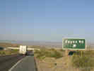
Zzyzx.
A: Zzyzx was the name that Doc Springer chose for his resort at what is
now known as Soda Springs. You can find out more about him at:
http://www.wordways.com/zzyzx.htm
As a matter of interest I came to North America for twelve weeks and drove through four Canadian provinces, 38 American states and walked into Mexico. My total mileage was just under 18,000 and I thoroughly enjoyed every mile of it. The scenery was stunningly beautiful and the people I met were kindness personified. I wish I was back there instead of in cold old England. Jack.
A: Well ... close but no cigar. Hwy 127 is the road that goes north
from Baker to Death Valley. You saw Zzyzx Road about 10 miles west of Baker on US Interstate 15. As far as the name, there is a former resort on the margin of Soda Lake, the big dry lake you could see in that area, that was at one time called Zzyzx. It is now a California State
University research station, known alternatively as Zzyzx or Soda
Springs Desert Research Station.
Locations:
Cima.
Kelso.
A: I am aware of two sources of humming noises.
A: Pressed to the wall, Amazon.com (USA) now says that the Geology of Spain book is back-ordered and they don't know when they will have it. So I ordered direct from the Geological Society of London. It turns out that membership in a major geological society earns one a discount almost large enough to pay for international shipping.
Literature Cited:
Locations:
Providence Mine.
Summit Spring.
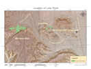
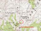
We were wondering if you would be so kind as to give us some information on you location for the Latham shale. Is it north or south of the summit spring? Is it accessible via Globe canyon road? Any info would be more than appreciated. (Perry, 20 Feb 2006)
A: Perry, I presume you're interested in the site shown here: http://www.schweich.com/imagehtml/1621-17.html
It's south of Summit Spring as shown in the attached map. This is locality P-11 from Hazzard, John C. 1954. Rocks and structure of the northern Providence Mountains, San Bernardino County, California. pp. 27-35 in Jahns, R. H., ed., 1954. Geology of Southern California. Bulletin 170.
Not sure how the roads are these days. In 1995 my Scout could not quite get up to the divide just north of Summit Spring. So we had to walk about a mile.
Other articles:
Locations:
Resting Spring Range.
Other articles:
QQQ: Mae wrote: Tom, Thanks, this sounds very interesting and I'll be sure to go to Shoshone real soon to see Mr. Troxel. I tried several times to get that e-mail you sent before but they would not let me see the map or any information. I'll go to the library with this information from you and see what I come up with. Thanks again, Mae.
A: "Large bodies of granitic magma intruded older rocks in the Sierra Nevada in the Mesozoic Era. Before being largely removed by erosion, a roof of Paleozoic rocks lay over the granitic rocks. Later deep erosion has left many fragmented sections and small bodies as roof pendants in the granite," pg 110, in Oakeshott, Gordon E. 1971. California's Changing Landscapes. McGraw-Hill. Accompanied by photograph on pg. 111 of Split Mountain, about 25 miles south of Bishop, Inyo Cty, California. There are similar photographs and discussion in Shelton, John S. 1966. Geology Illustrated. W. H. Freeman and Company.
A: What is appropriate certainly depends on what level of information you are looking for (technical, laymans, etc.). A couple of possibilities are the following:
Don Grayson has a nice chapter on the pluvial lakes of the US Southwest in his book: Grayson, D.K., 1993, The Desert's Past: A Natural Prehistory of the Great Basin. Washington, DC: Smithsonian Institution Press. 356pp. It is a well written account of the subject for an informed layman or professional interested in an overview of the subject. He provides extensive notes with references in case you want something more technical.
Some of his information is from the somewhat more technical: Benson, L. and Thompson, R.S., The physical record of lakes in the Great Basin, IN (W.F. Ruddiman and H.E. Wright, Jr., eds.) North America and Adjacent Oceans During the Last Deglaciation, The Geology of North America, Volume K-3. Boulder, CO: Geological Society of America. p. 241-260.
Another interesting source of info is Anthony D. Feig 1998 thesis called Paleolimnology and Paleoecology of the Coal Valley Region, Lincoln County, Nevada. It is availableonline at http://www.law.unlv.edu/unlv/Colleges/Sciences/Geoscience/QAP/cvthesis.html
Rick Toomey, Illinois State Museum, toomey@museum.state.il.us
Other articles:
P.S. I forgot the most important question of all - - is that a landslide?
A: Well
I haven't visited there yet
and no one has written me to say. But, yes, you'll go right by it. It's about 4 miles WNW from Death Valley Junction.
QQ: I don't know if you remember me -- Vicki -- the one who inquired about the picture of the landslide (?).
Well, I did see it, only because I pulled over at exactly the right spot to let my dog take a leak, and I happened to look up and there it was.
I was looking constantly while driving, but of course I didn't know that it's not that easy to spot if you are going in the direction I was (it's real easy to
spot coming from the other direction).
So it was just a lucky coincidence.
I did not have time to walk over, and in any case, it may have been private property.
But, to get to the point, in person, it didn't look like a landslide at all.
I really can't explain it, you'll have to go see it yourself.
I thought it
looked more like something an earthquake had caused.
Vicki
AA: Thanks for the follow up. As it turns out, I plan to take my Dad out to Ash Meadows. Maybe we'll walk over and take a look.
Literature Cited:
Other articles:
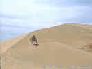
Locations:
Big Dune.
Crescent Dunes.
Eureka Sand Dunes.
Kelso Dunes.
Sand Mountain.
A: There are a number of dune fields in various parts of the world that emit sound when disturbed. Sounds produced by desert dunes have been variously described as roaring, squeaking, singing, and musical. The production of sand in desert dunes is not as common as the squeaking of beach sands. Shearing between adjacent layers of moving sand appears to cause the sounds; although, the cause is by no means settled. Lindsay et al. (1976) reported that only 27 areas in the world were known to exhibit the booming sound phenomenon. Criswell et al. (1975) reported their extensive investigation of sound production at Sand Mountain, Nevada. Trexler and Melhorn (1986) extended Lindsay's list by several additional sites in the southwestern United States. Overall, they reported booming or singing at Big Dune, Crescent Dunes, and Sand Mountain in Nevada, as well as the Eureka Dunes and Kelso Dunes in California.
Q: I read with great interest your posting about Singing Sand Dunes. Is there anywhere I might be able to obtain a recording? (Leslie, 6/13/2003)
A: Go to http://www-personal.engin.umich.edu/~nori/booming_sand.html
A: Funny you should ask. I sat through a presentation titled "The Mojave's legendary Underground River of Gold: facts, fiction and speculation" by Ralph E. Lewis, Vice President, Crystal Cave Mining Co., P.O. Box 135, Mt. Pass, CA 92366, email: cocoweep@aol.com. The entrance to the underground river was supposedly under Cocoweep Peak, which is south of Mountain Pass. I dunno, seemed like mostly fiction and speculation to me.
Other articles:
Locations:
Bristol Well.
Cottonwood Charcoal Kilns.
Frisco.
Ward Charcoal Ovens State Park.
A: The Bee Hives were Charcoal kilns that were used to make charcoal from wood. The charcoal was used to smelt the ore from the mines. They are fairly common in the southwest. At left are links to bee hive ovens on my web site. You might also want to search for "bee hive charcoal ovens"
A: Well ... here in Alameda the trees have lifted the sidewalks, overturned the curbs, and even buckled the asphault five to six feet out in the street. Alameda has tried trimming the roots, re-pouring the sidewalks, removing the curbs, replacing concrete sidewalks with free-set brick, and replacing the concrete sidewalk with asphault. Nothing works permanently and the street, curbs, and sidewalks require frequent maintenance. A few years ago the city maintenance department floated the idea of replacing the trees with a less disruptive species. The public reaction was pretty unanimous: the trees are very beautiful, and add significantly to the character of the neighborhood, therefore keep the trees, and deal with the maintenance.
A: Wildflowers are hit and miss depending upon rain and sun. I started going there at Easter, then
moved to Memorial Day and think next year I'll hit the middle of June. But if I only had one chance, I'd pick the third week of May.
Literature Cited:
A: About books, the most topical to the Eastern Mojave is, Plants of the East Mojave by Adrienne Knute, Amazon.com Price: $12.95, Paperback (November 1991) Wide Horizons Pr; ISBN: 0938109081 Adrienne Knute lives at the Quail Rock Ranch, close to Pinto Mountain.
Another is, California Desert Wildflowers, Philip A. Munz, $11.95. University of California Press; ISBN: 0520008995
And then, when you really intend to get serious about this, the standard for California is, The Jepson Manual : Higher Plants of James C. Hickman(Editor): $75.00.
Books are good, but the best way to become familiar with natural history (geology, botany, zoology, etc.) is the weekend field trip or class. Cal State San Bernadino offers the classes at Zzyzx, and there should be some pretty good things available at Anza Borrego State Park. I've met quite a few people who are active in the natural history association there. You might also check with San Diego State or a local community college, not to mention the local chapter of the California Native Plant Society.
A: Not a clue ... You might try posting the question on ECOLOG-L, that's a pretty active list server.
A: No, sorry, I don't have this information.
A:Louise, I can't tell you how happy I am to see you write that. I've got one dying in my yard now (Alameda). It's about 10 years old, about 20 feet high and something similar across, and it's hiding the monstrous remodel job of the house behind us. But, I think it's time to start cutting it down.
QQ: Tom, Keep reminding yourself, again and again, "It is not my fault!" (Louise, 5/31/2003)
Literature Cited:
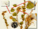
A: Well, it's certainly a Composite, which puts it way outside my area of expertise. However, it
looks a lot like a Brickellia. The Utah Flora lists a B. atractyloides that seems to fit. Neither the Jepson Manual of California nor the Utah Flora note a pungent odor to the species.
However, I have a copy of McMinn's California Shrubs that lists a "Pungent Brickellbush"
Brickellia arguta that has a synonym of B. atractyloides var. arguta. So maybe Brickellia atractyloides is a good guess. The way to find out for sure is to take your specimen to the herbarium at a local university and ask them.
Field guides for the desert are a problem. However, the Jepson Herbarium at UCBerkeley is working on the Jepson Desert Manual, which I believe is scheduled for publication this year.
Good luck! Let me know if you get another identification.
Other articles:
A: I'm not aware of any studies that would indicate the maximum age of blackbrush, although it has been a couple of years since I did an extensive literature search on the species. I would be skeptical of most anything published anyway, given the amount of variation my own
puny little studies are showning. If you find something, I would be interested.
A: You're probably thinking of Creosote Bush (Larrea tridentata). I can't think of any references right off, but you could go to the ASU biosciences library and ask the librarian to help you with a BIOSIS search for the species. You should find at least one reference to clonal rings in Lucerne Valley, California, and maybe other references as well. While Creosote Bush probably forms clonal rings as described in the television show, I'm not sure how unique that is. Many plants spread by roots, or rhizomes (underground stems). In my back yard there are Sweet Grass (Hierochloe odorata), California Rose (Rosa californica), Olallie berries (Rubus sp.), and probably several others that spread in similar fashions to Creosote Bush. Many other plants spread by layering from above-ground stems. The point is that many plants could possibly be found to have thousands of years of vegetative reproduction in their history. So, I'm not sure how unique Creosote Bush is. Perhaps it is simply a matter that the rings of Creosote Bush have made the vegetative reproduction more visually dramatic, and the desert environment has preserved the old wood so it could be dated.
Literature Cited:
A: I'm sorry to hear about your brother. It seems to me that Creosote Bush (Larrea tridentata) has also been called "chaparral" as well as "la Gobernadora" for its healing qualities. I think I read that in Edward Ball's "Native Uses of California Plants." I checked CalFlora and it lists 23 plants whose common names begin with chaparral, but lists none simply as chaparral. This is the problem with common names; they aren't defined rigourously and thus could refer to several different plants. In your research you may want to search for "ethnobotany" and remember that many of the servers, such as the USDA Plants data base and many of the USGS servers are shut down for Y2K.
A: I dunno. It depends upon what you mean by oldest living thing. Single celled organisms that reproduce asexually by cell division are probably older than any creosote bush ring or aspen grove. I also read someone's opinion that some northern forest fungus was likely the oldest and LARGEST single organism. Whatever the answer is, it certainly makes for lively discussion over beer.
AA: Dear Tom, Thank you for your answer. The idea with the beer discussion is great as my supervisor is a real "home-brew-pro"!
Ps How did you break up the plant? Did you just split the central whorl?
A:Kate, If they're happy they do. They seem to like plenty of water, on the roots not the
leaves, and some shade through the day. I've had mine in 3 or 4 places until I hit the right spot. I grow them in straight compost in the strawberry pot. The Lewisia(s) in the
strawberry pot were originally one plant. It got root rot. So I just cut it up with a knife,
trimming all the rot away, letting the cut portion sit in the sun for a day, dusting with Roottone, and then just plugging them into the ground.
BTW, I do find them very senstitive to some disease either spread or encouraged by spittle bugs. For that reason, in spittle bug season, I examine all the plants and carefully remove the spittle bugs with a pair of forceps. Also, they also produce quite a bit
of seed that germinates easily, but the seedlings grow very slowly.
A: Hi Diane, This plant is fairly common at plant sales in northern California. You might
want to try some northern California Nurseries, to see if they can mail them to you. You might
also try subscribing to the CA-NATIVES list server and post your request there.
A: We call them "Tumble Weeds" -- Salsola tragus, in the Chenopodiaceae. Another common name for this plant is Russian Thistle.
A: Yucca baccata does not grow a trunk. The Jepson manual
suggests Sunset zones 2, 3, 7, 8, 9, 10, 11, 14-16, 18-21, 22, 23. HTH.
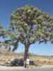
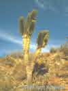
A: I guess I'm not entirely sure what you are asking of me. Do you want to grow a Joshua tree of that shape? Generally, I think Joshua trees are grown from seed. That particular Joshua tree in Joshua Tree National Park is well-known and often photographed because of its shape. If I had to guess, it's probably such a fine specimen because of its location next to a road that concentrates water from rainfall. The "edge effect" along roads in the desert is well known.
A: The Mohave Yucca (Yucca schidigera) has a trunk, and the leaves are yellowish green. The Blue Yucca (Yucca baccata) almost never has a trunk and has bluish-green leaves. You can almost always use the "trunk" or "no trunk" character to distinguish the two species, resorting to leaf color only in juvenile plants. The Joshua Tree (Yucca brevifolia) has a trunk and short leaves with toothed margins. Check it out next time you're out on I-15.
A: Both J.W. Cornett (1991. "The Joshua Tree" Palm Springs Desert Museum Natural Science Publication 1-91, p. 1-4) and W. Bronaugh (1993. "The Biggest Joshua Tree" American Forests. May/June, p. 36) attribute the name to Mormon pioneers travelling across the Mojave Desert from Salt Lake City, probably to San Bernardino.
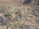
Native peoples used compounds derived from several species of yuccas for a variety of purposes. Among these include the flowers as food, as well as soaps and medicines made from the leaves, stems, and roots.
Surprisingly little is known about the biology of yuccas beyond the pollination story. I am not aware of any studies that have shown an interaction with myccorhizal fungi; based on the current literature on diversity of soil fungi I would not be surprised to find out that such interactions occur. Research in my laboratory and with colleagues at other institutions (Travis Huxman and Stan Smith at UNLV, and Erik Hamerlynck at Rutgers) is investigating various aspects of yucca biology, such as how global change could influence the distribution and abundance of different yucca species in the future. Michael Loik, Department of Environmental Studies, University of California, Santa Cruz, CA 95064
Other articles:
A: Well, I wasn't really looking for deer. The closest I've seen was the antelope between Elko and Eureka.
A: Terry, I don't think there are any Anasazi ruins in the Cedar Canyon of Mojave National Preserve. Possibly the ruins you've heard of are in another Cedar Canyon. There are lots of them.
QQ: There is a book coming out in June 2001 that documents by GPS coordinates dozens of ruins in the Cedar Canyon area that are mostly known by archeologists. There is a dialog going on between many archeologists complaining about how these ruins will now be know and the potenial problems.
AA: Perhaps the area covered by the book is the Cedar Mesa / Grand Gulch area of Utah.
A: Robb, I don't think I've come across any aircraft crash sites recently, but I'll keep you in mind if I do.
QQ: Hello back Tom, How about some old ones that you've found? In fact the older the better.
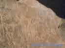
A: See also: Budinger Jr, Fred E. Artifacts from Lower Member B of the Manix type section, central Mojave Desert (Abstract). San Bernardino County Museum Association Quarterly 46(2) 1999, in which discusses "Modified lithic specimens, interpreted here as artifactual, have been recovered more than 5 m below the 185,000 +/- 15,000 yr bp Long Canyon Tephra (volcanic ash) in the Manix Type section of the central Mojave Desert." My take is that the date establishing a lower limit on the age of the specimens is reasonable. You just have to be willing to accept that the specimens were shaped by prehistoric humans, and not some other process.
Other articles:
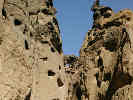
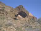
A: The hollowed out rock site shouldn't be too hard to find. It's officially designated SBr-291 so if you have access to archeological resources you can get exact location. Some people call it "Womb
Rock" or "Re-Birth Rock." The ranger at Hole-in-the-Wall may tell you where it is. Failing that, some careful sleuthing from my description of Wild Horse Canyon Road and the photographs, should help you find it in an hour or so. When you do find it, be sure to examine all the surrounding rocks carefully. There are a lot of surprises at this location.
A: Thank you for your very kind note about my web site. I really enjoy putting up the road logs, and often wondered if anyone else used them. Keep looking, you'll find the pictographs.
Literature Cited:
Madrid 1938. Carlos Tejada Alonso y Leon is a Sergeant in the Guardia Civil, a rank rare for a man not yet thirty, but Tejada is an unusual recruit. The bitter civil war between the Nationalists and the Republicans has interrupted his legal studies in Salamanca. Second son of a conservative Southern family of landowners, he is an enthusiast for the Catholic Franquista cause, a dedicated, and now triumphant, Nationalist. This war has drawn international attention. In a dress rehearsal for World War II, fascists support the Nationalists, while Communists have come to the aid of the Republicans. Atrocities have devastated both sides. It is at this moment, when the Republicans have surrendered, and the Guardia Civil has begun to impose order in the ruins of Madrid, that Tejada finds the body of his best friend, a hero of the siege of Toledo, shot to death on a street named Amor de Dios. Naturally, a Red is suspected. And it is easy for Tejada to assume that the woman wearing a red scarf, caught kneeling over the body, is the killer. But when his doubts are aroused, he cannot help seeking justice.
Literature Cited:
Carlos Tejada, newly promoted to the rank of lieutenant in the Guardia Civil, has been transferred to Salamanca, the city where he studied before the Civil War. There he finds Elena Fernandez who, having lost her job because of her political sympathies, has returned home to Salamanca where she and Lieutenant Tejada had first been romantically.
Literature Cited:
In 1940, Carlos Tejada arrives for his first independent command at a mountain village in Spain. But he soon discovers that the officer he is replacing was shot to death and that the village is a center of smuggling and guerrilla activity. Even worse, a new outbreak of the Civil War may be about to take place with his post as its epicenter.
Literature Cited:
When an aristocratic lady of Granada, Spain, is found dead in 1945, the local police can't believe that she really may have been murdered. Lieutenant Carlos Tejada Alonso y Leon is assigned because the rich woman is his grand aunt Rosalia, and one of the chief suspects is his father. The family expects Tejada to exonerate its members, but Tejada is a man who puts duty first.
Literature Cited:
Literature Cited:
Literature Cited:
Literature Cited:
Literature Cited:
Literature Cited:
Literature Cited:
Locations:
Rio Tinto.
Literature Cited:
Literature Cited:
Literature Cited:
Other articles:
Locations:
Emigrant Pass.
Resting Spring.
Stump Spring.
A: Mike, I'm sure there are many. Your local library probably has several books about the Old Spanish Trail, or western trails in general. Or try:
http://www.homesteadmuseum.org/family/mapost.htm
Other articles:
Locations:
Hoover Dam.
A: Hmmm .... don't know, have you tried the Arizona Department of Transportation or the Nevada Department of Transportation?
A: How about the Nevada Department of Transportation?
Other articles:
http://www.schweich.com/nvhwy228A.html#NVCty718:NVHwy228
today looking at routes between Lamoille and US50. Some great pictures, thanx! We are making a motorcycle run to S Utah in a few weeks, staying the night in Lamoille (good food!). Is there a paved route S from Jiggs across to US50? Or would we be advised to do I80/229/US93 to get south? Does SR278 from Carlin go anywhere (Paul, 5/20/2003).
A: The road south from Jiggs to US 50 is dirt in the middle part, see:
http://www.schweich.com/imagehtml/1340_3152_4275_31sm.html
It's a good road, but nevertheless, dirt.
SR 278 runs from Carlin to Eureka, and parallels the path of the Eureka and Palisade railroad that ran from the Southern Pacific at Palisade to the mines of Eureka. I have not been on the entire length but I would expect that it would be paved the entire route.
A: Well, I wasn't really looking for deer. The closest I've seen was the antelope between Elko and Eureka.
Enjoyed your detailed trip descriptions! Have you ever considered using a GPS receiver and including the location/position for points of interest and pictures? (Bob,3-Jul-04) A: Thanks you for your comments about my web site. I do carry a GPS receiver and all my plant collections are located by UTM grid from the GPS. But it never occurred to me put GPS coordinates in my field notes or the photo data. I'll have to think about it .... QQ: Due to potential for vandalism sometimes you do not want to include exact locations. I typically plan trips using software supplied with my GPS and topographic map software. When I am not able to get away it allows me to travel "virtually" and anticipate my next trip.
Locations:
Cedar Canyon.
Kelso.
A: Well, in general there are more people, but they seem to stay more on the main roads, and out of the back country. It seems like there are a lot more people who drive through the park on the way to or from Las Vegas, stopping briefly at the Kelso Depot. OTOH, I've spent some beautiful September weekends all by myself in the Mid Hills campground. I don't particularly care for how the Park Service
has designated some of the wilderness areas. They have signed off the cherry stem road into [unidentified location] in such a way that it directs traffic to Winklers Cabin. And, by putting the wilderness boundary right at the edge of Cedar Canyon Road, the Park Service has eliminated some really nice camping spots. A bit of un-thinking in my opinion. Still, they have been very cooperative with me and my research, so I can't complain too much.
Locations:
Kelso Dunes.
A: I'm afraid I don't have too much information about off-highway vehicle use in the Mojave National Preserve. The area covered by the Park is actually not too badly impacted by OHVs. The Kelso Dunes have been closed to vehicles for many years, whereas the Dumont Dunes, between Baker and Death Valley should be designated a National Sacrifice Area. Probably the most devastating impact in the eastern Mojave is from cows and burros. If you look at may web page and check out Black
Canyon Road, there are two photos that were taken back-to-back. One shows an area heavily impacted by cows, and the other a general view of an area that sometimes gets described as "pristine." In my experience there is no area in Mojave National Preserve, even in the so-called "wilderness" areas, that hasn't been impacted by cows. Another major impact to Mojave National
Preserve are the various pipelines, telephone cables, and power transmission lines. There
is even a microwave relay station within a half mile of Mid Hills campground, altho' I have to say it has been very cleaverly camouflaged Just north of the Preserve, at Keeney Pass north of Clark Mountain is a recently installed pipeline along the power transmission lines. I think Howard Wilshire published a couple of articles about the pipeline, including to so-called rehabilitation. So you might search on GeoRef at your library for Howard's articles. Also search for information about the Viceroy mine at Hart. This is a huge open-pit mine with a cyanide heap-leach operation. And don't forget the radioactive materials spill from the rare earth mine at Mountain Pass.
http://www.swparks.com/us/travel/southcalifornia/mojave.html - is the page in question. Justin, January 23, 2000
A: I would be happy to have you use my photographs on your web site, just give me credit and provide a link to my web site. When you start raking in millions from your site with my pictures we should talk again but, in the mean time, please use any of my pictures you like.
Thanks for asking!
I am traveling from Seattle to the park this weekend to do a little on-site research. I think I can find most of what I need, but since I am short on time I could use a little help with one of the illustrations. I am to do a painting set in a desert wash. The wash edges are to be vegetated with cattle spinach, atriplex, mesquite, and acacia. The wash feeds into a palm oasis. Do you know of such a wash in Joshua Tree, or will I pretty much find this community in washes near any palm oasis? Any suggestions you can give me will be a godsend. Pam, January 11, 2000.
A:I'm not sure how much help I can be, but here goes
Seems like kind of an odd mixture of vegetation. Cattle spinach is Atriplex polycarpa, perhaps the other "atriplex" your client is looking for is Atriplex canescens (Four-wing saltbush). It is unlikely you will find them together, as Cattle spinach prefers alkaline areas and Four-wing saltbush does not. I'm not sure you'll find alkaline washes in Joshua tree. I would expect few if any leaves on the mesquite, and none on the acacia: Acacia greggii (Cat-claw). So you'll have to fake the leaves.
I would go to the visitor center of the park, which is on the east end of 29 Palms, and ask for information. I find the rangers more helpful in person. While I'm not very familiar with the park I would expect to find what you're looking for along the road that goes south into the park from the visitor
center.
Other articles:
A: Faye, Sure. Please give me credit, or credit Trexler and Melhorn, if you are using material from their article. I always like to see what people do with material from my web site, so if you publish something, please let me know, or send a copy. When you start raking in the millions with material from my web site, then we should talk about licensing .....
A: I started using copyright notices when I found a large number of my pictures on someone else's web site. I'm not against anyone using my pictures; I just want to be credited for them. Anyway, when I contacted them (actually the father of the children who designed the site) the father assured me that they would remove the pictures or credit them to me. But they never did, and several years later they still use my pictures without credit to me. So, anyway, now I put copyright notices on all the pictures. Sure, someone can cut off the copyright notice, but I still have both the original copyrighted picture and the virgin picture on CD-ROM to prove ownership. Ugly? Yes! Necessary? Unfortunately.
A: Thank you for your kind note and the suggestions for fixing links on in the Images files. I have checked out your suggestions and agree that some changes need to be made. Unfortunately, I can't simply load the files you sent. As a result of my recent "shake-up" the HTML for the web site is actually written by Visual Basic code from Microsoft Access. I can correct the data base tables that generated the broken links. This I will do over the next week or so.
The unfortunate thing for you is that when I change one page I also change all pages, because the entire web site is generated at one time. I don't keep track of changes to individual files, so there is nothing you can do but down load the entire site every time I upload it. Sorry .... :-(
A: Jennifer, The last I knew Phillipe Chassot was still at Univeristy of Neuchatel. Actually if you just do a google search for his name there are several web sites that list his name and telephone number. His e-mail address appears to be philippe.chassot@unine.ch
A:Sure. Let me know if you need higher resolution photos than those on my web site. You can leave the "index.shtml" off of the credit. Also, if your finished work is available to the general public, I would be very interested to learn how I can obtain a copy. Thanks for asking. QQ: Thank you, Tom, for replying right away. Having higher resolution photos would be nice, but if you're busy and can't get to it for awhile, I can make do with those on your page. The draft plan report will be available by May. Since we are budget conscious and try to minimize paper use, we will it post as a PDF and possibly html files on the Nevada Natural Heritage Program web page http://heritage.nv.gov/ Some of the information on your site suggests that you are a botanist or naturalist, perhaps as an avocation. The natural world is a fascinating place and worth deep appreciation. Again, thank you. Ed, 30-Mar-05. AA: Ed, Three photos attached. Please remember me if the draft plan is published on the web. BTW, right now my plans are to collect (plants) in the Mesquite Mtns, on the California-Nevada border in late April, and in the Sylvania Mtns - Magruder Mtn - Silver Peak Rage in late May - early June.
A: But, isn't a little bit of collective amnesia a good thing ... maybe if we had more of it the Palestinians and Israeli's could get along better, not to mention the Irish, and the various flavors of Muslims and Christians ... I mean, without it, why heck, I could be planting car bombs in Ulan Bator in recompense for what the Mongol hordes did to Kiev .... I say, common names are what people use, let 'm be .... and, just to bring this discussion back to plants, you better not make any jokes about beet soup!
Date and time this article was prepared:
4/21/2025 8:21:06 PM
|