Eastern Mojave Vegetation
Tom Schweich
|
Eastern Mojave Vegetation
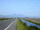
| California Highway 4 |
|
Tom Schweich |

|
(No Preface) |
|
Other articles:
|
Junction: US Interstate 80, south then west to San Francisco. |
| Junction: US Interstate 680, south to Concord and Walnut Creek, and ultimately San Jose, north to US Interstate 80 at Cordelia Junction. | |
| Junction: California Highway 242, a cutoff through Concord between US Interstate 680 and California Highway 4. | |
| Junction: Bailey Road. | |
| Junction: Kyrker Pass Road | |
| Junction: Somersville Road, south to Black Diamond Mines Regional Park. | |
Junction:
| |
|
|
Oakley |
|
|
Brentwood |
| Junction: Byron Highway. | |
| Bridge over Old River | |
|
|
Victoria Island |
| Union Point | |
| Garwood Bridge | |
|
Other articles:
|
Junction: US Interstate 5, north to Sacramento, south to Los Angeles. California Highway 4 follows the route of Interstate 5 north for about 0.7 miles, before turning east again through Stockton. |
|
Other articles:
|
Junction: US Interstate 5, north to Sacramento, south to Los Angeles. |
|
Other articles:
|
Junction: California Highway 99, north through Stockton to Sacramento, south through Fresno and Bakersfield before joining US Interstate 5 near the Grapevine. California Highway 4 follows the north-south route of US Highway 99 for about a mile before turning east-west again. |
|
Other articles:
|
Junction: California Highway 99, north and south through the Great Valley, a forerunner of US Interstate 5. |
|
|
Farmington |
| Junction: Main Street, near Copperopolis. | |
|
Other articles:
|
Junction: California Highway 49, north through the Mother Lode, or Gold Country, of California. The towns to the north are San Andreas, Mokelumne Hill, and Jackson. |
|
|
Angels Camp |
|
Other articles:
|
Junction: California Highway 49, south through the Mother Lode, or California Gold Country. The towns to the south are Sonora, Jamestown, and Coulterville. |
|
|
Douglas Flat |
|
|
Murphys |
| Calaveras Ranger Station. | |
|
|
Avery |
|
|
Big Trees |
|
|
Big Meadow |
|
|
Hells Kitchen Vista |
|
|
Lake Alpine |
|
|
Cape Horn |
|
|
Pacific Grade Summit |
|
|
Ebbets Pass |
|
|
Kinney Meadows |
|
Other articles:
|
Junction: CA Highway 89, east over Monitor Pass to US Highway 395, and north through Markleeville to Lake Tahoe, or over Carson Pass on California Highway 88. |
| If you have a question or a comment you may write to me at: tomas@schweich.com I sometimes post interesting questions in my FAQ, but I never disclose your full name or address. |
Date and time this article was prepared: 4/21/2025 8:14:38 PM |