Eastern Mojave Vegetation Excelsior Mine Road - Eastern Mojave Desert  
 

Tom Schweich  

Home Page  (No Preface)

Other articles:
• Smith Talc Road:  40000;  

Full Size Image
Looking down toward the Beck Spring Mine in the Kingston Range.
Junction: Smith Talc Road

Other articles:
• Field Notes:   31 May 1999;  

Full Size Image
Nolina sp. along Excelsior Mine Road in the Kingston Range.


Tecopa Pass


Other articles:
• Field Notes:   31 May 1999;

Locations: Horse Thief Springs.  

Horse Thief Springs

Full Size Image
Horse Thief Springs.
 

Images: Full Size Image
Excelsior Mine, Kingston Range, from Excelsior Mine Road.
 

Excelsior Mine in the Kingston Range. Mohave Yucca ( Yucca schidigera ) in the foreground.

Images: Full Size Image
Blackbrush (Coleogyne ramosissima) in bloom along Excelsior Mine Road.
 

Blackbrush (Coleogyne ramosissima) in bloom along Excelsior Mine Road.

Images: Full Size Image
Calochortus flexuosus growing in Blackbrush (Coleogyne ramosissima)
 

Calochortus flexuosusgrowing in Blackbrush (Coleogyne ramosissima) along Excelsior Mine Road.

Locations: Kingston Range.  

Full Size Image
Kingston Range as seen from Excelsior Mine Road.
Eastern side of the Kingston Range as seen from Excelsior Mine Road.

Other articles:
• Kingston Wash Road:  Excelsior Mine Road;  

Junction: Kingston Wash Road

Literature Cited:
- Baldwin, Bruce G., Donald W. Kyhos, Scott N. Martins, Frank C. Vasek, and Bridget L. Wessa, 1996.
- Lamson-Scribner, F., 1898.

Other articles:
• Field Notes:   Coll. No. 1570.2, 18 Apr 2017;   Coll. No. 1571, 18 Apr 2017;   Coll. No. 1572, 18 Apr 2017;   Coll. No. 1573, 18 Apr 2017;   Coll. No. 1574, 18 Apr 2017;  

Full Size Image
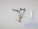
Coll. No. 1570.2, Bromus madritensis ssp. rubens
Full Size Image
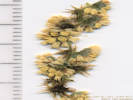
Mix of staminate and pistillate flowers in inflorescence of Ambrosia dumosa
Full Size Image
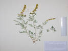
Overview of Coll. No. 1571, Ambrosia dumosa
Full Size Image
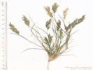
Coll. No. 1572, Schismus barbatus
Full Size Image
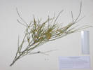
Coll. No. 1573, Ephedra nevadensis
Full Size Image
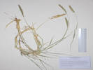
Coll. No. 1574, Hilaria rigida
Junction: dirt road.

This road formerly led to a water tank, and then down into Kingston Wash. It is now blocked by a gate approximately 0.4 mi. to the west. My collections 1569 to 1574 were made in the vicinity of the gate.

Other articles:
• Kingston Road:  60000;
• Routes to Water:   at Kingston Rd Jct;  

Junction:
  • Goodsprings to Silver Lake, from Thompson's (1921), Routes to Watering Places …
  • Kingston Road, south to US Interstate 15 at Valley Wells, or northeast through the Mesquite Mountains to Mesquite Valley.
If you have a question or a comment you may write to me at: tomas@schweich.com I sometimes post interesting questions in my FAQ, but I never disclose your full name or address.  


[Home Page] [Site Map]

Date and time this article was prepared: 8/1/2026 2:53:39 PM