 Eastern Mojave Vegetation
|
Eastern Mojave Vegetation
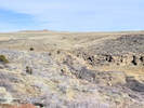
| Golden Ravine, Jefferson County, Colorado. |
|
Gazetteer Query: |
||||
|
Canyon on the south side of North Table Mountain, name applied by Kilburn and White (1992).
Latitude: 39.769921 Longitude: -105.211618 (° decimal)
Articles that refer to this location:
Literature Referring To This Location:
| ||||
| No collections made at this location. | ||||
| If you have a question or a comment you may write to me at: tomas@schweich.com I sometimes post interesting questions in my FAQ, but I never disclose your full name or address. |
A, B, C,
D, E, F,
G, H, I,
J, K, L,
M, Date and time this article was prepared:12:56:17 PM, 10/2/2026. | |||