 Eastern Mojave Vegetation
|
Eastern Mojave Vegetation
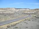
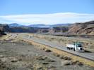
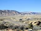
| Miller Canyon, Emery County, Utah. |
|
Gazetteer Query: G.N.I.S. See also: Miller Canyon. |
||||||||||||
|
Canyon cut by Muddy Creek through the Coal Cliffs.
Articles that refer to this location:
Literature Referring To This Location:
Species collected at or near this location. This list summarizes plants collected or observed at this specific, named location. It does not include plants collected or observed at nearby named or unnamed locations. It may be more instructive to use the Area Lists that contain this location.
Gentianaceae Frasera albomarginata S. Watson. (Oth) CC:7
| ||||||||||||
| ||||||||||||
| If you have a question or a comment you may write to me at: tomas@schweich.com I sometimes post interesting questions in my FAQ, but I never disclose your full name or address. |
A, B, C,
D, E, F,
G, H, I,
J, K, L,
M, Date and time this article was prepared:12:56:34 PM, 10/2/2026. | |||||||||||