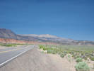
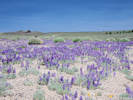
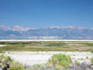
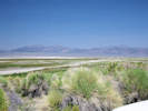
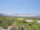
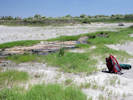
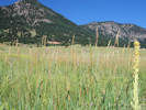
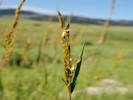
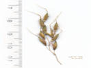
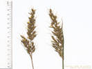
 Eastern Mojave Vegetation
Tom Schweich
|
Eastern Mojave Vegetation
| Field Notes (Continued) |
|
Tom Schweich |

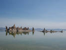
Topics in this Article: 1800s 1900s 1910s 1920s 1930s 1940s 1950s 1960s 1970s 1980s 1990 1991 1992 1993 1995 1996 1997 1998 1999 2000 2001 2002 2003 2004 2005 2006 2007 2008 2008 Tour de Swertia albomarginata Mono Lake, August 2008 2009 2010 2011 2012 2013 2014 2015 2016 2017 2018 2019 2020 2021 2022 2023 2024 2025 2026 Contents Literature Cited |
When I first read the field notes of Annie Alexander and Louise Kellogg, I was fascinated by the descriptions they wrote about the places they went and the plants and animals they found there. By publishing my field notes on the Internet I hope to follow a little bit in their tradition. | ||||||||||||||||||||||||||||||||||||||||||||||||||||||||||||||||||||||||||||||||||||||||||||||||||||||||||||||||||||||||||||||||||||||||||||||||||||||||||||||||||||||||||||||||||||||||||||||||||||||||||||||||||||||||||||||||||||||||||||||||||||||||||||||||||||||||||||||||||||||||||||||||||||||||||||||||||||||||||||||||||||||||||||||||||||||||||||||||||||||||||||||||||||||||||||||||||||||||||||||||||||||||||||||||||||||||||||||||||||||||||||||||||||||||||||||||||||||||||||||||||||||||||||||||||||||||||||||||||||||||||||||||||||||||||||||||||||||||||||||||||||||||||||||||||||||||||||||||||||||||||||||||||||||||||||||||||||||||||||||||||||||||||||||||||||||||||||||||||||||||||||||||||||||||||||||||||||||||||||||||||||||||||||||||||||||||||||||||||||||||||||||||||||||||||||||||||||||||||||||||||||||||||||||||||||||||||||||||||||||||||||||||||||||||||||||||||||||||||||||||||||||||||||||||||||||||||||||||||||||||||||||||||||||||||||||||||||||||||||||||||||||||||||||||||||||||||||||||||||||
|
|
2015 | ||||||||||||||||||||||||||||||||||||||||||||||||||||||||||||||||||||||||||||||||||||||||||||||||||||||||||||||||||||||||||||||||||||||||||||||||||||||||||||||||||||||||||||||||||||||||||||||||||||||||||||||||||||||||||||||||||||||||||||||||||||||||||||||||||||||||||||||||||||||||||||||||||||||||||||||||||||||||||||||||||||||||||||||||||||||||||||||||||||||||||||||||||||||||||||||||||||||||||||||||||||||||||||||||||||||||||||||||||||||||||||||||||||||||||||||||||||||||||||||||||||||||||||||||||||||||||||||||||||||||||||||||||||||||||||||||||||||||||||||||||||||||||||||||||||||||||||||||||||||||||||||||||||||||||||||||||||||||||||||||||||||||||||||||||||||||||||||||||||||||||||||||||||||||||||||||||||||||||||||||||||||||||||||||||||||||||||||||||||||||||||||||||||||||||||||||||||||||||||||||||||||||||||||||||||||||||||||||||||||||||||||||||||||||||||||||||||||||||||||||||||||||||||||||||||||||||||||||||||||||||||||||||||||||||||||||||||||||||||||||||||||||||||||||||||||||||||||||||||||
|
|
January | ||||||||||||||||||||||||||||||||||||||||||||||||||||||||||||||||||||||||||||||||||||||||||||||||||||||||||||||||||||||||||||||||||||||||||||||||||||||||||||||||||||||||||||||||||||||||||||||||||||||||||||||||||||||||||||||||||||||||||||||||||||||||||||||||||||||||||||||||||||||||||||||||||||||||||||||||||||||||||||||||||||||||||||||||||||||||||||||||||||||||||||||||||||||||||||||||||||||||||||||||||||||||||||||||||||||||||||||||||||||||||||||||||||||||||||||||||||||||||||||||||||||||||||||||||||||||||||||||||||||||||||||||||||||||||||||||||||||||||||||||||||||||||||||||||||||||||||||||||||||||||||||||||||||||||||||||||||||||||||||||||||||||||||||||||||||||||||||||||||||||||||||||||||||||||||||||||||||||||||||||||||||||||||||||||||||||||||||||||||||||||||||||||||||||||||||||||||||||||||||||||||||||||||||||||||||||||||||||||||||||||||||||||||||||||||||||||||||||||||||||||||||||||||||||||||||||||||||||||||||||||||||||||||||||||||||||||||||||||||||||||||||||||||||||||||||||||||||||||||||
|
Other articles:
|
Wednesday, January 14th
| ||||||||||||||||||||||||||||||||||||||||||||||||||||||||||||||||||||||||||||||||||||||||||||||||||||||||||||||||||||||||||||||||||||||||||||||||||||||||||||||||||||||||||||||||||||||||||||||||||||||||||||||||||||||||||||||||||||||||||||||||||||||||||||||||||||||||||||||||||||||||||||||||||||||||||||||||||||||||||||||||||||||||||||||||||||||||||||||||||||||||||||||||||||||||||||||||||||||||||||||||||||||||||||||||||||||||||||||||||||||||||||||||||||||||||||||||||||||||||||||||||||||||||||||||||||||||||||||||||||||||||||||||||||||||||||||||||||||||||||||||||||||||||||||||||||||||||||||||||||||||||||||||||||||||||||||||||||||||||||||||||||||||||||||||||||||||||||||||||||||||||||||||||||||||||||||||||||||||||||||||||||||||||||||||||||||||||||||||||||||||||||||||||||||||||||||||||||||||||||||||||||||||||||||||||||||||||||||||||||||||||||||||||||||||||||||||||||||||||||||||||||||||||||||||||||||||||||||||||||||||||||||||||||||||||||||||||||||||||||||||||||||||||||||||||||||||||||||||||||||
|
Other articles:
Locations: Atascadero Lake. |
Sunday, 18 January
| ||||||||||||||||||||||||||||||||||||||||||||||||||||||||||||||||||||||||||||||||||||||||||||||||||||||||||||||||||||||||||||||||||||||||||||||||||||||||||||||||||||||||||||||||||||||||||||||||||||||||||||||||||||||||||||||||||||||||||||||||||||||||||||||||||||||||||||||||||||||||||||||||||||||||||||||||||||||||||||||||||||||||||||||||||||||||||||||||||||||||||||||||||||||||||||||||||||||||||||||||||||||||||||||||||||||||||||||||||||||||||||||||||||||||||||||||||||||||||||||||||||||||||||||||||||||||||||||||||||||||||||||||||||||||||||||||||||||||||||||||||||||||||||||||||||||||||||||||||||||||||||||||||||||||||||||||||||||||||||||||||||||||||||||||||||||||||||||||||||||||||||||||||||||||||||||||||||||||||||||||||||||||||||||||||||||||||||||||||||||||||||||||||||||||||||||||||||||||||||||||||||||||||||||||||||||||||||||||||||||||||||||||||||||||||||||||||||||||||||||||||||||||||||||||||||||||||||||||||||||||||||||||||||||||||||||||||||||||||||||||||||||||||||||||||||||||||||||||||||||
|
Other articles:
Locations: Cima. Kelso. Morning Star Mine. New York Mountains. |
Thursday, 22 January | ||||||||||||||||||||||||||||||||||||||||||||||||||||||||||||||||||||||||||||||||||||||||||||||||||||||||||||||||||||||||||||||||||||||||||||||||||||||||||||||||||||||||||||||||||||||||||||||||||||||||||||||||||||||||||||||||||||||||||||||||||||||||||||||||||||||||||||||||||||||||||||||||||||||||||||||||||||||||||||||||||||||||||||||||||||||||||||||||||||||||||||||||||||||||||||||||||||||||||||||||||||||||||||||||||||||||||||||||||||||||||||||||||||||||||||||||||||||||||||||||||||||||||||||||||||||||||||||||||||||||||||||||||||||||||||||||||||||||||||||||||||||||||||||||||||||||||||||||||||||||||||||||||||||||||||||||||||||||||||||||||||||||||||||||||||||||||||||||||||||||||||||||||||||||||||||||||||||||||||||||||||||||||||||||||||||||||||||||||||||||||||||||||||||||||||||||||||||||||||||||||||||||||||||||||||||||||||||||||||||||||||||||||||||||||||||||||||||||||||||||||||||||||||||||||||||||||||||||||||||||||||||||||||||||||||||||||||||||||||||||||||||||||||||||||||||||||||||||||||||
|
Other articles:
Locations: Junction. Miller Canyon. Spotted Wolf Canyon. |
Friday, January 23 | ||||||||||||||||||||||||||||||||||||||||||||||||||||||||||||||||||||||||||||||||||||||||||||||||||||||||||||||||||||||||||||||||||||||||||||||||||||||||||||||||||||||||||||||||||||||||||||||||||||||||||||||||||||||||||||||||||||||||||||||||||||||||||||||||||||||||||||||||||||||||||||||||||||||||||||||||||||||||||||||||||||||||||||||||||||||||||||||||||||||||||||||||||||||||||||||||||||||||||||||||||||||||||||||||||||||||||||||||||||||||||||||||||||||||||||||||||||||||||||||||||||||||||||||||||||||||||||||||||||||||||||||||||||||||||||||||||||||||||||||||||||||||||||||||||||||||||||||||||||||||||||||||||||||||||||||||||||||||||||||||||||||||||||||||||||||||||||||||||||||||||||||||||||||||||||||||||||||||||||||||||||||||||||||||||||||||||||||||||||||||||||||||||||||||||||||||||||||||||||||||||||||||||||||||||||||||||||||||||||||||||||||||||||||||||||||||||||||||||||||||||||||||||||||||||||||||||||||||||||||||||||||||||||||||||||||||||||||||||||||||||||||||||||||||||||||||||||||||||||||
|
Other articles:
|
Saturday, January 24
| ||||||||||||||||||||||||||||||||||||||||||||||||||||||||||||||||||||||||||||||||||||||||||||||||||||||||||||||||||||||||||||||||||||||||||||||||||||||||||||||||||||||||||||||||||||||||||||||||||||||||||||||||||||||||||||||||||||||||||||||||||||||||||||||||||||||||||||||||||||||||||||||||||||||||||||||||||||||||||||||||||||||||||||||||||||||||||||||||||||||||||||||||||||||||||||||||||||||||||||||||||||||||||||||||||||||||||||||||||||||||||||||||||||||||||||||||||||||||||||||||||||||||||||||||||||||||||||||||||||||||||||||||||||||||||||||||||||||||||||||||||||||||||||||||||||||||||||||||||||||||||||||||||||||||||||||||||||||||||||||||||||||||||||||||||||||||||||||||||||||||||||||||||||||||||||||||||||||||||||||||||||||||||||||||||||||||||||||||||||||||||||||||||||||||||||||||||||||||||||||||||||||||||||||||||||||||||||||||||||||||||||||||||||||||||||||||||||||||||||||||||||||||||||||||||||||||||||||||||||||||||||||||||||||||||||||||||||||||||||||||||||||||||||||||||||||||||||||||||||||
|
Literature Cited:
Other articles:
Locations: Cambria Lime Kiln. Hogback Valley. Tripp Ranch. |
| ||||||||||||||||||||||||||||||||||||||||||||||||||||||||||||||||||||||||||||||||||||||||||||||||||||||||||||||||||||||||||||||||||||||||||||||||||||||||||||||||||||||||||||||||||||||||||||||||||||||||||||||||||||||||||||||||||||||||||||||||||||||||||||||||||||||||||||||||||||||||||||||||||||||||||||||||||||||||||||||||||||||||||||||||||||||||||||||||||||||||||||||||||||||||||||||||||||||||||||||||||||||||||||||||||||||||||||||||||||||||||||||||||||||||||||||||||||||||||||||||||||||||||||||||||||||||||||||||||||||||||||||||||||||||||||||||||||||||||||||||||||||||||||||||||||||||||||||||||||||||||||||||||||||||||||||||||||||||||||||||||||||||||||||||||||||||||||||||||||||||||||||||||||||||||||||||||||||||||||||||||||||||||||||||||||||||||||||||||||||||||||||||||||||||||||||||||||||||||||||||||||||||||||||||||||||||||||||||||||||||||||||||||||||||||||||||||||||||||||||||||||||||||||||||||||||||||||||||||||||||||||||||||||||||||||||||||||||||||||||||||||||||||||||||||||||||||||||||||||||
|
Other articles:
Locations: Welchester Tree Grant Park. |
Saturday, March 7th
| ||||||||||||||||||||||||||||||||||||||||||||||||||||||||||||||||||||||||||||||||||||||||||||||||||||||||||||||||||||||||||||||||||||||||||||||||||||||||||||||||||||||||||||||||||||||||||||||||||||||||||||||||||||||||||||||||||||||||||||||||||||||||||||||||||||||||||||||||||||||||||||||||||||||||||||||||||||||||||||||||||||||||||||||||||||||||||||||||||||||||||||||||||||||||||||||||||||||||||||||||||||||||||||||||||||||||||||||||||||||||||||||||||||||||||||||||||||||||||||||||||||||||||||||||||||||||||||||||||||||||||||||||||||||||||||||||||||||||||||||||||||||||||||||||||||||||||||||||||||||||||||||||||||||||||||||||||||||||||||||||||||||||||||||||||||||||||||||||||||||||||||||||||||||||||||||||||||||||||||||||||||||||||||||||||||||||||||||||||||||||||||||||||||||||||||||||||||||||||||||||||||||||||||||||||||||||||||||||||||||||||||||||||||||||||||||||||||||||||||||||||||||||||||||||||||||||||||||||||||||||||||||||||||||||||||||||||||||||||||||||||||||||||||||||||||||||||||||||||||||
|
Locations: Colorado School of Mines Survey Field. |
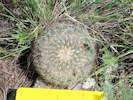
1070 |
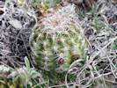
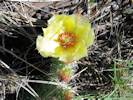
Determination tentative. Colorado School of Mines Survey Field, Jefferson County, Colorado. 39.7382°N, 105.2275°W. WGS 1984. Elev. 1844 m. Only one seen, among much prickly pear. Not collected, solitary cactus. | |||||||||||||||||||||||||||||||||||||||||||||||||||||||||||||||||||||||||||||||||||||||||||||||||||||||||||||||||||||||||||||||||||||||||||||||||||||||||||||||||||||||||||||||||||||||||||||||||||||||||||||||||||||||||||||||||||||||||||||||||||||||||||||||||||||||||||||||||||||||||||||||||||||||||||||||||||||||||||||||||||||||||||||||||||||||||||||||||||||||||||||||||||||||||||||||||||||||||||||||||||||||||||||||||||||||||||||||||||||||||||||||||||||||||||||||||||||||||||||||||||||||||||||||||||||||||||||||||||||||||||||||||||||||||||||||||||||||||||||||||||||||||||||||||||||||||||||||||||||||||||||||||||||||||||||||||||||||||||||||||||||||||||||||||||||||||||||||||||||||||||||||||||||||||||||||||||||||||||||||||||||||||||||||||||||||||||||||||||||||||||||||||||||||||||||||||||||||||||||||||||||||||||||||||||||||||||||||||||||||||||||||||||||||||||||||||||||||||||||||||||||||||||||||||||||||||||||||||||||||||||||||||||||||||||||||||||||||||||||||||||||||||||||||||||||||||||||||||||||
|
Other articles:
Locations: Colorado School of Mines Survey Field. |
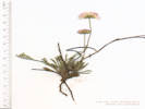
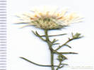
Colorado School of Mines Survey Field, Jefferson County, Colorado. 39.7365°N, 105.2268°W. WGS 1984. Elev. 1877 m. Exposed ridge, just starting to bloom. Coll. No. 1071, 12 Mar 2015, characters observed while keying: Perennial, herbaceous, cespitose; Leaves, not clearly opposite, linear, 50 mm. × 1 mm., entire, enlarged base; Heads, all alike, composed of two kinds of flowers, some of the flowers with strap-shaped corollas; Phyllaries, main ±equal, in 3 series, not sticky-gummy; Receptacle epaleate; Rays white with pinkish tint; Pappus of well-developed bristles, #>20, 5 mm., ±cylindric. Collected only one flower for identification. Discarded. | ||||||||||||||||||||||||||||||||||||||||||||||||||||||||||||||||||||||||||||||||||||||||||||||||||||||||||||||||||||||||||||||||||||||||||||||||||||||||||||||||||||||||||||||||||||||||||||||||||||||||||||||||||||||||||||||||||||||||||||||||||||||||||||||||||||||||||||||||||||||||||||||||||||||||||||||||||||||||||||||||||||||||||||||||||||||||||||||||||||||||||||||||||||||||||||||||||||||||||||||||||||||||||||||||||||||||||||||||||||||||||||||||||||||||||||||||||||||||||||||||||||||||||||||||||||||||||||||||||||||||||||||||||||||||||||||||||||||||||||||||||||||||||||||||||||||||||||||||||||||||||||||||||||||||||||||||||||||||||||||||||||||||||||||||||||||||||||||||||||||||||||||||||||||||||||||||||||||||||||||||||||||||||||||||||||||||||||||||||||||||||||||||||||||||||||||||||||||||||||||||||||||||||||||||||||||||||||||||||||||||||||||||||||||||||||||||||||||||||||||||||||||||||||||||||||||||||||||||||||||||||||||||||||||||||||||||||||||||||||||||||||||||||||||||||||||||||||||||||||||
|
Other articles:
Locations: Hildebrand Ranch Park. |
Sunday, March 15th
| ||||||||||||||||||||||||||||||||||||||||||||||||||||||||||||||||||||||||||||||||||||||||||||||||||||||||||||||||||||||||||||||||||||||||||||||||||||||||||||||||||||||||||||||||||||||||||||||||||||||||||||||||||||||||||||||||||||||||||||||||||||||||||||||||||||||||||||||||||||||||||||||||||||||||||||||||||||||||||||||||||||||||||||||||||||||||||||||||||||||||||||||||||||||||||||||||||||||||||||||||||||||||||||||||||||||||||||||||||||||||||||||||||||||||||||||||||||||||||||||||||||||||||||||||||||||||||||||||||||||||||||||||||||||||||||||||||||||||||||||||||||||||||||||||||||||||||||||||||||||||||||||||||||||||||||||||||||||||||||||||||||||||||||||||||||||||||||||||||||||||||||||||||||||||||||||||||||||||||||||||||||||||||||||||||||||||||||||||||||||||||||||||||||||||||||||||||||||||||||||||||||||||||||||||||||||||||||||||||||||||||||||||||||||||||||||||||||||||||||||||||||||||||||||||||||||||||||||||||||||||||||||||||||||||||||||||||||||||||||||||||||||||||||||||||||||||||||||||||||||
|
|
Monday, March 16th | ||||||||||||||||||||||||||||||||||||||||||||||||||||||||||||||||||||||||||||||||||||||||||||||||||||||||||||||||||||||||||||||||||||||||||||||||||||||||||||||||||||||||||||||||||||||||||||||||||||||||||||||||||||||||||||||||||||||||||||||||||||||||||||||||||||||||||||||||||||||||||||||||||||||||||||||||||||||||||||||||||||||||||||||||||||||||||||||||||||||||||||||||||||||||||||||||||||||||||||||||||||||||||||||||||||||||||||||||||||||||||||||||||||||||||||||||||||||||||||||||||||||||||||||||||||||||||||||||||||||||||||||||||||||||||||||||||||||||||||||||||||||||||||||||||||||||||||||||||||||||||||||||||||||||||||||||||||||||||||||||||||||||||||||||||||||||||||||||||||||||||||||||||||||||||||||||||||||||||||||||||||||||||||||||||||||||||||||||||||||||||||||||||||||||||||||||||||||||||||||||||||||||||||||||||||||||||||||||||||||||||||||||||||||||||||||||||||||||||||||||||||||||||||||||||||||||||||||||||||||||||||||||||||||||||||||||||||||||||||||||||||||||||||||||||||||||||||||||||||||
|
Other articles:
Locations: Tucker Gulch (lower). |
1073 |
Bud contains rolled-up leaves that are ciliate. | |||||||||||||||||||||||||||||||||||||||||||||||||||||||||||||||||||||||||||||||||||||||||||||||||||||||||||||||||||||||||||||||||||||||||||||||||||||||||||||||||||||||||||||||||||||||||||||||||||||||||||||||||||||||||||||||||||||||||||||||||||||||||||||||||||||||||||||||||||||||||||||||||||||||||||||||||||||||||||||||||||||||||||||||||||||||||||||||||||||||||||||||||||||||||||||||||||||||||||||||||||||||||||||||||||||||||||||||||||||||||||||||||||||||||||||||||||||||||||||||||||||||||||||||||||||||||||||||||||||||||||||||||||||||||||||||||||||||||||||||||||||||||||||||||||||||||||||||||||||||||||||||||||||||||||||||||||||||||||||||||||||||||||||||||||||||||||||||||||||||||||||||||||||||||||||||||||||||||||||||||||||||||||||||||||||||||||||||||||||||||||||||||||||||||||||||||||||||||||||||||||||||||||||||||||||||||||||||||||||||||||||||||||||||||||||||||||||||||||||||||||||||||||||||||||||||||||||||||||||||||||||||||||||||||||||||||||||||||||||||||||||||||||||||||||||||||||||||||||||
|
Other articles:
Locations: Tucker Gulch (lower). |
1074 |
Unclear what the bud contains, definitely not the clearly rolled-up leaves like Coll. No. 1073. | |||||||||||||||||||||||||||||||||||||||||||||||||||||||||||||||||||||||||||||||||||||||||||||||||||||||||||||||||||||||||||||||||||||||||||||||||||||||||||||||||||||||||||||||||||||||||||||||||||||||||||||||||||||||||||||||||||||||||||||||||||||||||||||||||||||||||||||||||||||||||||||||||||||||||||||||||||||||||||||||||||||||||||||||||||||||||||||||||||||||||||||||||||||||||||||||||||||||||||||||||||||||||||||||||||||||||||||||||||||||||||||||||||||||||||||||||||||||||||||||||||||||||||||||||||||||||||||||||||||||||||||||||||||||||||||||||||||||||||||||||||||||||||||||||||||||||||||||||||||||||||||||||||||||||||||||||||||||||||||||||||||||||||||||||||||||||||||||||||||||||||||||||||||||||||||||||||||||||||||||||||||||||||||||||||||||||||||||||||||||||||||||||||||||||||||||||||||||||||||||||||||||||||||||||||||||||||||||||||||||||||||||||||||||||||||||||||||||||||||||||||||||||||||||||||||||||||||||||||||||||||||||||||||||||||||||||||||||||||||||||||||||||||||||||||||||||||||||||||||
|
Other articles:
Locations: Coal Creek. Coal Creek Canyon. Plainview. Ranson/Edwards Homestead Open Space Park. Rocky Flats. |
Monday, March 23rd | ||||||||||||||||||||||||||||||||||||||||||||||||||||||||||||||||||||||||||||||||||||||||||||||||||||||||||||||||||||||||||||||||||||||||||||||||||||||||||||||||||||||||||||||||||||||||||||||||||||||||||||||||||||||||||||||||||||||||||||||||||||||||||||||||||||||||||||||||||||||||||||||||||||||||||||||||||||||||||||||||||||||||||||||||||||||||||||||||||||||||||||||||||||||||||||||||||||||||||||||||||||||||||||||||||||||||||||||||||||||||||||||||||||||||||||||||||||||||||||||||||||||||||||||||||||||||||||||||||||||||||||||||||||||||||||||||||||||||||||||||||||||||||||||||||||||||||||||||||||||||||||||||||||||||||||||||||||||||||||||||||||||||||||||||||||||||||||||||||||||||||||||||||||||||||||||||||||||||||||||||||||||||||||||||||||||||||||||||||||||||||||||||||||||||||||||||||||||||||||||||||||||||||||||||||||||||||||||||||||||||||||||||||||||||||||||||||||||||||||||||||||||||||||||||||||||||||||||||||||||||||||||||||||||||||||||||||||||||||||||||||||||||||||||||||||||||||||||||||||||
|
Other articles:
Locations: Ranson/Edwards Homestead Open Space Park. |
1075 |
Ranson/Edwards Homestead Open Space Park, Jefferson County, Colorado. Just north of Plainview Road, 2.1 miles by road north of the intersection of Plainview Road and Colorado State Highway 72, Coal Creek Canyon Road. 39.8981°N, 105.2725°W. WGS 1984. Elev. 2002 m. Scattered among grassy areas in recently burned Ponderosa pine woodland. Flowers: Coll. No. 1075, 23 Mar 2015; Fruit: Coll. No. 1082, 25 Apr 2015; Leaves: Coll. No. 1125, 28 May 2015. | |||||||||||||||||||||||||||||||||||||||||||||||||||||||||||||||||||||||||||||||||||||||||||||||||||||||||||||||||||||||||||||||||||||||||||||||||||||||||||||||||||||||||||||||||||||||||||||||||||||||||||||||||||||||||||||||||||||||||||||||||||||||||||||||||||||||||||||||||||||||||||||||||||||||||||||||||||||||||||||||||||||||||||||||||||||||||||||||||||||||||||||||||||||||||||||||||||||||||||||||||||||||||||||||||||||||||||||||||||||||||||||||||||||||||||||||||||||||||||||||||||||||||||||||||||||||||||||||||||||||||||||||||||||||||||||||||||||||||||||||||||||||||||||||||||||||||||||||||||||||||||||||||||||||||||||||||||||||||||||||||||||||||||||||||||||||||||||||||||||||||||||||||||||||||||||||||||||||||||||||||||||||||||||||||||||||||||||||||||||||||||||||||||||||||||||||||||||||||||||||||||||||||||||||||||||||||||||||||||||||||||||||||||||||||||||||||||||||||||||||||||||||||||||||||||||||||||||||||||||||||||||||||||||||||||||||||||||||||||||||||||||||||||||||||||||||||||||||||||||
|
Other articles:
Locations: Ranson/Edwards Homestead Open Space Park. |
1076 |
Ranson/Edwards Homestead Open Space Park, Jefferson County, Colorado. Just north of Plainview Road, 2.1 miles by road north of the intersection of Plainview Road and Colorado State Highway 72, Coal Creek Canyon Road. 39.8982°N, 105.272°W. WGS 1984. Elev. 2009 m. Widely scattered among grassy areas in recently burned Ponderosa pine woodland. Common across a wide area but never in dense clusters. | |||||||||||||||||||||||||||||||||||||||||||||||||||||||||||||||||||||||||||||||||||||||||||||||||||||||||||||||||||||||||||||||||||||||||||||||||||||||||||||||||||||||||||||||||||||||||||||||||||||||||||||||||||||||||||||||||||||||||||||||||||||||||||||||||||||||||||||||||||||||||||||||||||||||||||||||||||||||||||||||||||||||||||||||||||||||||||||||||||||||||||||||||||||||||||||||||||||||||||||||||||||||||||||||||||||||||||||||||||||||||||||||||||||||||||||||||||||||||||||||||||||||||||||||||||||||||||||||||||||||||||||||||||||||||||||||||||||||||||||||||||||||||||||||||||||||||||||||||||||||||||||||||||||||||||||||||||||||||||||||||||||||||||||||||||||||||||||||||||||||||||||||||||||||||||||||||||||||||||||||||||||||||||||||||||||||||||||||||||||||||||||||||||||||||||||||||||||||||||||||||||||||||||||||||||||||||||||||||||||||||||||||||||||||||||||||||||||||||||||||||||||||||||||||||||||||||||||||||||||||||||||||||||||||||||||||||||||||||||||||||||||||||||||||||||||||||||||||||||||
|
Other articles:
Locations: Ranson/Edwards Homestead Open Space Park. |
1077 |
Ranson/Edwards Homestead Open Space Park, Jefferson County, Colorado. On a somewhat rocky alluvial terrace, 1.2 miles north on Plainview Road from the intersection with Colorado State Highway 72, Coal Creek Canyon Road, and then 200 m east across the field. 39.89°N, 105.2593°W. WGS 1984. Elev. 1943 m. Occasional on drier or more-exposed surfaces. | |||||||||||||||||||||||||||||||||||||||||||||||||||||||||||||||||||||||||||||||||||||||||||||||||||||||||||||||||||||||||||||||||||||||||||||||||||||||||||||||||||||||||||||||||||||||||||||||||||||||||||||||||||||||||||||||||||||||||||||||||||||||||||||||||||||||||||||||||||||||||||||||||||||||||||||||||||||||||||||||||||||||||||||||||||||||||||||||||||||||||||||||||||||||||||||||||||||||||||||||||||||||||||||||||||||||||||||||||||||||||||||||||||||||||||||||||||||||||||||||||||||||||||||||||||||||||||||||||||||||||||||||||||||||||||||||||||||||||||||||||||||||||||||||||||||||||||||||||||||||||||||||||||||||||||||||||||||||||||||||||||||||||||||||||||||||||||||||||||||||||||||||||||||||||||||||||||||||||||||||||||||||||||||||||||||||||||||||||||||||||||||||||||||||||||||||||||||||||||||||||||||||||||||||||||||||||||||||||||||||||||||||||||||||||||||||||||||||||||||||||||||||||||||||||||||||||||||||||||||||||||||||||||||||||||||||||||||||||||||||||||||||||||||||||||||||||||||||||||||
|
Locations: Colorado School of Mines Survey Field. |
Thursday, April 23rd
| ||||||||||||||||||||||||||||||||||||||||||||||||||||||||||||||||||||||||||||||||||||||||||||||||||||||||||||||||||||||||||||||||||||||||||||||||||||||||||||||||||||||||||||||||||||||||||||||||||||||||||||||||||||||||||||||||||||||||||||||||||||||||||||||||||||||||||||||||||||||||||||||||||||||||||||||||||||||||||||||||||||||||||||||||||||||||||||||||||||||||||||||||||||||||||||||||||||||||||||||||||||||||||||||||||||||||||||||||||||||||||||||||||||||||||||||||||||||||||||||||||||||||||||||||||||||||||||||||||||||||||||||||||||||||||||||||||||||||||||||||||||||||||||||||||||||||||||||||||||||||||||||||||||||||||||||||||||||||||||||||||||||||||||||||||||||||||||||||||||||||||||||||||||||||||||||||||||||||||||||||||||||||||||||||||||||||||||||||||||||||||||||||||||||||||||||||||||||||||||||||||||||||||||||||||||||||||||||||||||||||||||||||||||||||||||||||||||||||||||||||||||||||||||||||||||||||||||||||||||||||||||||||||||||||||||||||||||||||||||||||||||||||||||||||||||||||||||||||||||||
|
Locations: Colorado School of Mines Survey Field. |
1078 |
| |||||||||||||||||||||||||||||||||||||||||||||||||||||||||||||||||||||||||||||||||||||||||||||||||||||||||||||||||||||||||||||||||||||||||||||||||||||||||||||||||||||||||||||||||||||||||||||||||||||||||||||||||||||||||||||||||||||||||||||||||||||||||||||||||||||||||||||||||||||||||||||||||||||||||||||||||||||||||||||||||||||||||||||||||||||||||||||||||||||||||||||||||||||||||||||||||||||||||||||||||||||||||||||||||||||||||||||||||||||||||||||||||||||||||||||||||||||||||||||||||||||||||||||||||||||||||||||||||||||||||||||||||||||||||||||||||||||||||||||||||||||||||||||||||||||||||||||||||||||||||||||||||||||||||||||||||||||||||||||||||||||||||||||||||||||||||||||||||||||||||||||||||||||||||||||||||||||||||||||||||||||||||||||||||||||||||||||||||||||||||||||||||||||||||||||||||||||||||||||||||||||||||||||||||||||||||||||||||||||||||||||||||||||||||||||||||||||||||||||||||||||||||||||||||||||||||||||||||||||||||||||||||||||||||||||||||||||||||||||||||||||||||||||||||||||||||||||||||||||
|
Locations: Colorado School of Mines Survey Field. |
1079 |
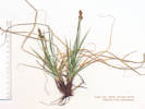
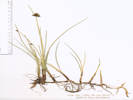
Carex inops L.H. Bailey ssp. heliophila (Mack.) Crins. Sun Sedge. Colorado School of Mines Survey Field, Jefferson County, Colorado. Grassy openings beside a small watercourse, about 350 m south of City of Golden Beverly Heights Park, 2 km south southwest of the GNIS location of Golden. 39.7381°N, 105.2274°W. WGS 1984. Elev. 1868 m. Coll. No. 1079, 23 April 2015, characters observed: Perennial herb, to 16 cm., prior year leaves to 23 cm.; Rhizome, unknown (none found); Culm, 11.5 cm. × 0.6 mm., ±triangular, but obscured by white striations at least when dry; Leaves, 12 cm. × 1.5 mm., ±flat, some folded ≤30°.; Inflorescence, multiple spikes, all approximate (I think this means all pretty close together), 1-2 pistillate spike(s) below, 1 staminate spike above; Bracts, lowest, blade 8 mm., sheath 4.5 mm., papery; Pistillate spike, peduncled 1.0-1.3 mm., 9 mm., brown (not black); Staminate spike, terminal, 16 mm., ovoid (not cylindric), brown (not black); Scales, >perigynum body; Perigynum, pubescent on faces, margin ciliate; Achenes, unknown. | |||||||||||||||||||||||||||||||||||||||||||||||||||||||||||||||||||||||||||||||||||||||||||||||||||||||||||||||||||||||||||||||||||||||||||||||||||||||||||||||||||||||||||||||||||||||||||||||||||||||||||||||||||||||||||||||||||||||||||||||||||||||||||||||||||||||||||||||||||||||||||||||||||||||||||||||||||||||||||||||||||||||||||||||||||||||||||||||||||||||||||||||||||||||||||||||||||||||||||||||||||||||||||||||||||||||||||||||||||||||||||||||||||||||||||||||||||||||||||||||||||||||||||||||||||||||||||||||||||||||||||||||||||||||||||||||||||||||||||||||||||||||||||||||||||||||||||||||||||||||||||||||||||||||||||||||||||||||||||||||||||||||||||||||||||||||||||||||||||||||||||||||||||||||||||||||||||||||||||||||||||||||||||||||||||||||||||||||||||||||||||||||||||||||||||||||||||||||||||||||||||||||||||||||||||||||||||||||||||||||||||||||||||||||||||||||||||||||||||||||||||||||||||||||||||||||||||||||||||||||||||||||||||||||||||||||||||||||||||||||||||||||||||||||||||||||||||||||||||||
|
Locations: Colorado School of Mines Survey Field. |
1080 |
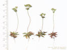
Colorado School of Mines Survey Field, Jefferson County, Colorado. Grassy openings beside a small watercourse, about 350 m south of City of Golden Beverly Heights Park, 2 km south southwest of the GNIS location of Golden. 39.738°N, 105.2274°W. WGS 1984. Elev. 1868 m. Tiny annual with small rosette of leaves, a single scape, and a small inflorescence. Collected with Cerastium arvense ssp. strictum and Carex inops ssp. heliophila. Coll. No. 1080, 23 April 2015, characters observed: Annual, to 5 cm., inconspicuous, seen only while lying in grass to collect a sedge, non-glandular hairs branched, glands few; Leaves, basal, 8 mm. × 1.8 mm. wide, elliptic, slightly narrowed at base but not clearly petioled; Peduncle (scape?), 40 mm.; Bracts, 3.7 mm., elliptic; Pedicel, 6 mm.; Sepals, 4 mm., prominently 1-veined, but keel not apparent in dry specimen, papery where united (could be described as a calyx with lobes ±= tube); Corolla, <calyx, white. | |||||||||||||||||||||||||||||||||||||||||||||||||||||||||||||||||||||||||||||||||||||||||||||||||||||||||||||||||||||||||||||||||||||||||||||||||||||||||||||||||||||||||||||||||||||||||||||||||||||||||||||||||||||||||||||||||||||||||||||||||||||||||||||||||||||||||||||||||||||||||||||||||||||||||||||||||||||||||||||||||||||||||||||||||||||||||||||||||||||||||||||||||||||||||||||||||||||||||||||||||||||||||||||||||||||||||||||||||||||||||||||||||||||||||||||||||||||||||||||||||||||||||||||||||||||||||||||||||||||||||||||||||||||||||||||||||||||||||||||||||||||||||||||||||||||||||||||||||||||||||||||||||||||||||||||||||||||||||||||||||||||||||||||||||||||||||||||||||||||||||||||||||||||||||||||||||||||||||||||||||||||||||||||||||||||||||||||||||||||||||||||||||||||||||||||||||||||||||||||||||||||||||||||||||||||||||||||||||||||||||||||||||||||||||||||||||||||||||||||||||||||||||||||||||||||||||||||||||||||||||||||||||||||||||||||||||||||||||||||||||||||||||||||||||||||||||||||||||||||
|
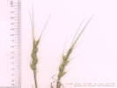
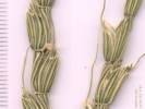
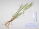
The name was first used by Pedanius Dioscorides in De Materia Medica (c. 40) as the Greek name for an uncertain marine plant (probably a species of Acetabularia), derived from andrós (genitive of an?r man) + -akes, derivative of ákos cure). The root was probably misconstrued by Linnaeus as a compound with Greek sákos shield, when applied to the land plant in the Primulaceae, meaning andros, male, and sakos, shield, alluding to anther shape.
Pronunciation: an-DRO-suh-kee
| |||||||||||||||||||||||||||||||||||||||||||||||||||||||||||||||||||||||||||||||||||||||||||||||||||||||||||||||||||||||||||||||||||||||||||||||||||||||||||||||||||||||||||||||||||||||||||||||||||||||||||||||||||||||||||||||||||||||||||||||||||||||||||||||||||||||||||||||||||||||||||||||||||||||||||||||||||||||||||||||||||||||||||||||||||||||||||||||||||||||||||||||||||||||||||||||||||||||||||||||||||||||||||||||||||||||||||||||||||||||||||||||||||||||||||||||||||||||||||||||||||||||||||||||||||||||||||||||||||||||||||||||||||||||||||||||||||||||||||||||||||||||||||||||||||||||||||||||||||||||||||||||||||||||||||||||||||||||||||||||||||||||||||||||||||||||||||||||||||||||||||||||||||||||||||||||||||||||||||||||||||||||||||||||||||||||||||||||||||||||||||||||||||||||||||||||||||||||||||||||||||||||||||||||||||||||||||||||||||||||||||||||||||||||||||||||||||||||||||||||||||||||||||||||||||||||||||||||||||||||||||||||||||||||||||||||||||||||||||||||||||||||||||||||||||||||||||||||||||||||
|
Locations: Colorado School of Mines Survey Field. |
1081 |
Colorado School of Mines Survey Field, Jefferson County, Colorado. On a nearly bare, rocky alluvial ridge, about 500 meters south of City of Golden Beverly Heights Park, 2.2 km south southwest of the GNIS location of Golden. 39.7365°N, 105.2267°W. WGS 1984. Elev. 1885 m. Coll. No. 1081, 23 Apr 2015, characters observed: Perennial, rosette to 5 cm. dia., flowering stems to 14 cm., not in alpine environment, eastern slope, hairs stellate throughout; Leaves, basal, rosette, 9 mm. × 6.5 mm., ovate, entire, petiole, 12 mm., cauline, 10 mm., appearing secund, narrowly oblanceolate; Inflorescence, exceeding leaves; Pedicels, in fruit, ascending; Fruit, 5 mm. × 2 mm., ovate-elliptic, hairs stellate, apex entire (not notched, although these immature). | |||||||||||||||||||||||||||||||||||||||||||||||||||||||||||||||||||||||||||||||||||||||||||||||||||||||||||||||||||||||||||||||||||||||||||||||||||||||||||||||||||||||||||||||||||||||||||||||||||||||||||||||||||||||||||||||||||||||||||||||||||||||||||||||||||||||||||||||||||||||||||||||||||||||||||||||||||||||||||||||||||||||||||||||||||||||||||||||||||||||||||||||||||||||||||||||||||||||||||||||||||||||||||||||||||||||||||||||||||||||||||||||||||||||||||||||||||||||||||||||||||||||||||||||||||||||||||||||||||||||||||||||||||||||||||||||||||||||||||||||||||||||||||||||||||||||||||||||||||||||||||||||||||||||||||||||||||||||||||||||||||||||||||||||||||||||||||||||||||||||||||||||||||||||||||||||||||||||||||||||||||||||||||||||||||||||||||||||||||||||||||||||||||||||||||||||||||||||||||||||||||||||||||||||||||||||||||||||||||||||||||||||||||||||||||||||||||||||||||||||||||||||||||||||||||||||||||||||||||||||||||||||||||||||||||||||||||||||||||||||||||||||||||||||||||||||||||||||||||||
| Also seen: Ipomopsis spicata, Scrophularia lanceolata sw of w. tank, Astragalus west and north of water tank, Eriogonum alatum (Syn: Pterogonium a.), ne of w. tank, a Mertensia, Viola nuttallii, Leucocrinum, and Thermopsis. | |||||||||||||||||||||||||||||||||||||||||||||||||||||||||||||||||||||||||||||||||||||||||||||||||||||||||||||||||||||||||||||||||||||||||||||||||||||||||||||||||||||||||||||||||||||||||||||||||||||||||||||||||||||||||||||||||||||||||||||||||||||||||||||||||||||||||||||||||||||||||||||||||||||||||||||||||||||||||||||||||||||||||||||||||||||||||||||||||||||||||||||||||||||||||||||||||||||||||||||||||||||||||||||||||||||||||||||||||||||||||||||||||||||||||||||||||||||||||||||||||||||||||||||||||||||||||||||||||||||||||||||||||||||||||||||||||||||||||||||||||||||||||||||||||||||||||||||||||||||||||||||||||||||||||||||||||||||||||||||||||||||||||||||||||||||||||||||||||||||||||||||||||||||||||||||||||||||||||||||||||||||||||||||||||||||||||||||||||||||||||||||||||||||||||||||||||||||||||||||||||||||||||||||||||||||||||||||||||||||||||||||||||||||||||||||||||||||||||||||||||||||||||||||||||||||||||||||||||||||||||||||||||||||||||||||||||||||||||||||||||||||||||||||||||||||||||||||||||||||||
|
|
Saturday, April 25thCollected at Ranson/Edwards Homestead Open Space Park with Matt Schweich. | ||||||||||||||||||||||||||||||||||||||||||||||||||||||||||||||||||||||||||||||||||||||||||||||||||||||||||||||||||||||||||||||||||||||||||||||||||||||||||||||||||||||||||||||||||||||||||||||||||||||||||||||||||||||||||||||||||||||||||||||||||||||||||||||||||||||||||||||||||||||||||||||||||||||||||||||||||||||||||||||||||||||||||||||||||||||||||||||||||||||||||||||||||||||||||||||||||||||||||||||||||||||||||||||||||||||||||||||||||||||||||||||||||||||||||||||||||||||||||||||||||||||||||||||||||||||||||||||||||||||||||||||||||||||||||||||||||||||||||||||||||||||||||||||||||||||||||||||||||||||||||||||||||||||||||||||||||||||||||||||||||||||||||||||||||||||||||||||||||||||||||||||||||||||||||||||||||||||||||||||||||||||||||||||||||||||||||||||||||||||||||||||||||||||||||||||||||||||||||||||||||||||||||||||||||||||||||||||||||||||||||||||||||||||||||||||||||||||||||||||||||||||||||||||||||||||||||||||||||||||||||||||||||||||||||||||||||||||||||||||||||||||||||||||||||||||||||||||||||||||
|
Locations: Ranson/Edwards Homestead Open Space Park. |
1082 |
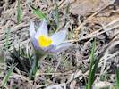
Anemone patens L. var. multifida Pritzel Developing fruit, to be combined with Coll. No. 1075. | |||||||||||||||||||||||||||||||||||||||||||||||||||||||||||||||||||||||||||||||||||||||||||||||||||||||||||||||||||||||||||||||||||||||||||||||||||||||||||||||||||||||||||||||||||||||||||||||||||||||||||||||||||||||||||||||||||||||||||||||||||||||||||||||||||||||||||||||||||||||||||||||||||||||||||||||||||||||||||||||||||||||||||||||||||||||||||||||||||||||||||||||||||||||||||||||||||||||||||||||||||||||||||||||||||||||||||||||||||||||||||||||||||||||||||||||||||||||||||||||||||||||||||||||||||||||||||||||||||||||||||||||||||||||||||||||||||||||||||||||||||||||||||||||||||||||||||||||||||||||||||||||||||||||||||||||||||||||||||||||||||||||||||||||||||||||||||||||||||||||||||||||||||||||||||||||||||||||||||||||||||||||||||||||||||||||||||||||||||||||||||||||||||||||||||||||||||||||||||||||||||||||||||||||||||||||||||||||||||||||||||||||||||||||||||||||||||||||||||||||||||||||||||||||||||||||||||||||||||||||||||||||||||||||||||||||||||||||||||||||||||||||||||||||||||||||||||||||||||||
|
Other articles:
Locations: Ranson/Edwards Homestead Open Space Park. |
1083 |
Antennaria rosea Greene. Rosy Pussytoes. Ranson/Edwards Homestead Open Space Park, Jefferson County, Colorado. 2.1 miles on Plainview Road north of Colorado State Highway 72, then 115 m west. 39.8978°N, 105.2732°W. WGS 1984. Elev. 2014 m. Growing in patches among openings in a grassy, formerly burned open ponderosa pine woodland. Coll. No. 1083, 25 April 2015, characters observed: Perennial herb, to 9 cm., stoloniferous 4-5 cm., forming loose mats in wet muddy soil, all sixteen plants collected pistillate (gynoecious?); Leaves, simple, white tomentose both sides, basal, 35 mm. × 9 mm wide, oblanceolate, cauline, 11-13 mm., linear; Inflorescence, >> basal leaves; Involucre, 5.5-7.0 mm.; Bracts (phyllaries), 5.0-6-5 mm. × 1.1-0.7 mm. wide, green at base, purplish band in middle, tips, white, scarious. | |||||||||||||||||||||||||||||||||||||||||||||||||||||||||||||||||||||||||||||||||||||||||||||||||||||||||||||||||||||||||||||||||||||||||||||||||||||||||||||||||||||||||||||||||||||||||||||||||||||||||||||||||||||||||||||||||||||||||||||||||||||||||||||||||||||||||||||||||||||||||||||||||||||||||||||||||||||||||||||||||||||||||||||||||||||||||||||||||||||||||||||||||||||||||||||||||||||||||||||||||||||||||||||||||||||||||||||||||||||||||||||||||||||||||||||||||||||||||||||||||||||||||||||||||||||||||||||||||||||||||||||||||||||||||||||||||||||||||||||||||||||||||||||||||||||||||||||||||||||||||||||||||||||||||||||||||||||||||||||||||||||||||||||||||||||||||||||||||||||||||||||||||||||||||||||||||||||||||||||||||||||||||||||||||||||||||||||||||||||||||||||||||||||||||||||||||||||||||||||||||||||||||||||||||||||||||||||||||||||||||||||||||||||||||||||||||||||||||||||||||||||||||||||||||||||||||||||||||||||||||||||||||||||||||||||||||||||||||||||||||||||||||||||||||||||||||||||||||||||
|
Locations: Ranson/Edwards Homestead Open Space Park. |
1084 | Frasera speciosa, with Mertensia, Sanicula (yellow flowers), Potentilla, Anemone patens var. multifida, etc. | |||||||||||||||||||||||||||||||||||||||||||||||||||||||||||||||||||||||||||||||||||||||||||||||||||||||||||||||||||||||||||||||||||||||||||||||||||||||||||||||||||||||||||||||||||||||||||||||||||||||||||||||||||||||||||||||||||||||||||||||||||||||||||||||||||||||||||||||||||||||||||||||||||||||||||||||||||||||||||||||||||||||||||||||||||||||||||||||||||||||||||||||||||||||||||||||||||||||||||||||||||||||||||||||||||||||||||||||||||||||||||||||||||||||||||||||||||||||||||||||||||||||||||||||||||||||||||||||||||||||||||||||||||||||||||||||||||||||||||||||||||||||||||||||||||||||||||||||||||||||||||||||||||||||||||||||||||||||||||||||||||||||||||||||||||||||||||||||||||||||||||||||||||||||||||||||||||||||||||||||||||||||||||||||||||||||||||||||||||||||||||||||||||||||||||||||||||||||||||||||||||||||||||||||||||||||||||||||||||||||||||||||||||||||||||||||||||||||||||||||||||||||||||||||||||||||||||||||||||||||||||||||||||||||||||||||||||||||||||||||||||||||||||||||||||||||||||||||||||||
|
Other articles:
Locations: Ranson/Edwards Homestead Open Space Park. |
1085 |
Noccaea fendleri (A. Gray) Holub ssp. glauca (A. Nelson) Al-Shehbaz & M. Koch. Ranson/Edwards Homestead Open Space Park, Jefferson County, Colorado. Openings in grassy, recently burned, ponderosa pine woodland, about 520 meters northeast of Plainview, 2.1 miles north on Plainview Road from Colorado State Highway 72, then 165 m west. 39.8978°N, 105.2737°W. WGS 1984. Elev. 2023 m. Perennial. Coll. No. 1085, 25 April 2015, characters observed: Perennial herbs, with basal leaves and flowering stems to 8 cm., glabrous, prior year flowering stems persistent; Leaves, basal, 8 mm. × 4 mm. wide, ±obovate, margin entire, petiole 5 mm., cauline, 8 mm. × 5 mm. wide, base auriculate, margin entire; Flowers, white, fading purple; Petals 4.5 mm.; Fruit, a silicle, 5.5 mm. × 2.5 mm., obcordate, winged distally. | |||||||||||||||||||||||||||||||||||||||||||||||||||||||||||||||||||||||||||||||||||||||||||||||||||||||||||||||||||||||||||||||||||||||||||||||||||||||||||||||||||||||||||||||||||||||||||||||||||||||||||||||||||||||||||||||||||||||||||||||||||||||||||||||||||||||||||||||||||||||||||||||||||||||||||||||||||||||||||||||||||||||||||||||||||||||||||||||||||||||||||||||||||||||||||||||||||||||||||||||||||||||||||||||||||||||||||||||||||||||||||||||||||||||||||||||||||||||||||||||||||||||||||||||||||||||||||||||||||||||||||||||||||||||||||||||||||||||||||||||||||||||||||||||||||||||||||||||||||||||||||||||||||||||||||||||||||||||||||||||||||||||||||||||||||||||||||||||||||||||||||||||||||||||||||||||||||||||||||||||||||||||||||||||||||||||||||||||||||||||||||||||||||||||||||||||||||||||||||||||||||||||||||||||||||||||||||||||||||||||||||||||||||||||||||||||||||||||||||||||||||||||||||||||||||||||||||||||||||||||||||||||||||||||||||||||||||||||||||||||||||||||||||||||||||||||||||||||||||||
|
Other articles:
Locations: Ranson/Edwards Homestead Open Space Park. |
1086 |
| |||||||||||||||||||||||||||||||||||||||||||||||||||||||||||||||||||||||||||||||||||||||||||||||||||||||||||||||||||||||||||||||||||||||||||||||||||||||||||||||||||||||||||||||||||||||||||||||||||||||||||||||||||||||||||||||||||||||||||||||||||||||||||||||||||||||||||||||||||||||||||||||||||||||||||||||||||||||||||||||||||||||||||||||||||||||||||||||||||||||||||||||||||||||||||||||||||||||||||||||||||||||||||||||||||||||||||||||||||||||||||||||||||||||||||||||||||||||||||||||||||||||||||||||||||||||||||||||||||||||||||||||||||||||||||||||||||||||||||||||||||||||||||||||||||||||||||||||||||||||||||||||||||||||||||||||||||||||||||||||||||||||||||||||||||||||||||||||||||||||||||||||||||||||||||||||||||||||||||||||||||||||||||||||||||||||||||||||||||||||||||||||||||||||||||||||||||||||||||||||||||||||||||||||||||||||||||||||||||||||||||||||||||||||||||||||||||||||||||||||||||||||||||||||||||||||||||||||||||||||||||||||||||||||||||||||||||||||||||||||||||||||||||||||||||||||||||||||||||||
|
Locations: Ranson/Edwards Homestead Open Space Park. |
1087 |
Townsendia hookeri Beaman. Hooker's Townsend Daisy. Ranson/Edwards Homestead Open Space Park, Jefferson County, Colorado. In the shade of a mature ponderosa pine, gentle slope, rocky alluvial soil, 460 meters northeast of the GNIS location of Plainview, 2.2 miles generally north on Plainview Road from Colorado State Highway 72, then 70 m west. 39.8969°N, 105.2731°W. WGS 1984. Elev. 2013 m. Coll. No. 1087, 25 Apr 2015, characters observed: Low growing perennial, from a woody caudex, to 2.5 cm.; Leaves, linear, 30 mm. × 1.2 mm. wide, appressed hairy, eglandular; Peduncle, 3 mm., spreading hairy, eglandular; Heads, solitary, disc 15-20 mm. wide; Phyllaries in 3+ overlapping series, 8 mm. × 1.2 mm. wide, all same length but inner phyllaries attached higher on receptacle giving impression of inner > outer, green, margin scarious and ciliate, tips acute and ciliate but not obviously tangled; Receptacle epaleate, flat; Ray flowers, fertile (pistillate), cypsela 3.3 mm., tuft of glandular hairs at base, pappus of 1 series white bristles, 4 mm., corolla, 11 mm., lavender; Disc flowers, bisexual, cypsela, 3.7 mm., glandular hairy, pappus 1 series white bristles, 4 mm., corolla, 3.8 mm., yellow, lobes dark. Coll. No. 1087, 25 Apr 2015, characters observed: Low growing perennial, from a woody caudex, to 2.5 cm.; Leaves, linear, 30 mm. × 1.2 mm. wide, appressed hairy, eglandular; Peduncle, 3 mm., spreading hairy, eglandular; Heads, solitary, disc 15-20 mm. wide; Phyllaries in 3+ overlapping series, 8 mm. × 1.2 mm. wide, all same length but inner phyllaries attached higher on receptacle giving impression of inner > outer, green, margin scarious and ciliate, tips acute and ciliate but not obviously tangled; Receptacle epaleate, flat; Ray flowers, fertile (pistillate), cypsela 3.3 mm., tuft of glandular hairs at base, pappus of 1 series white bristles, 4 mm., corolla, 11 mm., lavender; Disc flowers, bisexual, cypsela, 3.7 mm., glandular hairy, pappus 1 series white bristles, 4 mm., corolla, 3.8 mm., yellow, lobes dark. Coll. No. 1087, 25 Apr 2015, characters observed: Low growing perennial, from a woody caudex, to 2.5 cm.; Leaves, linear, 30 mm. × 1.2 mm. wide, appressed hairy, eglandular; Peduncle, 3 mm., spreading hairy, eglandular; Heads, solitary, disc 15-20 mm. wide; Phyllaries in 3+ overlapping series, 8 mm. × 1.2 mm. wide, all same length but inner phyllaries attached higher on receptacle giving impression of inner > outer, green, margin scarious and ciliate, tips acute and ciliate but not obviously tangled; Receptacle epaleate, flat; Ray flowers, fertile (pistillate), cypsela 3.3 mm., tuft of glandular hairs at base, pappus of 1 series white bristles, 4 mm., corolla, 11 mm., lavender; Disc flowers, bisexual, cypsela, 3.7 mm., glandular hairy, pappus 1 series white bristles, 4 mm., corolla, 3.8 mm., yellow, lobes dark.
| |||||||||||||||||||||||||||||||||||||||||||||||||||||||||||||||||||||||||||||||||||||||||||||||||||||||||||||||||||||||||||||||||||||||||||||||||||||||||||||||||||||||||||||||||||||||||||||||||||||||||||||||||||||||||||||||||||||||||||||||||||||||||||||||||||||||||||||||||||||||||||||||||||||||||||||||||||||||||||||||||||||||||||||||||||||||||||||||||||||||||||||||||||||||||||||||||||||||||||||||||||||||||||||||||||||||||||||||||||||||||||||||||||||||||||||||||||||||||||||||||||||||||||||||||||||||||||||||||||||||||||||||||||||||||||||||||||||||||||||||||||||||||||||||||||||||||||||||||||||||||||||||||||||||||||||||||||||||||||||||||||||||||||||||||||||||||||||||||||||||||||||||||||||||||||||||||||||||||||||||||||||||||||||||||||||||||||||||||||||||||||||||||||||||||||||||||||||||||||||||||||||||||||||||||||||||||||||||||||||||||||||||||||||||||||||||||||||||||||||||||||||||||||||||||||||||||||||||||||||||||||||||||||||||||||||||||||||||||||||||||||||||||||||||||||||||||||||||||||||
|
Locations: Ranson/Edwards Homestead Open Space Park. |
1088 |
| |||||||||||||||||||||||||||||||||||||||||||||||||||||||||||||||||||||||||||||||||||||||||||||||||||||||||||||||||||||||||||||||||||||||||||||||||||||||||||||||||||||||||||||||||||||||||||||||||||||||||||||||||||||||||||||||||||||||||||||||||||||||||||||||||||||||||||||||||||||||||||||||||||||||||||||||||||||||||||||||||||||||||||||||||||||||||||||||||||||||||||||||||||||||||||||||||||||||||||||||||||||||||||||||||||||||||||||||||||||||||||||||||||||||||||||||||||||||||||||||||||||||||||||||||||||||||||||||||||||||||||||||||||||||||||||||||||||||||||||||||||||||||||||||||||||||||||||||||||||||||||||||||||||||||||||||||||||||||||||||||||||||||||||||||||||||||||||||||||||||||||||||||||||||||||||||||||||||||||||||||||||||||||||||||||||||||||||||||||||||||||||||||||||||||||||||||||||||||||||||||||||||||||||||||||||||||||||||||||||||||||||||||||||||||||||||||||||||||||||||||||||||||||||||||||||||||||||||||||||||||||||||||||||||||||||||||||||||||||||||||||||||||||||||||||||||||||||||||||||
|
Other articles:
Locations: Ranson/Edwards Homestead Open Space Park. |
1089 |
Ranson/Edwards Homestead Open Space Park, Jefferson County, Colorado. On the upper bank, south side of a small creek, 75 meters east of Plainview Road, and 1.2 miles north on Plainview Road from Colorado State Highway 72. 39.8894°N, 105.2609°W. WGS 1984. Elev. 1944 m. | |||||||||||||||||||||||||||||||||||||||||||||||||||||||||||||||||||||||||||||||||||||||||||||||||||||||||||||||||||||||||||||||||||||||||||||||||||||||||||||||||||||||||||||||||||||||||||||||||||||||||||||||||||||||||||||||||||||||||||||||||||||||||||||||||||||||||||||||||||||||||||||||||||||||||||||||||||||||||||||||||||||||||||||||||||||||||||||||||||||||||||||||||||||||||||||||||||||||||||||||||||||||||||||||||||||||||||||||||||||||||||||||||||||||||||||||||||||||||||||||||||||||||||||||||||||||||||||||||||||||||||||||||||||||||||||||||||||||||||||||||||||||||||||||||||||||||||||||||||||||||||||||||||||||||||||||||||||||||||||||||||||||||||||||||||||||||||||||||||||||||||||||||||||||||||||||||||||||||||||||||||||||||||||||||||||||||||||||||||||||||||||||||||||||||||||||||||||||||||||||||||||||||||||||||||||||||||||||||||||||||||||||||||||||||||||||||||||||||||||||||||||||||||||||||||||||||||||||||||||||||||||||||||||||||||||||||||||||||||||||||||||||||||||||||||||||||||||||||||||
|
|
Thursday, April 30th | ||||||||||||||||||||||||||||||||||||||||||||||||||||||||||||||||||||||||||||||||||||||||||||||||||||||||||||||||||||||||||||||||||||||||||||||||||||||||||||||||||||||||||||||||||||||||||||||||||||||||||||||||||||||||||||||||||||||||||||||||||||||||||||||||||||||||||||||||||||||||||||||||||||||||||||||||||||||||||||||||||||||||||||||||||||||||||||||||||||||||||||||||||||||||||||||||||||||||||||||||||||||||||||||||||||||||||||||||||||||||||||||||||||||||||||||||||||||||||||||||||||||||||||||||||||||||||||||||||||||||||||||||||||||||||||||||||||||||||||||||||||||||||||||||||||||||||||||||||||||||||||||||||||||||||||||||||||||||||||||||||||||||||||||||||||||||||||||||||||||||||||||||||||||||||||||||||||||||||||||||||||||||||||||||||||||||||||||||||||||||||||||||||||||||||||||||||||||||||||||||||||||||||||||||||||||||||||||||||||||||||||||||||||||||||||||||||||||||||||||||||||||||||||||||||||||||||||||||||||||||||||||||||||||||||||||||||||||||||||||||||||||||||||||||||||||||||||||||||||||
|
Other articles:
|
1090 |
North Table Mountain Park, Jefferson County, Colorado. Lower west slopes of North Table Mountain, on the City of Golden's North Table Mountain Trail, which is also the access road to a water tank, 75 m south of the North Table Loop. 39.78°N, 105.2283°W. WGS 1984. Elev. 1861 m. Coll. No. 1090, 30 Apr 2015, characters observed: Annual, tap-rooted, to 15 cm., stellate hairs throughout (typically doubly branched and 8-pointed); Leaves, cauline, 14 mm. × 3.5 mm., oblanceolate, margin entire, tip acute, sessile or vaguely short-petioled; Sepals, 4, 2 mm., deciduous in fruit; Petals, 2.9 mm, yellow fading white, tip slightly notched; Stamens, 2.6 mm.; Filaments, 2.3 mm., winged proximal 1.8 mm.; Fruit, round, 3.5 mm. dia., margin entire, compressed parallel to the replum; Ovules, 2(4), most keys and descriptions say "2" when they give a specific number, but the genus is described as having 1-2(4) ovules. | |||||||||||||||||||||||||||||||||||||||||||||||||||||||||||||||||||||||||||||||||||||||||||||||||||||||||||||||||||||||||||||||||||||||||||||||||||||||||||||||||||||||||||||||||||||||||||||||||||||||||||||||||||||||||||||||||||||||||||||||||||||||||||||||||||||||||||||||||||||||||||||||||||||||||||||||||||||||||||||||||||||||||||||||||||||||||||||||||||||||||||||||||||||||||||||||||||||||||||||||||||||||||||||||||||||||||||||||||||||||||||||||||||||||||||||||||||||||||||||||||||||||||||||||||||||||||||||||||||||||||||||||||||||||||||||||||||||||||||||||||||||||||||||||||||||||||||||||||||||||||||||||||||||||||||||||||||||||||||||||||||||||||||||||||||||||||||||||||||||||||||||||||||||||||||||||||||||||||||||||||||||||||||||||||||||||||||||||||||||||||||||||||||||||||||||||||||||||||||||||||||||||||||||||||||||||||||||||||||||||||||||||||||||||||||||||||||||||||||||||||||||||||||||||||||||||||||||||||||||||||||||||||||||||||||||||||||||||||||||||||||||||||||||||||||||||||||||||||||||
|
Images:
|
1091 |
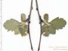
North Table Mountain, Jefferson County, Colorado. West slopes of North Table Mountain, along the City of Golden's North Table Mountain Trail, about 0.7 km south from North Table Loop, and 2.3 km north of the GNIS location of Golden. 39.7758°N, 105.2264°W. WGS 1984 Elev. 1904 m. Rocky outcrops on the toe of a landslide. Coll. No. 1091, 30 Apr 2015, characters observed: Perennial shrub, to 1.5 m.; Stem, bark, shreddy; Leaves, simple, 17 mm. × 23 mm. wide, palmate veined, lobed, serrate, few straight hairs, petiole, 11 mm.; Flowers, white, solitary, 17-19 mm.; Fruit, unknown. | |||||||||||||||||||||||||||||||||||||||||||||||||||||||||||||||||||||||||||||||||||||||||||||||||||||||||||||||||||||||||||||||||||||||||||||||||||||||||||||||||||||||||||||||||||||||||||||||||||||||||||||||||||||||||||||||||||||||||||||||||||||||||||||||||||||||||||||||||||||||||||||||||||||||||||||||||||||||||||||||||||||||||||||||||||||||||||||||||||||||||||||||||||||||||||||||||||||||||||||||||||||||||||||||||||||||||||||||||||||||||||||||||||||||||||||||||||||||||||||||||||||||||||||||||||||||||||||||||||||||||||||||||||||||||||||||||||||||||||||||||||||||||||||||||||||||||||||||||||||||||||||||||||||||||||||||||||||||||||||||||||||||||||||||||||||||||||||||||||||||||||||||||||||||||||||||||||||||||||||||||||||||||||||||||||||||||||||||||||||||||||||||||||||||||||||||||||||||||||||||||||||||||||||||||||||||||||||||||||||||||||||||||||||||||||||||||||||||||||||||||||||||||||||||||||||||||||||||||||||||||||||||||||||||||||||||||||||||||||||||||||||||||||||||||||||||||||||||||||||
|
Images:
|
1092 |
North Table Mountain, Jefferson County, Colorado. West slopes of North Table Mountain, along the City of Golden's North Table Mountain Trail, about 0.7 km south from North Table Loop, and 2.3 km north of the GNIS location of Golden. 39.7759°N, 105.2264°W. WGS 1984. Elev. 1904 m. Rocky outcrops on the toe of a landslide. | |||||||||||||||||||||||||||||||||||||||||||||||||||||||||||||||||||||||||||||||||||||||||||||||||||||||||||||||||||||||||||||||||||||||||||||||||||||||||||||||||||||||||||||||||||||||||||||||||||||||||||||||||||||||||||||||||||||||||||||||||||||||||||||||||||||||||||||||||||||||||||||||||||||||||||||||||||||||||||||||||||||||||||||||||||||||||||||||||||||||||||||||||||||||||||||||||||||||||||||||||||||||||||||||||||||||||||||||||||||||||||||||||||||||||||||||||||||||||||||||||||||||||||||||||||||||||||||||||||||||||||||||||||||||||||||||||||||||||||||||||||||||||||||||||||||||||||||||||||||||||||||||||||||||||||||||||||||||||||||||||||||||||||||||||||||||||||||||||||||||||||||||||||||||||||||||||||||||||||||||||||||||||||||||||||||||||||||||||||||||||||||||||||||||||||||||||||||||||||||||||||||||||||||||||||||||||||||||||||||||||||||||||||||||||||||||||||||||||||||||||||||||||||||||||||||||||||||||||||||||||||||||||||||||||||||||||||||||||||||||||||||||||||||||||||||||||||||||||||||
|
Other articles:
|
1093 |
North Table Mountain, Jefferson County, Colorado. West slopes of North Table Mountain, along the City of Golden's North Table Mountain Trail, about 1.0 km south from North Table Loop, and 2.0 km north of the GNIS location of Golden. 39.7735°N, 105.2257°W. WGS 1984. Elev. 1913 m. in thickets. Coll. No. 1093, 30 Apr 2015, characters observed: Perennial shrub, to 2 m.; Branches, spines or thorns 0, glabrous when young; Leaves, simple, 19 mm. × 8 mm. wide, lanceolate, pinnately veined, glabrous, margin toothed, teeth eglandular, petiole 3 mm., adaxially hairy; Sepals, 2.5 mm., reflexed; Flowers, in 2s and 3s in axils, Pedicels, sparsely hairy; Petals, white, 5-7 mm. × 4.5 mm. wide; Ovary superior; Styles 1; Fruit unknown. | |||||||||||||||||||||||||||||||||||||||||||||||||||||||||||||||||||||||||||||||||||||||||||||||||||||||||||||||||||||||||||||||||||||||||||||||||||||||||||||||||||||||||||||||||||||||||||||||||||||||||||||||||||||||||||||||||||||||||||||||||||||||||||||||||||||||||||||||||||||||||||||||||||||||||||||||||||||||||||||||||||||||||||||||||||||||||||||||||||||||||||||||||||||||||||||||||||||||||||||||||||||||||||||||||||||||||||||||||||||||||||||||||||||||||||||||||||||||||||||||||||||||||||||||||||||||||||||||||||||||||||||||||||||||||||||||||||||||||||||||||||||||||||||||||||||||||||||||||||||||||||||||||||||||||||||||||||||||||||||||||||||||||||||||||||||||||||||||||||||||||||||||||||||||||||||||||||||||||||||||||||||||||||||||||||||||||||||||||||||||||||||||||||||||||||||||||||||||||||||||||||||||||||||||||||||||||||||||||||||||||||||||||||||||||||||||||||||||||||||||||||||||||||||||||||||||||||||||||||||||||||||||||||||||||||||||||||||||||||||||||||||||||||||||||||||||||||||||||||||
|
Other articles:
|
1094 |
North Table Mountain Park, Jefferson County, Colorado. Near intersection of North Table Loop and Golden Cliffs Trail, 1.8 km north of the GNIS location of Golden. 39.7717°N, 105.2215°W. WGS 1984. Elev. 1966 m. Open grasslands on top of the mesa. | |||||||||||||||||||||||||||||||||||||||||||||||||||||||||||||||||||||||||||||||||||||||||||||||||||||||||||||||||||||||||||||||||||||||||||||||||||||||||||||||||||||||||||||||||||||||||||||||||||||||||||||||||||||||||||||||||||||||||||||||||||||||||||||||||||||||||||||||||||||||||||||||||||||||||||||||||||||||||||||||||||||||||||||||||||||||||||||||||||||||||||||||||||||||||||||||||||||||||||||||||||||||||||||||||||||||||||||||||||||||||||||||||||||||||||||||||||||||||||||||||||||||||||||||||||||||||||||||||||||||||||||||||||||||||||||||||||||||||||||||||||||||||||||||||||||||||||||||||||||||||||||||||||||||||||||||||||||||||||||||||||||||||||||||||||||||||||||||||||||||||||||||||||||||||||||||||||||||||||||||||||||||||||||||||||||||||||||||||||||||||||||||||||||||||||||||||||||||||||||||||||||||||||||||||||||||||||||||||||||||||||||||||||||||||||||||||||||||||||||||||||||||||||||||||||||||||||||||||||||||||||||||||||||||||||||||||||||||||||||||||||||||||||||||||||||||||||||||||||||
|
Other articles:
|
1095 |
Nothocalais cuspidata (Pursh) Greene. Prairie False Dandelion.
North Table Mountain Park, Jefferson County, Colorado. Beside North Table Loop, just south of intersection with Tilting Mesa Trail. 39.7751°N, 105.2225°W. WGS 1984. Elev. 1981 m. “Wavy-leaved dandelion,” open prairie on top of mesa, common. Coll. No. 1095, 30 Apr 2015, characters observed: Perennial herb, to 15 cm.; Leaves, basal, 120 mm. × 5 mm. wide, linear, arcuate, undulate, folded, margin ciliolate (?, W&W “crinkly white hairs”) Heads, solitary, ligulate; Phyllaries, in 2+ series, 20 mm. × 4 mm., green with purple coloration around midrib and scarious margins; Receptacle epaleate; Ray flowers, Pappus of bristles (with attenuate scales?); Corolla, yellow, 28 mm.; Achenes unknown (immature). | |||||||||||||||||||||||||||||||||||||||||||||||||||||||||||||||||||||||||||||||||||||||||||||||||||||||||||||||||||||||||||||||||||||||||||||||||||||||||||||||||||||||||||||||||||||||||||||||||||||||||||||||||||||||||||||||||||||||||||||||||||||||||||||||||||||||||||||||||||||||||||||||||||||||||||||||||||||||||||||||||||||||||||||||||||||||||||||||||||||||||||||||||||||||||||||||||||||||||||||||||||||||||||||||||||||||||||||||||||||||||||||||||||||||||||||||||||||||||||||||||||||||||||||||||||||||||||||||||||||||||||||||||||||||||||||||||||||||||||||||||||||||||||||||||||||||||||||||||||||||||||||||||||||||||||||||||||||||||||||||||||||||||||||||||||||||||||||||||||||||||||||||||||||||||||||||||||||||||||||||||||||||||||||||||||||||||||||||||||||||||||||||||||||||||||||||||||||||||||||||||||||||||||||||||||||||||||||||||||||||||||||||||||||||||||||||||||||||||||||||||||||||||||||||||||||||||||||||||||||||||||||||||||||||||||||||||||||||||||||||||||||||||||||||||||||||||||||||||||||
|
Other articles:
Locations: Mount Galbraith Park. Nightbird Gulch. |
Sunday, May 3rd | ||||||||||||||||||||||||||||||||||||||||||||||||||||||||||||||||||||||||||||||||||||||||||||||||||||||||||||||||||||||||||||||||||||||||||||||||||||||||||||||||||||||||||||||||||||||||||||||||||||||||||||||||||||||||||||||||||||||||||||||||||||||||||||||||||||||||||||||||||||||||||||||||||||||||||||||||||||||||||||||||||||||||||||||||||||||||||||||||||||||||||||||||||||||||||||||||||||||||||||||||||||||||||||||||||||||||||||||||||||||||||||||||||||||||||||||||||||||||||||||||||||||||||||||||||||||||||||||||||||||||||||||||||||||||||||||||||||||||||||||||||||||||||||||||||||||||||||||||||||||||||||||||||||||||||||||||||||||||||||||||||||||||||||||||||||||||||||||||||||||||||||||||||||||||||||||||||||||||||||||||||||||||||||||||||||||||||||||||||||||||||||||||||||||||||||||||||||||||||||||||||||||||||||||||||||||||||||||||||||||||||||||||||||||||||||||||||||||||||||||||||||||||||||||||||||||||||||||||||||||||||||||||||||||||||||||||||||||||||||||||||||||||||||||||||||||||||||||||||||||
|
Other articles:
Locations: Mount Galbraith Park. |
1096 |
| |||||||||||||||||||||||||||||||||||||||||||||||||||||||||||||||||||||||||||||||||||||||||||||||||||||||||||||||||||||||||||||||||||||||||||||||||||||||||||||||||||||||||||||||||||||||||||||||||||||||||||||||||||||||||||||||||||||||||||||||||||||||||||||||||||||||||||||||||||||||||||||||||||||||||||||||||||||||||||||||||||||||||||||||||||||||||||||||||||||||||||||||||||||||||||||||||||||||||||||||||||||||||||||||||||||||||||||||||||||||||||||||||||||||||||||||||||||||||||||||||||||||||||||||||||||||||||||||||||||||||||||||||||||||||||||||||||||||||||||||||||||||||||||||||||||||||||||||||||||||||||||||||||||||||||||||||||||||||||||||||||||||||||||||||||||||||||||||||||||||||||||||||||||||||||||||||||||||||||||||||||||||||||||||||||||||||||||||||||||||||||||||||||||||||||||||||||||||||||||||||||||||||||||||||||||||||||||||||||||||||||||||||||||||||||||||||||||||||||||||||||||||||||||||||||||||||||||||||||||||||||||||||||||||||||||||||||||||||||||||||||||||||||||||||||||||||||||||||||||
|
Locations: Mount Galbraith Park. |
1097 |
Cerastium arvense L. ssp. strictum Gaudin. (Syn: Cerastium strictum L. ) Field Chickweed.
Mount Galbraith Park, Jefferson County, Colorado. In the saddle near the top of Nightbird Gulch trail. 39.7656°N, 105.2499°W. WGS 1984. Elev. 2068 m. Very common, early season, white flowers. | |||||||||||||||||||||||||||||||||||||||||||||||||||||||||||||||||||||||||||||||||||||||||||||||||||||||||||||||||||||||||||||||||||||||||||||||||||||||||||||||||||||||||||||||||||||||||||||||||||||||||||||||||||||||||||||||||||||||||||||||||||||||||||||||||||||||||||||||||||||||||||||||||||||||||||||||||||||||||||||||||||||||||||||||||||||||||||||||||||||||||||||||||||||||||||||||||||||||||||||||||||||||||||||||||||||||||||||||||||||||||||||||||||||||||||||||||||||||||||||||||||||||||||||||||||||||||||||||||||||||||||||||||||||||||||||||||||||||||||||||||||||||||||||||||||||||||||||||||||||||||||||||||||||||||||||||||||||||||||||||||||||||||||||||||||||||||||||||||||||||||||||||||||||||||||||||||||||||||||||||||||||||||||||||||||||||||||||||||||||||||||||||||||||||||||||||||||||||||||||||||||||||||||||||||||||||||||||||||||||||||||||||||||||||||||||||||||||||||||||||||||||||||||||||||||||||||||||||||||||||||||||||||||||||||||||||||||||||||||||||||||||||||||||||||||||||||||||||||||||
|
Locations: Mount Galbraith Park. |
1098 |
Alyssum simplex Rudolphi. European Madwort.
Mount Galbraith Park, Jefferson County, Colorado. In the saddle near the top of Nightbird Gulch trail. 39.7655°N, 105.2498°W. WGS 1984. Elev. 2071 m. Common, flowers yellow, early season. | |||||||||||||||||||||||||||||||||||||||||||||||||||||||||||||||||||||||||||||||||||||||||||||||||||||||||||||||||||||||||||||||||||||||||||||||||||||||||||||||||||||||||||||||||||||||||||||||||||||||||||||||||||||||||||||||||||||||||||||||||||||||||||||||||||||||||||||||||||||||||||||||||||||||||||||||||||||||||||||||||||||||||||||||||||||||||||||||||||||||||||||||||||||||||||||||||||||||||||||||||||||||||||||||||||||||||||||||||||||||||||||||||||||||||||||||||||||||||||||||||||||||||||||||||||||||||||||||||||||||||||||||||||||||||||||||||||||||||||||||||||||||||||||||||||||||||||||||||||||||||||||||||||||||||||||||||||||||||||||||||||||||||||||||||||||||||||||||||||||||||||||||||||||||||||||||||||||||||||||||||||||||||||||||||||||||||||||||||||||||||||||||||||||||||||||||||||||||||||||||||||||||||||||||||||||||||||||||||||||||||||||||||||||||||||||||||||||||||||||||||||||||||||||||||||||||||||||||||||||||||||||||||||||||||||||||||||||||||||||||||||||||||||||||||||||||||||||||||||||
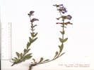
Castilleja, red, no open flowers.
|
|
Other articles:
Locations: Mount Galbraith Park.
1099
|
|
Mount Galbraith Park, Jefferson County, Colorado. South-facing, steep, rocky slopes above the Nightbird Gulch trail. 39.7654°N, 105.2452°W. WGS 1984. Elev. 2030 m.
|
Locations: Mount Galbraith Park.
1100
|
Erysimum capitatum (Hook.) Greene. Sanddune Wallflower.
| Mount Galbraith Park, Jefferson County, Colorado. South-facing, steep, rocky slopes above the Nightbird Gulch trail. 39.7654°N, 105.2452°W. WGS 1984. Elev. 2034 m.
|
Other articles:
Locations: Mount Galbraith Park.
1101
|
|
Agoseris parviflora (Nutt.) D. Dietr. Steppe Agoseris. Mount Galbraith Park, Jefferson County, Colorado. Small saddle on ridge, 40 m north of Nightbird Gulch Trail. 2.3 km northwest of the GNIS location of Golden. 39.7664°N, 105.2441°W. WGS 1984. Elev. 2018 m. Coll. No. 1101, 3 May 2015, characters observed: Perennial herb, to 20 cm.; Leaves, basal, to 180 mm. × 6 mm. wide, not prickly, margins, generally straight (not wavy), 0- to 6-toothed, sparsely ciliate or hairy; Inflorescence, single heads on scape to 15 cm.; Phyllaries, in 2+ graduated series, 10-13-16 mm., generally green, mid-vein dark purple, margin scarious, outer phyllaries, mid-vein and margin ciliate; Ray flowers, corolla, 20-22 mm., yellow (drying more purple than pink), lobes 5; Disc flowers 0; Pappus, simple capillary bristles; Achene, surface smooth, beak unknown (immature).
|
|
| Monday, May 11thTucker Gulch
|
Other articles:
1102
|
|
Tucker Gulch (lower), Jefferson County, Colorado. Along Tucker Gulch, near its junction with Cressmans Gulch, about 220 m below Ford Street, and 400 m above First Street. 39.7697°N, 105.229°W. WGS 1984. Elev. 1754 m. Probably var. interius (Britton) Sarg. Coll. No. 1102, 11 May 2015, characters observed: Tree, ±5 m.; Branches, young, soft short hairy; Leaves, opposite, ternately compound, leaflets 3; Pistil 1; Stigma, branches 2; Fruit, 2 winged 1-seeded samaras.
|
Other articles:
1103
|
Salix, yellow, match with Coll. No. 1073.
| Salix alba L. White Willow. Tucker Gulch (lower), Jefferson County, Colorado. On the lower banks adjacent to creek, lower Tucker Gulch, about 260 meters north northwest of the First Street bridge. 39.7687°N, 105.228°W. WGS 1984. Elev. 1776 m. Stems bright yellow, glabrous. Eight to ten plants on both sides of creek with roots in water, plus 2 multi-trunk trees approximately 100 meters upstream. Contains materials matched from Coll. No. 1073, 16 Mar 2016. Coll. No. 1103, 11 May 2015, characters observed: Perennial upright shrub to 4 m., growing into multiple-trunked tree to 10 m.; Twigs, yellow-brown, glabrous (not pruinose), current-year growth not available; Bud, scale margins connate; Leaves, alternate, 39 mm. × 9.5 mm. wide, = 4.1×long vs. wide, mid-vein slightly long hairy, margins hairy, otherwise leaves glabrous, youngest leaves with margins glandular-toothed, petiole, 3 mm., eglandular, deeply grooved adaxially; Plants, staminate, no pistillate material found. Catkins, 50 mm., not branched, arising from subterminal buds; Stamens 2, Filaments, 3 mm., not connate; Anthers, 0.7 mm.; Capsules, unknown.
|
1104
|
Salix, red-brown, match with Coll. No. 1074.
|
|
Other articles:
Locations: Rooney Road Sports Complex. Tin Cup Ridge.
|
| Thursday, May 15th
|
Other articles:
1105
|
Comandra umbellata (L.) Nutt. ssp. pallida (A. DC.) Piehl. Pale Bastard Toadflax.
| Tin Cup Ridge, Jefferson County, Colorado. Along the top of the north end of Tin Cup Ridge, the northward extension of Dakota Ridge into the city of Golden, 4.5 km south southeast of the GNIS location of Golden, east across US Highway 40 from the Peabody Museum dig at Magic Mountain. 39.7166°N, 105.2066°W. WGS 1984. Elev. 1872 m.
|
Other articles:
1106
|
| Zigadenus paniculatus (Nutt.) S. Watson var. gramineus (Rydb.) Ackerfield. Grassy Death Camas. Tin Cup Ridge, Jefferson County, Colorado. Along the top of the north end of Tin Cup Ridge, the northward extension of Dakota Ridge into the city of Golden, 4.5 km south southeast of the GNIS location of Golden, east across US Highway 40 from the Peabody Museum dig at Magic Mountain. 39.7166°N, 105.2065°W. WGS 1984. Elev. 1893 m. Coll. No. 1106, 14 May 2015, characters observed (or not!): Perennial herb, geophyte, to 30 cm.; Leaves, mostly basal and some cauline, linear, cauline alternate; Inflorescence, terminal raceme (no paniculate branches at base of inflorescence); Pedicels, ascending; Flowers, symmetric, bisexual, 9 mm. dia.; Tepals, 6, all similar, to 4.5 mm. × 3 mm. wide, white to cream, some clawed ≥1 mm. (although, it is not clear to me that these are the outer tepals), unable to visualize glands at base of tepals in dry specimens; Stamens, 6, 5 mm., ≥tepals.
|
Other articles:
1107
|
|
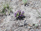
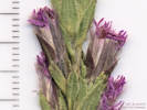
Tin Cup Ridge, Jefferson County, Colorado. Openings along the rocky top of Tin Cup Ridge, the northern extension of Dakota Ridge into Golden, 4.53 km south southeast of the GNIS location of Golden. 39.7163°N, 105.2066°W. WGS 1984. Elev. 1903 m. East across US Highway 40 from the Peabody Museum dig at Magic Mountain, which was collected by E. H. Brunquist (1959). Coll. No. 1107, 14 May 2015, characters observed (or not!): Perennial terrestrial herb, to 30 cm.; Stem very short hairy proximally (supposedly in lines but not clearly so to me), becoming glandular-hairy in the inflorescence; Leaves, basal and cauline, glabrous, basal, petiole, 20 mm., blade, 35 mm. × 13 mm. wide, ovate, entire, cauline, petioled 8 mm. to sessile distally, 25 mm. × 7 mm. wide, margin entire to minutely toothed distally; Inflorescence, thryse, 8 to 12 flowers per node; Calyx, lobe 2 mm. + 5 lobes 2 mm. = 4 mm.; Flowers, zygomorphic, parts in 5s, not spurred; Corolla fused at base, purple, 15 mm., lobes 2 mm., limb 10 mm., outer surface glandular-pubescent; Stamens, 4, included, staminode 1, hairy at tip; Anther, purple, sacs papillate.
|
Other articles:
1108
|
|
Senecio integerrimus Nutt. Columbia Ragwort. Tin Cup Ridge, Jefferson County, Colorado. In shrubby vegetation along the top of Tin Cup Ridge, the northward extension of Dakota Ridge into Golden, 4.58 km south southeast of the GNIS location of Golden. 39.716°N, 105.2066°W. WGS 1984. Elev. 1905 m. East across US Highway 40 from the Peabody Museum dig at Magic Mountain, which was collected by E. H. Brunquist (1959). Coll. No. 1108, characters observed: Perennial herb, to 60 cm.; Leaves, basal and cauline, some densely tomentose along petiole and mid-vein, else thinly tomentose, basal, petiole 60 mm. + blade ovate 110 mm. × 35 mm. wide, margin entire to slightly scalloped (somewhat more like that described for P. crocata), cauline, sessile, lance-linear, 130 mm. × 15 mm. wide, reduced above, margins, some with small, dense, sharp teeth; Inflorescence, ±8 heads per stem; Phyllaries in 1 series, (partially enclosing alternate ray and disc flowers), 6 mm. × 1.7 mm. wide, tips mucronate; Receptacle epaleate; Pappus of bristles in ±1+ series, 6-7 mm.; Ray flowers, few (8-12), ♀-only, tube 4 mm. + blade 8 mm. = 12 mm. × 3 mm. wide; Disc flowers bisexual.
|
Other articles:
1109
|
| Tin Cup Ridge, Jefferson County, Colorado. In grasses and shrubs high on the east side of Tin Cup Ridge, a northward extension of Dakota Ridge into Golden, 4.9 km south southeast of the GNIS location of Golden. 39.7133°N, 105.2051°W. WGS 1984, Elev. 1928 m. East across US Highway 40 from the Peabody Museum dig at Magic Mountain, which was extensively collected by E. H. Brunquist (1959). Coll. No. 1109, 14 May 2015, characters observed: Perennial herb to 50 cm.; Inflorescence, solitary heads on 40 cm. scape; Phyllaries in 2 series, outer lance-linear, 18 mm. × 4 mm. wide, veins, 5, prominent, tomentose abaxially, adaxially distally, inner obovate, 11 mm. × 4 mm. wide, distal abaxial tomentose and ciliate; Receptacle paleate, Paleae, 11 mm × 3 mm. wide, ciliate, and distal abaxial tomentose, palea covers abaxial side of achene, and is barely folded around one edge, but does not fully enclose achene; Pappus 0; Ray flower, fertile, stamens present but degenerate (?) and not functional (?), corolla, tube 2 mm. + blade 27 mm. × 12 mm. wide, yellow; Disc flowers, bisexual, corolla, 6 mm., yellow; Achene, 9 mm., compressed radially.
|
Images:
|
| Sunday, May 17thHike on Green Mountain.
|
Other articles:
Locations: Apex Park.
|
| Monday, May 25th
|
Other articles:
|
| Tuesday, May 26th
|
Other articles:
1110
|
|
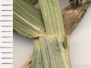
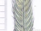
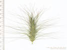
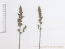
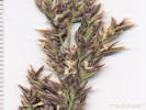
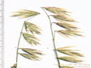
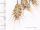
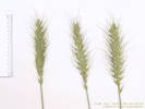
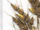
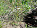
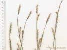
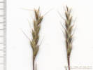
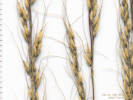
Secale cereale L. Cereal Rye. Golden, Jefferson County, Colorado. On a bank of Nightbird Gulch, just east of CO State Highway 93, and south of Iowa Drive, 1.35 km northwest of the GNIS location of Golden. 39.7637°N, 105.233°W. WGS 1984. Elev. 1776 m. Coll. No. 1110, 26 May 2015, characters observed: Annual, erect to 1 m.; Leaf, sheath open, ligule membraneous, auricle 1 mm.; Inflorescence, terminal spike, 10 cm.; Internode 2 mm.; Spikelets, 2-ranked, 1 per node, sessile, bases not embedded in rachis; Glumes, 2, awl-like, 8-9 mm., ±equal, keeled, purplish distally, appearing to hide the rachis but not the lemmas; Florets 2, arranged side-to-side; Lemma, 12 mm., keeled, keel ciliate, margins, one ciliate, the other less so, awned; Awns, 16 mm., short proximally, lengthening distally, straight to wavy, some slightly twisted.
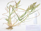
|
Other articles:
1111
|
|
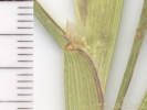
Dactylis glomerata L. Orchard Grass. Golden, Jefferson County, Colorado. On a bank of Nightbird Gulch, east of CO State Highway 93, and south of Iowa Drive, 1.35 km northwest of the GNIS location of Golden. 39.7636°N, 105.233°W. WGS 1984. Elev. 1783 m. Coll. No. 1111, 26 May 2015, characters observed: Perennial grass, to 1.15 m., not rhizomatous, base not bulbous; Leaf, sheath open (roughly half of published descriptions describe sheath as closed), blade, 25 cm. × 0.7 cm. wide, ligule, membraneous, 5 mm., auricle, rounded, <1 mm.; Inflorescence, panicle, 13 cm., 1° branches open, erect; Spikelets, all on one side of rachis, crowded in dense clusters, on 2°-4° panicle branches with ±4 developed florets; Glumes, 2, lower, 3.5 mm, smaller and thinner than upper, 6 mm., keeled, ciliate on keel, else sparsely hairy, Florets, not forming bulblets; Lemmas, lowest largest, 5 mm., with 1 mm. awn tip, reduced above.
|
Other articles:
1112
|
|
Golden, Jefferson County, Colorado. On a bank of Nightbird Gulch, east of CO State Highway 93, and south of Iowa Drive, 1.35 km northwest of the GNIS location of Golden. 39.7638°N, 105.2329°W. WGS 1984. Elev. 1784 m. Coll. No. 1112, 26 May 2015, characters observed: Annual grass, to 30 cm.; Leaves, Sheath, 50 mm., closed proximal ⅔, open distally, Ligule, membraneous, 1 mm.; Blade, 60 mm.; Inflorescence, open panicle, rachis and pedicels short hairy, Spikelets, 1 per node, 15 mm., laterally compressed; Glumes, 2, sparsely hairy, margins scarious, lower, 2.3 mm., veins indistinct, upper, 4.5 mm. Callus, glabrous, very short, Florets, ±6, Lemma, 6.5 mm., 0.7 from mid-vein to margin, back rounded, sparsely hairy, tip, forked, teeth 1 mm., awned from near tip, awn, 5-7 mm.; Anthers, 3, 0.4 mm. Dimensions are small for B. tectorum, perhaps because of the early date of collection.
|
Other articles:
1113
|
|
Golden, Jefferson County, Colorado. On a bank of Nightbird Gulch, east of CO State Highway 93, and south of Iowa Drive, 1.35 km northwest of the GNIS location of Golden. 39.7638°N, 105.2329°W. WGS 1984. Elev. 1779 m. Coll. No. 1113, 26 May 2014, characters observed: Perennial grass to 1 m., should have creeping rhizomes but these not collected; Leaves, sheath, 80 mm., closed, ligule, <1 mm., membraneous, blade, 170 mm × 5 mm., soft, with a distinguishing fold, usually described as an “M” or a “W”; Inflorescence, panicle, multiple 1° branches per node, mostly on one side of rachis; Spikelets, 1 per node on 1° and 2° panicle branches, 18-19 mm., laterally compressed, 4+ florets per spikelet; Glumes, 2, keeled, glabrous, lower, 8 mm., upper, 10 mm., <lowest floret; Rachilla, sparsely hairy on abaxial side, not extended beyond uppermost floret; Callus, small, glabrous; Lemma, 12 mm., veins, 3 obvious, tip bifid, some awned; Awn (when present), 1.6 mm., arising near tip of lemma.
|
Other articles:
1114
|
|
Tucker Gulch (lower), Jefferson County, Colorado. Along the Tucker Gulch trail, 70 m. north of the First Street bridge, 1.4 km north northwest of the GNIS location of Golden. 39.7671°N, 105.2273°W. WGS 1984. Elev. 1771 m.
|
Other articles:
Locations: Ranson/Edwards Homestead Open Space Park.
|
| Thursday, May 28th
|
Other articles:
1115
|
|
Tragopogon dubius Scop. Yellow Salsify. Ranson/Edwards Homestead Open Space Park, Jefferson County, Colorado. High plains above Rocky Flats, 15.2 km north northeast of Golden, 1.3 miles north of CO State Highway 72 on Plainview Road, 65 m. east of Plainview Road, 39.8893°N, 105.2609°W. WGS 1984. Elev. 1933 m. Peduncle inflated distally, flowers yellow, phyllaries in 1 overlapping series, ligules 3-5 mm. shorter than phyllaries. Dry upper banks on south side of creek.
|
Other articles:
1116
|
|
Ranson/Edwards Homestead Open Space Park, Jefferson County, Colorado. High plains above Rocky Flats, 15.2 km north northeast of Golden, 1.3 miles north of CO State Highway 72 on Plainview Road, 65 m. east of Plainview Road. 39.8893°N, 105.2608°W. WGS 1984. Elev. 1950 m. Not common in Jefferson County, but with several other nearby collections, e.g., from Rocky Flats and around the mouth of Coal Creek Canyon. Coll. No. 1116, 28 May 2015, characters observed: Perennial, to 5-6 cm., with scapose inflorescence to 9 cm., spreading by leafy stoloniferous branches; Leaves, basal and cauline, entire, basal, linear-oblanceolate, 35 mm. × 2.5 mm., cauline, linear, 13 mm. × 1.5 mm.; Inflorescence, single heads on scape to 8 cm.; Receptacle epaleate; Phyllaries, 2+series, ±equal, 4 mm., hairy abaxially, ascending multicellular hairs with clear crosswalls, glandular between hairs; Flowers of 2 kinds; Pappus of bristles, 2 mm., + short scales, that of ray and disc flowers alike; Rays, #±80, corolla white, fading lilac, 8 mm. × 0.5 mm.; Disc flowers, corolla yellow, lobes triangular; Achene, short hairy.
|
Other articles:
1117
|
|
Koeleria macrantha (Ledeb.) Schult. Prairie Junegrass.
Ranson/Edwards Homestead Open Space Park, Jefferson County, Colorado. High plains above Rocky Flats, 15.2 km north northeast of Golden, 1.3 miles north of CO State Highway 72 on Plainview Road, 85 m. east of Plainview Road. 39.8893°N, 105.2607°W. WGS 1984. Elev. 1947 m. Perennial bunch grass, not rhizomatous. Coll. No. 1117, 28 May 2015, characters observed: Perennial grass, to 40 cm., not rhizomatous, lacking bulbous base; Leaves, sheath open, ligule membraneous, 1 mm., auricles 0, blade 38 mm. × 2.5 mm., tip, prow-shaped; Inflorescence, 70-80 mm., panicle, narrow, contracted; Spikelets, not enclosed in burs, not in pairs, pedicellate, 5 mm., green with purple tinge, moderately laterally compressed; Pedicel, ascending hairs; Glumes, ±similar, slightly keeled, ±hairy on keel, lower, 3 mm., <1st lemma, upper, 5 mm.; Florets, mostly 2 per spikelet; Rachilla, extends beyond upper floret, glabrous; Callus, few hairs, not cobwebby; Lemma, 4 mm., hairs at base, barely keeled, keel with few short hairs, veins, 3 conspicuous, tips scarious; Palea, <lemma, transparent, veins, 2, hairy. Distinguished from P. secunda on the strength of: lateral compression (Harrington, 1954), keels on glumes and lemmas (Weber & Wittmann, 2012, and Ackerfield, 2015), lack of cobwebby hairs at base of lemma (Shaw, 2008), and lemma hairy on keel and flowers unisexual (Baldwin, 2012).
|
Other articles:
1118
|
|
Poa pratensis L. ssp. pratensis. Kentucky Bluegrass. Ranson/Edwards Homestead Open Space Park, Jefferson County, Colorado. High plains above Rocky Flats, 15.2 km north northeast of Golden, 1.3 miles north of CO State Highway 72 on Plainview Road, 100 m. east of Plainview Road. 39.8895°N, 105.2605°W. WGS 1984. Elev. 1940 m. Sloping bank of creek, perennial grass, rhizomatous. Coll. No. 1118, 28 May 2015, characters observed: Perennial grass, to 60 cm.; Rhizomes, to 12 cm., 0.8 mm. dia.; Culm, not bulbous at base, not strongly flattened; Leaf, sheath, 130 mm., open at least ½; ligule, 1.8 mm., membraneous; auricles 0, blade, lower involute, upper flat, 75 mm. × 3 mm. wide, tip prow-shaped; Inflorescence, panicle, shape at maturity unknown, branches scabrous; Spikelets, 5 mm., singly pedicelled on 3°-5° branches; Compression lateral; Disarticulation above the glumes; Glumes, keeled, small line of stiff hairs distally, lower, 2.3 mm., <lowest lemma, veins 3, upper, 2.5 mm.; Florets, appear staminate, may be immature; Callus with some cobwebby hairs, but cobwebby hairs also elsewhere; Lemma, 3 mm., veins, 5, prominent, ±evenly spaced (leads to Melica, which this is not), keel and margins cobwebby proximally, margins scarious, tip broadly acute, awns 0, Palea, 2.5 mm., green, esp. on veins.
|
Other articles:
1119
|
|
Arnica fulgens Pursh. Foothill Arnica. Ranson/Edwards Homestead Open Space Park, Jefferson County, Colorado. High plains above Rocky Flats, 15.2 km north northeast of Golden, 1.3 miles north of CO State Highway 72 on Plainview Road, 110 m. east of Plainview Road. 39.889°N, 105.2604°W. Elev. 1943 m. Very wet, running water among grasses and sedges. Coll. No. 1119, 28 May 2015: characters observed: Perennial herb of wetlands, to 35 cm., glandular hairy throughout; Leaves, mostly basal and few cauline, basal, axils with 5 mm. brown wavy hair, petiole 70 mm. + blade 60 mm. × 12 mm. wide, 5 × longer than wide, cauline, opposite, sessile, ±2 pair, much reduced; Inflorescence, single heads on peduncle to 80 mm., flowers of two kinds; Phyllaries, 2 ±equal series, 12 mm., green with dark tips; Receptacle epaleate; Rays, fertile, tube 3 mm. + blade 16 mm. × 7 mm. wide = 19 mm., corolla yellow; Disc flowers, tube 7 mm. + lobes ≤1 mm. = 8 mm.; Pappus, bristles, 9 mm., white; Achene, 5 mm., short hairy.
|
Other articles:
1120
|
|
Ranson/Edwards Homestead Open Space Park, Jefferson County, Colorado. High plains above Rocky Flats, 15.2 km north northeast of Golden, 1.3 miles north of CO State Highway 72 on Plainview Road, 150 m. east of Plainview Road. 39.8892°N, 105.2598°W. WGS 1984. Elev. 1941 m. Coll. No. 1120, 28 May 2015, characters observed: Perennial herb, to 40 cm., caulescent, eastern slope; Leaves, opposite, well-spaced, sessile, 66 mm. × 23 mm. wide, lanceolate, entire, glaucus; Inflorescence, axis glabrous, not glandular-hairy, flowers mostly on one side of the stem; Calyx, 5 mm., with purple-tinged sinus tissue; Flowers, 18 mm., magenta; Stamens, inserted; Staminode, 1.8 mm. wide at tip, hairy; Anther, sacs, glabrous on side opposite dehiscence.
|
Other articles:
1121
|
|
Ranson/Edwards Homestead Open Space Park, Jefferson County, Colorado. High plains above Rocky Flats, 15.2 km north northeast of Golden, 1.3 miles north of CO State Highway 72 on Plainview Road, 150 m. east of Plainview Road. 39.8892°N, 105.2598°W. WGS 1984. Elev. 1938 m. Penstemon, small, sparsely flowering, easily overlooked. Coll. No. 1121, 28 May 2015, characters observed: Perennial herb, of eastern slope, ascending 16 cm. from horizontal rooting stem; Stem, short hairy becoming gland-tipped hairs distally; Leaves, “basal” and cauline, “basal,” crowded around sprouts from horizontal stems, petiole 30 mm. + blade 30 mm. × 7 mm. wide, oblanceolate, entire, tip mucronate, cauline, opposite, sessile, 30 mm. × 8 mm. wide, lanceolate, slightly toothed; Inflorescence, thyrse, arising from axils, leaves reduced; Pedicels, 3 mm., with gland-tipped hairs; Calyx, 4 mm., lobe tips acute; Corolla, 13 mm., blue-violet (not pale); Stamens, inserted; Staminode, not enlarged at tip, hairy in terminal 2 mm.; Anther sacs, papillate, not hairy.
|
Other articles:
Locations: Ranson/Edwards Homestead Open Space Park.
1122
|
|
Ranson/Edwards Homestead Open Space Park, Jefferson County, Colorado. High plains above Rocky Flats, 15.3 km north northeast of Golden, 1.3 miles north of CO State Highway 72 on Plainview Road, 190 m. east of Plainview Road, 100 m. north of creek. 39.8906°N, 105.2597°W. WGS 1984. Elev. 1935 m. Collected only four flowers and two leaves because this was a single plant out on the lone prairie.
|
Other articles:
1123
|
|
Ranson/Edwards Homestead Open Space Park, Jefferson County, Colorado. High plains above Rocky Flats, 15.3 km north northeast of Golden, 1.3 miles north of CO State Highway 72 on Plainview Road, 60 m. east of Plainview Road, 35 m. north of creek. 39.8998°N, 105.261°W. WGS 1984. Elev. 1939 m. Growing in spring-fed flowing water. Coll. No. 1123, 28 May 2015, characters observed: Perennial herb, to 50 cm., growing in running water; Inflorescence, 3-5 spikelets, 18-31 mm., cylindrical, lowest pistillate, peduncle 6 mm., stout, erect, intermediate pistillate below and staminate above, upper staminate; Bracts, lowest without sheath; Scales, pistillate, 3.5 mm. × 1.4 mm. wide, generally black except prominent midrib and chartaceous margin; Perigynia, 3.0 mm. × 1.2 mm. wide, some 3-5 veined, but not all, beak, 0.4 mm, bifid; Stigmas, 2.
|
|
Georeferenced collections of Carex made within 15 km. (10 mi.) of Ranson Edwards Homestead Open Space Park.
|
|
1124
|
Lithospermum incisum
|
|
Other articles:
1125
|
Anemone patens L. var. multifida Pritzel. Eastern Pasqueflower.
| Ranson/Edwards Homestead Open Space Park, Jefferson County, Colorado. Just north of Plainview Road, 2.1 miles by road north of the intersection of Plainview Road and Colorado State Highway 72, Coal Creek Canyon Road. 39.8981°N, 105.2725°W. WGS 1984. Elev. 2002 m. Scattered among grassy areas in recently burned Ponderosa pine woodland. Flowers: Coll. No. 1075, 23 Mar 2015; Fruit: Coll. No. 1082, 25 Apr 2015; Leaves: Coll. No. 1125, 28 May 2015. Material from this collection combined with Coll. No. 1075.
|
Other articles:
Locations: Mount Falcon Park.
|
| Monday, June 1st
|
Other articles:
1126
|
|
Poa fendleriana (Steud.) Vasey. ssp. fendleriana Muttongrass. Mount Falcon Park, Jefferson County, Colorado. Just south of the main observation tower on the top of Mount Falcon. 39.6296°N, 105.2306°W. WGS 1984. Elev. 2391 m. Perennial bunchgrass, growing in rocks and on wooded slopes, spikelets light and dark colors, no rhizomes. Coll. No. 1126, 1 June 2015, characters observed: Perennial grass, of shady dry places, to 40 cm., not rhizomatous; Leaves, sheath, open ½, ligule, membraneous, ±1 mm., auricles 0, blade, soft, short and rolled distally; Inflorescence, panicle, 3°-4° branches, somewhat contracted, i.e., not broad, branches sparsely scabrous; Pedicels, 1.5-2.5 mm., short ascending hairs; Spikelets, 1 per node; Compression lateral; Glumes, 2, lower, 3 mm., <lowest lemma, upper, 4 mm., Florets, 5-6, lowest 1-3 pistillate, upper undetermined but no evidence of stamens; Callus glabrous; Rachilla, extends beyond upper floret; Lemma, 4 mm., keeled, veins 5, tip obtuse, awns 0, wavy hairs proximal half of keels and margins; Palea, 2.3 mm., transparent, keels green and hairy. Didn't feel very confident about my determination on this one. Checked it out again. Keys easily to Poa fendleriana in Shaw (2012), but in Ackerfield (2015) it gets lost at 2a-2b over the shape of the panicle, i.e., is it “open or loosely contracted” vs. “narrow and tightly contracted.” I would say “loosely contracted,” which leads most easily to P. wheeleri. P. wheeleri has not been collected in Jefferson County.
|
Other articles:
1127
|
|
|
Other articles:
1128
|
|
Antennaria parvifolia Nutt. Small-Leaf Pussytoes. Mount Falcon Park, Jefferson County, Colorado. East-facing, grassy slope of small unnamed hill, 530 m north northwest of Mt. Falcon, approximately 13.5 km south of Golden. 39.634°N, 105.2323°W. WGS 1984. Elev. 2365 m. Dense mats in openings of sparse ponderosa pine. Involucres large.
|
1129
|
|
Mertensia lanceolata (Pursh) DC. Prairie Bluebells. Mount Falcon Park, Jefferson County, Colorado. West-facing, grassy slope of small unnamed hill, 630 m north northwest of Mt. Falcon, approximately 13.5 km south of Golden. 39.6345°N, 105.234°W. WGS 1984. Elev. 2372 m. Strigose hairs on adaxial surface of leaves pointed toward tip, ring of hairs near base of corolla tube, and hairy at insertion point of filaments.
|
Literature Cited:
|
Neson and Baird (1993) placed Chrysothamnus nauseosus and similar taxa within Ericameria based on their dissimilarity to Chrysothamnus and their similarity to Ericameria, as noted by commentaries in earlier literature and corroborated by their observations, and by comparative embryology, latex production, DNA variation, and various other chemical studies. Together, these suggest that similarities in phyllary arrangement have been unduly weighted in the definition of Chrysothamnus.
| Neson and Baird (1993) defined Ericameria nauseosa (Pallas ex Pursh) Nesom & Baird subsp. nauseosa, including the following varieties (the gray forms): bemardina, bigelovii, glabrata, glareosa, hololeuca, iridis, latisquamea, nana, nauseosa, psilocarpa, salicifolia, speciosa, texensis, and washoensis. For the common variety of Ericameria nauseosa in the Golden, Colorado, Nesom and Baird (1993) define Ericameria nauseosa (Pallas ex Pursh) Nesom & Baird var. glabrata(A. Gray) Nesom & Baird, comb. nov. BASIONYM: Bigelovia graveolens Nutt. var. glabrata A. Gray, Proc. Amer. Acad. Arts 8:645. 1873. Synonym: Chrysothamnus nauseosus (Pallas ex Pursh) Britt. subsp. graveolens (Nutt.) Hall & Clements, Carnegie Inst. Washington Publ. 326:214. 1923. We now use the name E. nauseosa var. graveolens (Nuttall) Reveal & Schuyler, published in Proc. Acad. Nat. Sci. Philadelphia. 149: 20. 1999. I have been unable to obtain that publication, so I don't know the rationale for using the name var. graveolens.
|
Other articles:
Locations: North Table Mountain.
|
| Tuesday, June 9th
|
Other articles:
1130
|
|
North Table Mountain Park, Jefferson County, Colorado. Flat area below the rim of North Table Mountain, and above W. 43rd Drive and Ulysses Way, 3.2 km northeast of the GNIS location of Golden. 39.7774°N, 105.197°W. WGS 1984. Elev. 1861 m. Flowering stems arise from base of rosette. Growing in volcanic rock outcrop on toe of landslide. Coll. No. 1130, 9 Jun 2015, characters observed: Perennial herb, to 30 cm., stellate hairs throughout, caulescent, of eastern slope, non-alpine; Leaves, basal and cauline, petiole 28 mm. + blade 33 mm. × 12 mm. wide, margin entire to wavy to slightly toothed; Inflorescence, exceeding leaves; Pedicels, in fruit, ascending to sigmoid to rarely recurved; Fruit, notched at apex.
|
Other articles:
1131
|
|
Koeleria macrantha (Ledeb.) Schult. Prairie Junegrass. North Table Mountain Park, Jefferson County, Colorado. Flat area below the rim of North Table Mountain, and above W. 43rd Drive and Ulysses Way, 3.2 km northeast of the GNIS location of Golden. 39.7775°N, 105.197°W. WGS 1984. Elev. 1892 m. Perennial, clumped, non-rhizomatous, contracted shiny panicle. Coll. No. 1131, 9 June 2015, characters observed: Perennial grass, to 45 cm., non-rhizomatous; Leaves, sheath, open, ligule, 1.5 mm., membraneous, auricles, 0, blade, tip prow-shaped; Inflorescence, panicle, shiny in anthesis, short branches, branches hairy; Florets, 3, #1 and #2 pistillate, #3 staminate, open, i.e., palea separated from lemma; Disarticulation, between florets; Rachilla hairy, extends nearly 1 mm. above upper floret, extension undecorated; Lemma, 4.5 mm., veins 5, short hairy throughout, awn, 0.5 mm., short, soft; Palea, =lemma, transparent; Stamens, 3, 1.8 mm.
|
Other articles:
1133
|
|
Erigeron tracyi Greene. Running Fleabane.
North Table Mountain Park, Jefferson County, Colorado. Mesa top, southeast portion of North Table Mountain, 3.3 km northeast of the GNIS location of Golden. 39.7789°N, 105.1972°W. WGS 1984. Elev. 1939 m. Stem hairs spreading. Very thin soil on volcanic caprock of mesa. Coll. No. 1133, 9 Jun 2015, characters observed: Perennial herb, 20 25 cm., non-rhizomatous, stems non-stoloniferous, eglandular hairy throughout, with hairs 0.2-0.4 mm. spreading in all directions; Leaves, basal and cauline, basal, petiole 23 mm. + blade oblanceolate 20 mm. × 4 mm. wide, margin entire, tip acute, some withered at flowering time, cauline, ±sessile, reduced above, but up to 32 mm. × 1.8 mm. wide; Phyllaries, in 2 ±equal series, but not distinctly imbricate, 3 mm., lanceolate, green center, light margins; Receptacle epaleate; Flowers, 2 kinds; Ray flowers, cypsela 0.5 mm. + tube 2 mm. + ligule 4 mm. = 6.5 mm. × 0.8 mm. wide, fertile, tip rounded, white fading purple; Disk flowers, yellow, just beginning to open but lobes appear to be triangular; Pappus of short and long bristles.
|
Other articles:
1134
|
|
North Table Mountain Park, Jefferson County, Colorado. Mesa top, southeast portion of North Table Mountain, 3.4 km northeast of the GNIS location of Golden. 39.7797°N, 105.1972°W. WGS 1984. Elev. 1944 m. Flowers white. Very thin soil on the volcanic caprock of the mesa.
|
Other articles:
1135
|
| Veronica peregrina L. ssp. xalapensis (Kunth) Pennell. Neckweed. North Table Mountain Park, Jefferson County, Colorado. Mesa top, southeast portion of North Table Mountain, 3.4 km northeast of the GNIS location of Golden 39.7803°N, 105.1978°W. WGS 1984. Elev. 1951 m. Annual, tiny white flowers, growing in standing water in small pools on the volcanic caprock of North Table Mountain. Coll. No. 1135, 9 June 2015, characters observed: Annual herb to 18 cm., of very wet places, stem, bracts, and sepals lightly stalked glandular; Leaves, cauline, opposite, what appears to be alternate leaves above are really bracts of inflorescence; Inflorescence, appears to be flowers borne singly in leaf axils, but “leaves” are actually bracts in a terminal raceme; Bracts, 12 mm. × 1.8 mm., lanceolate, entire, tip rounded; Sepals, 4, 2.5 mm. × 0.8 mm. wide, united at base in pairs, entire, persistent; Corolla, 2.8 mm., white, fused at base, lobes, 4, 2 mm., tips rounded; Ovary, 1 mm. × 0.8 mm. wide, superior; Style, short, (0.1 mm.?), persistent; Stigma, entire, ball-shaped; Fruit, 3 mm. × 4 mm. wide, obovoid, in 2 parts; Ovules, many.
|
Other articles:
|
|
|
Other articles:
1137
|
| Lupinus argenteus Pursh var. argenteus. Loosely Flowered Silver Lupine. North Table Mountain Park, Jefferson County, Colorado. North-facing grassy slope, 50 m south of the Mesa Top Trail, 150 m west of the east rim of North Table Mountain, 3.6 km northeast of the GNIS location of Golden. 39.7835°N, 105.2007°W. WGS 1984. Elev. 1914 m. Perennial, leaves cauline, spur absent, corolla white with blue-lavender stripes. Upper slope, north-facing. Coll. No. 1137, 9 Jun 2015, characters observed: Perennial herb, to 50 cm., caulescent, generally appressed hairy, except as noted; Leaves, cauline, petiole 25 mm., appressed hairy, blade, palmately compound, leaflets, 7, 40 mm. × 6 mm. wide, lanceolate, glabrous adaxially, appressed hairy abaxially; Inflorescence, 15-20 cm., elongating as it matures; Pedicel, 3 mm., densely spreading hairs; Calyx, 5 mm., hairy, persistent; Flowers, spur, <1 mm., corolla, white with blue-lavender stripes, banner, 11 mm., recurved from a point 4 mm. below apex, back lightly hairy, wings, 12 mm., keel, shallow, glabrous except few small hairs below, pouched down mid-keel; Style, 9 mm., persistent; Fruit, 10 mm. × 3 mm. high, shaggy hairy. Weber & Wittmann (2012) use “keel glabrous” as a key character. Harrington (1954) and Ackerfield (2015) neither use keel decoration as a key character nor do they describe the decoration of the keel. California floras, e.g., Munz (1965) and Baldwin (2012), use a ciliate keel, as a key character to identify L. argenteus. Welch, et al. (1993) note that the keel can be glabrous or variously ciliate.
|
Other articles:
1138
|
|
North Table Mountain Park, Jefferson County, Colorado. Trailside, in colluvium at base of steep slope, along the Mesa Top Trail, just below the east rim of North Table Mountain, 3.8 km northeast of the GNIS location of Golden. 39.7847°N, 105.1977°W. WGS 1984. Elev. 1913 m.
|
Images:
1139
|
|
North Table Mountain Park, Jefferson County, Colorado. Trailside, along the Mesa Top Trail, just below the east rim of North Table Mountain, 3.8 km northeast of the GNIS location of Golden. 39.7847°N, 105.1976°W. WGS 1984. Elev. 1909 m.
|
Other articles:
1140
|
|
Aristida purpurea Nutt. Var. longiseta (Steud.) Vasey. Purple Threeawn. North Table Mountain Park, Jefferson County, Colorado. Scattered beside and across the Mesa Top Trail at a small switchback, 250 m east of and below the east rim of North Table Mountain, 3.9 km northeast of the GNIS location of Golden. 39.785°N, 105.1966°W. WGS 1984. Elev. 1897 m. Short, fine-leaved grass, long awns. Coll. No. 1140, 9 Jun 2015, characters observed: Perennial grass, 20 cm. when collected, possibly elongating in maturity; Inflorescence, panicle, branches not pulvinate, i.e., no swelling at bases of pedicels; Axis ±straight; Pedicels, stiff, ±straight; Spikelets with 1 floret; Glumes, 2, lower, 11 mm., veins 1, upper, 20 mm.; Lemma, 11 mm., smoothly transitioning to awns without twisted column, apex 0.4-0.6 mm. wide, awns, 3, 58 mm., straight. Determined var. longiseta per length of upper glumes and dimensions of lemma.
|
Other articles:
1141
|
|
Astragalus drummondii Dougl. Ex Hook. Drummond's Milkvetch. North Table Mountain Park, Jefferson County, Colorado. Trailside in grass and small brush, near the intersection of the Mesa Top Trail and North Table Loop, eastern slopes of North Table Mountain, 4.1 km northeast of the GNIS location of Golden. 39.7862°N, 105.1951°W. WGS 1984. Elev. 1852 m. Coll. No. 1141, 9 Jun 2015, characters observed: Perennial herb, to 35 cm., caulescent; Stem, rachis, abaxial leaf surfaces, and calyx spreading hairy, hairs basifixed; Leaves, cauline, compound, odd-pinnate, stipules, 9 mm., free, entire, leaflets, 23-27, 19 mm. × 5.5 mm. wide, wavy hairy abaxially and marginally, ±glabrous adaxially; Calyx, tube 6 mm. + lobes 3 mm. = 9 mm., green at base to cream color at tube and lobes, few dark wavy hairs, persistent; Corolla, 17 mm., color cream, banner, 17 mm., wings, claw 6 mm. + blade 9 mm., tip obtuse, keel, 14 mm., tip purple, Ovary, 9 mm.; Style, 4 mm., glabrous, persistent; Fruit, stalked 12 mm. + body 26 mm. × 4 mm. Wide, pendant, smooth, glabrous, not inflated.
|
Locations: Colorado School of Mines Survey Field.
|
| Monday, June 15thColorado School of Mines Survey Field
|
Images:
1142
|
Tradescantia occidentalis
|
|
Other articles:
Locations: Colorado School of Mines Survey Field.
1143
|
|
Colorado School of Mines Survey Field, Jefferson County, Colorado. Northern section of Survey Field, just south of Lookout Mountain Road, 1.95 km south southwest of the GNIS location of Golden. 39.739°N, 105.2286°W. WGS 1984. Elev. 1869 m. Collected with Tradescantia occidentalis, Ratibida columnifera, Dalea purpurea, and a Helianthus. Coll. No. 1143, 15 Jun 2015, characters observed: Perennial herb, to 30 cm.; Stem, tomentose throughout; Leaves, cauline, sessile, 90 mm. × 5 mm., narrowly lanceolate, entire; Bracts, 36 mm. × 11 mm., elliptic to oblanceolate, entire, green at base to red-orange; Calyx, tube 25 mm. + cleft below 10 mm. = 35 mm., cleft above 8 mm., light green to tips red-orange; Corolla, 36 mm.
|
1144
|
Field determination: June grass?
| Koeleria macrantha (Ledeb.) Schult. Prairie Junegrass. Colorado School of Mines Survey Field, Jefferson County, Colorado. Northern section of Survey Field, base of Lookout Mountain, 70 m west of Windy Saddle Park boundary, 2.06 km southwest of the GNIS location of Golden. 39.7383°N, 105.2301°W. WGS 1984. Elev. 1889 m. Bunch grass, not rhizomatous. Coll. No. 1144, 15 Jun 2015, characters observed: Perennial bunchgrass, to 55 cm., non-rhizomatous; Leaves, most basal or lowest cauline, cauline, sheath, 90 mm., open, ligule, membraneous, <1 mm., auricles, 0, blade, 40 mm., tip constricted but not prow-shaped; Inflorescence, panicle, 60 mm. × 9 mm., contracted, has shiny appearance due to exposure of translucent palae, Spikelets, 5 mm., 1 per node on 1-3° or indistinct panicle branches; Pedicel, short hairy; Glumes, lower, 3 mm., veins 1, upper, 4 mm., veins 3; Rachis, short hairy; Florets, mixed bisexual and pistillate; Lemma, awns, 0; Palea, translucent or colorless, exposed, i.e., outside lemma.
|
1145
|
Field identification: Carex?
| Carex brevior (Dewey) Mack. Shortbeak Sedge. Colorado School of Mines Survey Field, Jefferson County, Colorado. Northern section of Survey Field, base of Lookout Mountain, 70 m west of Windy Saddle Park boundary, 2.06 km southwest of the GNIS location of Golden. 39.7383°N, 105.23°W. WGS 1984. Elev. 1891 m. Coll. No. 1145, 15 June 2015, characters observed: Grass-like perennial, to 75 cm.; Leaves, basal and lower cauline; Inflorescence, terminal, multiple individually distinct spikelets; Bracts, 9 mm., <inflorescence and spikelets, lacking sheath, strong central vein, Spikelets, 4-6 per stem, 10 mm. × 5 mm. wide, gynecandrous (staminate below, pistillate above); Scales, thin, <perigynia; Perigynia, 4.5 mm. × 3 mm. wide, 1.5 × long as wide, glabrous, margin, ±winged, entire below, serrulate above, beak, 1.4 mm., flat, serrulate to tip; Stigmas, 2; Achene, 2 mm. × 1.5 mm. wide, lenticular.
|
1146
|
|
Nassella viridula (Trin.) Barkworth. Green Needlegrass. Colorado School of Mines Survey Field, Jefferson County, Colorado. Northern section of Survey Field, base of Lookout Mountain, 70 m west of Windy Saddle Park boundary, 2.06 km southwest of the GNIS location of Golden. 39.7383°N, 105.2301°W. WGS 1984. Elev. 1893 m. Coll. No. 1146, 15 Jun 2015, characters observed: Perennial grass, to 1 m., non-rhizomatous; Leaves, cauline, sheath, 17 mm., ligule, 3 mm., membraneous, collar with few hairs at sides, blade, to 30 cm., convolute; Inflorescence, panicle, to 20 cm.; Glumes, 2, 9 mm., ±equal, colorless, exc. 3 green veins, tip, short (2 mm.) hair-like awn; Disarticulation, above the glumes, Florets, 1 per spikelet; Lemma, 6 mm. × 1.2 mm. wide, green, hairy, indurate, enclosing grain, awns, 1, 20 mm., twisted, bent; Palea, 2 mm., glabrous.
|
Images:
1147
|
|
Oenothera suffrutescens (Ser.) W. L. Wagner & Hoch. Linda Tarde. Colorado School of Mines Survey Field, Jefferson County, Colorado. Northwestern corner of Survey Field, 40 m east of Windy Saddle Park at base of Lookout Mountain, near City of Golden water tank and site of former Lookout Mountain tramway, 2.2 km south southwest of the GNIS location of Golden. 39.7371°N, 105.2303°W. WGS 1984. Elev. 1910 m. Coll. No. 1147, 15 June 2015, characters observed: Perennial herb, to 40 cm.; Stem, exfoliating brown layer proximally, very few eglandular hairs distally; Leaves, cauline, alternate, sessile, 21 mm. × 4.5 mm. wide, elliptic, margin toothed; Bud, appressed hairy; Sepals, 9 mm., reflexed; Flowers, solitary in bracted spike or axils; Petals, 4, 7 mm. × 3 mm. wide, clawed 2 mm., color red, without spots or streaks; Capsule, 4 mm., mature size and shape unknown; Seeds, unknown.
|
Locations: Colorado School of Mines Survey Field.
1148
|
|
Astragalus flexuosus G. Don. Flexible Milkvetch. Colorado School of Mines Survey Field, Jefferson County, Colorado. Northwestern corner of Survey Field, 50 m east of Windy Saddle Park boundary at base of Lookout Mountain, near City of Golden water tank and site of former Lookout Mountain tramway, 2.25 km south southeast of the GNIS location of Golden. 39.7365°N, 105.2302°W. WGS 1984. Elev. 1913 m. Coll. No. 1148, 15 Jun 2015, characters observed: Perennial herb, to 50 cm., not vine-like, caulescent, hairs basifixed; Leaves, cauline, compound, odd pinnate, leaflets ±15, terminal leaflet not modified into tendril, stipules, entire, not lobed at base, not connate, leaflets, 12 mm. × 4 mm. wide, oblong, notched, terminal leaflet 7 mm. < uppermost pair 8 mm.; Inflorescence, raceme; Calyx, 4 mm., not inflated in fruit; Flower, zygomorphic, banner, 9 mm., wings (2), 9 mm., keel, 5.5 mm., <wings, not beaked; Style, 3 mm., glabrous, persistent; Fruit, 9 mm. × 4.5 mm., substipitate 1 mm., not inflated, compression lateral sparse appressed hairs.
|
Locations: Colorado School of Mines Survey Field.
1149
|
|
Geranium caespitosum James. Pineywoods Geranium. Colorado School of Mines Survey Field, Jefferson County, Colorado. Northwestern corner of Survey Field, 50 m east of Windy Saddle Park boundary at base of Lookout Mountain, near City of Golden water tank and site of former Lookout Mountain tramway, 2.25 km south southeast of the GNIS location of Golden. 39.7365°N, 105.2301°W. WGS 1984. Elev. 1914 m. It's not crystal clear that this is G. caespitosum vs. G. viscosissimum, especially since this collection includes neither fruit nor basal leaves. Aedo (2001) distinguishes between then two taxa on the ratio of fruit length / stigmatic remains length, and the width of the basal leaves. Weber and Wittmann (2012) use the shape of the plant, i.e., erect with 1 or few stems, vs. many stems, often sprawling. Ackerfield (2015) distinguishes between the two taxa on the width of the basal leaves, and the shapes of the lobes thereon. Harrington (1954) distinguishes between G. caespitosum and G. nervosum Rydb. (=G. viscosissimum) on the basis of single stems from a branched caudex vs. multiple stems from a simple caudex. So, it would appear important to collect fruit or pay special attention to the basal leaves, the caudex and how stems arise from the caudex. The California treatment of Geranium was authored by Carlos Aedo where G. caespitosum is not recognized.
|
Other articles:
Locations: Green River. No Name.
|
| Saturday, June 20th
|
Other articles:
Locations: Tonopah.
|
| Sunday, June 21st
|
Other articles:
Locations: Columbus Salt Marsh.
|
| Monday, June 22nd
|
Other articles:
Locations: The Gap.
1150
|
| Psorothamnus polydenius (S. Watson) Rydb. var. polydenius. Nevada Dalea. Gap Spring, Esmeralda County, Nevada. On the side of a spring mound about 1.25 mi north of the GNIS location of Gap Spring, sometimes also called “The Gap,” 0.75 mi east of Nevada State Route 773, 3 mi south of US Highway 6. 37.9919°N, 117.9881°W. WGS 1984. Elev. 1402 m. Coll. No. 1150, 22 Jun 2015, characters observed: Perennial shrub, to 40 cm., unarmed; Stem, short soft hairy with dense hemispherical glands, 0.4 mm., the hairs and glands becoming hardened with age; Leaves, compound, 10 mm. × 3.5 mm. wide, odd-pinnate, leaflets 7-11, 2 mm. × 1 mm. wide, ovate, terminal leaflet ±=lateral, hairy, few reddish-brown glands; Inflorescence, crowded at tops of stems, 12 mm. × 8 mm. dia.; Pedicel, 0.5 mm., bractlets 0; Calyx, tube, 1.8 mm., green, glabrous with rows of red-brown glands, lobes, 2 mm., spreading hairy with red-brown gland at tip; Flower, bilateral, 4.5 mm., corolla purple; Fruit, unknown.
|
Other articles:
Locations: The Sump.
|
|
|
Other articles:
|
|
|
Other articles:
|
|
|
Other articles:
|
|
|
Other articles:
Locations: Benton Valley.
|
|
|
Other articles:
|
|
|
Other articles:
Locations: Big Sand Flat.
|
|
|
1151
|
Field identification: Anisocoma acaulis, not common, milky sap.
| Anisocoma acaulis Torr. & A. Gray. Scale Bud. Big Sand Flat, Mono County, California. Northwest side of CA Hwy 120, near center of Big Sand Flat and intersection of CA Hwy 120 and Forest Road 01S04 “Pilot Springs Road.” 37.8769°N, 118.8927°W. WGS 1984 Elev. 2401 m. Milky sap. Also found at this location, Astragalus monoensis.
|
|
Observation of Astragalus monoensis.
|
|
Other articles:
|
|
|
Other articles:
1154
|
|
Elymus elymoides (Raf.) Swezey var. elymoides. Squirreltail Grass. Mono Mills, Mono County, California. In a small unnamed sand flat, with a sheep watering trough, northeast of the intersection of Forest Roads 1S06 “120 Cutoff” and 1S13 “Old Rail Road.” 37.8508°N, 118.9379°W. WGS 1984. Elev. 2402 m. Perennial, tufted, non-rhizomatous, in pumice sand. Also found at this location, Astragalus monoensis. Coll. No. 1154, 22 Jun 2015, characters observed: Perennial tufted grass to 30 cm.; Leaves, hairy throughout, sheath, 8-9 cm., hairy abaxial, ligule, membraneous, <1 mm., auricle,0, blade, 11 cm., rolled, hairy both sides; Inflorescence, 10-11 cm., internodes 5 mm., disarticulating at axis; Spikelets, 2-ranked, sessile, 2 per node, not embedded in pits; Glumes, 50-55 mm., spreading, some with 2-3 awn-like divisions; Lemma, awns ±=glume awns.
|
|
| Tuesday, June 23rd
|
Other articles:
|
|
|
Other articles:
1155
|
|
Big Sand Flat, Mono County, California. Along Forest Road 01S19B, northwest side of Big Sand Flat, reached from California Highway 120, northwest 0.25 mi on Forest Road 01S19 “M&R Tank Rd, ” then northeast 0.25 mi on Forest Road 01S19B. 37.8779°N, 118.8995°W. WGS 1984. Elev. 2400 m. Also collected or observed nearby, Abronia turbinata, Astragalus monoensis, Carex douglasii, and Diplacus mephiticus.
|
|
Observation of Astragalus monoensis
|
|
Other articles:
|
|
|
1158
|
Abronia turbinata S. Watson. Transmontane Sand Verbena.
| Big Sand Flat, Mono County, California. Sandy soil in open pine forests, slope above and northwest of Big Sand Flat, along Forest Road 01S19D, reached by way of Forest Road 01S19 “M&R Tank Rd” from California Highway 120. 37.8768°N, 118.9031°W. WGS 1984. Elev. 2429 m.
|
Other articles:
|
|
|
|
| Wednesday, June 24th
|
Other articles:
|
|
|
Other articles:
|
|
|
Other articles:
|
|
|
Other articles:
Locations: Warm Springs.
|
|
|
Other articles:
Locations: Warm Springs.
|
|
|
1159
|
Triglochin maritima L. Seaside Arrowgrass.
| Warm Springs, Mono County, California. About 450 m south of the GNIS location of Warm Springs, accessed by way of Forest Road 01N54 “East Shore Road”, 20.4 km by air east northeast of Lee Vining, California. 38.0296°N, 118.9042°W. WGS 1984. Elev. 1956 m. Beside a small stream of warm water, on an otherwise bare former shoreline of Mono Lake.
|
Other articles:
1160
|
|
Amphiscirpus nevadensis (S. Watson) Oteng-Yeb. Nevada Bulrush. Warm Springs, Mono County, California. About 450 m south of the GNIS location of Warm Springs, accessed by way of Forest Road 01N54 “East Shore Road”, 20.4 km by air east northeast of Lee Vining, California. 38.0296°N, 118.9042°W. WGS 1984. Elev. 1956 m. Beside a small stream of warm water, on an otherwise bare former shoreline of Mono Lake. Perianth, bristles present (rudimentary perianth segments).
|
1161
|
Cleomella parviflora A. Gray. Slender Cleomella.
| Warm Springs, Mono County, California. About 450 m south of the GNIS location of Warm Springs, accessed by way of Forest Road 01N54 “East Shore Road”, 20.4 km by air east northeast of Lee Vining, California. 38.0296°N, 118.9042°W. WGS 1984. Elev. 1947 m. Beside a small stream of warm water, on an otherwise bare former shoreline of Mono Lake.
|
Other articles:
1162
|
|
Warm Springs, Mono County, California. About 450 m south of the GNIS location of Warm Springs, accessed by way of Forest Road 01N54 “East Shore Road”, 20.4 km by air east northeast of Lee Vining, California. 38.0294°N, 118.9042°W. WGS 1984. Elev. 1948 m. On a bare, indurated former shoreline of Mono Lake, away from a small stream of warm water.
|
Images:
1163
|
Schoenoplectus pungens (Vahl) Palla. Threesquare.
| Warm Springs, Mono County, California. About 650 m south of the GNIS location of Warm Springs, accessed by way of Forest Road 01N54 “East Shore Road”, 20.4 km by air east northeast of Lee Vining, California. 38.0277°N, 118.9055°W. WGS 1984. Elev. 1953 m. Growing in the waters of a small warm spring, one of many such springs in this location.
|
1164
|
Cleomella parviflora A. Gray. Slender Cleomella.
| Warm Springs, Mono County, California. About 650 m south of the GNIS location of Warm Springs, accessed by way of Forest Road 01N54 “East Shore Road”, 20.4 km by air east northeast of Lee Vining, California. 38.0278°N, 118.9054°W. WGS 1984. Elev. 1946 m. Growing among tufa-covered rocks around a small warm spring.
|
Images:
1165
|
Juncus balticus Willd. ssp. ater (Rydb.) Snogerup.
| Warm Springs, Mono County, California. About 650 m south of the GNIS location of Warm Springs, accessed by way of Forest Road 01N54 “East Shore Road”, 20.4 km by air east northeast of Lee Vining, California. 38.0278°N, 118.9054°W. WGS 1984. Elev. 1948 m. Growing among tufa-covered rocks around a small warm spring. Coll. No. 1165, 24 Jun 2015, characters observed: Perennial grass-like herb, to 60 cm.; Rhizomes unknown; Stem, smooth, cylindric; Leaves, sheath, 5 cm., blades, 0; Inflorescence, appearing lateral, open, bract, cylindric, resembling continuation of stem; Perianth, 4.5 mm.; Stamens, 6; Stigmas, 3; Fruit, 2.5 mm., beak prominent.
|
Other articles:
Locations: Warm Springs.
|
|
|
Other articles:
|
|
|
Other articles:
1166
|
|
Mono Valley, Mono County, California. About 1 km south of California Highway 167 on Forest Road 03N103, which parallels the former Bodie & Benton Railway roadbed. 38.1075°N, 118.9337°W. WGS 1984. Elev. 1991 m. In a slowly filling sand depression of the former railway roadbed. Coll. No. 1166, 24 Jun 2015, characters observed: Caespitose annual or short-lived perennial herb, to 10 cm.; Leaves, mostly basal, petiole 44 mm. + blade 33 mm. × 14 mm. wide, ovate, margins entire and toothed; Buds erect; Corolla, 32 mm., limb 56 mm., white, fading lavender; Anthers versatile, attached in middle; Pollen, with viscin threads; Stigma, lobes, 4; Fruit, unknown, fortunately not necessary to key in Taylor (2010), though required in most other floras.
|
Other articles:
1167
|
|
Sarcobatus vermiculatus (Hook.) Torr. Greasewood. Mono Valley, Mono County, California. Along Forest Road 02N47 “Waford Springs Cutoff,” near the intersection of California Highway 267 and Cottonwood Canyon Road, 8.4 km northeast of Lee Vining. 38.0758°N, 119.0446°W. WGS 1984. Elev. 1966 m. Staminate. Also collected nearby, Tetradymia glabrata.
|
Other articles:
1168
|
|
Mono Valley, Mono County, California. Along Forest Road 02N47 “Waford Springs Cutoff,” near the intersection of California Highway 267 and Cottonwood Canyon Road, 8.4 km northeast of Lee Vining. 38.0758°N, 119.0445°W. WGS 1984. Elev. 1966 m. Also collected nearby, Sarcobatus vermiculatus. Coll. NO. 1168, 24 Jun 2015, characters observed: Perennial woody shrub, to 1 m., drying quite brittle; Stems, pubescence of stems interrupted by glabrescent streaks; Leaves, eglandular, primary leaf an appressed thorn, 4.5 mm., early deciduous, secondary leaves clustered in axils, 5.0 mm. × 0.8 mm. wide, linear to oblanceolate; Inflorescence, 7-8 heads on ends of short branches, none of flowers with strap-shaped corollas, flowers of one kind (disk flowers); Peduncle, 5.5-6.0 mm., tomentose; Involucre, cylindric; Phyllaries, #4, in 1 series, 6 mm., ±keeled, tomentose abaxially; Receptacle, epaleate; Flowers, #4; Corolla, yellow; Pappus of many well-developed bristles; Fruit, long soft hairy;
|
Other articles:
Locations: Mono Lake, north shore (as a collection locality).
1169
|
|
Mono Valley, Mono County, California. At the current end of Forest Road 03N09 “No. Mono Gravel Pit,” 1 km south of the intersection of California Highway 167 and Cottonwood Canyon Road, and 15 km northwest of Lee Vining. 38.0732°N, 119.039°W. WGS 1984. Elev. 1962 m. Volcanic cinder sand, some windblown, on a former shoreline terrace of Mono Lake. Coll. No. 1169, 24 Jun 2015, characters observed: Perennial bunch grass, to 1 m., of high-altitude desert, caespitose (non-rhizomatous); Nodes, (densely?) pubescent; Leaf, short hairy throughout, sheath, 22 cm., open, ligule, 3 mm., auricles, ? (I don't see any), blade, 32 cm., flat; Inflorescence, 15 cm. × 15 mm., 2-ranked, not branched; Rachis (axis), short hairy, assumed to remain intact with age (not disarticulating at flowering or after drying), internodes, 6 mm.; Spikelets, many, all similar, 2 per node, sessile, 20 mm., bisexual; Compression, lateral; Glumes, #2, awn-like, ±equal, 12-13 mm.; Lemma, 10 mm., awn 1 mm.; Palea, 10 mm.; Anthers, 6.7&mnsp;mm.
|
Other articles:
Locations: South Tufa Area.
|
| Thursday, June 25th
|
Other articles:
Locations: South Tufa Area.
|
|
|
Other articles:
Locations: Rush Creek delta.
|
|
|
Other articles:
Locations: Rush Creek delta.
|
|
|
Other articles:
Locations: Rush Creek delta.
|
|
|
1170
|
Myosotis laxa Lehm. Bay Forget-Me-Not.
| Rush Creek delta, Mono County, California. Beside the newly incised main channel of Rush Creek, 1 km north northeast of the intersection of Forest Roads 01N51 “South Tufa Road” and 01N50 “Rush Creek Road”, 5.8 km east of Lee Vining. 37.9554°N, 119.0526°W. WGS 1984. Elev. 1949 m. Growing in waterlogged gravels creekside. Substantially outside the natural range of this taxon in California, but well-established in the Mono Lake basin; perhaps a garden escapee.
|
1171
|
Field identification: Veronica
| Veronica anagallis-aquatica L. Water Speedwell. Rush Creek delta, Mono County, California. Beside the newly incised main channel of Rush Creek, 1 km north northeast of the intersection of Forest Roads 01N51 “South Tufa Road” and 01N50 “Rush Creek Road”, 5.8 km east of Lee Vining. 37.9554°N, 119.0527°W. WGS 1984. Elev. 1949 m. Growing in waterlogged gravels creekside. Coll. No. 1171, 25 Jun 2015, characters observed: Emergent aquatic herb, to 25 cm., may be perennial but annual here due to recent habitat changes, generally glabrous throughout; Leaves, opposite, sessile, 32 mm. × 13 mm wide (2.46 × longer than wide), elliptic; Inflorescence, opposite axillary racemes and terminating main stem; Flower; Corolla, lavender with darker streaks; Petals, 2.5 mm. × 2 mm. wide; Capsule, 3 mm. × 2.2 mm. wide.
|
1172
|
Undetermined. Opposite leaves, small axillary flowers.
| Veronica peregrina L. ssp. xalapensis (Kunth) Pennell. Neckweed. Rush Creek delta, Mono County, California. Beside the newly incised main channel of Rush Creek, 1 km north northeast of the intersection of Forest Roads 01N51 “South Tufa Road” and 01N50 “Rush Creek Road”, 5.8 km east of Lee Vining. 37.9554°N, 119.0526°W. WGS 1984, Elev. 1948 m. Opposite leaves, small axillary flowers. Growing in waterlogged gravels creekside. There are two collections of this taxon from the Bodie Hills nearby, but this would appear to be the first collection from the Mono Lake basin. Coll. No. 1172, 25 Jun 2015, characters observed: Emergent aquatic herb, to 20 cm., probably annual, glandular hairy throughout; Leaves, opposite, sessile, 24 mm. × 6 mm. wide, oval, margin entire; Inflorescence, an elongated terminal raceme; Bracts to 12 mm, reduced above; Pedicel (in fruit) 0.6-1.0 mm.; Sepals, 4.5-5.0 mm., outer pair slightly larger; Flowers, small, corolla white; Capsule, 4.5 mm. × 5 mm. wide, notched 0.3 mm.; Style, very short, ±0.1 mm.
|
Images:
1173
|
Juncus macrandrus Coville. Long-Anther Rush.
| Rush Creek delta, Mono County, California. Beside the newly incised main channel of Rush Creek, 1 km north northeast of the intersection of Forest Roads 01N51 “South Tufa Road” and 01N50 “Rush Creek Road”, 5.8 km east of Lee Vining. 37.9555°N, 119.0526°W. WGS 1984. Elev. 1949 m. Growing in waterlogged gravels creekside. Coll. No. 1173, 25 Jun 2015, characters observed: Grass-like perennial herb, to 30 cm.; Rhizomes present; Leaf, blade, flat, iris-like, oriented with edge toward stem; Inflorescence, appearing terminal, bract, not resembling continuation of stem; Anthers, 2 mm., >> filaments; Pistil, style 2 mm. + stigma 2.2 mm. = 4.2 mm; Fruit, abruptly tapered to beak.
|
Other articles:
Locations: Rush Creek delta.
1174
|
|
Puccinellia nuttalliana (Schult.) Hitchc. Nuttall's Alkali Grass. Rush Creek delta, Mono County, California. Rush Creek delta near the Mono Lake shoreline, 1 km north northeast of the intersection of Forest Roads 01N51 “South Tufa Road” and 01N50 “Rush Creek Road”, 5.8 km east of Lee Vining. 37.9555°N, 119.0518°W. WGS 1984. Elev. 1948 m. Perennial, non-rhizomatous, open inflorescence. In a former distributary channel of Rush Creek, now drying because of incision of the main channel, due to lowering lake level. Coll. No. 1174, 25 Jun 2015, characters observed: Perennial grass, to 60 cm., not rhizomatous; Leaves, sheath, open, ligule, membraneous, blade, involute, 2 mm. wide when flat; Inflorescence, well-developed panicle, 21 cm., many similar spikelets; Spikelets, 1 per node, attached to 1°-3° branches, 6 mm. × 1.3 mm. wide, Glumes, 2, lower < lowest floret, awns 0; Pedicel, uniformly scabrous; Florets, #3, androgynous; Lemmas, lowest, 2.7 mm., veins 5, tip obtuse, awns 0; Anther, 0.9 mm.
|
Images:
1175
|
|
Poa secunda J. Presl ssp. juncifolia (Scribn.) Soreng. Sandberg Bluegrass.. Rush Creek delta, Mono County, California. Rush Creek delta near the Mono Lake shoreline, 1 km north northeast of the intersection of Forest Roads 01N51 “South Tufa Road” and 01N50 “Rush Creek Road”, 5.8 km east of Lee Vining. 37.9555°N, 119.0518°W. WGS 1984. Elev. 1948 m. Beside a former distributary channel of Rush Creek, now drying because of incision of the main channel, due to lowering lake level. Coll. No. 1175, 25 Jun 2015, characters observed: Perennial grass, to 75 cm., basal or subterranean nodes not enlarged, rhizomes 0; Leaves, sheath, open, ligule, membraneous, 3 mm., blade, tips, prow-shaped; Inflorescence, well-developed panicle, 1°-4° branching evident, exceeding upper leaves; Spikelets, many, all similar, 1 per node, not subtended by bristles or long-silky hairs, ovate in outline, bisexual; Compression, obvious, moderate lateral; Glumes, #2, awns 0, < lowest floret, lower, 2.4 mm., veins 1, upper, 2.8 mm., veins 3; Disarticulation, above the glumes, Florets, #3+, fertile, 2+; Callus, generally glabrous, but there is a small (0.3 mm.) tangle of hairs atop the callus or at the base of the lemma that stays with the callus or caryopsis when lemma is removed; Lemma, 3.5 mm., slightly keeled distally, veins indistinct, awn 0; Palea, 3.2 mm., veins hairy or scabrous; Anthers, 1.8 mm.
|
1176
|
Erythranthe guttata (Fisch. ex DC.) G.L. Nesom. Seep Monkeyflower.
| Rush Creek delta, Mono County, California. Rush Creek delta near the Mono Lake shoreline, 1 km north northeast of the intersection of Forest Roads 01N51 “South Tufa Road” and 01N50 “Rush Creek Road”, 5.8 km east of Lee Vining. 37.9555°N, 119.0519°W. WGS 1984. Elev. 1948 m. Throat pouched up. In a former distributary channel of Rush Creek, now drying because of incision of the main channel, due to lowering lake level. Coll. No. 1176, 25 Jun 2015, characters observed, Annual herb, erect, largest 20 cm.; Leaves, toothed, not lobed or dissected; Pedicel, 10-25 mm.; Flowers, (2)5-6(13) per stem; Calyx, (in flower) 7-8 mm.; Corolla, yellow, throat pouched up, closed.
|
1177
|
|
Rush Creek delta, Mono County, California. Rush Creek delta near the Mono Lake shoreline, 1 km north northeast of the intersection of Forest Roads 01N51 “South Tufa Road” and 01N50 “Rush Creek Road”, 5.8 km east of Lee Vining. 37.9555°N, 119.0518°W. WGS 1984. Elev. 1948 m. In a former distributary channel of Rush Creek, now drying because of incision of the main channel, due to lowering lake level.
|
Other articles:
Locations: Rush Creek delta.
1178
|
|
Eremothera boothii (Douglas) W.L. Wagner & Hoch ssp. intermedia (Munz) W.L. Wagner & Hoch. Booth's Hairy Evening Primrose. Rush Creek delta, Mono County, California. Rush Creek delta near the Mono Lake shoreline, 1 km north northeast of the intersection of Forest Roads 01N51 “South Tufa Road” and 01N50 “Rush Creek Road”, 5.8 km east of Lee Vining. 37.9561°N, 119.0509°W. WGS 1984. Elev. 1948 m. On a former gravel beach bar of Mono Lake, now incised by Rush Creek because of dropping lake levels. Coll. No. 1178, 25 Jun 2015, characters observed: Annual herb, to 12 cm.; Stem, substantial, i.e., not thread-like; Leaves, no basal rosette leaves found, cauline, petiole 5-10 mm. + blade 18-35 mm. × 4-8 mm. wide, all shapes, but mostly elliptical to oblanceolate, hairy both sides, oil cells 0, margin, entire or wavy (not serrate), red in color; Inflorescence, flowers from distal nodes, fully open at 9:30AM, Sepals, 4 mm., reflexed, deciduous in fruit; Petals, #4, 4.5 mm., white, yellow at base; Stigma, entire, hemispherical; Fruit, sessile, S-shaped, 12 mm., wider at base than tip; Seeds, 1 row per chamber, 1.8 mm., not hair-tufted, papillate;
|
Other articles:
1179
|
|
Rush Creek delta, Mono County, California. About 200 m south of the delta, on old deltaic deposits, and near a lone cottonwood tree, 0.9 km north northeast of the intersection of Forest Roads 01N51 “South Tufa Road” and 01N50 “Rush Creek Road”, 6 km east of Lee Vining. 37.9535°N, 119.0506°W. WGS 1984. Elev. 1955 m. One plant, many tall stems.
|
Other articles:
1180
|
|
Rush Creek delta, Mono County, California. Along a former road to the shore of Mono Lake, now closed and used as a trail, 0.5 km northeast of the intersection of Forest Roads 01N51 “South Tufa Road” and 01N50 “Rush Creek Road”, 5.8 km east of Lee Vining. 37.9509°N, 119.053°W. WGS 1983. Elev. 1959 m. Open area in loose volcanic cinder soil amid Artemisia tridentata, with some Chrysothamnus and Carex douglasii. Coll. No. 1180, 25 Jun 2015, characters observed: Parasitic perennial plant, 15 cm., dark-red or purple; Inflorescence branched; Pedicels with bractlets; Calyx lobes 18 mm.; Flowers 15-22; Corolla 24 mm., lower lip 6 mm.; Anthers hairy all over.
|
Other articles:
Locations: Lee Vining Creek.
1181
|
|
Lupinus lepidus Douglas ex Lindl. var. confertus (Kellogg) C. P. Sm. Crowded Lupine. Lee Vining Creek, Mono County, California. On a former beach strand of Mono Lake, now exposed by falling lake levels, in the delta of Lee Vining Creek, 2.75 km northeast of the GNIS location of Lee Vining. 37.9775°N, 119.1032°W. WGS 1984. Elev. 1948 m. Banner back glabrous. Coll. No. 1181, 25 Jun 2015, characters observed: Perennial herb, to 50 cm.; Leaves, cauline, petiole, 8 cm., compound, palmate, leaflets, 7, 28 mm. × 4 mm. wide, oblanceolate, hairs, appressed to slightly spreading; Inflorescence, 12 cm., >leaves, crowded, 12+ whorls; Bract, 6 mm., lanceolate, tip acuminate, hairy, persistent; Calyx, 5 mm., asymmetric, spur 0 to barely bulged; Banner, 8 mm., purple with yellow spot, recurved 4.5 mm. from tip, back glabrous; Wings, 10 mm., blue; Keel, upper margin middle to tip, otherwise glabrous.
|
Images:
1182
|
Field identification: Castilleja sp.
| Castilleja miniata Hook. ssp. miniata. Giant Red Indian Paintbrush. Lee Vining Creek, Mono County, California. On a former beach strand of Mono Lake, now exposed by falling lake levels, in the delta of Lee Vining Creek, 2.75 km northeast of the GNIS location of Lee Vining. 37.9778°N, 119.1032°W. WGS 1984. Elev. 1948 m. Perennial. Coll. No. 1182, 25 June 2015, characters observed: Perennial herb, to 45 cm., very sparsely glandular hairy proximally; Leaves, opposite below, alternate above, 70 mm. × 3 mm. wide, lance-linear, reduced above; Inflorescence, glandular-hairy; Bract, not like leaves, 27 mm., lobes 3; Calyx, 26 mm., cleft ±equally top and bottom; Corolla, 40 mm.
|
1183
|
Melilotus albus Medik.
| Lee Vining Creek, Mono County, California. On a former beach strand of Mono Lake, now exposed by falling lake levels, in the delta of Lee Vining Creek, 2.75 km northeast of the GNIS location of Lee Vining. 37.9778°N, 119.1032°W. WGS 1984. Elev. 1948 m.
|
Locations: Lee Vining Creek.
|
|
|
1184
|
Field identification: Erythranthe
| Erythranthe guttata (Fisch. Ex DC.) G.L. Nesom. Seep Monkeyflower. Lee Vining Creek, Mono County, California. On a former beach strand of Mono Lake, now exposed by falling lake levels, in the delta of Lee Vining Creek, 2.75 km northeast of the GNIS location of Lee Vining. 37.978°N, 119.1034°W. WGS 1984. Elev. 1948 m. Throat pouched.
|
1185
|
Myosotis laxa Lehm. Bay Forget-Me-Not.
| Lee Vining Creek, Mono County, California. On a former beach strand of Mono Lake, now exposed by falling lake levels, in the delta of Lee Vining Creek, 2.75 km northeast of the GNIS location of Lee Vining. 37.978°N, 119.1034°W. WGS 1984. Elev. 1948 m. A recent introduction, outside of its natural range, found in all three major creeks entering Mono Lake, i.e., Mill Creek, Lee Vining Creek, and Rush Creek, and in other nearby wetland areas.
|
1186
|
Field identification: Epilobium ciliatum, very red, collected from algal/bacterial mats.
| Epilobium sp., probably E. ciliatum Raf. Fringed Willowherb. Lee Vining Creek, Mono County, California. On a former beach strand of Mono Lake, now exposed by falling lake levels, in the delta of Lee Vining Creek, 2.75 km northeast of the GNIS location of Lee Vining. 37.978°N, 119.1034°W. WGS 1984. Elev. 1948 m. Rooted in algal/bacterial mats, very red, parts in 4s.
|
Locations: Grant Lake.
|
| Friday, June 26thSoutheast side of Grant Lake.
|
Other articles:
1187
|
|
Grant Lake, Mono County, California. South end of Grant Lake, east side of the lake, at the end of Forest Road 01S30 “Grant Lake Road.” 37.8227°N, 119.1114°W. WGS 1984. Elev. 2180 m. Sandy slopes below cliffs. Coll. No. 1187, 26 June 2015, characters observed: Perennial caespitose grass, to 35 cm., basal or subterranean nodes not swollen; Leaf, sheath and blade differentiated, tips flat; Inflorescence, panicle, 1° and 2° branches, appressed, pedicels sharply bent below spikelets, Spikelets, many, 1 per node, all similar, laterally compressed, Glumes, very short hairy, awns 0, lower, 10 mm., veins 3, <lowest floret, broadly transparent, upper, 11 mm., veins 5; Axis, scabrous or shory hairy, segments not thickened; Callus, glabrous; Florets, (3)4(5) per spikelet, lowest sterile, next 2 bisexual, uppermost vestigal; Lemma, 11 mm., very short hairy, veins 5 faint, awns 0; Palea, 6 mm., keels ciliate, margins.
|
Other articles:
1188
|
|
Heuchera rubescens Torr. Pink Alumroot. Grant Lake, Mono County, California. South end of Grant Lake, east side of the lake, at the end of Forest Road 01S30 “Grant Lake Road.” 37.822°N, 119.1121°W. WGS 1984. Elev. 2186 m. Growing in cracks of cliff face. Coll. No. 1188, 26 Jun 2015, characters observed: Perennial, mat forming; Leaves, basal, 12 mm. × 12 mm. wide, ovate, 7-12 lobes; Inflorescence, panicle; Flower, conspicuous, radial; Petals, 5 mm.; Stamens, 5, exserted.
|
Images:
1189
|
|
Holodiscus discolor (Pursh) Maxim. ssp. microphyllus (Rydb.) Jeps. Ocean Spray. Grant Lake, Mono County, California. South end of Grant Lake, east side of the lake, at the end of Forest Road 01S30 “Grant Lake Road.” 37.822°N, 119.1121°W. WGS 1984. Elev. 2185 m. In sandy soil at base of cliffs. Coll. No. 1189, 26 June 2015, characters observed: Perennial shrub, to 2 m.; Leaves, alternate and alternate clusters, 12 mm. × 11 mm. wide, base wedge-shaped, widest at or below middle, toothed distally, teeth entire, veins pinnate, glands 0; Inflorescence, raceme; Pedicels, 4.5 mm., bractlets, #2; Petals, white; Ovary, superior; Pistils, #5, hairs dense bristle-like.
|
1190
|
Phacelia growing up through shrubs.
| Phacelia ramosissima Douglas ex Lehm. Branching Phacelia. Grant Lake, Mono County, California. South end of Grant Lake, east side of the lake, at the end of Forest Road 01S30 “Grant Lake Road.” 37.822°N, 119.1121°W. WGS 1984. Elev. 2185 m.
|
1191
|
Eriogonum umbellatum Torr. var. nevadense Gand. Sulphur-Flower Buckwheat.
| Grant Lake, Mono County, California. South end of Grant Lake, east side of the lake, at the end of Forest Road 01S30 “Grant Lake Road.” 37.8221°N, 119.1121°W. WGS 1984. Elev. 2186 m. Sandy soil at base of cliffs, north-facing slope.
|
Literature Cited:
Other articles:
1192
|
|
Phacelia humilis Torr. & A. Gray var. dudleyi J. T. Howell. Dudley's Phacelia. Grant Lake, Mono County, California. South end of Grant Lake, east side of the lake, at the end of Forest Road 01S30 “Grant Lake Road.” 37.8223°N, 119.1108°W. WGS 1984. Elev. 2186 m. Exposed sandy, north-facing slope, well above the highest level of Grant Lake. Coll. No. 1192, 26 June 2015, characters observed: Annual, to 8 cm., hairy throughout, straight white eglandular hairs; Leaves, simple, petiole 3.5 mm., blade, 22 mm. × 6.5 mm. wide, elliptical, margin entire; Corolla, 6 mm., deciduous; Stamens, #5, exserted 2 mm.; Filaments, sparsely long hairy, which conflicts with “short hairy” in TJM2, but is consistent with “filamentis sparse et longe pilosis” per Howell (1943). Collection #793 is very similar. After originally determining the collection as var. dudleyi, I changed my mind to var. humilis. Now, I'm not so sure that was correct. Collection data in Mono County shows many of the collections are not determined to infraspecific taxa, and many that are determined to infraspecific taxa are sympatric with the other variety.
|
1193
|
Field identification: Mentzelia, | Mentzelia congesta Torr. & A. Gray. United Blazing Star. Grant Lake, Mono County, California. South end of Grant Lake, east side of the lake, at the end of Forest Road 01S30 “Grant Lake Road.” 37.8223°N, 119.1107°W. WGS 1984. Elev. 2186 m. Exposed sandy, north-facing slope, well above the highest level of Grant Lake. Coll. No. 1193, 26 June 2015, characters observed: Annual, 13 to 35 cm., tap-rooted; Leaves, alternate, mid-cauline, sessile, 29 mm. × 5 mm. wide, lanceolate, margin entire to lobed; Inflorescence, congested; Bracts, conspicuous, concealing fruit, fused to ovary below, mostly white, upper margin green, lobes 3; Sepals, 3.5 mm.; Fruit, 8-9 mm. × 2.8-3.2 mm. wide, obconic; Seeds, in more than 2 rows above the middle.
|
Other articles:
1194
|
|
Madia gracilis (Sm.) D. D. Keck & J. C. Clausen ex Applegate. Grassy Tarweed. Grant Lake, Mono County, California. Sandy, dry northwest slope above Grant Lake, at the south end of Forest Road 01S30 “Grant Lake”, 125 m southeast of the nominal shore, and 25 m above nominal lake level. 37.8223°N, 119.1103°W. WGS 1984. Elev. 2206 m. Coll. No. 1194, 26 Jun 2015, characters observed: Annual, to 6 cm.; Stems, red-brown, more hairy proximally, stalked black glandular distally; Leaves, cauline, opposite, 5 mm. × 1.3 mm. wide, hairy, light-colored glandular, margin entire, tip rounded; Inflorescence, not showy, open, heads borne singularly; Peduncles, to 4 mm.; Phyllaries, completely enclosing flowers, persistent, glands stalked, black; Ray flowers, 0-3, fruit, 2 mm. × 0.8 mm., not compressed side-to-side, maybe 3-angled, black; Disc flowers ≤5, bisexual, corolla 1.7 mm., yellow; Anthers light brown.
|
Other articles:
1195
|
|
Grant Lake, Mono County, California. Near the south end of Grant Lake on the east side, near the south end of Forest Road 01S30 “Grant Lake Road.” 37.8245°N, 119.1095°W. WGS 1984. Elev. 2178 m. Growing on former lake bed recently exposed by falling lake levels due to drought.
|
1196
|
Field identification: Unknown. Compound leaf, parts in 5s, corolla rotate, stamens 5, stigmas 3, adjacent to stream.
| Polemonium occidentale Greene. June Mountain Ski Lodge, Mono County, California. Northeast side of the June Mountain Ski Area parking lot, about 1.1 mi by road southwest of the GNIS location of the town of June Lake. 37.7691°N, 119.0896°W. WGS 1984. Elev. 2309 m. Boggy area beside Reversed Creek.
|
Locations: Colorado School of Mines Survey Field.
|
| Sunday, July 12thColorado School of Mines Survey Field.
|
Other articles:
1197
|
|
Colorado School of Mines Survey Field, Jefferson County, Colorado. Open field in the northern portion of the survey field, 25 m north of the unnamed road to the water tank 1.96 km southwest of the GNIS location of Golden. 39.739°N, 105.2281°W. WGS 1984. Elev. 1858 m. Perennial, leaves cauline.
|
Other articles:
1198
|
|
Colorado School of Mines Survey Field, Jefferson County, Colorado. Northern portion of the Survey Field, near the road to city water tank from Lookout Mountain Road, 1.95 km south southeast of the GNIS location of Golden 39.7389°N, 105.2282°W. WGS 1984. Elev. 1864 m. Perennial, leaves cauline. Highest plains at the base of Lookout Mountain. Coll. No. 1198, 12 July 2015, characters observed: Perennial herb, to 50 cm., tap-rooted; Leaves, cauline, to 11 cm. × 3 cm. wide, 1-pinnate, pinnae to 39 mm. × 4 mm. wide, some toothed; Inflorescence, single heads per stem, >> leaves; Involucre, 14 mm. diameter; Phyllaries, 1 series, lanceolate, hairy abaxially; Receptacle, cylindric, paleate; Rays, #5, 17 mm., × 13 mm. wide, elliptic-ovate, sterile, corolla yellow; Disk, cylindric, 20-45 mm. × 9-12 mm. wide; Palea, folded around but not enclosing disk flowers; Disk flowers, many, corolla greenish-yellow; Pappus, short crown of scales; Fruit, compressed, but maybe not strongly, ciliate adaxially(!).
|
Other articles:
1199
|
Field determination: Helianthus ?
| Helianthus pumilus Nutt. Little Sunflower. Colorado School of Mines Survey Field, Jefferson County, Colorado. Northern portion of the Survey Field, near the road to city water tank from Lookout Mountain Road, 1.95 km south southeast of the GNIS location of Golden 39.739°N, 105.2282°W. WGS 1984. Elev. 1866 m. Perennial, opposite leaves, open grassy fields. Highest plains at the base of Lookout Mountain. Coll. No. 1199, 12 Jul 2015, characters observed: Perennial herb, to 40 cm.; Leaves, cauline, opposite, 65 mm. × 14 mm. wide, reduced distally, narrowly elliptic; Inflorescence, 1-3 heads borne singly; Peduncles, to 60 mm.; Heads, all alike, limb 50 mm.; Phyllaries, 2+ graduated series, coriaceous to stiff, 6-7 mm. × 2.5-3.8 mm. wide, ovate to narrowly lanceolate, abaxially increasingly hairy distally, tips, appressed, acute to slightly acuminate, margin ciliate, eglandular; Flowers, 2 kinds; Receptacle convex, paleate; Paleae, 8-9 mm., folded around disk ovary; Rays, #12, 24 mm. × 6.5 mm. wide, sterile (style 0), deciduous; Disk flowers, corolla, 5 mm., lobes reddish at tips; Pappus, scales, #2, 3 mm., short-aristate, + 0-3 other accessory scales; Fruit, weakly compressed, margin not thin. See also: Coll. No. 1260.
|
Other articles:
1200
|
|
Cirsium arvense (L.) Scop. Canada Thistle. Colorado School of Mines Survey Field, Jefferson County, Colorado. Northern portion of the Survey Field, 2.1 km south southwest of the GNIS location of Golden. 39.738°N, 105.2294°W. WGS 1984. Elev. 1881 m. Purple “thistle,” not particularly stickery, small flower heads, around spring. Coll. No. 1200, 12 Jul 2015, characters observed: Annual or perennial unknown, to 1 m., caulescent, described as dioecious, flowers examined appeared to have stamens without pollen and functional styles; Leaves, cauline, 140 mm. × 28 mm. wide, margins spiny, adaxial thinly tomentose (visible at 10× magnification), upper and middle leaves sessile and not decurrent; Heads, indented around top of peduncle; Involucre, 9-11 mm.; Phyllaries, 4-5 series, appressed, dark dorsal ridge, spine-tip, 1 mm., spreading; Receptacle, densely bristly; Flowers, 1 kind; Disk flowers; Corolla, 15 mm., lobes, 4-5 mm., lavender; Pappus, bristles, feathery.
|
Other articles:
1201
|
|
Colorado School of Mines Survey Field, Jefferson County, Colorado. Northern portion of the Survey Field, 2.1 km south southwest of the GNIS location of Golden. 39.7379°N, 105.2293°W. WGS 1984. Elev. 1884 m. Only one seen, faint lemon-spice odor, beside a small spring.
|
Other articles:
1202
|
Field identification: Veronica sp.
| Veronica anagallis-aquatica L. Water Speedwell. Colorado School of Mines Survey Field, Jefferson County, Colorado. Northern portion of the Survey Field, 2.1 km south southwest of the GNIS location of Golden. 39.7379°N, 105.2291°W. WGS 1984. Elev. 1881 m. Growing in running water, just below an old road. Coll. No. 1202, 12 July 2015, characters observed: Leaves, sessile and clasping, 35 mm. × 11 mm. wide, length 3.2× width, elliptic; Inflorescence, flowers in axillary racemes; Corolla, 3 mm, limb 5 mm., blue; Capsule, notched 0.2 mm. The three Colorado floras, Harrington (1954), Weber and Wittmann (2012), and Ackerfield (2015), and one checklist (Snow, 2009) are inconsistent regarding recognition of V. anagallis-aquatica and V. catenata in Colorado, with V. salina mixed in. I have followed Ackerfield (2015). For Utah flora (Welsh, et al., 1993), this collection is firmly in V. catenata, whereas the Jepson Manual (Baldwin, 2012) clearly places this collection in V. anagallis-aquatica. We eagerly await the FNANM treatment.
|
Other articles:
1203
|
|
Juncus bufonius L. Toad Rush. Colorado School of Mines Survey Field, Jefferson County, Colorado. Northern portion of the Survey Field, 2.1 km south southwest of the GNIS location of Golden. 39.7379°N, 105.2291°W. WGS 1984. Elev. 1881 m. Annual rush, growing in running water. Coll. No. 1203, 12 Jul 2015, characters observed: Annual, to 15 cm., of wet places; Leaves, basal and cauline, sheath 19-20 mm., not bristle-tipped, auricles 0, blade, 45 mm., rolled, not equitant (leaves of two ranks each folded in half); Inflorescence, >½ total height of plant, appears terminal, bract erect, ±=inflorescence, but does not appear be a continuation of stem, 12-15 heads per inflorescence; Perianth, 3-5-4.0 mm.; Capsule, 3 mm. × 1.5 mm. wide, oblong; Seeds, 0.3 mm., brown, not tailed.
|
1204
|
Asclepias speciosa Torr. Showy Milkweed.
| Colorado School of Mines Survey Field, Jefferson County, Colorado. In a ditch adjacent to an old dirt road, near the center of the Survey Field, 2.2 km south southeast of the GNIS location of Golden. 39.7367°N, 105.2276°W. WGS 1984. Elev. 1882 m. Pink lavender flowers.
|
1205
|
Gailardia aristida Pursh. Blanketflower.
| Colorado School of Mines Survey Field, Jefferson County, Colorado. On the top of a drier alluvial ridge, near the center of the Survey Field, 2.2 km south southeast of the GNIS location of Golden. 39.7365°N, 105.2267°W. WGS 1984. Elev. 1882 m. Ball-shaped receptacle. Coll. No. 1205, 12 Jul 2015, characters observed: Perennial herb, to 40 cm.; Leaves, alternate, entire to toothed; Inflorescence, single heads on peduncles 13-18 cm., flowers of 2 kinds; Phyllaries, 2+ series, 17 mm. × 2.7 mm. wide, lance-linear; Receptacle, epaleate, setae, to 10 mm.; Rays, sterile, corolla, 21 mm. × 10 mm. wide, yellow, deeply 3-lobed; Disk flowers, corolla, 7 mm., purple; Pappus of 6+ aristate scales, 4 mm., awn 2×> body.
|
Other articles:
1206
|
|
Verbascum blattaria L. Moth Mullein. Coll. No. 1206, 12 Jul 2015, characters observed: Annual or biennial herb, to 1.5 m.; Stem, round; Leaves, basal and cauline, cauline leaves alternate, sessile; Inflorescence, raceme; Flowers, 1 per axil; Calyx radial, lobes 5, stalked glandular, glands clear; Corolla, ±rotate, early deciduous, falling with stamens as a unit; Petals, 5, united at base, yellow-orange, all slightly folded, none wide open; Stamens 5; Filaments, all hairy glandular; Ovary, superior; Style 1, persistent Stigma, entire; Fruit, spheric, to 1 cm.
|
Other articles:
Locations: North Table Mountain Park.
|
| Monday, July 13th
|
Images:
1207
|
|
Bromus japonicus Thunb. Japanese Cheat Grass. North Table Mountain Park, Jefferson County, Colorado. Lower north slopes of North Table Mountain, between the Tablerock Trail and North Table Loop, 4.0 km north northeast of the GNIS location of Golden. 39.7914°N, 105.2144°W. WGS 1984. Elev. 1827 m. Large pendent spikelets. Coll. No. 1207, 13 Jul 2015, characters observed: Annual grass, to 40 cm.; Leaves, sheath, 60 mm. closed + 12 mm. open, pilose (but not densely so), ligule, membraneous, + some hairs, blade, hairy; Inflorescence, panicle, >leaves; Pedicel, 20 mm.; Spikelets, 1-3 per panicle branch, 22 mm. × 6 mm. wide, elliptical, drooping; Glumes, #2, <lowest floret, lower, 4.5 mm., veins 3, upper, 5.5 mm., veins 5; Rachilla, short hairy; Callus, glabrous; Florets, #12, 2-ranked, closely held hiding rachilla; Disarticulation between florets; Lemma, 8 mm. × 4 mm. wide, margin, hyaline, 0.5 mm., tip bifid, awn, #1, 5-12 mm. long, mid-spikelet awns longest, flattened at base, not twisted, attached near bifid tip.
|
1208
|
Lupine, perennial, leaves cauline, banner back | Lupinus argenteus Pursh. Loosely Flowered Silver Lupine. North Table Mountain Park, Jefferson County, Colorado. Lower north slopes of North Table Mountain, between the Tablerock Trail and North Table Loop, 4.0 km north northeast of the GNIS location of Golden. 39.7911°N, 105.2146°W. WGS 1984. Elev. 1845 m. Perennial, leaves cauline, banner back hairy. Coll. No. 1208, 13 Jul 2015, characters observed: Perennial herb, to 40 cm.; Leaves, cauline, leaflets, adaxial glabrous; Calyx, spur <1 mm.; Banner, recurved from >mid-point (3.0-3.5 mm.), back hairy at middle; Keel, ciliate distally above. Unclear as to variety of L. argenteus or possible hybrid with L. caudatus.
|
1209
|
|
Heterotheca villosa (Pursh) Shinners var. nana (A. Gray) Semple. Hairy False Golden Aster. North Table Mountain Park, Jefferson County, Colorado. Lower north slopes of North Table Mountain, between the Tablerock Trail and North Table Loop, 4.0 km north northeast of the GNIS location of Golden. 39.7909°N, 105.2145°W. WGS 1984. Elev. 1848 m. Coll. No. 1209, 13 Jul 2015, characters observed: Perennial herb, to 40 cm.; Stem, curved multicellular hairs, glands; Leaves, cauline, alternate, 13 mm. × 4 mm. wide, oblong to oblanceolate, margin entire (some contorted after drying), tip small pointed, curved hairs, yellow glandular; Inflorescence, 1-7 heads per stem, single heads on short pedicels, flowers of 2 kinds; Bracts, unremarkable; Phyllaries, in 2+ graduated series, 2-7 mm. × <1 mm. wide, lance-linear, tips erect, hairy, glandular; Receptacle epaleate, hemispheric; Rays, sterile, corolla, 10 mm. × 1.3 mm. wide, yellow; Disk flowers, corolla, 5.0 mm., yellow; Pappus, outer of short scales and inner of long bristles (easier seen in mature fruit, in flower will appear as one series of long and short bristles), longest 5.5-6.0 mm., ≥disk flowers, short plumose; cypsela, 2.6 mm. × 1.2 mm. wide, hairy.
|
1210
|
Field identification: Helianthus ?
| Helianthus pumilus Nutt. Little Sunflower. North Table Mountain Park, Jefferson County, Colorado. Middle north slopes of North Table Mountain, above the North Table Loop trail, 3.9 km north northeast of the GNIS location of Golden. 39.7905°N, 105.2142°W. WGS 1984. Elev. 1864 m. Coll. No. 1210, 13 Jul 2015, characters observed: Perennial herb, to 40 cm.; Inflorescence, heads borne singly on leafy stems, flowers of 2 kinds; Phyllaries in 2+ series, 6 mm. × 3.5 mm. wide, erect, ovate, hairy abaxially and on margins, tip acuminate, not as “stiff” or “tough” as those of Coll. No. 1199; Rays, sterile, #10-12, corolla, 17 mm. × 6 mm. wide, yellow; Disk flowers, corolla, 5 mm., yellow, lobes, #5, 1 mm., yellow; Pappus of few long (2.5 mm.) scales.
|
1211
|
Field identification: Astragalus
| Astragalus flexuosus G. Don. Flexible Milkvetch. North Table Mountain Park, Jefferson County, Colorado. Middle north slopes of North Table Mountain, above (south of) the North Table Loop trail, 3.9 km north northeast of the GNIS location of Golden. 39.7903°N, 105.2142°W. WGS 1984. Elev. 1865 m.
|
1212
|
Dalea candida Willd. White Prairie Clover.
| North Table Mountain Park, Jefferson County, Colorado. Middle north slopes of North Table Mountain, above (south of) the North Table Loop trail, 3.9 km north northeast of the GNIS location of Golden. 39.7903°N, 105.2143°W. WGS 1984. Elev. 1871 m. Dense cylindric spikes of white flowers.
|
Locations: Ranson/Edwards Homestead Open Space Park.
|
| Thursday, July 17thRanson/Edwards Homestead Open Space Park.East of Plainview Road.
|
1213
|
Carex, immature material previously collected.
|
|
Other articles:
1214
|
|
Hordeum brachyantherum Nevski. Meadow Barley. Ranson/Edwards Homestead Open Space Park, Jefferson County, Colorado. High plains above Rocky Flats, 15.2 km north northeast of Golden, 1.3 miles north of CO State Highway 72 on Plainview Road, 90 m. east of Plainview Road. 39.889°N, 105.2605°W. WGCS 1984. Elev. 1937 m. Grass, growing only in open water of spring. Coll. No. 1214, 16 Jul 2015, characters observed: Perennial grass, to 60 cm.; Leaves, sheath, 8 cm., glabrous, ligule, membraneous, 0.5 mm., auricles, unremarkable, blade, 11 cm., flat; Inflorescence, single spikes per culm, 9 cm., × 3 cm. wide, 2-ranked, fully exserted at maturity; Spikelets, 3 per node; Disarticulation, at nodes of rachis; Lateral spikelets, pedicelled, reduced, sterile, glumes, 18-20 mm., awn-like, scabrous at base; Central spikelet, glumes, 21 mm., similar in shape to lateral glumes, lemmas, 5 mm., awn, #1, 21 mm.
|
Images:
1215
|
| Eleocharis sp. Spikerush. Ranson/Edwards Homestead Open Space Park, Jefferson County, Colorado. High plains above Rocky Flats, 15.2 km north northeast of Golden, 1.3 miles north of CO State Highway 72 on Plainview Road, 90 m. east of Plainview Road. 39.889°N, 105.2605°W. WGS 1984 Elev. 1941 m. Growing in water.
|
Other articles:
1216
|
|
Phleum pratense L. Timothy. Ranson/Edwards Homestead Open Space Park, Jefferson County, Colorado. High plains above Rocky Flats, 15.2 km north northeast of Golden, 1.3 miles north of CO State Highway 72 on Plainview Road, 90 m. east of Plainview Road. 39.8889°N, 105.2606°W. WGS 1984. Elev. 1938 m. Perennial, bulbous base, inflorescence spike, wet area away from spring.
|
1217
|
Field identification: Plantago sp.
| Plantago lanceolata L. Narrowleaf Plantain. Ranson/Edwards Homestead Open Space Park, Jefferson County, Colorado. High plains above Rocky Flats, 15.2 km north northeast of Golden, 1.3 miles north of CO State Highway 72 on Plainview Road, 95 m. east of Plainview Road. 39.8889°N, 105.2605°W. WGS 1984. Elev. 1940 m. Coll. No. 1217, 16 Jul 2015, characters observed: Perennial herb, to 55 cm., scapose; Leaves, basal, 22 cm. × 1.5 mm. wide, lance-elliptic, glabrous; Inflorescence, spike, 42 mm. × 6-7 mm. wide, slightly wider at base; Sepals, outer two connate, 3 mm., mid-rib strong green, villous-ciliate distally; Corolla, scarious, lobes, #4, 2 mm.
|
Other articles:
1218
|
Field identification: Potentilla sp.
| Potentilla hippiana Lehm. var. effusa (Douglas ex Lehm.) Dorn. Wooly Cinquefoil. Ranson/Edwards Homestead Open Space Park, Jefferson County, Colorado. High plains above Rocky Flats, 15.2 km north northeast of Golden, 1.3 miles north of CO State Highway 72 on Plainview Road, 85 m. east of Plainview Road. 39.8889°N, 105.2607°W. WGS 1984. Elev. 1941 m. Potentilla, just starting to bloom, dense population, southwest of spring. Same as Coll. No. 1261, which was made 29 Jul 2015. Coll. No. 1261, 29 Jul 2015, characters observed: Perennial herb, to 40 cm., long straight hairy to wooly throughout, eglandular; Leaves, basal and cauline, basal, compound, stipules, 18 mm., entire, petiole, 50 mm., blade, 50 mm. × 33 mm. wide, obovate, leaflets, #9, 23 mm. × 9 mm. wide, bases decurrent, margin, flat, toothed most of length; Inflorescence, cymose; Bractlets, 3 mm., slightly darker than calyx lobes; Calyx, lobes #5, 5 mm.; Petals, #5, 5 mm. × 4 mm. wide, yellow; Ovary, glabrous; Style, 2 mm., widest at base; Fruit, achene, #10, 1.5 mm. × 1 mm. wide, brown, smooth, glabrous.
|
|
West of Plainview Road.
|
|
Other articles:
1219
|
|
Ranson/Edwards Homestead Open Space Park, Jefferson County, Colorado. High plains above Rocky Flats, 15.2 km north northeast of Golden, 1.3 miles north of CO State Highway 72 on Plainview Road, 40 m. west of Plainview Road. 39.8895°N, 105.2623°W. WGS 1984. Elev. 1950 m. Coll. No. 1219, 16 Jul 2015, characters observed: Perennial grass, to 1 m., rhizomatous; Leaves, sheath, 10-11 cm., closed, ligules, membraneous, short, auricles 0, blade, 12-13 cm., flat, distinctive M-shaped crimp mid-blade when fresh; Inflorescence, panicle, 15 cm. × 4 cm. wide; Spikelets, 1 per node, 15-24 mm. × 5 mm. wide; Glumes, #2, lower, 7 mm., veins 1, upper, 8 mm., veins 3; Disarticulation, above the glumes; Florets, 2-6 per spikelet; Rachilla, sparsely hairy, extends beyond upper floret; Callus, glabrous; Lemma, 11 mm., veins, 5,7, short hairy proximally, awns, #1, 1-2 mm.; Palea, 9 mm., veins ciliate.
|
Other articles:
1220
|
|
Ranson/Edwards Homestead Open Space Park, Jefferson County, Colorado. High plains above Rocky Flats, 15.2 km north northeast of Golden, 1.3 miles north of CO State Highway 72 on Plainview Road, 60 m. west of Plainview Road. 39.8893°N, 105.2626°W. WGS 1984. Elev. 1948 m. Flowers sparse. Thinly vegetated rocky alluvial terrace. Colorado Noxious Weed List C.
|
1221
|
Heterotheca villosa (Pursh) Shinners var. nana (A. Gray) Semple. Hairy False Golden Aster.
| Ranson/Edwards Homestead Open Space Park, Jefferson County, Colorado. High plains above Rocky Flats, 15.2 km north northeast of Golden, 1.3 miles north of CO State Highway 72 on Plainview Road, 60 m. west of Plainview Road. 39.8893°N, 105.2627°W. WGS 1984. Elev. 1952 m. Thinly vegetated rocky alluvial terrace.
|
Other articles:
1222
|
|
Ranson/Edwards Homestead Open Space Park, Jefferson County, Colorado. High plains above Rocky Flats, 15.2 km north northeast of Golden, 1.3 miles north of CO State Highway 72 on Plainview Road, 67 m. west of Plainview Road. 39.8894°N, 105.2626°W. WGS 1984. Elev. 1953 m. Thick vegetation along intermittent stream.
|
Other articles:
1223
|
|
Ranson/Edwards Homestead Open Space Park, Jefferson County, Colorado. High plains above Rocky Flats, 15.2 km north northeast of Golden, 1.3 miles north of CO State Highway 72 on Plainview Road, 70 m. west of Plainview Road. 39.8894°N, 105.2627°W. WGS 1984. Elev. 1952 m. Beside intermittent stream, sap not milky.
|
1224
|
Field identification: Mentha arvensis, determination tentative.
| Mentha arvensis L. Wild Mint. Ranson/Edwards Homestead Open Space Park, Jefferson County, Colorado. High plains above Rocky Flats, 15.2 km north northeast of Golden, 1.3 miles north of CO State Highway 72 on Plainview Road, 75 m. west of Plainview Road. 39.8894°N, 105.2627°W. WGS 1984. Elev. 1952 m. In dense vegetation beside intermittent stream.
|
Other articles:
1225
|
|
Agrostis gigantea Roth. Janet L. Wingate, 12/2016, Kathryn Klambach (KHD) (Other vouchers at JCOS and UC.) Ranson/Edwards Homestead Open Space Park, Jefferson County, Colorado. High plains above Rocky Flats, 15.2 km north northeast of Golden, 1.3 miles north of CO State Highway 72 on Plainview Road, 70 m. west of Plainview Road. 39.8894°N, 105.2627°W. WGS 1984. Elev. 1952 m. Coll. No. 1225, 16 Jul 2015, characters observed: Perennial grass, to 1 m., no sign of either rhizomes or stolons; Stem, nodes green; Leaves, sheath, open, glabrous at summit, ligule, membraneous, 4 mm., angled, auricles, 0 (double fold of proximal blade margin), blade, 85 mm. × 3.8 mm. wide, scabrous abaxially; Inflorescence, open panicle, 18 cm. × 14 cm. wide, deltate; Spikelets, 1 per node, on 1°-3° panicle branches, axis not extended beside or above floret; Glumes, #2, 2.2 mm., ±equal, keeled, scabrous on keel, veins 1, awns 0, purplish; Disarticulation above the glumes; Florets, 1 per spikelet, bisexual; Lemma, 1.8 mm., transparent, except 3 green veins, awns 0; Palea, 1.5 mm.; Anthers, #3, 1.4 mm., tan with purple abaxially. Keys to A. gigantea in TJM2 because key will permit rhizomes to be absent, but will not permit stolons to be absent in A. stolonifera.
|
1226
|
Field identification: Geranium sp.
| Geranium caespitosum James. Pineywoods Geranium. Ranson/Edwards Homestead Open Space Park, Jefferson County, Colorado. High plains above Rocky Flats, 15.2 km north northeast of Golden, 1.3 miles north of CO State Highway 72 on Plainview Road, 65 m. west of Plainview Road. 39.8893°N, 105.2626°W. WGS 1984. Elev. 1949 m.
|
Other articles:
Locations: North Table Mountain Park.
|
| Monday, July 20th
|
Other articles:
1227
|
|
North Table Mountain Park, Jefferson County, Colorado. North of the radio tower at the northern top of mesa, just outside the radio tower exclosure, 3.3 km north northeast of the GNIS location of Golden. 39.7848°N, 105.2159°W. WGS 1984. Elev. 1988 m.
|
Other articles:
1228
|
|
North Table Mountain Park, Jefferson County, Colorado. Northern part of top of North Table Mountain, just east of the radio tower, 3.3 km north northeast of the GNIS location of Golden. 39.7846°N, 105.2144°W. WGS 1984. Elev. 1982 m.
|
Other articles:
1229
|
|
North Table Mountain Park, Jefferson County, Colorado. Northern part of top of North Table Mountain, just east of the radio tower, 3.3 km north northeast of the GNIS location of Golden. 39.7846°N, 105.2143°W. WGS 1984. Elev. 1982 m. Colorado Noxious Weed List C species.
|
1230
|
Field identification: Castilleja integra, determination tentative.
| Castilleja integra A. Gray. Wholeleaf Indian Paintbrush. North Table Mountain Park, Jefferson County, Colorado. Northern portion of North Table Mountain, 200 m east of radio tower, 3.3 km north northeast of the GNIS location of Golden. 39.7846°N, 105.2137°W. WGS 1984. Elev. 1982 m. Rocky ground.
|
Other articles:
1231
|
|
Poa compressa L. Canada Bluegrass. North Table Mountain Park, Jefferson County, Colorado. Northern portion of North Table Mountain, low area beside road to radio tower, 200 m east of radio tower, 3.3 km north northeast of the GNIS location of Golden. 39.7846°N, 105.214°W. WGS 1984. Elev. 1984 m. Coll. No. 1231, 20 Jul 2015, characters observed: Perennial grass, to 50 cm.; Rhizomes, to 12 cm., ±1 mm. wide; Culms flattened; Nodes laterally compressed, marked by dark line; Leaves, cauline, sheath, 40-60 mm., open, glabrous, ligule, membraneous, 1 mm., auricle 0, blade, 55-85 mm., folded, tip prow-shaped, (veins coalescing); Inflorescence, panicle, 50 mm. × 7 mm. wide, moderately contracted; Spikelets, many, 1 per node, 5 mm. × 1.5 mm. wide; Glumes, #2, lower, 2 mm., veins 3, upper, 2.2 mm., veins 5 (outer pair visible at base of glume); Florets, #5+, bisexual (?, stamens early deciduous?, a few distal florets had small stamens just barely exserted), Rachilla, glabrous; Callus, glabrous; Lemma, 2 mm., veins 5, awns 0; Palea, 2 mm., ciliate on veins; Achene, 1.2 mm. × 0.5 mm. wide, brown.
|
Other articles:
1232
|
| Eriogonum flavum Nutt. var. flavum. Alpine Wild Golden Buckwheat. North Table Mountain Park, Jefferson County, Colorado. Northern portion of North Table Mountain, 210 m east of radio tower, 3.3 km north northeast of the GNIS location of Golden. 39.7846°N, 105.2135°W. WGS 1984. Elev. 1984 m. Rooted in thin soils and fractures of exposed caprock of mesa. Coll. No. 1232, 20 Jul 2015, characters observed: Perennial herb, to 15 cm., caespitose but not mat-forming, scapose; Leaves, basal, petiole 8-10 mm. + blade 40-45 mm. × 12-18 mm. wide, elliptic-oblanceolate, adaxial tomentose but still ±green, abaxial densely white tomentose; Inflorescence, scape, 100 mm., bracts, #8, 2° branching, but not umbellate, 1° branch 35-40 mm., 2° branch (peduncle), ±15 mm.; Involucre, #8-10 per scape, tube 3.5 mm. + lobes 1 mm., rounded, reflexed; Flowers, stipe-like base, 0.8 mm.; Perianth, bright yellow, fading red, 6 mm. (measured from base of stipe), long straight hairy. Cannot be keyed in FNANM because of an HTML coding error at couplet 22 of the key for Eriogonum subgp. Oligogonum (16 Dec 2015).
|
Other articles:
1233
|
|
Centaurea diffusa Lam. White Knapweed. North Table Mountain Park, Jefferson County, Colorado. Northern portion of North Table Mountain, 205 m east of radio tower, 3.3 km north northeast of the GNIS location of Golden. 39.7846°N, 105.2136°W. WGS 1984. Elev. 1984 m. Colorado Noxious Weed List B species. Coll. No. 1233, 20 Jul 2015, characters observed: Biennial/Perennial herb, to 50 cm.; Leaves, cauline, alternate, 30 mm. × 12 mm. wide, pinnately lobed, much reduced and entire above, spine-tipped, margins not spiny; Inflorescence, heads borne singly, flowers of one kind; Involucre, 10 mm.; Phyllaries, 4+ series, graduated, 3.5-10.0 mm., all spine tipped, outer and middle with marginal fringe spines; Receptacle, flat, epaleate, bristly; Disk flowers, inner bisexual, Corolla, tube 7.5 mm. + lobes 3 mm., white; Pappus, 0, or very thin ring of scales.
|
1234
|
Tradescantia occidentalis (Britton) Symth. Prairie Spiderwort. Flowers pressed in parchment in hope of a good specimen.
| North Table Mountain Park, Jefferson County, Colorado. Northern portion of North Table Mountain, 175 m east of radio tower, 3.3 km north northeast of the GNIS location of Golden. 39.7845°N, 105.2139°W. WGS 1984. Elev. 1982 m.
|
1235
|
Allium cernuum Roth. Nodding Onion.
| North Table Mountain Park, Jefferson County, Colorado. Northern portion of North Table Mountain, 215 m east of radio tower, 3.3 km north northeast of the GNIS location of Golden. 39.7848°N, 105.2135°W. WGS 1984. Elev. 1984 m. Growing among rocks at top of north-facing slope.
|
Other articles:
1236
|
|
North Table Mountain Park, Jefferson County, Colorado. Northern portion of North Table Mountain, 160 m northeast of radio tower, 3.4 km north northeast of the GNIS location of Golden. 39.7857°N, 105.2147°W. WGS 1984. Elev. 1978 m. Several inconspicuous plants in grasslands. Coll. No. 1236, 20 Jul 2015, characters observed: Annual, to 25 cm., erect; Stem, hairs retrorse; Leaves, cauline, opposite, petiole 7 mm. + blade 35 mm. × 8 mm. wide, ovate-lanceolate, pinnate veined, margin serrate, gland-dotted; Inflorescence, axillary clusters; Corolla, 14 mm., upper lip prominent, color cream.
|
Other articles:
1237
|
|
Elymus canadensis L. Canadian Wildrye. North Table Mountain Park, Jefferson County, Colorado. Northern portion of North Table Mountain, beside the Mesa Top Trail in a small valley below the rim of the mesa, 195 m west of radio tower, 3.25 km north of the GNIS location of Golden. 39.7848°N, 105.2182°W. WGS 1984. Elev. 1946 m. Grass, long awns, heavy nodding inflorescence. Coll. No. 1237, 20 Jul 2015, characters observed: Perennial grass, to 1.2 m.; Inflorescence, terminal spike, 20 cm. × 5 mm. wide, drooping; Spikelets, sessile, 2 per node, 15 mm. × 5 mm. wide (excluding awns), ascending; Glumes, #2, body 10 mm. × 1 mm. wide + awn 15 mm. = 25 mm., veins 5?, entire, scabrous; Florets, #5, bisexual; Rachilla, short hairy; Callus, glabrous; Lemma, 13 mm., veins 5, rounded, hairy, awns, #1, 22 mm.; Palea, 9.5 mm.; Stamens, #3, 4 mm.
|
Locations: Alkali Lake. Teels Marsh.
|
BayStreet.ca - Stocks to Watch
| According to Roskill, a mineral consulting firm, the total global demand for lithium reached 150,000t LCE. The total value of the global demand is estimated at more than $2 billion. Since the start of this millennium, lithium demand has increased at an average CAGR of 6.8%. Going forward, Roskill expects demand to grow at an annual base rate of 9.7% until 2017. According to Roskill, consumption of lithium in volume terms will be mostly driven by the rechargeable battery market. The rechargeable battery market is forecast to grow at 21.5% per year. The growth in the rechargeable battery market is being driven by the fact that lithium-ion batteries are crucial in portable and mobile applications. In fact, the growing use of smartphones and tablets is one of the key drivers of the market and will remain so going forward. Orocobre Limited, citing a Citigroup forecast from 2012, noted in a report that the lithium-ion battery market is expected to rise from $13.9 billion in 2011 to $34.3 billion in 2020. This is significant growth and not surprisingly, the market has been bullish on lithium miners over the past few years. This morning one such miner, Dajin Resources Corp. (TSX-Venture: DJI) reported that its wholly-owned subsidiary Dajin Resources (US) Corp. has completed a 550 station gravity survey at Alkali Lake. Vancouver-based Dajin is an energy metals company with strategically located brine-based lithium exploration projects in both South and North America. The Alkali Lake project comprises of 138 placer claims, spread over an area of 1,138 hectares or 2,811 acres. Surface sampling conducted in March and April confirmed the presence of near surface lithium. DJI said that the results of the gravity survey are now undergoing processing. The basin is situated close to Rockwood Lithium’s Clayton Valley/Silver Peak lithium operation, which is the only producing brine-based lithium mine in operation in North America. Apart from Alkali Lake, Dajin also has a 100% interest in claims known to contain lithium and boron values in the Teels Marsh region of Mineral County, Nevada. The claims are spread over an area of 2,187 hectares and are close to the Mono Lake Crater, a lithium rich mega volcano. This volcano is possibly the source for lithium rich volcanic ashes blown eastward to depositions in local basins such as Teels Marsh. In addition, Dajin also has a 100% interest in concessions or concession applications in Jujuy Province in Argentina. Investors seem to like the progress and prospects for Dajin as shares are up over 100% in the last 12 months alone, currently trading at $0.08 a share with a couple hours of trading left in the day.
|
Locations: Colorado School of Mines Survey Field. Windy Saddle Park.
|
| Friday, July 24th
|
Other articles:
1238
|
|
Colorado School of Mines Survey Field, Jefferson County, Colorado. Northern portion of the Survey Field, 2.06 km south southwest of the GNIS location of Golden. 39.7383°N, 105.23°W. WGS 1984. Elev. 1858 m. 1.2 m tall, lvs basal, single unbranched stalk, only 1 in bloom now, many prior year's scapes nearby. High plains becoming lowest rocky slopes of Lookout Mountain.
|
1239
|
Allium cernuum Roth. Nodding Onion.
| Colorado School of Mines Survey Field, Jefferson County, Colorado. Northern portion of the Survey Field, 2.12 km south southwest of the GNIS location of Golden. 39.738°N, 105.2307°W. WGS 1984. Elev. 1904 m. East-facing lower slope of Lookout Mountain above high plains, becoming rocky.
|
Locations: Windy Saddle Park.
1240
|
|
Windy Saddle Park, Jefferson County, Colorado. Southeastern Windy Saddle Park, just west of and above the Colorado School of Mines Survey Field, 2.12 km south southwest of the GNIS location of Golden. 39.7377°N, 105.2312°W. WGS 1984. Elev. 1929 m. East-facing rocky lower slopes of Lookout Mountain above high plains.
|
1240.1
|
Undet.
| Windy Saddle Park, Jefferson County, Colorado. Southeastern Windy Saddle Park, just west of and above the Colorado School of Mines Survey Field, 2.12 km south southwest of the GNIS location of Golden. 39.7377°N, 105.2312°W. WGS 1984. Elev. 1929 m. Leaves only, no flowers. East-facing rocky lower slopes of Lookout Mountain above high plains. Determination tentative.
|
Locations: Windy Saddle Park.
1241
|
|
Windy Saddle Park, Jefferson County, Colorado. Southeastern Windy Saddle Park, west of and above the Colorado School of Mines Survey Field, 2.2 km south southwest of the GNIS location of Golden. 39.7375°N, 105.2314°W. WGS 1984. Elev. 1934 m. Low bunch grass growing among clumps of bryophytes and lichens on rocky ridge. Lower east slopes of Lookout Mountain.
|
Images:
1242
|
|
Windy Saddle Park, Jefferson County, Colorado. Southeastern Windy Saddle Park, west of and above the Colorado School of Mines Survey Field, 2.2 km south southwest of the GNIS location of Golden. 39.7374°N, 105.2314°W. WGS 1984. Elev. 1939 m. Less common here than B. curtipendula. Quite small, crowded plants.
|
Images:
1243
|
Field identification: Aristida purpurea
| Aristida purpurea Nutt. var. longiseta (Steud.) Vasey. Purple Threeawn. Windy Saddle Park, Jefferson County, Colorado. Southeastern Windy Saddle Park, west of and above the Colorado School of Mines Survey Field, 2.2 km south southwest of the GNIS location of Golden. 39.7374°N, 105.2314°W. WGS 1984. Elev. 1944 m. Collected at this location with Bouteloua curtipendula and B. gracilis.
|
1244
|
Juniperus scopulorum Sarg. Rocky Mountain Juniper.
| Windy Saddle Park, Jefferson County, Colorado. Southeastern Windy Saddle Park, west of and above the Colorado School of Mines Survey Field, 2.19 km south southwest of the GNIS location of Golden. 39.7375°N, 105.2314°W. WGS 1984. Elev. 1938 m. Several trees on the edge of a rocky ridge.
|
Images:
1245
|
Monarda fistulosa L. Wild Bergamot.
| Windy Saddle Park, Jefferson County, Colorado. Southeastern Windy Saddle Park, west of and above the Colorado School of Mines Survey Field, 2.31 km south southwest of the GNIS location of Golden. 39.7366°N, 105.2324°W. WGS 1984. Elev. 1962 m. Growing in poison ivy.
|
1246
|
Campanula rotundiflora L. Harebell.
| Windy Saddle Park, Jefferson County, Colorado. Southeast Windy Saddle Park, lower portion of unnamed canyon on east side of Lookout Mountain, 2.28 km south southeast of the GNIS location of Golden. 39.7368°N, 105.2319°W. WGS 1984. Elev. 1948 m. Partially shaded north-facing rocky slopes. Coll. No. 1246, 24 July 2015, characters observed: Perennial herb, to 40 cm.; Leaves, basal, ?, cauline, alternate, ±lance-linear, 52 mm. × 2.5 mm. wide; Inflorescence, solitary and loose racemes; Pedicel, 9 mm.; Calyx, tube 2.5 mm. + 5 lobes 2.5 mm. = 5.0 mm.; Corolla, 13 mm, blue-purple; Capsule, nodding, 5.5 mm. × 4.5 mm. wide, opening by pores near the base.
|
Other articles:
1247
|
|
Townsendia grandiflora Nutt. Largeflower Townsend Daisy. Windy Saddle Park, Jefferson County, Colorado. Southeast Windy Saddle Park, rocky ridge on the lower slopes of Lookout Mountain, 2.21 km south southeast of the GNIS location of Golden. 39.7373°N, 105.2314°W. WGS 1984. Elev. 1940 m. Several plants between two Cercocarpus montana. Coll. No. 1247, 24 Jul 2015, characters observed: Perennial herb, to 15 cm.; Stem, hairs appressed; Leaves, opposite below, alternate above, 32 mm. × 3 mm. wide, long ciliate at base; Inflorescence, heads borne singly; Phyllaries, 5+ imbricate series, 13 mm. × 2.5 mm. wide, ovate, margin ciliate, tip acuminate, green around prominent mid-vein, chartaceous margins; Receptacle, flat, epaleate, very short bristles; Flowers of two kinds; Rays, sterile, pappus, scales, 0.6 mm., corolla, 14 mm. × 1.5 mm. wide, white; Disk, 14 mm. wide, pappus, bristles, 4.0 mm., corolla, 4.5 mm., yellow; cypsela, 4 mm. × 1.3 mm., flattened.
|
Images:
1248
|
Unknown, red-stemmed stuff, behind water tank.
| Undet. Colorado School of Mines Survey Field, Jefferson County, Colorado. Northern part of the Survey Field, on the edge of the Lookout Mountain funicular track, 2.16 km south southwest of the GNIS location of Golden. 39.7374°N, 105.2304°W. WGS 1984. Elev. 1901 m. Red-stemmed stuff behind water tank. Coll. No. 1248, 24 Jul 2015, characters observed: Annual/Perennial unknown, to 50 cm.; Leaves, cauline, 10 mm. & times; 4 mm. wide, elliptical, toothed; Inflorescence, raceme, flower parts in 5s; Calyx, tube 1 mm. + 5 lobes 1 mm. = 2 mm.; Ovary, superior; Style, persistent; Fruit, capsule, 2.5 mm. × 1.8 mm., ovoid; Seeds, #1, 1.2 mm. × 0.8 mm., ovoid, light brown, smooth.
|
Other articles:
Locations: Ranson/Edwards Homestead Open Space Park.
|
| Sunday, July 26th
|
Other articles:
1249
|
| Sorghastrum nutans (L.) Nash. Yellow Indian Grass. Ranson/Edwards Homestead Open Space Park, Jefferson County, Colorado. High plains above Rocky Flats, 15.2 km north northeast of Golden, 1.3 miles north of CO State Highway 72 on Plainview Road, 100 m. west of Plainview Road. 39.8894°N, 105.2631°W. WHS 1984. Elev. 1951 m. Grass, inflorescence with unique yellow-ish cast, stamens yellow, stigmas pink. Coll. No. 1249, 26 Jul 2015: Perennial warm season grass, to 1.2 m.; Inflorescence, panicle, 12 cm., color distinct yellowish; Spikelets, paired (theoretically), sessile spikelet present, pedicellate spikelet absent leaving a hairy pedicel; Compression, ±dorsal (upper glume flattened); Glumes, 6 mm., ±equal, veins 7 prominent green, upper glabrous, lower hairy; Florets, 2 per spikelet, lower floret reduced and sterile, upper floret perfect; Lemma, 4.5 mm., membraneous, apex bifid and awned, awn, 12 mm., twisted, bent once; Palea, reduced or missing; Stamens, 3, 4 mm., yellow; Stigmas, 2, feathery, pink (turning brown?).
|
1250
|
Field identification: Hypericum perforatum
| Hypericum perforatum L. Common St. John's Wort. Ranson/Edwards Homestead Open Space Park, Jefferson County, Colorado. High plains above Rocky Flats, 15.2 km north northeast of Golden, 1.3 miles north of CO State Highway 72 on Plainview Road, 102 m. west of Plainview Road. 39.8893°N, 105.263°W. WGS 1984. Elev. 1943 m. Adjacent to intermittent stream. Colorado Noxious Weed List C species.
|
Other articles:
1251
|
|
Achillea millefolium L. Common Yarrow. Ranson/Edwards Homestead Open Space Park, Jefferson County, Colorado. High plains above Rocky Flats, 15.2 km north northeast of Golden, 1.3 miles north of CO State Highway 72 on Plainview Road, 175 m. west of Plainview Road. 39.889°N, 105.2638°W. WGS 1984. Elev. 1955 m. Banks of intermittent stream.
|
1252
|
Field indentification: Symphoricarpos occidentalis
| Symphoricarpos occidentalis Hook. Western Snowberry. Ranson/Edwards Homestead Open Space Park, Jefferson County, Colorado. High plains above Rocky Flats, 15.2 km north northeast of Golden, 1.3 miles north of CO State Highway 72 on Plainview Road, 175 m. west of Plainview Road. 39.889°N, 105.2638°W. WGS 1984. Elev. 1953 m. Banks of an intermittent stream. Woody perennial to 50 cm., forming dense colonies in moist open swales, [spreading by long sparsely-branched rhizomes,] Twigs without lenticels, minutely hairy when young; Leaves opposite, ovate, to 7 cm. × 5 cm. wide, reduced above, thick, approaching leathery, pinnately veined, upper surface glabrous, lower few short white hairs, margin slightly wavy, slightly rolled under, sparsely curved hairy; Petioles to 7 mm.; Inflorescence axillary (and terminal?); Floral bracts triangular, 3 mm.; Flowers in dense axillary clusters, bisexual, ±radial, possibly slightly bilateral, 2 or more whorls; Corolla fused at base, tube 2-3 mm., throat with recurved hairs, lobes 5, 2.0-3.5 mm, slightly longer than tube, hairy within at level of stamen insertion, white with magenta mottling; Stamens 5, alternate, exserted or barely exserted; Filaments, 3.3-3.6 mm., tapered; Anthers versatile; Ovary inferior Pistil 1; Style exserted or barely exserted; Stigma entire; Fruit a berry, green when young, mature color and size unknown. (Described from specimen seen on Green Mountain, 2 August 2014 and Coll. No. 1252, 26-Jul-2015).
|
1253
|
Field identification: Allium cernuum
| Allium cernuum Roth. Nodding Onion. Ranson/Edwards Homestead Open Space Park, Jefferson County, Colorado. High plains above Rocky Flats, 15.2 km north northeast of Golden, 1.3 miles north of CO State Highway 72 on Plainview Road, 204 m. west of Plainview Road. 39.8888°N, 105.2642°W. WGS 1984. Elev. 1957 m. North-facing bank of small watercourse.
|
1254
|
Field identification: Campanula rotundiflora, tentative.
| Campanula rotundiflora L. Harebell. Ranson/Edwards Homestead Open Space Park, Jefferson County, Colorado. High plains above Rocky Flats, 15.2 km north northeast of Golden, 1.3 miles north of CO State Highway 72 on Plainview Road, 204 m. west of Plainview Road. 39.8888°N, 105.2642°W. WGS 1984. Elev. 1958 m. North slope along imtermittent stream.
|
1255
|
|
Solidago missouriensis Nutt. Missouri Goldenrod. Ranson/Edwards Homestead Open Space Park, Jefferson County, Colorado. High plains above Rocky Flats, 15.2 km north northeast of Golden, 1.3 miles north of CO State Highway 72 on Plainview Road, 212 m. west of Plainview Road. 39.8888°N, 105.2643°W. WGS 1984. Elev. 1957 m. Coll. No. 1255, 26 Jul 2015, characters observed: Perennial herb, to 40 cm., generally glabrous throughout; Leaves, cauline, petiole 45 cm. + blade 100 mm. × 21 mm. wide, oblanceolate, short toothed distally, glabrous, veins 5; Inflorescence, crowded panicle; Pedicels, 1 mm.; Bracts, #2, 1.8 mm.; Involucre, 4.5 mm. × 5 mm. wide, obconic; Receptacle, epaleate; Flowers, 2 kinds; Phyllaries, 2+ series, graduated, 2.2-3.5 mm., veins 1; Rays, fertile, tube 2 mm. + blade 2.2 mm., yellow; Disk flower, tube 2.8 mm. + lobes 0.7 mm. = 3.5 mm., yellow; Pappus, bristles, 3.0 mm.; cypsela, 0.4-0.6 mm., glabrous.
|
Other articles:
1256
|
|
Solidago missouriensis Nutt. Missouri Goldenrod. Ranson/Edwards Homestead Open Space Park, Jefferson County, Colorado. High plains above Rocky Flats, 15.2 km north northeast of Golden, 1.3 miles north of CO State Highway 72 on Plainview Road, 240 m. west of Plainview Road. 39.8889°N, 105.2646°W. WGS 1984. Elev. 1963 m. Small colony of ±25 plants. South-facing slope. Same as Coll. No. 1255, but of shorter stature, perhaps because of distance from intermittent stream.
|
Other articles:
1257
|
|
Pseudognaphalium macounii (Greene) Kartesz. Macoun’s Rabbit-Tobacco. Ranson/Edwards Homestead Open Space Park, Jefferson County, Colorado. High plains above Rocky Flats, 15.2 km north northeast of Golden, 1.3 miles north of CO State Highway 72 on Plainview Road, 260 m. west of Plainview Road. 39.8889°N, 105.2648°W. WGS 1984. Elev. 1963 m. Gentle south-facing slope away from intermittent stream. Coll. No. 1257, 26 Jul 2015, characters observed: Annual (?) to 45 cm.; Leaves, cauline, alternate, 40 mm. × 4 mm. wide, decurrent, lance-linear, entire, stalked glandular, tomentose abaxially; Inflorescence, branched axial and terminal; Heads in tight clusters, disciform; Involucre, 4 mm.; Receptacle, epaleate; Phyllaries in 4+ series, hyaline; Pappus, bristles.
|
1258
|
Field identification: DYC.
| Heterotheca foliosa (Nutt.) Shinners. Hairy False Goldenaster. Ranson/Edwards Homestead Open Space Park, Jefferson County, Colorado. High plains above Rocky Flats, 15.2 km north northeast of Golden, 1.3 miles north of CO State Highway 72 on Plainview Road, 295 m. west of Plainview Road. 39.8886°N, 105.2652°W. WGS 1984. Elev. 1963 m. Comp., many flowering stems, leaves alternate from base. North-facing slope, south of the intermittent stream. Coll. No. 1258, 26 Jul 2015, characters observed: Perennial, to 40 cm.; Stem, spreading hairy, glandular; Leaves, cauline, alternate, 33 mm. × 9 mm. wide, oblong, margin entire, tip acute, appressed hairy; Peduncle, 15 mm.; Bracts, leafy, 10-16 mm. × 2.5 mm., lanceolate, some exceeding heads by 4-7 mm.; Involucre, 9 mm. × 14 mm. wide; Phyllaries, in 4+ graduated series, 4-9 mm. × 1 mm. wide, lanceolate, slightly keeled proximally, mostly green, abaxial surface glandular and hairy, margin hairy; Receptacle, epaleate, short (0.5 mm.) scales; Flowers, 2 kinds; Rays, sterile, corolla, 11 mm., yellow; Disk flowers, corolla, 7 mm., yellow; Pappus, short (0.6 mm.) and long (6 mm.) bristles, ≥disk corolla; cypsela, 1.3 mm., hairy. Treated as H. foliosa (Nutt.) Shinners by Ackerfield (2015), H. villosa (Pursh) Shinners var. foliosa (Nuttall) V. L. Harms by FNANM. H. fulcrata (Greene) Shinners misapplied.
|
1259
|
Field identification: (Platy) Opuntia.
| Opuntia macrorhiza Engelm. Western Pricklypear. Ranson/Edwards Homestead Open Space Park, Jefferson County, Colorado. High plains above Rocky Flats, 15.2 km north northeast of Golden, 1.3 miles north of CO State Highway 72 on Plainview Road, 295 m. west of Plainview Road. 39.8895°N, 105.267°W. WGS 1984. Elev. 1988 m. South-facing slope above intermittent stream.
|
Other articles:
1260
|
|
Helianthus pauciflorus Nutt. Ssp. subrhomboideus (Rydb.) O. Spring & E. Schilling. Stiff Sunflower. Ranson/Edwards Homestead Open Space Park, Jefferson County, Colorado. High plains above Rocky Flats, 15.2 km north northeast of Golden, 1.3 miles north of CO State Highway 72 on Plainview Road, 436 m. west of Plainview Road. 39.8895°N, 105.267°W. WGS 1984. Elev. 1988 m. Comp., yellow, tall, solitary heads full of bugs, opposite leaves. Coll. No. 1260, 26 Jul 2015, characters observed: Perennial from rhizomes (not a tap-rooted annual), to 1 mm.; Leaves, cauline, opposite, 135 mm. × 32 mm. wide, rhomboid, margin, straight, short-toothed, green, not glaucus, adaxial scabrous-hispid, abaxial scabrous; Inflorescence, solitary heads on long peduncles; Peduncle, 25 cm.; Phyllaries in 3+ imbricate series, all similar, 8-9 mm. × 4 mm. wide, ovo-lanceolate, margin, ciliate, tips, erect; Receptacle, hemispheric, paleate; Paleae, 8 mm., ciliate distally; Rays, sterile, pappus, 2 scales 2.5 mm., corolla, 24 mm. × 6 mm. wide, yellow; Disk flowers, fertile, pappus, crown of scales with 2 elongated to 4 mm., corolla, 5 mm., yellow to dark red distally; cypsela, 3.3 mm., compressed quadrangular. See also: Coll. No. 1199.
|
Locations: Ranson/Edwards Homestead Open Space Park.
|
| Wednesday, July 29thRanson/Edwards Homestead Open Space Park
|
Other articles:
1261
|
|
Potentilla hippiana Lehm. var. effusa (Douglas ex Lehm.) Dorn. Wooly Cinquefoil. Ranson/Edwards Homestead Open Space Park, Jefferson County, Colorado. High plains above Rocky Flats, 15.2 km north northeast of Golden, 1.3 miles north of CO State Highway 72 on Plainview Road, 85 m. east of Plainview Road. 39.8888°N, 105.2606°W. WGS 1984. Elev. 1865 m. Same as Coll. No. 1218, which was made 16 Jul 2015. Coll. No. 1261, 29 Jul 2015, characters observed: Perennial herb, to 40 cm., long straight hairy to wooly throughout, eglandular; Leaves, basal and cauline, basal, compound, stipules, 18 mm., entire, petiole, 50 mm., blade, 50 mm. × 33 mm. wide, obovate, leaflets, #9, 23 mm. × 9 mm. wide, bases decurrent, margin, flat, toothed most of length; Inflorescence, cymose; Bractlets, 3 mm., slightly darker than calyx lobes; Calyx, lobes #5, 5 mm.; Petals, #5, 5 mm. × 4 mm. wide, yellow; Ovary, glabrous; Style, 2 mm., widest at base; Fruit, achene, #10, 1.5 mm. × 1 mm. wide, brown, smooth, glabrous.
|
1262
|
|
Schizachyrium scoparium (Michx.) Nash. Little Bluestem. Ranson/Edwards Homestead Open Space Park, Jefferson County, Colorado. High plains above Rocky Flats, 15.8 km north northeast of Golden, 1.4 miles north of CO State Highway 72 on Plainview Road, 125 m. northeast of Plainview Road. 39.8925°N, 105.2609°W. WGS 1984. Elev. 1945 m. Clumped, not rhizomatous, in bloom, anthers yellow-purple, stigmas purple.
|
1263
|
|
Paronychia jamesii Torr. & A. Gray. Jame's Nailwort. Ranson/Edwards Homestead Open Space Park, Jefferson County, Colorado. High plains above Rocky Flats, 15.8 km north northeast of Golden, 1.4 miles north of CO State Highway 72 on Plainview Road, 130 m. northeast of Plainview Road. 39.8925°N, 105.2609°W. WGS 1984. Elev. 1948 m. Opposite sharp-pointed leaves. Coll. No. 1263, 29 July 2015, characters observed: Perennial erect subshrub, to 15 cm.; Leaves, cauline, opposite, 10 mm., linear, pointed, stipules, 4-5 mm., papery; Inflorescence, many-flowered cyme; Sepals, #5, 2.3 mm., greenish, awn-tipped; Petals, absent.
|
1264
|
|
Liatris punctata Hook. Dotted Blazing Star. Ranson/Edwards Homestead Open Space Park, Jefferson County, Colorado. High plains above Rocky Flats, 15.8 km north northeast of Golden, 1.4 miles north of CO State Highway 72 on Plainview Road, 150 m. northeast of Plainview Road. 39.8924°N, 105.2606°W. WGS 1984. Elev. 1947 m. Coll. No. 1264, 29 Jul 2015, characters observed: Perennial herb, to 32 cm.; Leaves, cauline, alternate, 78 mm. × 3.5 mm. wide, gradually reduced above, linear, glandular punctate, margins, entire, revolute, sparsely hairy; Inflorescence, single heads in axils on short pedicels; Involucre, 16 mm. × 7 mm. wide, ±cylindrical; Phyllaries, in 2+ series, inbricate, 14 mm. × 3.8 mm. wide, glandular-punctate abaxially distally, margin, ciliate, scarious, tip acute; Receptacle, epaleate; Flowers, one kind; Disk flowers; Corolla, tube white 8 mm. + lobes purple 2.5 mm.; Pappus, bristles, one series, 10 mm., plumose; Cypsela, 7 mm., hairy.
|
Images:
1265
|
|
Andropogon gerardii Vitman. Big Bluestem. Ranson/Edwards Homestead Open Space Park, Jefferson County, Colorado. High plains above Rocky Flats, 15.8 km north northeast of Golden, 1.4 miles north of CO State Highway 72 on Plainview Road, 150 m. northeast of Plainview Road. 39.8924°N, 105.2606°W. WGS 1984. Elev. 1947 m.
|
Other articles:
1266
|
|
Symphyotrichum porteri (A. Gray) G.L. Nesom. Smooth White Aster. Ranson/Edwards Homestead Open Space Park, Jefferson County, Colorado. High plains above Rocky Flats, 15.8 km north northeast of Golden, 1.4 miles north of CO State Highway 72 on Plainview Road, 163 m. northeast of Plainview Road. 39.8923°N, 105.2603°W. WGS 1984. Elev. 1944 m. More shrubby and branched than other white “asters” found nearby. Coll. No. 1266, 29 Jul 2015, characters observed: Perennial herb, to 35 cm., eglandular, generally not hairy; Stem ascending; Leaves, cauline, alternate, sessile, 53 mm. × 3 mm. wide, lance-linear, many rolled, tip pointed, maybe spinulose, generally glabrous except some distal margins; Inflorescence, crowded, ±flat-topped; Heads borne simgly on short pedicels; Involucre, 5 mm. × 8 mm. wide; Phyllaries, 2+series, 3.5 mm. × 0.7 mm. wide, ±equal, inner ≥ outer, mid-vein green, margins white proximally, green distally, tip acute; Receptacle, epaleate, convex (if not conic); Flowers of two kinds; Rays, fertile, corolla, 6.5 mm., white; Disk flowers, corolla, 3.0 mm., yellow; Pappus, bristles, barbed, single, 2.5 mm.; Cypsela, 0.7 mm., sparsely hairy. See also: Coll. No. 1279.
|
1267
|
Tall sunflower with opposite leaves, same as Coll. No. 1260.
| Helianthus pauciflorus Nutt. ssp. subrhomboideus (Rydb.) O. Spring & E. Schilling. Stiff Sunflower. Ranson/Edwards Homestead Open Space Park, Jefferson County, Colorado. High plains above Rocky Flats, 15.8 km north northeast of Golden, 1.4 miles north of CO State Highway 72 on Plainview Road, 194 m. northeast of Plainview Road. 39.8923°N, 105.26°W. WGS 1984. Elev. 1942 m. Tall sunflowers with opposite leaves, same as Coll. No. 1260.
|
1268
|
Tall spicate grass, purple anthers.
| Phleum pratense L. Timothy. Ranson/Edwards Homestead Open Space Park, Jefferson County, Colorado. High plains above Rocky Flats, 15.8 km north northeast of Golden, 1.4 miles north of CO State Highway 72 on Plainview Road, 300 m. east northeast of Plainview Road. 39.892°N, 105.2586°W. WGS 1984. Elev. 1931 m. Tall spicate grass, purple anthers.
|
1269
|
Field identification: Juncus sp.
| Juncus arcticus (Willd.)Trautv. var. balticus (Willdenow) Trautvetter. Arctic Rush. Ranson/Edwards Homestead Open Space Park, Jefferson County, Colorado. High plains above Rocky Flats, 15.8 km north northeast of Golden, 1.4 miles north of CO State Highway 72 on Plainview Road, 330 m. east of Plainview Road. 39.8919°N, 105.2582°W. WGS 1984. Elev. 1922 m. In swale. Coll. No. 1269, 29 Jul 2015, characters observed: Perennial, to 1 m.; Leaves, basal sheaths only; Inflorescence, appears lateral; Bract, appearing to be extension of stem, 14-18 cm., >stem; Flowers, many per stem, (obs. 20); Stamens, 5.
|
1270
|
Field identification: some sort of Caryophyllaceae, i.e, Paronychia, Arenaria, or Eremogene.
| Eremogone fendleri (A. Gray) Ikonnikov. Fendler's Sandwort. Ranson/Edwards Homestead Open Space Park, Jefferson County, Colorado. High plains above Rocky Flats, 15.8 km north northeast of Golden, 1.4 miles north of CO State Highway 72 on Plainview Road, 212 m. northeast of Plainview Road. 39.8931°N, 105.2602°W. WGS 1984. Elev. 1942 m. Near end of season. Coll. No. 1270, 29 Jul 2015, characters observed: Perennial herb, tufted, to 30 cm.; Stem, proximal glabrous, distal short glandular hairy “peg-like hairs”; Leaves, cauline, 50 mm. × 0.5 mm. wide, linear to needle-like, erect to appressed, tip small spinulose, stipules absent; Inflorescence, open cyme; Pedicels, 3-8 mm.; Sepals, distinct, 4.5 mm., glandular hairy; Petals, entire; Anthers, purple.
|
1271
|
Field identification: Oenothera, or related.
| Oenothera villosa Thunb. Hairy Evening Primrose. Ranson/Edwards Homestead Open Space Park, Jefferson County, Colorado. High plains above Rocky Flats, 15.8 km north northeast of Golden, 1.4 miles north of CO State Highway 72 on Plainview Road, 104 m. northeast of Plainview Road. 39.893°N, 105.2619°W. WGS 1984. Elev. 1951 m. Coll. No. 1271, 29 July 2015, characters observed: Perennial herb, to 25 cm., ±straight hairy throughout; Stem, eglandular, villous, hairs with red pustular bases; Leaves, cauline, alternate, sessile, 55 mm. × 12 mm. wide, elliptical, reduced above, entire, very shallowly toothed; Inflorescence, leafy bracteate spike; Sepals, #4, 13 mm., reflexed; Floral tube, 24 mm.; Petals, #4, 9 mm. × 5 mm. wide, yellow fading pink, obovate, entire; Stigma, lobes #4; Capsules, 25-33 mm.; Seeds, 0.8 mm., squarish, glabrous throughout.
|
Locations: North Table Mountain. North Table Mountain Park.
|
| Thursday, July 30thNorth Table Mountain and North Table Mountain Park.
|
Other articles:
1272
|
|
Thinopyrum intermedium (Host) Barkworth & D.R. Dewey. Intermediate Wheatgrass. North Table Mountain, Jefferson County, Colorado. Southwest slopes of North Table Mountain, 1.34 km north of the GNIS location of Golden 39.7676°N, 105.2224°W. WGS 1984. Elev. 1808 m. Rhizomatous perennial. Flat area with rock outcrops, probably the headscarp of a small landslide. Coll. No. 1272, 20 July 2015, characters observed: Perennial grass, to >1 m., rhizomatous; Leaves, sheath, open, 19 cm., outer margin ciliate proximally, ligules, membraneous, 1 mm., auricles, 0, blade, 24 cm., involute; Inflorescence, 2-sided spike; Spikelets, 1 per node, sessile, ascending; Glumes, ±equal, 7.5-8.0 mm., stiff, veins 5, tip offset mucronate, awn 0, sparsely hairy on veins and margins; Florets per spikelet, 6; Lemma, 9 mm., stiff, veins 5, tip rudimentary awn; Palea, 8.5 mm., robust, fused to grain.
|
Other articles:
1273
|
|
Mirabilis linearis (Pursh) Heimerl. Narrowleaf Four O'Clock. North Table Mountain, Jefferson County, Colorado. Southwestern slope of North Table Mountain along the North Table Mountain trail (a City of Golden trail), 1.63 km north of the GNIS location of Golden. 39.7701°N, 105.2236°W. WGS 1984. Elev. 1873 m. Emerging from brush below the trail. Coll. No. 1273, 30 Jul 2015, characters observed: Perennial herb, to 1 m.; Stem, ascending through brush, glabrous below; Leaves, cauline, alternate, sessile, 90 mm. × 5 mm. wide, linear; Involucre, 15 mm., hairs with pale crosswalls; Flowers, 3 per involucre; Fruit, 4 mm. × 2.2 mm., obovate, ribs 4, hairy.
|
Other articles:
1274
|
|
Juncus sp., cf. articus Willd. North Table Mountain Park, Jefferson County, Colorado. In the head of a gulch draining North Table Mountain to the east, 1.8 km north of the GNIS location of Golden. 39.7716°N, 105.2183°W. WCGS 1984. Elev. 1946 m. End of season, may not be good collection. Coll. No. 1274, 30 Jul 2015, characters observed: Perennial, to 70 cm.; Leaves, present, sheaths terminating in a blade rather than a bristle tip; Inflorescence, appearing lateral, bract appearing to be a continuation of stem, 13-20 cm.; Flowers, per stem, ±50, subtended by a single bracteole (not a pair); Stamens, unknown; Capsule, 2 mm. × 1.5 mm. wide.
|
Other articles:
1275
|
|
Eleocharis sp. Spikerush. North Table Mountain Park, Jefferson County, Colorado. In the head of a gulch draining North Table Mountain to the east, 1.8 km north of the GNIS location of Golden. 39.7716°N, 105.2183°W. WGS 1984. Elev. 1951 m. Perhaps too mature to voucher.
|
Other articles:
1276
|
|
Muhlenbergia wrightii Vasey ex J.M. Coult. Spike muhly. North Table Mountain Park, Jefferson County, Colorado. In the head of a gulch draining North Table Mountain to the east, 1.8 km north of the GNIS location of Golden. 39.7716°N, 105.2183°W. WGS 1984. Elev. 1947 m. Very small spikelets in a tight panicle. Coll. No. 1276, 30 Jul 2015, characters observed: Perennial grass, to 60 cm., caespitose; Culms, erect, not rooting at nodes, short hairy; Leaves, sheath, open, 12 cm., ligule, membraneous, 1 mm., auricles 0, blade, 12 cm. × 1.5 mm., folded; Inflorescence, narrow (4 mm.) spike-like panicle; Spikelets, neither enclosed in burs nor in pairs; Florets, 1 per spikelet, reduced florets absent; Glumes, ±equal, 1.5 mm. + awn 0.5 mm.; Disarticulation, above the glumes; Lemma, 2 mm. × 0.5 mm. wide + awn 0.5 mm. (usually described as “mucronate” rather than awned); Palea, ?.
|
1277
|
Field identification: Tragia ramosa, hairy fruits in threes.
| Tragia ramosa Torr. Branched Noseburn. North Table Mountain Park, Jefferson County, Colorado. Just below the southwest rim of North Table Mountain, 1.75 Km north of the GNIS location of Golden. 39.7712°N, 105.2224°W. WGS 1984. Elev. 1942 m. Three hairy fruits, stinging hairs. Growing among loose rocks at base of rim.
|
Locations: Ranson/Edwards Homestead Open Space Park.
|
| Thursday, August 20th
|
Images:
|
|
|
1278
|
Field determination: Symphyotricum sp.
| Symphyotrichum laeve (L.) Á. Löve & D. Löve. Smooth Blue Aster. Ranson/Edwards Homestead Open Space Park, Jefferson County, Colorado. High plains above Rocky Flats, 16.7 km north northeast of Golden, 2.4 miles north of CO State Highway 72 on Plainview Road, then 250 m. northwest of Plainview Road on a social trail. 39.8966°N, 105.276°W. WGS 1984 Elev. 1920 m. Coll. No. 1278, 20 August 2015, characters observed: Perennial herb, to 70 cm., rhizomatous or rooting at nodes; Leaves, alternate, cauline, linear, 120 mm. × 8 mm. wide, reduced and more lanceolate above, glabrous, margin very shallowly toothed and lightly ciliate, entire above; Inflorescence, panicle with 1° and 2° branches; Heads borne singly on 10-15 mm. pedicels, 8 mm. × 10 mm. wide; Phyllaries in 3+ graduated series, 3-10 mm. margins white to tips diamond-shaped green, all tips acute, few hairs; Receptacle epaleate; Flowers of 2 kinds; Ray flowers, fertile, tube green 3.5 mm. + blade blue 9.5 mm. × 1.5 mm, spatulate-oblanceolate; Disk flowers, outer reddish-purple, inner yellow, corolla, 6.5 mm.; Pappus, bristles, 5 mm.; Cypsela, 3 mm × 1.2 mm. wide, glabrous, veins, 4, prominent. Only var. geyeri is recognized in Colorado per Weber & Wittmann (2012) and Ackerfield (2015). However, the green apical zones of these phyllaries are more diamond-shaped than lanceolate suggesting var. laeve, especially if the phyllaries are described as strongly unequal. The possibility that these plants should be assigned to var. laeve or that var. geyeri should be considered a synonym of var. laeve is discussed in FNANM.
|
Other articles:
1279
|
|
Symphyotrichum porteri (A. Gray) G.L. Nesom. Smooth White Aster. Ranson/Edwards Homestead Open Space Park, Jefferson County, Colorado. High plains above Rocky Flats, 16.7 km north northeast of Golden, 2.4 miles north of CO State Highway 72 on Plainview Road, then 250 m. northwest of Plainview Road on a social trail. 39.8966°N, 105.276°W. WGS 1984. Elev. 1920 m. Sparse ponderosa pine forest. Coll. No. 1279, 20 Aug 2015, characters observed: Perennial herb, to 25 cm., ascending, spreading by rhizomes and rooting stems, generally glabrous, except as noted; Leaves, alternate, cauline, lower leaves shriveled at flowering, largest mid-cauline, 28 mm. × 2 mm., reduced above, lanceolate, revolute, margin entire, tip acute; Inflorescence, cymose, single heads on short pedicels; Involucre, 6 mm. × 8 mm. wide; Phyllaries, 3+series, ±equal, 3 mm. × 0.4 mm. wide, imbricate, bases chartaceous, tips, green, acute, margins very lightly ciliate; Receptacle, convex, epaleate; Flowers of two kinds; Rays, fertile, corolla, 12 mm. × 0.7 mm. wide, white; Disk flowers, corolla, 3.3 mm., light yellow; Pappus, bristles, 3 mm.; Cypsela, 1 mm., sparsely hairy. See also: Coll. No. 1266.
|
Images:
|
|
|
Locations: Ranson/Edwards Homestead Open Space Park.
|
| Friday, August 28thRanson/Edwards Open Space Park
|
1280
|
|
Solidago rigida L. var. humilis Porter. Stiff Goldenrod. Ranson/Edwards Homestead Open Space Park, Jefferson County, Colorado. High plains above Rocky Flats, 15.2 km north northeast of Golden, 1.3 miles north of CO State Highway 72 on Plainview Road, 435 m. west of Plainview Road. 39.8892°N, 105.267°W. WGS 1984. Elev. 1982 m. Small terrace near an intermittent stream. Coll. No. 1280, 28 August 2015, characters observed: Herbaceous perennial, to 70 cm., apparently reproducing in part by offsets (“caudices branching”), short spreading hairy throughout; Leaves, basal and cauline, basal, #3-8, petiole, 15 cm., blade, 12.5 cm. × 6 cm. wide, ovate, entire, withered at flowering, cauline, alternate, sessile, 60 mm. × 27 mm. wide, ovate, entire, reduced above; Inflorescence, cymose, heads borne singly on short pedicels; Phyllaries, 2+ series, graduated, largest, 4.5 mm. × 1.3 mm. wide, tip obtuse, veins 3, ciliate distally; Receptacle, convex, epaleate; Flowers of 2 kinds; Rays, fertile, corolla, 5.5 mm. × 0.8 mm. wide, yellow; Disk flowers, corolla, 5 mm., yellow; Pappus, bristles, 1 series; Cypsela, 1 mm., glabrous.
|
1281
|
|
Artemisia ludoviciana Nutt. Silver Wormwood. Ranson/Edwards Homestead Open Space Park, Jefferson County, Colorado. High plains above Rocky Flats, 15.2 km north northeast of Golden, 1.3 miles north of CO State Highway 72 on Plainview Road, then 535 m. west of Plainview Road. 39.89°N, 105.2682°W. WGS 1984. Elev. 2001 m. Leaf margins entire. In a grassy low spot away from established drainage. In Weber & Wittmann (2012) and Ackerfield (2015) will key to Artemisia ludoviciana Nutt. var. ludoviciana, because of the entire leaves. However, in FNANM, revolute margins lead one away from subsp. ludoviciana, perhaps in the direction of subsp. mexicana (Willdenow ex Sprengel) D. D. Keck. Most of the collections of A. ludoviciana Nutt. in Jefferson County, Colorado, are undetermined as to infraspecific taxa, and considerable variation in leaf margins and lobes can be seen in the specimens.
|
1282
|
|
Muhlenbergia montana (Nutt.) Hitchc. Mountain Muhly. Ranson/Edwards Homestead Open Space Park, Jefferson County, Colorado. High plains above Rocky Flats, 15.2 km north northeast of Golden, 1.3 miles north of CO State Highway 72 on Plainview Road, then 700 m. west of Plainview Road. 39.8898°N, 105.27°W. WGS 1984. Elev. 2015 m. Coll. No. 1282, 28 Aug 2015, characters observed: Perennial grass, to 50 cm., caespitose; Leaves, sheath, open, ligule, membraneous, 4.5 mm., auricles, 0, blade, 110 mm. × 1 mm. wide; Inflorescence, rather sparse contracted panicle, 120 mm.; Florets per spikelet, #1; Glumes, #2, papery, toothed, lower, 1.5 mm., upper, 2 mm., teeth 3; Lemma, 3 mm. + awn 13 mm., flexuous, tuft of hairs at base; Palea, 2.8 mm.
|
1283
|
Field identification: Gentiana affinis
|
|
1284
|
Field identification: Gentiana affinis
|
|
1285
|
|
Symphoricarpos occidentalis Hook. Western Snowberry. Ranson/Edwards Homestead Open Space Park, Jefferson County, Colorado. High plains above Rocky Flats, 15.2 km north northeast of Golden, 1.3 miles north of CO State Highway 72 on Plainview Road, then 870 m. west of Plainview Road, nearing the railroad tracks at the top of the park. 39.8883°N, 105.2718°W. WGS 1984. Elev. 2029 m. Relatively moist area, but not quite a wetland. Coll. No. 1285, 28 Aug 2015, characters observed: Woody perennial, to 1 m.; Leaves, cauline, opposite, 45 mm. × 28 mm. wide, ovate, margin, entire, revolute, becoming toothed with age; Flowers, ±8 in dense axillary clusters; Corolla, tube 3 mm. + lobes 3 mm. = 6 mm., hairy at level of insertion of filaments; Stamens, exserted; Style, exserted; Fruit, 5 mm.
|
1286
|
Field identification: Epilobium cf. ciliatum
| Epilobium ciliatum Raf. Fringed Willowherb. Ranson/Edwards Homestead Open Space Park, Jefferson County, Colorado. High plains above Rocky Flats, 15.2 km north northeast of Golden, 1.3 miles north of CO State Highway 72 on Plainview Road, then 860 m. west of Plainview Road, nearing the railroad tracks at the top of the park. 39.8882°N, 105.2717°W. WGS 1984. Elev. 2026 m. Relatively moist area, but not quite a wetland. Coll. No. 1286, 28 August 2015, characters observed: Perennial herb, to 45 cm.; Stem, glandular hairy; Leaves, cauline, opposite below, alternate above, 52 mm. × 20 mm. wide, ovate, reduced above; Sepals, #4, 3.5 mm., erect at anthesis; Flowers, limb, 5.5 mm.; Corolla, 5 mm., pink; Capsule, 40 mm.; Seeds, 1 mm., tuft of long white hairs at distal end;
|
1286.1
|
Field identification: Epilobium cf. brachycarpum.
| Epilobium brachycarpum C. Presl. Autumn Willow Herb. Ranson/Edwards Homestead Open Space Park, Jefferson County, Colorado. High plains above Rocky Flats, 15.2 km north northeast of Golden, 1.3 miles north of CO State Highway 72 on Plainview Road, then 860 m. west of Plainview Road, nearing the railroad tracks at the top of the park. 39.8882°N, 105.2717°W. WGS 1984 Elev. 2026 m. Relatively moist area, but not quite a wetland.
|
1287
|
Field identification: Lamiaceae.
| Lycopus americanus W. P. C. Barton. American Bugleweed. Ranson/Edwards Homestead Open Space Park, Jefferson County, Colorado. High plains above Rocky Flats, 15.2 km north northeast of Golden, 1.3 miles north of CO State Highway 72 on Plainview Road, then 860 m. west of Plainview Road, nearing the railroad tracks at the top of the park. 39.8882°N, 105.2717°W. WGS 1984. Elev. 2027 m. Growing in banks of ephemeral creek, below a small reservoir.
|
1288
|
Field identification: Grass, infl. of digitate racemes, large scaly rhizomes -- Spartina pectinata ?
| Spartina pectinata Bosc ex Link. Prairie Cordgrass. Ranson/Edwards Homestead Open Space Park, Jefferson County, Colorado. High plains above Rocky Flats, 15.4 km north northeast of Golden, 1.3 miles north of CO State Highway 72 on Plainview Road, then 840 m. west of Plainview Road, nearing the railroad tracks at the top of the park. 39.8883°N, 105.2715°W. WGS 1984. Elev. 2027 m. Relatively moist area, but not quite a wetland.
|
Other articles:
Locations: Ranson/Edwards Homestead Open Space Park.
|
| Wednesday, September 9th
|
1289
|
|
Gutierrezia sarothrae (Pursh) Britton & Rusby. Broom Snakeweed. Ranson/Edwards Homestead Open Space Park, Jefferson County, Colorado. High plains above Rocky Flats, 16.25 km north northwest of Golden, 1.8 miles north of CO State Highway 72 on Plainview Road, then 105 m. west of Plainview Road. 39.8948°N, 105.2696°W. WGS 1984. Elev. 1976 m. Steep south-facing slope, with a prairie rose, blue grama, and artemisia. Coll. No. 1289, 8 Sep 2015, characters observed: Shrub, to 30 cm.; Leaves, cauline, alternate, 27 mm. × 0.8 mm. wide, linear; Inflorescence, many subsessile heads in flat-topped clusters; Involucre, 4 mm. × 1.5 mm. wide, obconic; Phyllaries, 2+ series (very waxy and difficult to dissect cleanly); Receptacle, epaleate; Flowers of 2 kinds; Rays, #6-7, fertile, corolla, 3.5 mm., yellow; Disk flowers, #2-3, corolla, 2.5 mm., yellow; Pappus, scales; Cypsela, 0.8 mm.
|
1290
|
|
Symphyotrichum porteri (A. Gray) G.L. Nesom. Smooth White Aster. Ranson/Edwards Homestead Open Space Park, Jefferson County, Colorado. High plains above Rocky Flats, 16.25 km north northwest of Golden, 1.8 miles north of CO State Highway 72 on Plainview Road, then 125 m. west of Plainview Road. 39.895°N, 105.2698°W. WGS 1984. Elev. 1990 m. Shade of ponderosa pine.
|
|
|
|
1291
|
|
Symphyotrichum laeve (L.) Á. Löve & D. Löve. Smooth Blue Aster. Ranson/Edwards Homestead Open Space Park, Jefferson County, Colorado. High plains above Rocky Flats, 16.25 km north northwest of Golden, 1.8 miles north of CO State Highway 72 on Plainview Road, then 175 m. west of Plainview Road. 39.8943°N, 105.2703°W. WGS 1984. Elev. 1987 m. Northeast slope, with Gentiana, Monardella, and a mat-forming Asteraceae. Ambiguous as to variety name, as also noted on Coll. No. 1278.
|
Images:
|
Also found here was a Gentiana affinis with white flowers.
|
|
Images:
1292
|
Field identification: Senecio sp.
| Solidago nana Nutt. Baby Goldenrod. Ranson/Edwards Homestead Open Space Park, Jefferson County, Colorado. High plains above Rocky Flats, 16.25 km north northwest of Golden, 1.8 miles north of CO State Highway 72 on Plainview Road, then 175 m. west southwest of Plainview Road. 39.8942°N, 105.2703°W. WGS 1984. Elev. 1985 m. Few plants, or maybe one plant, few flowering stems, northwest side of ponderosa pine. Coll. No. 1292, 9 Sep 2015, characters observed: Perennial herb, to 40 cm., short white hairy throughout; Leaves, basal, withered (late in season), cauline, alternate, 95 mm. × 9-10 mm. wide (includes 15 mm. winged petiole? below) veins, 1 (others discontinuous), margin hairs similar to surface hairs, i.e., not ciliate, gradually reduced and sessile above; Inflorescence, heads numerous and small, involucre, 5.5 mm.; Phyllaries, 3-4 series, imbricate, graduated, 3-4 mm., veins 1; Receptacle, epaleate, (scales? to 0.5 mm.); Flowers of 2 kinds; Rays, few (3-4), fertile? (stigma visible but cypsela not as developed as those of disk flowers), corolla, 6 mm., yellow; Disk flowers, few (6-8), corolla, 4 mm., yellow; Pappus, capillary bristles; Cypsela, 1.5 mm., short hairy.
|
1293
|
|
Heterotheca villosa (Pursh) Shinners var. villosa. Hairy False Goldenaster. Ranson/Edwards Homestead Open Space Park, Jefferson County, Colorado. High plains above Rocky Flats, 16.25 km north northwest of Golden, 1.8 miles north of CO State Highway 72 on Plainview Road, then 185 m. west southwest of Plainview Road. 39.8941°N, 105.2704°W. WGS 1984. Elev. 1986 m. Perennial, pappus of short and long capillary bristles, leaves and phyllaries eglandular. Coll. No. 1293, 9 Sep 2015, characters observed: Perennial herb, to 80 cm.; Stem, short and spreading long hairs, glandular; Leaves, cauline, alternate, 30 mm. × 9 mm. wide, mid-cauline oblong, reduced and ovate-lanceolate above, sessile, strigose, eglandular margin entire, not contorted after drying; Involucre, 8-10 mm. × 9-12 mm. wide; Phyllaries in 3+ imbricate graduated series, 4.5-8 mm. × 1.3 mm. wide, tip obtuse, dark spot, abaxially spreading hairy, margin ciliate, eglandular; Receptacle, epaleate; Flowers of 2 kinds; Rays, fertile, corolla, 9 mm., yellow; Disk flowers, corolla, 6 mm., yellow; Pappus, 2 series of capillary bristles, outer 1 mm., and inner 5.5 mm.
|
1294
|
|
Prunella vulgaris L. Common Selfheal. Ranson/Edwards Homestead Open Space Park, Jefferson County, Colorado. High plains above Rocky Flats, 16.25 km north northwest of Golden, 1.8 miles north of CO State Highway 72 on Plainview Road, then 315 m. southwest of Plainview Road. 39.8924°N, 105.2707°W. WGS 1984. Elev. 2008 m. Flowers purple, flat, wide.
|
1295
|
Field identification: Timothy.
| Phleum pratense L. Timothy. Ranson/Edwards Homestead Open Space Park, Jefferson County, Colorado. High plains above Rocky Flats, 16.25 km north northwest of Golden, 1.8 miles north of CO State Highway 72 on Plainview Road, then 315 m. southwest of Plainview Road. 39.8923°N, 105.2707°W. WGS 1984. Elev. 2008 m. Second bloom, smaller.
|
Other articles:
1296
|
|
Echinochloa muricata (P. Beauv.) Fernald var. microstachya Wiegand. Rough Barnyardgrass. Ranson/Edwards Homestead Open Space Park, Jefferson County, Colorado. High plains above Rocky Flats, 16.25 km north northwest of Golden, 1.8 miles north of CO State Highway 72 on Plainview Road. 39.8948°N, 105.2685°W. WGS 1984. Elev. 1970 m. Coarse non-rhizomatous grass in drying stream bed at culvert under road. Sterile lemma bristles have small pustulate bases, tip of fertile lemma does not have line of hairs.
|
Other articles:
|
| Monday, October 12th
|
Locations: Rooney Road Sports Complex.
|
| Wednesday, September 23rdTin Cup Ridge, between Rooney Road Sports Complex, and US Highway 40.
|
Other articles:
Locations: Rooney Road Sports Complex.
|
|
|
Other articles:
|
|
|
Other articles:
|
|
|
Other articles:
|
|
|
Other articles:
|
|
|
Other articles:
|
|
|
Other articles:
|
|
|
Other articles:
|
|
|
Other articles:
Locations: Tin Cup Ridge.
|
|
|
Other articles:
|
|
|
Other articles:
Locations: Tin Cup Ridge.
1297
|
|
Symphyotrichum porteri (A. Gray) G.L. Nesom. Smooth White Aster. Tin Cup Ridge, Jefferson County, Colorado. Openings along the rocky top of Tin Cup Ridge, the northern extension of Dakota Ridge into Golden, 5.1 km south southeast of the GNIS location of Golden. 39.7111°N, 105.204°W. WGS 1984 Elev. 1907 m. West-facing grassy slope.
|
Other articles:
Locations: Tin Cup Ridge.
1298
|
|
Senecio spartioides Torr. & A. Gray. Broomlike Ragwort. Tin Cup Ridge, Jefferson County, Colorado. Among rocks along the top of Tin Cup Ridge, the northern extension of Dakota Ridge into Golden, 4.7 km south southeast of the GNIS location of Golden. 39.7147°N, 105.2062°W. WGS 1984. Elev. 1928 m. Coll. No. 1298, 23 Sep 2015, characters observed: Perennial herb, to 50 cm.; Leaves, basal, unknown, cauline, alternate, 90 mm. × 3 mm. wide, narrowly oblanceolate, reduced above to 30 mm. × 1 mm. wide, variously hairy in axils and ±lower surface; Involucre, 12.5 mm. × 6 mm., narrowly campanulate, bractlets not prominent; Phyllaries, 2 series? Or 1 series with 2 forms? Outer, 7.5 mm. × 0.7 mm. wide, all green, inner, 7.5 mm. × 1.3 mm. wide, centrally green with margins chartaceous, all tips dark; Receptacle, epaleate; Rays, fertile, corolla, tube 5 mm. + blade 9 mm. × 2 mm. wide, yellow, lobes 3; Disk flowers, corolla, 6 mm., yellow; Pappus, 1 series of fine capillary bristles, 5 mm.; Cypsela, 4 mm., 5-angled, dark gray, “hirtellous” throughout (not just the angles).
|
Other articles:
Locations: Tin Cup Ridge.
1299
|
|
Dieteria bigelovii (A. Gray) D. R. Morgan & R. L. Hartman. Bigelow's Tansy Aster. Tin Cup Ridge, Jefferson County, Colorado. Among rocks along the top of Tin Cup Ridge, the northern extension of Dakota Ridge into Golden, 4.7 km south southeast of the GNIS location of Golden. 39.7148°N, 105.2063°W. WGS 1984. Elev. 1929 m. Coll. No. 1299, 23 Sep 2015, characters observed: Perennial herb, to 60 cm.; Stem erect, stipitate-glandular, more dense above; Leaves, basal, unknown, cauline, alternate, sessile, 50 mm. × 4-5 mm. wide, reduced above, lance-linear, spinulose toothed; Inflorescence, panicle, heads borne singly on pedicels 10-20 mm.; Involucre, 8 mm. × 12 mm. wide; Phyllaries, 5+ series, imbricate, chartaceous below, green and stipitate-glandular above, tips, acuminate, reflexed; Receptacle, epaleate; Flowers of 2 kinds; Rays, fertile, corolla, tube 4.5 mm. + laminae 10 mm. × 1.5 mm. wide, spatulate, blue; Disk flowers, corolla, 6 mm., yellow; Pappus, capillary bristles, 6 mm.; Cypsela, 3 mm., hairy.
|
1300
|
|
Symphyotrichum falcatum (Lindl.) G.L. Nesom. White Prairie Aster. Tin Cup Ridge, Jefferson County, Colorado. Lower northeast slopes of Tin Cup Ridge, the northern extension of Dakota Ridge into Golden, 4.5 km south southeast of the GNIS location of Golden. 39.7169°N, 105.2062°W. WGS 1984. Elev. 1879 m. Coll. No. 1300, 23 Sep 2015, characters observed: Perennial herb, to 40 cm., scabrous throughout; Leaves, basal, unknown, cauline, alternate, sessile, 32 mm. × 2.7 mm. wide, linear-oblanceolate, entire, tip spinulose, gradually reduced above; Inflorescence, extended panicle; Involucre, 5 mm. × 4.5 mm. wide; Phyllaries, in 4 graduated series, 3-5 mm. × 0.8 mm. wide, chartaceous below, green above, elliptical, tip spinulose except innermost; Receptacle, epaleate; Flowers of 2 kinds, Rays, pistillate, corolla, tube 2.5 mm. + laminae 5 mm. × 1.3 mm, white spatulate; Disk flowers, corolla, 4 mm., some rose to purple, some yellow; Pappus, capillary bristles, 4.5 mm.; Cypsela, 1 mm., hairy.
|
Images:
|
| Wednesday, October 7th
|
Other articles:
Locations: Colorado School of Mines Survey Field. Golden.
|
| Friday, October 9th
|
Other articles:
Locations: Denver. North Table Mountain Park.
|
| Sunday, November 8th
|
|
[Previous Page]
[Next Page]
| Go to page: [1800s] [1900s] [1910s] [1920s] [1930s] [1940s] [1950s] [1960s] [1970s] [1980s] [1990] [1991] [1992] [1993] [1994] [1995] [1996] [1997] [1998] [1999] [2000] [2001] [2002] [2003] [2004] [2005] [2006] [2007] [2008] [2009] [2010] [2011] [2012] [2013] [2014] [2015] [2016] [2017] [2018] [2019] [2020] [2021] [2022] [2023] [2024] [2025] [2026] [A]
If you have a question or a comment you may write to me at:
tomas@schweich.com
I sometimes post interesting questions in my FAQ, but I never disclose your full name or address.
|
|
Date and time this article was prepared: 10/2/2026 12:46:45 PM | ||||||||||||||||||||||||||||||||||||||||||||||||||||||||||||||||||||||||||||||||||||||||||||||||||||||||||||||||||||||||||||||||||||||||||||||||||||||||||||||||||||||||||||