 Eastern Mojave Vegetation
Tom Schweich
|
Eastern Mojave Vegetation
| Field Notes (Continued) |
|
Tom Schweich |

Topics in this Article: 1800s 1900s 1910s 1920s 1930s 1940s 1950s 1960s 1970s 1980s 1990 1991 1992 1993 1995 1996 1997 1998 1999 2000 2001 2002 2003 2004 2005 2006 2007 2008 2008 Tour de Swertia albomarginata Mono Lake, August 2008 2009 2010 2011 2012 2013 2014 2015 2016 2017 2018 2019 2020 2021 2022 2023 2024 2025 2026 Contents Literature Cited |
When I first read the field notes of Annie Alexander and Louise Kellogg, I was fascinated by the descriptions they wrote about the places they went and the plants and animals they found there. By publishing my field notes on the Internet I hope to follow a little bit in their tradition. | |||||||
|
|
2006 | |||||||
|
Other articles:
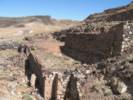
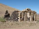
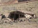
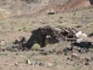
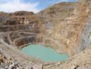
Locations: Columbia Mine. Rainbow Wells. |
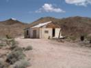
Found the following in the California Integrated Waste Management Board Year 2000 archives about Rainbow Wells and the Columbia Mine. Collectively, they seem to be known as the Sterner Claims.
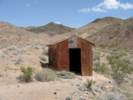
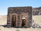
Rainbow Wells Disposal Site- The site is located approximately 8 miles west of the Town of Cima and approximately 6 miles south of Aiken Mine Road. The site was formerly a small mining operation and after the owner’s death, became a haven for transients and the production of illegal drugs. The site consists of dilapidated residences, burned outbuildings, unlivable mobile homes, discarded appliances, scrap metal items, waste tires, and solid waste (cans, bottles, trash). Columbia Mine Disposal Site- the Columbia Mine was owned and operated by the same miner as Rainbow Wells. The Columbia Mine was also acquired by the NPS after the owner’s death. The site is located approximately 4 miles east of Kelso-Cima Road and 3 miles west of Wild Horse Road near Macedonia Spring. Items associated with mining (primarily metals) and several dilapidated structures, and solid waste (primarily cans and bottles) make up the majority of waste at this site. (CIWMB 2000 04 18 Agenda) | |||||||
|
|
Saturday, 4-Feb-06 | |||||||
|
Other articles:
|
| |||||||
|
Other articles:
|
| |||||||
|
Other articles:
|
| |||||||
|
Other articles:
|
| |||||||
|
Other articles:
|
| |||||||
|
Other articles:
|
This San Lorenzo Creek drains Peachtree Valley in the central Coast Ranges. Lewis Creek is a tributary, even though it drains a larger area. For most of its course San Lorenzo Creek flows northwest until it passes Lewis Creek, and then turns southwest, joining the Salinas River just south of King City. | |||||||
|
Other articles:
|
| |||||||
|
Other articles:
|
| |||||||
|
Other articles:
Locations: Sulphur Springs. |
| |||||||
|
Other articles:
|
| |||||||
|
Other articles:
|
| |||||||
|
Other articles:
|
| |||||||
|
Other articles:
|
| |||||||
|
Other articles:
Locations: San Benito River. |
| |||||||
|
Other articles:
|
| |||||||
|
Other articles:
|
| |||||||
|
Other articles:
|
| |||||||
|
Other articles:
Locations: San Benito River. |
| |||||||
|
Other articles:
|
| |||||||
| ||||||||
|
Other articles:
|
| |||||||
|
Other articles:
|
| |||||||
|
Other articles:
|
| |||||||
|
Other articles:
|
| |||||||
|
Other articles:
|
| |||||||
|
Locations: Coalinga. |
| |||||||
|
Other articles:
|
| |||||||
|
|
Sunday, February 5, 2006 | |||||||
|
Other articles:
Locations: Warthan Canyon. |
Headed out of town to the southwest on California Highway 198, I was watching for a place to take an early morning photograph looking back to the northeast to Coalinga. Did not find one, as the little hills and ridges south of town were all fenced. California Highway 198 passes through Warthan Canyon on its route to the west. There were many photographs of the construction of this highway on display in the R. C. Baker Museum. From the photographs, I had expected a more deep, rugged canyon than the canyon appeared from the highway. However, maybe the highway construction over the years opened up the canyon. | |||||||
|
Other articles:
|
| |||||||
|
Images:
|
||||||||
|
Other articles:
Locations: Coalinga Mineral Springs. |
| |||||||
|
Other articles:
|
| |||||||
|
Other articles:
Locations: Kreyenhagen Peak. |
| |||||||
|
Other articles:
Locations: Priest Valley. |
| |||||||
|
Other articles:
Locations: Priest Valley. |
| |||||||
|
Other articles:
|
| |||||||
|
Other articles:
|
| |||||||
|
|
Friday 10 March 06 | |||||||
| Our trip into London-Heathrow was about an hour early because we had tailwinds. Off the tip of Greenland they were up to 198 mph. While this made for a quick trip, it also made for a very bumpy flight as we were entering the jet stream. We landed at London just before dawn. The flight pattern went directly over London and, from the window, Cheryl could see the Thames River and the Tower Bridge. | ||||||||
| In London we de-planed and went through passport control. Our luggage was not checked through to Sevilla because Iberia does not code-share with United. On the way back, though, Iberia had no problem checking our luggage through to San Francisco on United. | ||||||||
| The line at passport control was very long, and it took us an hour and 20 minutes. Then we collected baggage, walked through customs and over to Terminal 2 from Terminal 3. Upon check in at Iberia, we were told that the gate would not be announced until 30-40 minutes before the flight. We got a coffee and a roll, and then went inside the security area to wait. There were several T-Mobile HotSpots at London-Heathrow, and I logged on to check e-mail while we waited. | ||||||||
| Our flight to Sevilla was about an hour late, and we got to Sevilla about 3:00 PM. Rachel and Ian met us at the airport. We got the rental car, really a small van, called a Fiat Ulysse. It seats eight. I followed Rachel home around the north end of Sevilla, as the airport is on the east side of Sevilla and Rachel and Nacho live on the west side. | ||||||||
| After arriving and getting settled, we took Rachel over to the Fiat dealership to pick up their new car. It is a Fiat Scenic. Nacho will use it mostly to drive to Rota for his new job. | ||||||||
| We had a dinner of pasta, and then we managed to stay up until about 930 PM. | ||||||||
|
|
Saturday 11 March 06 | |||||||
| This morning we got going early to shopping. We went to Carrefour, which is a huge shopping mall and store, perhaps equivalent to a Super K-Mart. They have everything from tires to broccoli. One thing we bought was Cranberry juice. This is a new juice in Spain, appearing recently in the larger stores. | ||||||||
| We had sandwiches for lunch. Rachel picked Nacho up at the train station, as he was arriving from Madrid on the AVE. The neighbor kids, Ale (Alejandro) and Blanquita came over -- literally as the neighbors hand their kids over the fence -- along with Ariana who is the cousin of Ale and Blanquita. For a while the kids colored on paper. Then they colored on the table, the then everything else. I played soccer with Ale, then tried to keep the coloring from getting too far out of control. | ||||||||
| Nacho was working in his room, so I went out for a run. The downhill part was pretty good, but on the way back up, I would run up a block, and then across the slope, up a block, and then back across the slope. Meanwhile Rachel and Cheryl went to a store in Bormujos called IDEA to buy a large coffee pot. This is a kind of percolater in that the water in the botton section is forced up through the grounds into an upper section. The coffee is quite strong, and we microwave some milk to heat it, and then mix about 4 parts milk to one part coffee. | ||||||||
| For dinner, Cheryl made pasta. After cleaning up, it was time for Rachel and I to get son and daughter in law at the airport. While Cheryl and I walked right through customs, the Customs officer stopped son and daughter in law. They checked one of the bags and found the box of Cheerios. son had to pull the bag of Cheerios out of the box, probably to show that there were no drugs hidden amongst the Cheerios. | ||||||||
|
|
Sunday 12 March 06 | |||||||
| This morning we got a slow start. We went to Parque de Alamillo just to get outside a little bit. On the way back we stopped at Cervezeria Aljarafe for a little lunch. Ian and Colin were asleep when we got home, so I also went upstairs and had a short nap. | ||||||||
| This afternoon we went to the park. Ian's friend Fernando from his school also came to the park with his family. Ian and Fernando played and then hit each other and then played some more. "Afternoon" here is from about 400 PM until 800 PM. | ||||||||
| For dinner Cheryl cooked salmon and made a big salad, then son broke up the salmon to put it on the salad. | ||||||||
| After dinner Ian and Colin had a bath and the kids went to bed. Ian was pretty wound up and had a hard time going to sleep. | ||||||||
|
|
Monday 13 March 06 | |||||||
| Today was shop for supplies for Colin-day. Rachel went with us to Hipercor, the low-cost market for El Corte Ingles. | ||||||||
| In the afternoon, I had a run, while some adults took the children to the park. Cheryl stayed home and made dinner. | ||||||||
|
|
Tuesday 14 March 06 | |||||||
| On Tuesday we went to Cordoba. We got a little bit of an early start and then drove to the Santa Justa railroad station in Sevilla. We got round trip tickets to Cordoba on the AVE. There was just a few minutes to spare before train departure time. | ||||||||
|
Locations: Rio Guadalquivir. |
| |||||||
| This was the first time Cheryl and I visited the Mezquita as it has been under repair our previous visits. | ||||||||
| We got on the bus from the train station, but then missed our stop to get off. So we had a very complete tour of eastern Cordoba, I think. | ||||||||
| Inside the Mezquita was very impressive. This location was a Roman bath, and maybe something else before it became a Christian church, a mosque, and a Christian church again. | ||||||||
| We tried to visit the Alcazar, and nearly cirambulated the entire fort before we learned it was closed for repair. | ||||||||
| Looking for lunch, we walked up through the Juderia until we came to Casa Pepe where we had eaten before. I guess maybe this place is a kind of tourist dive, as they certainly cater to tourists. However, they also do a very nice job of making you feel welcome. They put us in an upstairs room at one end, with lots of room around the table, so we could deal with the children without bothering the other customers. They also recommended food to us. You never know if you're getting taken when you're offered suggestions as a tourist, but these turned out to be very good. One suggestion was an eggplant fried in a batter (tempura eggplant?) with a light sorghum syrup that made it quite palatable. We had the usual salad, I had a nice halibut, and we shared a light white wine that seemed to go with everything. | ||||||||
| Lunch was followed by a slow, meandering walk back to the train station, and then an AVE ride back to Sevilla. | ||||||||
|
|
Wednesday 15 March 06 | |||||||
| This afternoon we went to Triana so that son and daughter in law could buy a gift for the person taking care of their house, and Cheryl could buy something for Lee, who is taking care of our cat. | ||||||||
| We parked in the parking lot called Paseo Colon on the Sevilla side of the river because the entry and return is relatively easy. | ||||||||
| Exiting from the car park, we walked across the Triana bridge and then into the neighborhood of tile shops. We went to the largest tile shop where there were many options to choose from. After buying the tile, we walked around the block of tile shops, and then to the Triana side of the river were we had various refreshments. | ||||||||
|
|
Thursday 16 March 06 | |||||||
| Today we went into Sevilla and visited the Alcazar (fort) and grounds. | ||||||||
| We drove into Sevilla and parked along the river then had a coffee, and walked to the Alcazar. | ||||||||
| Like many such forts in Spain, the building was started by the Moors and then taken over by the Spanish, so it shows a variety of architectures. | ||||||||
|
|
Friday 17 March 06 | |||||||
| Today we left Sevilla driving south to El Puerto de Santa Maria, where we will pick up Nacho after work. Thenmorrow we are going to Zahara de los Atunes, a small town on the Atlantic Ocean near the Straits of Gibraltar. | ||||||||
| We ate lunch in El Puerto while the rain beat down on the roof above, then drove to Zahara. | ||||||||
| The weather was not too good, and we made a couple of attempts to get out, but nothing too serious or too successful. | ||||||||
|
|
Saturday 18 March 06 | |||||||
| Saturday morning, Colin had a high fever. We asked at the front desk of the hotel about a doctor. They directed us to a clinic in Barbate. Rachel, son, and daughter in law went in with Colin. They had no wait, and were seen immediately by a doctor. Because it was a Social Security clinic, there was no way to pay for the services, and the only cost was a couple of Euros for amoxicillin at the drug store across the street. | ||||||||
| From Barbate, we visited Vejer de la Frontera, a white town on top of a hill. It took us a while to find a place to park both cars. | ||||||||
| Then we got out and walked the of narrow streets across the top of the hill. We tried to eat in a Restaurante El Jardin del Califa, but they could not accomodate the size of our party for inside seating (it was raining) without a reservation. Instead we ate across the plaza at Restaurante Trafalgar. I had the roast lamb, very good, but not the best I've ever had. | ||||||||
| The rain was a bit bothersome, but we didn't let it stop us. | ||||||||
|
|
Sunday 19 March 06 | |||||||
| Sunday, we left Zahara and stopped for a hike in the umbrella pine forests near Barbate. | ||||||||
| From Barbate we drove to Conil, where we walked on the beach, and then had lunch. | ||||||||
| We drove to El Puerto, and had a coffee with Nacho's brother: Julio, and his family: Pamen, Marta and Julito. | ||||||||
| From El Puerto we drove to San Lucar de Barrameda where we stayed in Hotel Partner Doñana. | ||||||||
|
|
Monday 20 March 06 | |||||||
| On Monday we had reserved a tour of the Donana National Park, a wildlife sanctuary where the River Guadalquivir enters the Atlantic Ocean. Lots of birds there, but no bird flu yet in Spain -- yet. | ||||||||
| In the morning we took a boat ride up the river getting off several times for a guided tours of the plains, forests, and salt marshes. | ||||||||
| Our lunch on the river included Gambas al aljillo (prawns in garlic sauce) and Acedias (sand dabs?), while sampling the local sherry, a specialty of this region. | ||||||||
| Last night we watched the pilgrims return from a pilgrimage to Rocio. They go through the national park of Donana, and then ride a ferry across the Rio Guadalquivir. There were hundreds of carts, and ferrying them all across the river took more than eight hours. | ||||||||
|
|
Tuesday 21 March 06 | |||||||
| Today we are returned to Bormujos from Sanlucar de Barrameda. | ||||||||
|
|
Wednesday 22 March 06 | |||||||
| Wednesday, son and daughter in law went to Aracena, in the mountains north of Sevilla. | ||||||||
| I stayed in Bormujos and Rachel took me to the doctor. After a consultation, it was decided that I had a sinus infection following a cold, and an antibiotic was prescribed. | ||||||||
|
|
Thursday 23 March 06 | |||||||
| We stayed local on Thursday, getting ready to fly home on Friday. | ||||||||
|
|
Friday 24 March 06 | |||||||
| Today we flew home from Sevilla. | ||||||||
|
Locations: Eastern Star Wash. |
Up the wash we could see the water tank at the Eastern Star Mine. This road used to go all the way through to the Power Lines near Riggs wash, but now the way is blocked by a wilderness area. | |||||||
|
Literature Cited:
Locations: Eastern Star Wash. |
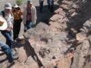
This is field trip Stop 1-1 in Reynolds (2006). We parked here and walked across to the reddish outcrop on the other side of the wash. | |||||||
| From our parking place we walked across several branches of Eastern Star Wash to the small outcrop of reddish sediments. | ||||||||
|
Images:
|
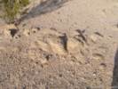
There were tracks left by Miocene gomphotheres, antelopes, and camels.
Some of the gomphothere tracks were up to 12 inches in diameter. | |||||||
|
Images:
|
Just as we were getting ready to leave, someone hollered, "There are bird tracks up here!" This set off a mad scramble up the loose shale slope. I enjoyed the scene from below, so I have no photograph of the tracks. There were described as a little indistinct, but definitely bird tracks. | |||||||
|
Other articles:
Locations: Silurian Hills. |
| |||||||
|
Literature Cited:
Other articles:
|
The red sediments filled an extending Miocene basin between 12 and 10 million years ago. The presence of Tapeats Sandstone in a red groundmass suggests a source from weathered sediments that occur only at the Tapeats locality on the north side of Clark Mountain. | |||||||
|
Other articles:
Locations: Silurian Hills. |
This is Field Trip Stop 1-3 from Reynolds (2006). I had been here before to see the Liesegang weathering. This is a pre-Miocene erosional surface over which were thrust carbonate gravity slide blocks from the west. The previous field trip I was distracted by the plants, and did not see the weathering feature. Of them, I can only remember the Abronia villosa. | |||||||
|
Locations: Silurian Hills. |
We drove up to take a look at the strongly accented strata on the left side of the photo. Then we drove down between "The Islands" to the playa of Silurian Lake. | |||||||
|
Locations: Silurian Lake. |
| |||||||
|
Other articles:
|
| |||||||
|
To the northwest was an classic view of distant ridge lines silhouetted by the setting sun.
After taking in the view, we continued our crossing of Silurian Lake, and then returned to Zzyzx for some attitude adjustment and dinner. | ||||||||
|
|
Sunday, 23 April 2006 | |||||||
|
Other articles:
|
| |||||||
|
Other articles:
|
| |||||||
|
Other articles:
Locations: Silver Lake (site). |
I saw these footings at Silver Lake. The pattern of these footings suggested they may have supported a water tank on the Tonopah and Tidewater Railroad. However, at home later I noticed that the Tonopah and Tidewater road bed was closer to Silver Lake. | |||||||
|
Other articles:
|
| |||||||
|
Other articles:
Locations: Kavorka Hills. |
Missed the turn off for Thompson's Silver Lake to Goodsprings route, and finally turned up a small road along a wash. | |||||||
|
Other articles:
|
| |||||||
|
Other articles:
|
I stopped here and walked a little way northwest on the route and then took this photo back toward my car parked at the junction. | |||||||
|
Other articles:
|
| |||||||
|
Other articles:
|
| |||||||
|
Other articles:
Locations: Wander Mine. |
| |||||||
|
Other articles:
|
This photo was taken from a dump of the Wander Mine. | |||||||
|
Locations: Wander Mine. |
| |||||||
|
Other articles:
|
| |||||||
|
Other articles:
|
||||||||
|
Other articles:
Locations: Cree Camp. |
| |||||||
|
Locations: Cree Camp. |
The roof and shade porch of the two-room cabin were in pretty bad shape, but the cabin could still be made habitable. | |||||||
|
Literature Cited:
Other articles:
Locations: Hytens Well. |
| |||||||
|
Other articles:
Locations: Wander Mine. |
| |||||||
|
Other articles:
Locations: Turquoise Mountain. |
Determined to find Hytens Well, I continued east on Halloran Springs Road to the location shown on USGS maps. | |||||||
|
Images:
|
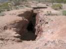
I did not find a "well" at the location shown on the map as Hytens Well.
I did find this mine shaft and hoist anchor. However, this mine is not shown on maps, and I believe is a short distance past the location shown for Hytens Well. | |||||||
|
Images:
|
||||||||
|
Other articles:
Locations: Solomons Knob. |
| |||||||
|
Other articles:
|
There is a pole here with an orange traffic cone on top. | |||||||
| Road north toward Turquoise Mountain from Halloran Springs Road. I think this might be BLM Route NN 581. | ||||||||
|
Other articles:
|
| |||||||
|
Locations: Turquoise Mountain. |
After enjoying the view for a few minutes, I returned to Turquoise Mountain Road to make my way to Francis Spring. | |||||||
|
Other articles:
|
| |||||||
|
Other articles:
|
| |||||||
|
Other articles:
|
| |||||||
|
Other articles:
|
| |||||||
|
Other articles:
|
| |||||||
|
Other articles:
Locations: Francis Spring. |
| |||||||
|
Other articles:
|
This was as far as I went on this road, checking out the view, and then returning the way I came. | |||||||
|
Other articles:
Locations: Solomons Knob. |
| |||||||
|
Other articles:
Locations: Bull Spring. |
| |||||||
|
Other articles:
Locations: Bull Spring Wash. |
| |||||||
|
Other articles:
Locations: Bull Spring Wash. |
| |||||||
|
Other articles:
Locations: Halloran Springs. |
| |||||||
|
Other articles:
|
| |||||||
|
Other articles:
|
| |||||||
|
Other articles:
Locations: Nipton. |
| |||||||
|
Locations: Nipton. |
| |||||||
|
Other articles:
Locations: Murphy Well. |
| |||||||
|
Other articles:
Locations: Murphy Well. |
| |||||||
|
Literature Cited:
Locations: Hytens Well. Wander Mine. |
5-May-06Found the following in Vredenburgh, Shumway, and Hartill (1981):
| |||||||
|
|
Friday, 2 June 2006 | |||||||
|
Other articles:
Locations: Don Pedro Reservoir. |
| |||||||
|
Other articles:
|
| |||||||
|
Images:
|
||||||||
|
Images:
|
||||||||
|
Images:
|
||||||||
|
|
Saturday, June 3, 2006 | |||||||
|
Images:
|
||||||||
|
|
Sunday, June 4, 2006 | |||||||
|
Other articles:
|
| |||||||
|
Other articles:
|
| |||||||
|
Other articles:
|
| |||||||
|
Other articles:
|
||||||||
|
Locations: Pinecrest Lake. |
| |||||||
|
Locations: Pinecrest Lake. |
| |||||||
|
Locations: Pinecrest Lake. |
| |||||||
|
Other articles:
|
||||||||
|
Locations: Columns of the Giants. |
| |||||||
|
Other articles:
|
| |||||||
|
Other articles:
|
| |||||||
|
Other articles:
|
| |||||||
|
Other articles:
|
| |||||||
|
Other articles:
Locations: Leavitt Falls. |
| |||||||
|
Other articles:
Locations: USMC Mountain Warfare Training Center. |
| |||||||
|
Other articles:
|
| |||||||
|
Other articles:
|
| |||||||
|
Other articles:
|
| |||||||
|
Other articles:
|
| |||||||
|
Other articles:
|
| |||||||
|
|
Monday, June 5, 2006 | |||||||
|
Other articles:
Locations: Lee Vining. |
| |||||||
|
Locations: Lee Vining Creek. |
| |||||||
|
Locations: Negit Island. |
| |||||||
|
Locations: Paoha Island. |
| |||||||
|
Other articles:
|
| |||||||
|
Other articles:
|
| |||||||
|
Literature Cited:
Other articles:
|
| |||||||
|
Other articles:
|
| |||||||
|
Other articles:
|
| |||||||
|
Other articles:
|
| |||||||
|
Other articles:
|
| |||||||
|
Other articles:
Locations: Anchorite Pass. |
| |||||||
|
Other articles:
|
| |||||||
|
Other articles:
|
| |||||||
|
Other articles:
|
| |||||||
|
Other articles:
|
| |||||||
|
Other articles:
|
| |||||||
|
Other articles:
|
| |||||||
|
Other articles:
|
| |||||||
|
Literature Cited:
Other articles:
|
| |||||||
|
Other articles:
|
| |||||||
|
Other articles:
|
| |||||||
|
Literature Cited:
Other articles:
Locations: Candelaria. |
| |||||||
|
Other articles:
|
| |||||||
|
Other articles:
Locations: Columbus Salt Marsh. |
| |||||||
|
Locations: Columbus Salt Marsh. |
| |||||||
|
Other articles:
Locations: White Mountains. |
| |||||||
|
Other articles:
|
| |||||||
|
Other articles:
Locations: Tonopah. |
| |||||||
|
Other articles:
|
| |||||||
|
Other articles:
Locations: Amargosa River. |
| |||||||
|
Other articles:
Locations: Amargosa River. |
| |||||||
|
Other articles:
Locations: Amargosa River. |
| |||||||
|
Literature Cited:
Other articles:
Locations: Big Dune. |
| |||||||
|
Locations: Ivanpah (#1). |
| |||||||
|
Literature Cited:
Locations: Coliseum Gorge. |
| |||||||
|
Locations: Coliseum Mine. |
| |||||||
|
Locations: Clark Mountain. |
| |||||||
|
Images:
|
||||||||
| My sister said this about the photo, "… and the photo of you in the campground looks, well, like you." I wonder what she meant by that? | ||||||||
|
Images:
|
||||||||
|
|
June 7, 2006 | |||||||
|
Other articles:
|
| |||||||
|
Other articles:
|
| |||||||
|
Other articles:
|
| |||||||
|
Other articles:
|
| |||||||
|
Other articles:
|
| |||||||
|
Other articles:
|
| |||||||
|
Other articles:
|
| |||||||
|
Other articles:
|
| |||||||
|
Other articles:
|
| |||||||
|
Other articles:
|
| |||||||
|
Other articles:
|
| |||||||
|
Other articles:
|
| |||||||
|
Other articles:
|
| |||||||
|
Other articles:
|
| |||||||
|
Other articles:
|
| |||||||
|
Other articles:
|
| |||||||
|
Other articles:
|
| |||||||
|
Other articles:
|
| |||||||
|
Other articles:
|
16 |
| ||||||
|
Other articles:
|
| |||||||
|
Other articles:
|
| |||||||
|
Other articles:
|
| |||||||
|
Other articles:
|
| |||||||
|
Other articles:
|
| |||||||
|
Other articles:
|
| |||||||
|
Other articles:
|
| |||||||
|
Other articles:
|
| |||||||
|
Other articles:
|
| |||||||
|
Other articles:
Locations: Mid Hills Campground. |
| |||||||
|
Other articles:
|
| |||||||
|
Other articles:
|
| |||||||
|
Locations: Coalinga Mineral Springs. |
26-Aug-06
"The mineral springs was acquired from a foreclosure of a loan of just a few hundred dollars. This was a real part of their family business in those early years. They leased it later and finally sold it in the 1930s. "Kreyenhagen Peak, Kreyenhagen Shale, Kreyenhagen Hills [are] all named after Gustav and Julia and their 5 children, Adolph, Emil, Hugo, Charles, and Bertha." | |||||||
|
|
Friday, September 22, 2006 | |||||||
|
Other articles:
Locations: Half Dome. |
| |||||||
|
Other articles:
Locations: Tenaya Lake. |
| |||||||
|
Locations: Tenaya Lake. |
| |||||||
|
Other articles:
Locations: Saddlebag Lake. |
| |||||||
|
Other articles:
|
||||||||
|
|
Saturday, September 23, 2006 | |||||||
|
Other articles:
|
| |||||||
| California Highway 158 turns off to the southwest just before Rush Creek. There is a turnoff to Parker Lake, and then the road goes over a little rise to give a view of Grant Lake. I don’t think the canyon has a name in common usage. | ||||||||
|
Other articles:
Locations: Grant Lake. |
| |||||||
| There is a short, narrow section of the canyon, and then it opens up to Silver Lake. The Rush Creek trailhead is just at the lower edge of Silver Lake. | ||||||||
| We drove by the power station and saw a little bit of the tram tracks. The tram does not run any more. | ||||||||
| Then I tried a few side streets between Silver Lake and Gull Lake. I was hoping to get a view of Rush Creek where it comes down from Agnew Lake into Silver Lake. There is one house that is built right on the rock outcrop. It looks like this might be possible place to climb up on the rock, but one would have to work around some private property. | ||||||||
|
Other articles:
Locations: Carson Peak. Gull Lake. |
| |||||||
| From Gull Lake, past June Lake, and then north on US Highway 395 to the Vista Point for the West Portal. | ||||||||
| Somewhere near here, the water from Grant Lake enters a tunnel under the Mono Craters. It then comes out in the Owens River near Owens River Road. | ||||||||
|
Other articles:
Locations: Aeolian Buttes. West Portal. |
| |||||||
| Turned right off of US Highway 395. At this intersection there was a whimsical Tomb of the Unknown Fisherman. The intersection has been re-aligned, and now it has been replaced by the Grave of the Unknown Miner. I did not take a photo because the light was bad. | ||||||||
|
Other articles:
Locations: Panum Crater. |
| |||||||
|
Other articles:
Locations: Bloody Canyon. Bloody Canyon (upper). Mono Pass. Mount Gibbs. Mount Lewis. |
| |||||||
|
Literature Cited:
Other articles:
Locations: Mount Biedeman. Paoha Island. |
| |||||||
|
Other articles:
Locations: South Tufa Area. |
| |||||||
|
Other articles:
Locations: Cedar Hill. |
| |||||||
|
Literature Cited:
Other articles:
Locations: Mono Mills. |
| |||||||
|
Other articles:
Locations: Big Sand Flat. |
| |||||||
| The only marked pass on this portion of California Highway 120 is Sagehen Summit. I can't remember how high the highway sign said the pass was. The GNIS does not list Sagehen Summit. From the Delorme atlas, I would estimate it is about 8127 ft. There were roads leading south to Crooked Meadow, and we could see some pretty yellow and green foliage on the hills in that direction. | ||||||||
|
Other articles:
|
| |||||||
|
Other articles:
|
| |||||||
|
Other articles:
|
| |||||||
|
Other articles:
|
| |||||||
|
Other articles:
|
| |||||||
|
Other articles:
|
| |||||||
|
Other articles:
|
| |||||||
|
Other articles:
|
| |||||||
|
Other articles:
|
| |||||||
| The spillway itself is not very dramatic. It is not incised, and does not drop away steeply in the direction of the current, to the south. | ||||||||
| The elevation of the spillway is 7203 feet, by the bench mark just off the road. | ||||||||
|
Other articles:
|
| |||||||
|
Other articles:
Locations: Alameda Well. |
| |||||||
|
Other articles:
|
Back up California Highway 167 we turned east, crossed the stateline into Nevada, and continued on Nevada State Route 359 a short way. At the power lines we turned north on a combination power line road and Toiyabe Forest 058. While Forest Road 058 diverged slightly to the east, we stayed on the power line road, as it seemed to be the better road. | |||||||
| At a four-way junction, we turned right, returning to Forest Road 058 as it made its way east and a little north across Alkali Valley. | ||||||||
|
Other articles:
|
| |||||||
|
Other articles:
|
| |||||||
| The driver of the lead pickup warned us not to continue through on 058C, because there was a burned area with very difficult travel. | ||||||||
| The last part of the road to the spillway was very rough, made of basalt cobbles. | ||||||||
|
Other articles:
Locations: Mount Hicks Spillway. |
| |||||||
|
Other articles:
|
| |||||||
| I did get out and looked around. There were many obsidian flakes at this location. It's in a pass, there is probably water, and there are pinyons for nuts, and to hunt game. | ||||||||
| Our return trip went via Buckram Well. The shack is pretty dilapidated, and looks as though it could fall over any time. There is a corral that had a small barn or shed, now also collapsed. | ||||||||
| On our way out, I found the well. It has a casing of 2 ft diameter corrugated pipe and there is water in the pipe at 6 to 7 feet depth. | ||||||||
|
Other articles:
|
| |||||||
|
Other articles:
Locations: Larkin Lake. |
| |||||||
|
Other articles:
|
Later, having returned home, I reviewed the collections of frogs at the Museum of Vertebrate Zoology (MVZ). There are four species of frogs that have been collected in Mono County. They are:
| |||||||
|
Literature Cited:
Other articles:
Locations: Trench Canyon. |
| |||||||
|
Other articles:
|
| |||||||
|
Other articles:
Locations: Lime Kiln. |
| |||||||
| Kirkwood Spring appeared to be occupied by a house, and we continued on Dobie Meadows Road until we reached Cottonwood Canyon Road, also the road to Bodie. | ||||||||
| We took a little shortcut on Cemetery Road from CA Hwy 167 to 395. | ||||||||
|
Other articles:
Locations: Mill Creek. |
| |||||||
|
Other articles:
Locations: Mono Lake Cemetery. |
| |||||||
|
Other articles:
Locations: Mono Lake County Park. |
| |||||||
| From there, we came back to the motel, where I am making these notes, while we wait for dinner time. | ||||||||
|
|
Sunday, September 24, 2006 | |||||||
|
Other articles:
Locations: Ellery Lake. |
| |||||||
|
Locations: Cathedral Peak. |
| |||||||
|
Locations: Soda Springs. |
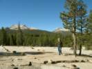
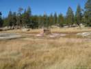
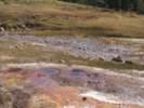
At Soda Springs there is a small spring mound with red algae around. From there, we walked down to the bridge over the Tuolumne River, and then on a small trail cross country to the Tuolumne Meadows Grill, then back to the Lembert Dome along the highway. | |||||||
|
[Previous Page]
[Next Page]
Go to page: [1800s] [1900s] [1910s] [1920s] [1930s] [1940s] [1950s] [1960s] [1970s] [1980s] [1990] [1991] [1992] [1993] [1994] [1995] [1996] [1997] [1998] [1999] [2000] [2001] [2002] [2003] [2004] [2005] [2006] [2007] [2008] [2009] [2010] [2011] [2012] [2013] [2014] [2015] [2016] [2017] [2018] [2019] [2020] [2021] [2022] [2023] [2024] [2025] [2026] [A] | ||||||||
| If you have a question or a comment you may write to me at: tomas@schweich.com I sometimes post interesting questions in my FAQ, but I never disclose your full name or address. |
Date and time this article was prepared: 10/2/2026 12:44:53 PM |
|||||||