Eastern Mojave Vegetation
Tom Schweich
|
Eastern Mojave Vegetation
| Field Notes (Continued) |
|
Tom Schweich |

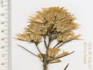
Topics in this Article: 1800s 1900s 1910s 1920s 1930s 1940s 1950s 1960s 1970s 1980s 1990 1991 1992 1993 1995 1996 1997 1998 1999 2000 2001 2002 2003 2004 2005 2006 2007 2008 2008 Tour de Swertia albomarginata Mono Lake, August 2008 2009 2010 2011 2012 2013 2014 2015 2016 2017 2018 2019 2020 2021 2022 2023 2024 Contents Literature Cited |
When I first read the field notes of Annie Alexander and Louise Kellogg, I was fascinated by the descriptions they wrote about the places they went and the plants and animals they found there. By publishing my field notes on the Internet I hope to follow a little bit in their tradition. | ||||||||||||||||||||||||||||||||||||||||||||||||||||
|
Literature Cited:
Other articles:
|
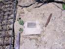
Plate Boundary Observatory GPS Station #P637 | ||||||||||||||||||||||||||||||||||||||||||||||||||||
|
|
2012 | ||||||||||||||||||||||||||||||||||||||||||||||||||||
|
Other articles:
Locations:
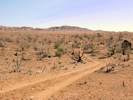
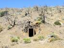
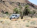
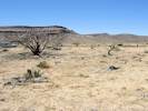
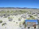
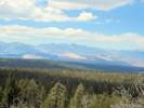
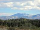
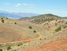
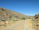
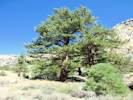
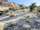
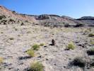
Hualapai Mountains, East Base.
|
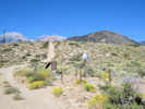
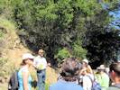
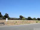
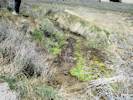
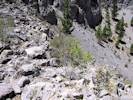
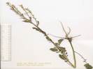
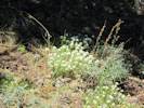
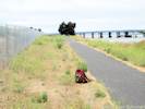
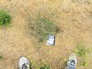
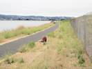
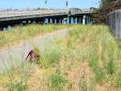
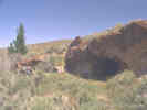
I was up at the Kingman BLM office last Friday so I stopped to check on the Hualapai Mountains collection sites for Frasera albomarginata figuring the dried stems would still be visible. I dont remember what you said about whether you had been to those sites or not. The first (Butterwick 5238 ASU) is 1.4-1.5 miles south of I-40 at the truckstop on the Blake Ranch Rd at its junction with Palomino Dr. The plants are growing on the east side of the road on the slope above the road cut in openings in chaparral, 12S 0244530 3894406 to 12S 0244444 3894324. Ive attached photos of this site. Its on private land with houses on top of the hills. I looked for the second site (Reeves R-5508 ASU) which is 6.2 miles south of I-40 but didnt find it, it was getting late so I didnt spend a lot of time looking, the chaparral gets thick there so I didnt really see any good habitat. | ||||||||||||||||||||||||||||||||||||||||||||||||||||
 Sister Ramona Schweich Sister Ramona Schweich
|
Mankato Mortuary 1001 N. Riverfront Drive Mankato, MN 56001 507-388-2202
Our beloved Sister M. Ramona Schweich, 89, died peacefully at 3:01 p.m.,
Sunday, March 11, 2012, in Notre Dame Health Care Center, Good Counsel
Campus, Mankato, Minnesota. Several sisters and her niece, Susan Woodwick, were with her when she died.
The funeral Mass for Sister Ramona, with Fr. Paul Nelson and Fr. Charles
Quinn as co-presiders, will be on Monday, March 19, at 10:30 a.m. in Good
Counsel Chapel, followed by burial in our cemetery. The vigil service
will be at 7:00 p.m. on March 18. Loving sympathy to her sister, Jeanette
Fox, and her brother, Ralph, her nieces and nephews and their families,
her former students and colleagues, and her sisters in community, the
School Sisters of Notre Dame. Sister Ramona was preceded in death by her
parents, Peter and Susan Schweich, a
sister, Monica, and brothers, Roman
and Gerald.
Sister Ramona was born August 17, 1922, on the family farm near New
Trier, Minnesota, and given the name Mildred Margaret. She described her
first days, The first three days of my sojourn on earth, I slept
constantly and didn't cry at all. Early on August 20, the doctor advised
that I be baptized since he feared I would never be able to throw off
sleep.' She was the fifth child in the family; however, since one had
died in infancy, there were now four children, two boys and two girls, in
the family. When Mildred was six months old, their home burned and all
contents were lost. No one was hurt, but for the next eighteen months,
the family lived in temporary housing, either with relatives or in a
made-over granary. Two more children were born later.
Mildred experienced strong family love as she was growing up. She wrote,
I used to pray that I would be the first one to die in my family because
I thought I could never go on living if anyone in the family died. She
loved living on the farm, and always considered herself a country girl.
For eight years she attended St. Mary's School, New Trier, where she was
taught by the School Sisters of Notre Dame. During the winter months, the
Schweich children usually boarded at the convent during the week. In her
autobiography, Sister Ramona related an incident during her grade school
years that directly impacted her choice of vocation: When I was about
ten years old, Reverend Mother Almeda from
Germany visited America [1933]. My dad was asked to take the New Trier
sisters to see her. When she heard that he had three daughters, she gave
him three holy cards and said that some day she
wanted to claim one of them as a School Sister of Notre Dame. That holy
card haunted me and eventually I thought being a sister was a good idea.
Sisters Tharcisia [Weingaertner],
Seraphica [Guter],
and Seraphine [Hochhausen]
had a profound influence on me. Sister Seraphine
was a fun person, and she was a good teacher. She was very strict, but
always fair and just.
In 1936, Mildred enrolled as a freshman aspirant at Good Counsel Academy,
Mankato. She graduated in 1940 and entered the candidature the following
September. In 1942 she was received into the novitiate and given the name
Sister M. Ramona. She professed first vows on July 22, 1943. Later that
summer she received her first teaching assignment: junior high grades at
St. Andrew, St. Paul, where she stayed until 1946. In the following years
she taught junior and senior high students, often in the fields of
religion, math and science, in several schools: St. Felix, Wabasha
(1946-47); St. Mary, Madelia (1947-50); Guardian Angel/Notre Dame
Academy, Colton, Washington (1950-54); St. Peter, New Haven, Iowa
(1954-56); St. Peter, Hokah (1956-60); Loyola
High School, Mankato (1960-64); St. Agnes, St. Paul (1964-1969); and
Cotter High School, Winona (1969-70). During these years, she earned a
bachelor's degree in English from the College of St. Catherine, St. Paul
(1949) and a master's degree in education from Gonzaga University,
Spokane, Washington (1956). She also earned several post-graduate credits
in a variety of subjects.
Sister Ramona became campus minister at the Moorhead State College Newman
Center in 1970. When one of the faculty members died unexpectedly, Sister
Ramona was asked by the college administration to take the vacancy, which
she did. One of her colleagues recalled, Sister Ramona made many
contributions, in terms of her teaching, but perhaps even more in her
impromptu and intentionally non-structured counseling. She would take
time to be available to students in the Student Union, or the Snack Bar
or lounge, where they would be able to visit with her on an ostensibly
casual basis, unobtrusively asking for her help while not appearing to be
seeking assistance.
In 1971, Sister Ramona became principal of Good Counsel Academy in
Mankato, a position she held until 1973. At that time, she was diagnosed
with lymphoma, and the prognosis was not good. In fact, she began
preparing for death, and wrote about this in A Little Wine, the book that
she and Father Paul Halloran co-authored in 1974. In the introduction,
she wrote, The articles in this volume are Father Paul Halloran's
written by him, alive, vibrant, and on the move. To each of these
articles I have added a concrete thought for the day' written as I sit
here preparing for death. The articles are from a person full of life;
the resolutions are penned by one who is in full view of death. In
actuality, her chemotherapy treatment was successful, and in a second
collaboration, A Little More Wine, (1977) Sister Ramona expressed her
appreciation to medical personnel for their role in bringing the lymphoma
into remission. As she regained her health, Sister Ramona became the
Coordinator of the Mankato Campus of Mount Mary College (1973-77) and an
educational consultant for the Winona Diocese (1975-76). In 1977, she was
welcomed back as principal of Good Counsel Academy. An October 1977 St.
Paul Pioneer Press article featured Good Counsel and described Sister
Ramona as the new, new principal of just a few weeks. Hearty, ebullient,
positive, Sister Ramona mirrors the enthusiasm with which the School
Sisters of Notre Dame underscore that word SCHOOL in the name of
their order.
Sister Ramona stayed at Good Counsel for one year, and then became high
school counselor at Loyola in Mankato (1978-83). In 1983, at the request
of the pastor at SS. Peter & Paul, she began another ministry, that
of pastoral worker, a position she held until 1991. She was recognized by
the Mankato YWCA in 1986 as a Leaderdinner
Award winner for her help and ministry that reached beyond the parish.
She has established numerous support groups which serve a variety of
community needs, including parenting, marriage, divorce and chemical
dependency counseling, and dealing with loss. From 1991 until 1993,
Sister Ramona assisted at Good Counsel Education Center as director of
residents and pastoral minister.
Looking forward to retirement, Sister Ramona moved to St. Dominic Parish,
Northfield, in 1993. After a sabbatical year, she served in part-time
parish ministry until 2003. She remarked that she was looking for a place
with rural ties. Northfield fit that description, and the parish
appreciated the many ways she ministered to them.
After a short stay at Guardian Angels, Oakdale, Sister Ramona came to
Good Counsel in 2004. She continued her outreach as much as she was able,
and stayed in contact with family and friends via letters, phone and
e-mail. She was a very welcoming presence to all who stopped by her room
for a visit. Throughout her life, Sister Ramona lived out three words, God is love. May she now enjoy the fullness of that love for all | ||||||||||||||||||||||||||||||||||||||||||||||||||||
|
Other articles:
|
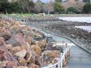
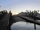
The morning after the "side show." | ||||||||||||||||||||||||||||||||||||||||||||||||||||
|
Other articles:
|
802 |
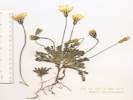
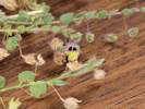
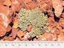
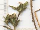
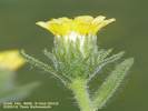
Crassula tillaea L. Moss Pgymy Weed.
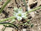
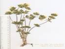
Bay Farm Island, City of Alameda, Alameda County, California. In low spots of a graveled median strip on the south side of Adelphian Way near the intersection with Sweet Road. 37.7392°N, 122.2585°W. WGS 1984 Elev. 2 m. Coll. No. 802, 2 Apr 2012, characters observed while keying: Annual, 2.5-3.5 cm.; Stems, erect, not branched; Leaves, cauline, opposite, 2 mm., bases fused sheathing stem, margins entire; Inflorescence, axillary, 2 per node, parts in threes; Pedicels, 0.3 mm.; Sepals, 3, 1.5 mm.; Petals, 3, 1.0 mm.; Stamens, included; Seeds, 2, ellipsoid, 0.4 mm., surface reticulate. | |||||||||||||||||||||||||||||||||||||||||||||||||||
|
Other articles:
|
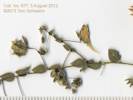
803 |
Medicago polymorpha L. Bur Clover. 4-Apr-2012, Collection No. 803, characters observed while keying: Annual prostrate, hairs 0; Stipules deeply toothed; Leaflet 4-10 mm, without dark-central part, glabrous; Flower yellow, 4 mm; Fruit several-seeded, spirally-coiled, prickly. | |||||||||||||||||||||||||||||||||||||||||||||||||||
|
Other articles:
|
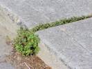
804 | Stellaria media L. Vill. Common Chickweed. | |||||||||||||||||||||||||||||||||||||||||||||||||||
|
Other articles:
Locations:
Towata Park, City of Alameda.
|
805 |
Towata Park, City of Alameda, Alameda County, California. In the wasteland across Bridgeview Isle street from the park. 37.7501°N, 122.2369°W. WGS 1984. Elev. 2 m. Coll. No. 805, 8 Apr 2012, characters observed while keying: Annual herb; Leaves in basal rosette, 10-15 cm., toothed, sparsely hairy; Corolla tube few hairs near base outside, glabrous inside (key states "corolla tube hairy"); Stamens 4. | |||||||||||||||||||||||||||||||||||||||||||||||||||
|
Other articles:
Locations:
Towata Park, City of Alameda.
|
806 |
Towata Park, City of Alameda, Alameda County, California. In the wasteland across Bridgeview Isle street from the park. 37.7501°N, 122.2368°W. WGS 1984. Elev. 2 m. Coll. No. 806, 8 Apr 2012, characters observed while keying: Annual herb, to 4 cm.; Leaves opposite, 3 mm, tip rounded; Pedicels to 2 mm.; Flowers 2 per node; Flower parts in 4's; Sepals = petals; Seeds 0.5 mm., grooved (rather than reticulated). | |||||||||||||||||||||||||||||||||||||||||||||||||||
|
|
15 April 2012 | ||||||||||||||||||||||||||||||||||||||||||||||||||||
|
Other articles:
Locations:
Chimney Rock.
|
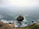
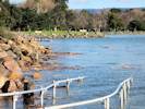
Chimney Rock at Point Reyes. | ||||||||||||||||||||||||||||||||||||||||||||||||||||
|
|
16 April 2012 | ||||||||||||||||||||||||||||||||||||||||||||||||||||
|
Other articles:
|
The "FERN HIGH 1947" control point. | ||||||||||||||||||||||||||||||||||||||||||||||||||||
|
Other articles:
Locations:
Skyline Serpentine Prairie.
|
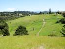
| ||||||||||||||||||||||||||||||||||||||||||||||||||||
|
Other articles:
|
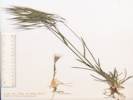
808 |
Festuca perennis (L.) Columbus & J.P. Sm. Perennial Ryegrass.
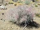
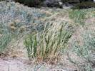
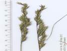
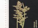
Mount Trashmore, Alameda County, California. Northern slopes of Mount Trashmore, about 200 m east of the Bay Farm bicycle bridge. 37.748°N, 122.2334°W. WGS 1984. Elev. 3 m. Tall, spikelets sessile, short-awned. Coll. No. 808, 8 May 2012, characters observed while keying: Annual, to 75-90 cm; Roots fibrous; Stem herbaceous; Nodes dark and constricted; Internodes hollow; Leaf blades and sheath differentiated; Blade soft; Sheath open; Ligule membraneous, short (1 mm); Inflorescence 3-many, spike, > leaves, spikelets many, alternate; Compresson lateral (unremarkable); Disarticulation unknown; Spikelets similar, 1/node, sessile, 2-many flowered, length 15-20 mm; Florets, 12-13 per spikelet, lowermost pistillate; Glumes, upper, 10 mm, 5 veins prominent abaxially, lower absent except in terminal spikelets; Lemma veins 5, awns 1, to 10 mm. | |||||||||||||||||||||||||||||||||||||||||||||||||||
|
Other articles:
|
809 |
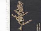
Bromus diandrus Roth. Rip Gut Brome.
Mount Trashmore, Alameda County, California. Northern slopes of Mt. Trashmore, 300 m east of the Bay Farm bicycle bridge. 37.7479°N, 122.2323°W. WGS 1984. Elev. 3 . Plant has a reddish cast. Coll. No. 809, 8 May 2012, characters observed while keying: Annual to 60 cm.; Roots fibrous; Stem herbaceous; Internodes hollow; Leaf, soft, blades and sheath differentiated; Sheath closed from just below the ligule; Ligule membraneous, 2 mm.; Inflorescence 3-many, panicle, > leaves; Compression lateral; Disarticulation above the glumes; Spikelets many, similar, 2-8 per node, 1° and 2° branches, to 8 cm including awns; Florets, 3-4 per spikelet, bisexual, fertile 2+, club-shaped rudiment 0; Glumes, upper and lower, veisn 3-9, upper < florets, awns 0; Axis short hairy, extending beyond upper floret, Lemma length 30 mm, rounded (not keeled), width < 2 mm dia when rolled, 4 mm wide when unrolled, veins = 5, tip 5 mm, 2 toothed, acute, awn 1, long (60 mm.), straight; Anthers 0.6 mm.; Fruit, achene, fused to lemma and palea. | |||||||||||||||||||||||||||||||||||||||||||||||||||
|
Other articles:
|
812 |
Avena fatua L. Wild Oat.
Mount Trashmore, Alameda County, California. Northern slopes of Mount Trashmore (the former Alameda city dump), about 550 m east of the Bay Farm bicycle bridge. 37.748°N, 122.2294°W. WGS 1984. Elev. 3 m. Coll. No. 812, 8 Apr 2012, characters observed while keying: Annual, to 100 cm; Roots fibrous; Stem herbaceous; Internodes hollow; Leaf blade and sheath differentiated; Sheath open; Blade soft, margins glabrous; Inflorescence many, panicle, > leaves; Spikelets many on 1° and 2° branches, 20-25 mm.; Florets 3 per spikelet; Glumes present, ±equal, veins 9, awns 0; Axis hairy on abaxial side; Callus bearded; Lemma 10-12 mm, rounded, veins >= 5, tip 2-forked, awns 1, attached at middle, 15 + 25 = 40 mm, single bent, twisted below, straightening when wetted; Palea, ±< lemma, glabrous, margins ciliate; Ovary hairy. | |||||||||||||||||||||||||||||||||||||||||||||||||||
|
Other articles:
|
807 |
Hordeum brachyantherum var. brachyantherum Bay Farm Island, City of Alameda, Alameda County, California. Northern slopes of Mt. Trashmore, along the bicycle path 200 m east of Bay Farm Island Bridge. 37.7481°N, 122.2341°W. WGS 1984. Elev. 3 m. Collection No. 807, 22 May 2012, characters observed while keying: Perennial (?) to 45 cm.; Internodes 2/3 hollow, typical (not woody, not swollen); Leaf differentiated into sheath and blade; Sheath open, glabrous; Ligule membrane; Auricles a very small appendage, < 1 mm.; Blades generally soft, few hairs; Infloresence well-developed, panicle, 2° branched, fully exserted; Compression not remarkable; Disarticulation along the infloresence axis; Spikelets 3 per node, all similar, central spikelet sessile, lateral spikelets stalked; Florets 1 per spikelet (but there is also some other accessory stucture); Glumes 26 mm., generally straight with age, short hairy; Lemma 10 mm + 25 mm awn, 5 veins; Palea tip forked. | |||||||||||||||||||||||||||||||||||||||||||||||||||
|
Other articles:
|
810 |
Bromus commutatus Schrad. Meadow Brome. Bay Farm Island, City of Alameda, Alameda County, California. Northern slopes of Mount Trashmore, along the bicycle path, 700 m east of the bicycle bridge, and 100 m west of the east end of Mount Trashmore. 37.748°N, 122.228°W. Elev. 3 m. Large head, small-awned. Collection No. 810, 24 May 2012, characters observed while keying: Annual to 90 cm.; Leaf differentiated into sheath and blade; Sheath closed, lower sheaths hairy; Ligule membraneous, but with few hairs on abaxial side; Infloresence > sheath, panicle, spreading slightly, 2° branching evident, 1-3 spikelets per branch; Spikelets all similar, many per infloresence, axis glabrous, axis < spikelet, disarticulation along the axis; Florets 8+ per spikelet; Glumes < lemma, lower 3-veined, upper 5-veined; Lemma 8 mm., rounded (not keeled or ciliate), 7-veined not raised, 2-toothed inconspicuous; Awn 3-5 mm., abaxially attached, < 1.5 mm. below tip; Anthers 1.0-1.5 mm (i.e., < 2.5 mm.); Fruit flat to C-shaped (not U- or V-shaped). | |||||||||||||||||||||||||||||||||||||||||||||||||||
|
Other articles:
Locations:
Bay Farm Island, City of Alameda.
|
813 |
Bay Farm Island, City of Alameda, Alameda County, California. Northern slopes of Mount Trashmore, just west of the single tree along the bicycle path. 37.7481°N, 122.2347°W. Elev. 3 m. Perennial bunchgrass. Collection No. 813, 10 May 2012, characters observed while keying: Perennial bunchgrass, to 1 m.; Internodes 40%-50% hollow, basal not swollen; Nodes purple-black; Leaf sheath and blade differentiated; Sheath open; Ligules membraneous, auricles 0; Blades soft, flat, 9 mm wide, rolled or folded in age; Infloresence proximal node 7-branched, fewer branched above, 3°-4° branched, < uppermost leaf at this stage; Spikelets many, all similar, not subtended by bristles or hairs; Florets 1 per spikelet, 2.5 mm., calus small; Glumes > lemma, 3 mm., rounded not keeled, glabrous; Lemma 1.5-2.0 mm., 3-veined, smooth, glabrous, not crowned, margins overlapping; Palea not grooved. | |||||||||||||||||||||||||||||||||||||||||||||||||||
|
Other articles:
Locations:
Bay Farm Island, City of Alameda.
|
815 |
Dactylis glomerata L. Orchard Grass.
Bay Farm Island, City of Alameda, Alameda County, California. In shaded area along the northern shore of Bay Farm Island, opposite the basketball court of the Harbor Bay Club. Also common along channel-side of bicycle path to the west. 37.7479°N, 122.2384°W. WGS 1984. Elev. 1 m. Collection No. 815, 9 May 2012, characters observed while keying: Perennial to 1.0-1.1 m; Basal or subterranean internodes not swollen; Stem herbaceous; Sheath closed; Leaf blade differentiated from sheath, base not constricted, blades soft, not sharp pointed; Ligule membraneous; Infloresence exceeding leaves, panicle, well developed, branching 4° or 5°; Spikelets not enclosed in a bur-like involucre, not subtended by bristles or long silky hairs, similar throughout plant, 1 per node, axis few hairy, some spikelets appear to be infertile; Glumes < lowest floret, glabrous; Florets not modified into bulblets 4+ per spikelet , have feathery stigma-like material but no ovary (immature?), uppermost vestigal floret not club-shaped rudiment (as seen in Melica); Lemma keeled, line of hairs on keel, 5 veins, tip forked, awn 1.5 mm.; Palea light green with 2 veins forked at tip. | |||||||||||||||||||||||||||||||||||||||||||||||||||
|
Other articles:
|
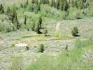
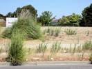
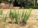
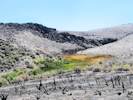
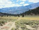
May 11, 2012Very dry this year at Shell Creek. | ||||||||||||||||||||||||||||||||||||||||||||||||||||
|
Other articles:
|
May 15, 2012 | ||||||||||||||||||||||||||||||||||||||||||||||||||||
|
Other articles:
|
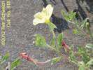
818 |
Rumex crispus L. Curley Dock.
Mount Trashmore, Alameda County, California. East end of Mount Trashmore, along bicycle path, 175 meters north of Doolittle Drive. 37.7471°N, 122.2269°W. WGS 1984. Coll. No. 818, 15 May 2012, characters observed: Perennial, to 1 m., terrestrial; Stem erect, leafy axillary shoots below terminal inflorescence; Leaves basal and cauline, petiole 15-20 cm., leaves 4x long as wide (Obs: 20 cm. x 5 cm. wide, 25 cm. x 6 cm. wide); Pedicels, 5-8 mm., joints swollen; Flowers bisexual; Perianth, inner lobes 3 mm. x 2 mm. wide, margins entire, tubercles 3, width < 1/3 inner lobe; Stamens, 6; Styles, 3, Stigmas, feathery. | |||||||||||||||||||||||||||||||||||||||||||||||||||
|
Other articles:
|
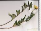
819 |
Bay Farm Island, City of Alameda, Alameda County, California. In the median strip of North Loop Road, Harbor Bay Business Park, City of Alameda. 37.7301°N, 122.243°W. Elev. 3 m. Collection No. 819, 23 May 2012, Characters observed while keying: Herb, annual or short-lived perennial; Stem decumbent; Leaves cauline, alternate, to 35 mm, oblanceolate, entire; Stipule absent; Bud curved upward, sepal tips free in bud 2 mm.; Flowers in distal axils, parts in 4s, open, bisexual; Hypanthium 22 mm.; Perianth in 2 or more whorls; Sepals reflexed, 12 mm., deciduous after flowering; Petals free at hypanthium, 17 mm., yellow, base not spotted; Stamens 8 in one series; Ovary inferior, tip projection 0; Style 1; Stigma 4-lobed in maturity; Fruit cylindric, 4-chambered, elongate 35-42 mm., dehiscent; Seeds many, rounded or ovoid in shape (not angled, ribbed, or winged). Native to eastern US, widely naturalized, but occurrences scattered. Self pollinated. | |||||||||||||||||||||||||||||||||||||||||||||||||||
|
Other articles:
|
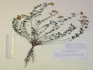
820 |
Lotus corniculatus L. Bird's Foot Trefoil.
Bay Farm Island, City of Alameda, Alameda County, California. In the median strip of North Loop Road, Harbor Bay Business Park, Bay Farm Island, City of Alameda. 37.73°N, 122.2428°W. WGS 1984. Elev. 3 m. Very sandy soil. Collection No. 820, 24 May 2012, characters observed while keying: Perennial herb; Leaf palmate compound; Leaflets 3, entire, not gland-dotted, length of longest upper leaflet 3.15 x width; Infloresence 5-flowered; Flower bilateral; Sepals fused 4 mm., tips 2 mm.; Corolla 10 mm.; Stamens 10, filaments of 9 fused, 10th upper free; Fruit exserted from calyx. | |||||||||||||||||||||||||||||||||||||||||||||||||||
|
Other articles:
|
May 27, 2012 | ||||||||||||||||||||||||||||||||||||||||||||||||||||
|
|
May 28, 2012 | ||||||||||||||||||||||||||||||||||||||||||||||||||||
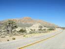
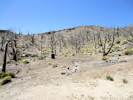
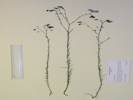
 A last look at my plot on Pinto Mountain. A last look at my plot on Pinto Mountain.
|
Pulled out my plot on Pinto Mountain. | ||||||||||||||||||||||||||||||||||||||||||||||||||||
 WW II archeological site WW II archeological site
 WW II archeological site WW II archeological site
|
Archeological site with Howitzer shells. | ||||||||||||||||||||||||||||||||||||||||||||||||||||
|
Other articles:
|
| ||||||||||||||||||||||||||||||||||||||||||||||||||||
|
Other articles:
|
| ||||||||||||||||||||||||||||||||||||||||||||||||||||
|
Other articles:
Locations:
Winklers Cabin.
|
| ||||||||||||||||||||||||||||||||||||||||||||||||||||
|
Other articles:
|
Along the drive into Lobo Point for lunch. | ||||||||||||||||||||||||||||||||||||||||||||||||||||
|
Other articles:
Locations:
Lobo Point.
|
| ||||||||||||||||||||||||||||||||||||||||||||||||||||
|
Other articles:
|
| ||||||||||||||||||||||||||||||||||||||||||||||||||||
|
Other articles:
|
View from the rim. | ||||||||||||||||||||||||||||||||||||||||||||||||||||
|
|
May 29, 2012 | ||||||||||||||||||||||||||||||||||||||||||||||||||||
|
Other articles:
Locations:
Kelso.
|
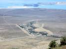
Kelso Depot | ||||||||||||||||||||||||||||||||||||||||||||||||||||
|
Other articles:
Locations:
Shady Rest Campground.
|
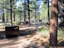
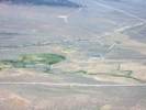
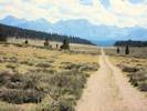
Shady Rest Campground Very highly groomed; the pine needles have been raked away exposing the volcanic sand underneath. I think I would prefer to camp on the pine needles. | ||||||||||||||||||||||||||||||||||||||||||||||||||||
|
|
Wednesday, May 30thStopped at Airfield Flat to look for Astragalus monoensis. | ||||||||||||||||||||||||||||||||||||||||||||||||||||
|
Other articles:
Locations:
Airfield Flat.
|
| ||||||||||||||||||||||||||||||||||||||||||||||||||||
|
Other articles:
|
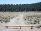
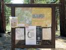
Forest Service interpretive sign; mostly about vehicle use of the forest, the maps in the box at left are pretty useful. | ||||||||||||||||||||||||||||||||||||||||||||||||||||
|
Other articles:
|
821 |
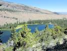
Gull Lake, Mono County, California. Disturbed land north of Gull Lake, on Leonard Drive, near Lauterbrunnen Strasse. 37.779°N, 119.0876°W. WGS 1984. Elev. 2348 m. Common here, and in other near-by disturbed areas. Also collected on the beach at June Lake. | |||||||||||||||||||||||||||||||||||||||||||||||||||
|
Other articles:
|
822 |
Festuca idahoensis Elmer. Idaho Fescue.
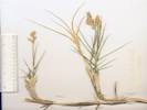
Gull Lake, Mono County, California. Disturbed areas north of Gull Lake, off Leonard Drive near Highland Drive. 37.779°N, 119.0876°W. WGS 1984. Elev. 2347 m. Coll. No. 822, 30 May 2012, characters observed while keying: Perennial, to 50 cm; Roots fibrous; Stem herbaceous; Internodes hollow; Leaf blade and sheath differentiated, soft; Sheath open; Ligule membraneous, 0.5 mm.; Blade rolled inward; Inflorescence 1-2, 8-9 cm., > leaves, branching evident, panicle, spikelets many; Spikelets similar, 1/node, 1° and 2° branches, many flowered, 10 mm.; Florets, 4-6 per spikelet, bisexual (1-2 staminate, 3-4 staminate and pistillate, 5-6 staminate and ?pistillate); Glumes lower 4.5 mm, upper 3.0 mm, lower < lowest floret, veins 3-9, awns 0; Axis sparsely hairy, not extended beyond upper floret; Lemma 5 mm., rolled, veins 5, outer faint, tip entire, awns 1, 2.0-2.5 mm, straight, attached at tip; Palea < lemma, keel glabrous, margin glabrous, Anthers 3, 2 mm.; Ovary glabrous. | |||||||||||||||||||||||||||||||||||||||||||||||||||
|
Other articles:
|
823 |
Linum lewisii Pursh.
Gull Lake, Mono County, California. Disturbed areas north of Gull Lake, on Leonard Drive, near Lauterbrunnen Strasse. 37.779°N, 119.0876°W. WGS 1984. Elev. 2346 m. . The most recent previous collection of Linum lewisii was by Chesnut and Drew at the foot of Bloody Canyon in 1889. | |||||||||||||||||||||||||||||||||||||||||||||||||||
|
|
Thursday, May 31stWent out to Sagehen Meadow to visit Bill. | ||||||||||||||||||||||||||||||||||||||||||||||||||||
|
Other articles:
|
824 |
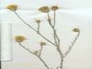
Anisocoma acaulis Torr. & A. Gray. Scale Bud.
Sagehen Meadow, Mono County, California. Disturbed places near residence. 37.8731°N, 118.858°W. WGS 1984. Elev. 2550 m. | |||||||||||||||||||||||||||||||||||||||||||||||||||
|
Other articles:
|
825 |
Bromus carinatus Hook. & Arn. Var. carinatus. California Brome. Bromus tectorum L. Cheat Grass. (as annotated by Andy Sanders). Sagehen Meadow, Mono County, California. Previously disturbed soil around the house on the north side of Sagehen Meadow. 37.8731°N, 118.8581°W. WGS 1984. Elev. 2550 m. Coll. No. 825, 30 May 2012, characters observed while keying: Perennial, to 40 cm.; Roots fibrous; Stem herbaceous; Internodes hollow; Leaf blade and sheath differentiated; Sheath closed; Ligule membraneous, 2 mm.; Blade flat, to 4 mm wide, short hairy, margin sparse wavy hairy; Inflorescence 3-many, 10-12 cm., panicle, branching evident, longest branch 25 mm., > leaves, spikelets many; Compression lateral; Spikelets similar, 1 / node, 1° and 2° branches, length 30-35 mm., 5-6 florets; Florets 2+ bisexual; Glumes lower 7 mm., upper 10 mm., margins thin translucent, upper glume has 3 prominent veins (keeled), awns 0; Lemma, lower 12 mm., keeled, veins = 3 or 7, outer 2 appear doubled, tip 2-forked, awns 1, 13 mm, straight, attached to back at 9 mm.; Palea, 8 mm, < lemma, keel hairy, margin ciliate; Anthers 3, 0.7 mm., brown; Ovary 5 mm., glabrous below, hairy near tip. | |||||||||||||||||||||||||||||||||||||||||||||||||||
|
|
Wednesday, June 6th | ||||||||||||||||||||||||||||||||||||||||||||||||||||
|
Other articles:
|
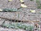
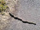
In the mid-morning, en route from the gym to home, I saw this gopher snake on the edge of the bicycle trail. | ||||||||||||||||||||||||||||||||||||||||||||||||||||
|
|
Friday, June 8th | ||||||||||||||||||||||||||||||||||||||||||||||||||||
 Coll. No. 826, Bromus diandrus Coll. No. 826, Bromus diandrus
|
826 |
Bromus diandrus Roth. Rip Gut Brome.
Alameda, Alameda County, California. 37.7624°N, 122.2303°W. WGS 1984. Elev. 7 m. Garden weed. Shaded habitat. Coll. No. 826, 8 June 2012, characters observed while keying: Annual, to 90 cm, spreading; Internodes hollow; Leaf differentiated into sheath and blade; Sheath closed; Ligule membraneous; Inflorescence panicle 2°, > sheath; Compression unremarkable; Disarticulation above the glumes; Spikelets all the same, 1 per node; Glumes < lemma; Florets per spikelet 5-6, fertile 3, male 1, 1-2 infertile; Lemma 26 mm x 3 mm wide, rounded (i.e., not keeled), 2-toothed, translucent teeth, Veins 3 prominent + 2 intermediate = 5; Awns from the back of the lemma, 70 mm., straight; Palea very thin, < lemma, veins and margin variously ciliate; Achenes fuse to lemma and palea as floret matures. | |||||||||||||||||||||||||||||||||||||||||||||||||||
|
Other articles:
|
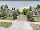
Tuesday, June 12, 2012The Google car goes by. | ||||||||||||||||||||||||||||||||||||||||||||||||||||
|
|
Sunday, June 17th | ||||||||||||||||||||||||||||||||||||||||||||||||||||
|
Other articles:
|
827 |
Melilotus albus Medik.
Tioga Lodge, Mono County, California. At the shoreline of Mono Lake opposite Tioga Lodge, 2.6 miles by road north of Lee Vining, California. 37.9903°N, 119.1396°W. WGS 1984. Elev. 1950 m. | |||||||||||||||||||||||||||||||||||||||||||||||||||
|
Other articles:
|
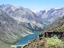
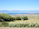
When we pulled into Lee Vining, we saw great clouds of yellow "smoke." Took a while, but we decided it was great clouds of Pinyon pollen stirred up by gusty winds. | ||||||||||||||||||||||||||||||||||||||||||||||||||||
|
|
Monday, June 18th | ||||||||||||||||||||||||||||||||||||||||||||||||||||
|
Other articles:
Locations:
Mono Lake, northwest shore (as a col. locality).
|
Also saw a few Calochortus bruneaunis growing in the sagebrush here, just north of the burned area. Did not see any growing in the burned area. Only a very few here, so did not collect. | ||||||||||||||||||||||||||||||||||||||||||||||||||||
 Location of collection nos. 828-831. Location of collection nos. 828-831.
|
The rock outcrop around which collections 828 to 831 were made. | ||||||||||||||||||||||||||||||||||||||||||||||||||||
|
Other articles:
|
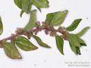
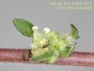
828 |
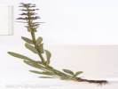
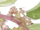
Scrophularia desertorum
Coll. No. 828, 18 Jun 2012, characters observed: Herbaceous shrub, to 1 m.; Stem square, glandular; Petiole 4.5 cm.; Leaf 9 cm. x 6 cm. wide, triangular-deltate, base cordate below to oblique above, green (not yellow, not gray-green); Inflorescence a panicle, glandular, 9+ flowers per branch; Pedicels curved upward; Corolla dark red, 5 (6-7) mm. Leaf color and base point toward S. californica; pedicel and corolla characters point to S. desertorum. | |||||||||||||||||||||||||||||||||||||||||||||||||||
|
Other articles:
|
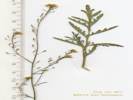
829 |
Chaenactis douglasii (Hook.) Hook. & Arn. var. douglasii. Douglas' Dustymaiden.
Tioga Lodge, Mono County, California. Granite outcrop surrounded by very sandy soil, likely a former shoreline or deltaic deposit from a high-stand of Mono Lake, above Tioga Lodge, along a powerline road, 2.8 miles north of Lee Vining. 37.991°N, 119.1474°W. WGS 1984. Elev. 2093 m. This area burned several years ago. Coll. No. 829, 18 Jun 2012, characters observed: Perennial, woody at base, to 40 cm.; Stem hairs white; Leaves cauline (basal leaves absent); Inflorescence, flowers of 1 kind, rayless, discoid; Heads solitary on peduncles 4-6 cm. at flowering; Phyllaries in two overlapping series, outer 5-7 mm., inner 9 mm., tips appressed; Receptacle epaleate; Pappus a well-developed crown of scales, 1.0-5.0 mm., not alternating with awns or bristles; Fruit 6 mm. | |||||||||||||||||||||||||||||||||||||||||||||||||||
|
Other articles:
|
830 |
Symphyotrichum campestre (Nutt.) G. L. Nesom. Western Meadow Aster.
Tioga Lodge, Mono County, California. Granite outcrop surrounded by very sandy soil, likely a former shoreline or deltaic deposit from a high-stand of Mono Lake, above Tioga Lodge, along a powerline road, 2.8 miles north of Lee Vining. 37.9909°N, 119.1474°W. WGS 1984. Elev. 2096 m. Coll. No. 830, 18 Jun 2013, characters observed: Perennial herb to 50 cm.; Stems ascending, appressed short hairy; Leaves, alternate, sessile, strap-like, to 22 mm., short hairy glandular, margins entire; Peduncle barely glandular; Involucre 5 mm., glandular; Phyllaries, 2.5 - 4.5 mm., in 4+ series, herbaceous especially at tips, tips appressed, densely glandular, inner bases straw colored, margins scarious; Heads radiate, composed of 2 kinds of flowers, in few flowered flat topped clusters; Receptacle epaleate, Pappus of single bristles, not alternating with scales, 16 (but going with > 20 while keying), well-developed in ray and disk flowers, ± cylindric, small plumose; Rays blue-purple, conspicuous, fruiting, style present; Disk corolla 4 mm, yellow. | |||||||||||||||||||||||||||||||||||||||||||||||||||
|
Other articles:
|
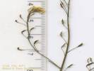
831 |
Caulanthus sierrae ined. Sierra Jewelflower.
Tioga Lodge, Mono County, California. Granite outcrop surrounded by very sandy soil, likely a former shoreline or deltaic deposit from a high-stand of Mono Lake, above Tioga Lodge, along a powerline road, 2.8 miles north of Lee Vining. 37.9909°N, 119.1474°W. WGS 1984. Elev. 2095 m. Coll. No. 831, 18 Jun 2013, characters observed: Perennial, from tap root, to 75 cm., caudex woody, hairs proximal simple, distal 0; Leaves basal withered, cauline petioled lobed, distal sessile, smaller than mid cauline; Raceme not bracted, terminal cluster fertile; Pedicels 2 mm. in flower to 3.5 mm. in fruit; Flowers radial; Stigma entire; Stamens 6, ± equal in length, well exserted; Fruit ascending silique, ± sessile on receptacle, linear, glabrous. Keys poorly in TJM2, can be forced into C. pilosus. Keys fairly easily to C. sp. In Taylor (2010), i.e., the undescribed Sierra Jewelflower (Caulanthus sierrae ined.). | |||||||||||||||||||||||||||||||||||||||||||||||||||
|
Other articles:
|
832 |
Mentzelia congesta Torr. & A. Gray. United Blazing Star.
Mono Mills, Mono County, California. Along California Highway 120 about 1 mile east of Mono Mills, while looking for M. monoensis Brokaw & Hufford. 37.8819°N, 118.9448°W. WGS 1984. Elev. 2278 m. Coll. No. 832, 18 Jun 2012, characters observed: Annual, tap root, 15 cm.; Stem, white, ascending, branched, straight hairy; Bracts, conspicuous, concealing fruits, mostly white body with green edges, 5 lobed; Petals, 3.5 mm.; Fruit, somewhat obconic (tapered proximally, cylindric distally), 6 mm. x 2.1 mm. wide, seed rows >1 above mid-fruit. | |||||||||||||||||||||||||||||||||||||||||||||||||||
|
Other articles:
|
833 |
Trisetum spicatum (L.) K. Richt. Spike Trisetum.
Dry Creek, Mono County, California. In very sandy area on the edge of Dry Creek, where Dry Creek enters Big Sand Flat, about 90 meters southeast of California Highway 120, 13.7 air miles southeast of Lee Vining, California. 37.8818°N, 118.8854°W. WGS 1984. Elev. 2410 m. Coll. No. 833, 18 Jun 2012, characters observed: Perennial, 13cm; Stem, herbaceous, soft hairy; Leaf sheath and blade differentiated, sheath open, blade soft, soft hairy; Ligule ciliate, 1 mm.; Inflorescence spike-like panicle 4.5 cm., barely exceeding leaves, purple interior; Compression lateral; Spikelets similar, 2-8 per node on 1° and 2° branches, Florets 4± per spikelet, bisexual; Glumes, lanceolate, lower 3.5 mm < upper 4.5 mm.; Lemma 4 mm., veins 3+, awns 1 attached to back; | |||||||||||||||||||||||||||||||||||||||||||||||||||
|
Other articles:
|
834 |
Abronia turbinata S. Watson. Transmontane Sand Verbena.
Sagehen Peak, Mono County, California. In deep powdery sand beside Sagehen Meadows Road, about ½ mile north northwest of Sagehen Peak. 37.8575°N, 118.8484°W. WGS 1984. Elev. 2647 m. | |||||||||||||||||||||||||||||||||||||||||||||||||||
|
Other articles:
Locations:
Crooked Meadows.
|
| ||||||||||||||||||||||||||||||||||||||||||||||||||||
|
Other articles:
Locations:
Crooked Meadows.
|
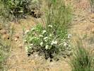
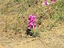
Penstemon cinicola in bloom in Crooked Meadows. | ||||||||||||||||||||||||||||||||||||||||||||||||||||
|
Other articles:
Locations:
Wild Horse Meadow.
|
| ||||||||||||||||||||||||||||||||||||||||||||||||||||
|
|
Tuesday, June 19th | ||||||||||||||||||||||||||||||||||||||||||||||||||||
|
Other articles:
|
835 |
Potentilla biennis Greene. Biennial Cinquefoil.
Rush Creek, Mono County, California. Disturbed areas near Rush Creek, near the confluence of the return ditch and the original course of the creek, 7 miles by road south of Lee Vining, CA. 37.8695°N, 119.1061°W. WGS 1984. Elev. 2157 m. | |||||||||||||||||||||||||||||||||||||||||||||||||||
|
Other articles:
|
836 |
Agropyron cristatum (L.) Gaertn. Crested Wheat Grass.
June Lake, Mono County, California. On the beach at the northeast shore of June Lake. 37.7959°N, 119.0697°W. WGS 1984. Elev. 2328 m. Growing among Purshia tridentata. | |||||||||||||||||||||||||||||||||||||||||||||||||||
| Wilson Butte flat, found Lupinus duranii and some little composite with folded leaves and flower heads on long pedicels, but did not find Astragalus monoensis. | |||||||||||||||||||||||||||||||||||||||||||||||||||||
|
Locations:
Piagi Park.
|
Saw this Pandora larva while climbing into the inner crater. | ||||||||||||||||||||||||||||||||||||||||||||||||||||
|
Locations:
Punch Bowl.
|
Climbed to the rim of the innermost crater. | ||||||||||||||||||||||||||||||||||||||||||||||||||||
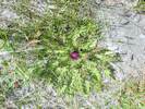
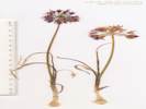
 Frasera puberulenta in the Punch Bowl. Frasera puberulenta in the Punch Bowl.
|
I saw several Frasera puberulenta on the south-facing slope of the rim of the inner crater. | ||||||||||||||||||||||||||||||||||||||||||||||||||||
|
Other articles:
|
|||||||||||||||||||||||||||||||||||||||||||||||||||||
|
Other articles:
Locations:
Airfield Flat.
|
Not-so-good photo of the little sand flat to the south of Wilson Butte. I stopped here to look for Astragalus monoensis since the type locality is described as "near Deadman Summit." I have already found the species in nearby "Airfield Flat," but I could not find it here, leading to the suggestion that "Airfield Flat" is the likely type locality. | ||||||||||||||||||||||||||||||||||||||||||||||||||||
|
|
Wednesday, June 20th | ||||||||||||||||||||||||||||||||||||||||||||||||||||
|
Other articles:
|
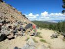
View of powerline road just north of Deep Wells. | ||||||||||||||||||||||||||||||||||||||||||||||||||||
|
Other articles:
|
|||||||||||||||||||||||||||||||||||||||||||||||||||||
|
Other articles:
|
|||||||||||||||||||||||||||||||||||||||||||||||||||||
|
Other articles:
Locations:
Sulphur Pond.
|
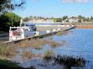
General view of Sulphur Pond, some water, but not as much as usual. | ||||||||||||||||||||||||||||||||||||||||||||||||||||
| 837 | See Collection No. 840. | ||||||||||||||||||||||||||||||||||||||||||||||||||||
|
Other articles:
Locations: Sulphur Pond. |
838 | Schoenoplectus pungens (Vahl) Palla. (Syn: Scirpus pungens Vahl ) Threesquare. | |||||||||||||||||||||||||||||||||||||||||||||||||||
| 12-24 large-size pollywogs in pond outside the exclosure. | |||||||||||||||||||||||||||||||||||||||||||||||||||||
|
Other articles:
Locations:
Sulphur Pond.
|
839 |
Distichlis spicata (L.) E. Greene. Saltgrass.
Sulphur Pond, Mono County, California. 38.0859°N, 118.9654°W. WGS 1984. Elev. 1966 m. Common among dunes and rabbitbrush in dry areas around Sulphur Pond. Coll. No. 839, 20 Jun 2012, characters observed: Perennial, herbaceous, to 20 cm. above ground; Rhizomes, 3-5 mm. dia., scaly when young, buried 15-20 cm. below surface; Stem, cylindric (and don't you forget it!), herbaceous, leafy, unisexual; Leaf differentiated into sheath and blade, arranged in two (not three!) rows, blade 6-7 cm., glabrous, stiff; Ligule soft hairy around exterior; Inflorescence of many crowded spikelets, compressed laterally; Flowers, staminate and pistillate on different stems; Glumes 2, Stigmas 2 per flower; Fruit an achene. | |||||||||||||||||||||||||||||||||||||||||||||||||||
|
Other articles:
Locations: Sulphur Pond. |
840 | Thelypodium integrifolium (Nutt.) Endl. ex Walp. ssp. complanatum Al-Shehbaz. Entireleaved Thelypody. | |||||||||||||||||||||||||||||||||||||||||||||||||||
|
Other articles:
Locations:
Cottonwood Canyon.
|
841 | Epilobium, no flowers or fruit. Collected at the same location, and probably the same as Collection Number 690.1. | |||||||||||||||||||||||||||||||||||||||||||||||||||
|
Other articles:
Locations:
Cottonwood Canyon.
|
842 |
Ranunculus cymbalaria Pursh. (Syn: Ranunculus cymbalaria Pursh var. saximontanus Fernald ) Alkali Buttercup.
Cottonwood Canyon, Mono County, California. In the spring between Cottonwood Canyon Road and the miner's shack, 6.3 miles by road northeast of Goat Ranch. 38.1794°N, 119.0123°W. WGS 1984. Elev. 2449 m. | |||||||||||||||||||||||||||||||||||||||||||||||||||
|
Other articles:
Locations:
Cottonwood Canyon.
|
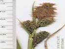
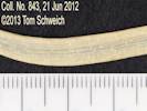
843 |
Cottonwood Canyon, Mono County, California. In the spring between Cottonwood Canyon Road and the miner's shack, 6.3 miles by road northeast of Goat Ranch. 38.1794°N, 119.0123°W. WGS 1984. Elev. 2448 m. Coll. No. 843, 20 June 2012, characters observed: Perennial, herbaceous, to 20 cm. above ground, rhizomed; Stem, bisexual, pistillate and staminate spikelets on same stem; Leaf, differentiated into sheath and blade, sheath, 6 cm., front fibrous (but how much fibrous is fibrous?), crosswalls irregular (though not a specified character for this taxon), blade, 11cm.; Inflorescence, 1 terminal staminate spikelet, and 3-4 lateral pistillate spikelets (puts us in Group 8); Bract, > inflorescence, sheath 1.5 mm.; Spikelets, erect; Perigynum, 2.5-3.0 mm. x 1.0-1.3 mm. wide, not fleshy, ±flat, walls thin, (faint veins); Stigmas, 2. | |||||||||||||||||||||||||||||||||||||||||||||||||||
|
Other articles:
Locations:
Cottonwood Canyon.
|
844 |
Potentilla millefolia Rydb. Cutleaf Cinquefoil.
Cottonwood Canyon, Mono County, California. In a small wet area on the east side of Cottonwood Canyon Road, in a section of the canyon where the landscape is more open, 4.6 miles by road northeast of Goat Ranch, Mono County, California. 38.1599°N, 119.0179°W. WGS 1984. Elev. 2231 m. This may be the southernmost collection of this taxon, and a range extension south into the Mono Lake watershed from the Walker River watershed. | |||||||||||||||||||||||||||||||||||||||||||||||||||
|
Other articles:
|
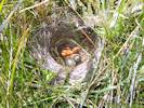
Grackle nest just outside the road berm, and on the edge of a roadside wetland. | ||||||||||||||||||||||||||||||||||||||||||||||||||||
|
|
Thursday, June 21st | ||||||||||||||||||||||||||||||||||||||||||||||||||||
|
Other articles:
Locations:
Mill Creek.
|
We tried to walk down the east side of Mill Creek. Was a mistake. Next time we'll try to west side. | ||||||||||||||||||||||||||||||||||||||||||||||||||||
|
Other articles:
Locations:
Mill Creek.
|
| ||||||||||||||||||||||||||||||||||||||||||||||||||||
|
Other articles:
Locations:
Mill Creek.
|
845 |
Mill Creek, Mono County, California. On islands of Mill Creek, 240 m upstream of the Cemetery Road crossing. 38.0253°N, 119.1335°W. WGS 1984. Elev. 1976 m.
Coll. No. 845, 21 Jun 2013, characters observed while keying:
Herbaceous perennial, aquatic but not submersed;
Leaves, true leaves, not scale- or needle-like, sheath open, veination parallel, multiple veins,
blade flattened, iris-like, oriented edge toward stem, glabrous;
Inflorescence 4-14 clusters of flowers;
Bract exceeding only lowest flower cluster, not cylindric;
Clusters <= 10 mm.;
Flowers present, bisexual;
Perianth in 2 whorls of 3, sepals and petals, very similar, all brown;
Anther 1.2 mm., > filament;
Ovary superior;
Pistil 1;
Style 1, 1.0 mm.;
Stigmas 3;
Fruit [ | |||||||||||||||||||||||||||||||||||||||||||||||||||
|
Other articles:
Locations:
Mill Creek.
|
846 |
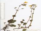
Myosotis laxa Lehm. Bay Forget-Me-Not. Mill Creek, Mono County, California. Moist partially shaded areas along creek, about 240 m upstream of Cemetery Road. 38.0253°N, 119.1335°W. WGS 1984. Elev. 1976 m. Coll. No. 846, 21 Jun 2013, characters observed while keying: Herbaceous annual or perennial, to 20 cm.; Roots fibrous; Leaves 25 mm x 5 mm wide, oblanceolate, upper cauline much-reduced, elliptical-lanceolate; Inflorescence scorpioid cyme; Calyx tube ±= lobes, tube hairs simple, appressed; Receptacle flat; Corolla salverform, radial, yellow-white tube 1.3 mm + yellow appendages + blue lobes 1 mm = 2.3 mm. x 3 mm. dia.; Stamens included; Anthers 0.6 mm.; Ovary deep-lobed; Style 1, base hidden among lobes, < nutlets; Nutlets, 1.5 mm., black, smooth, erect, margin prominent, scar basal without thick rim. Possibly, like many people, I saw this plant, thought ... “Jessica Stick Tight (Hackelia micrantha),” threw it in my press, and went on. Only later, under my microscope, did I discover it could not be a Hackelia. The main thing I noticed was that the nutlets were very smooth, and had no prickles. Working through the key, there are two other significant differences. In Hackelia the receptacle is conic and the attachment scar is lateral. In Coll. No. 846, the attachment scar is definitely basal, and the receptacle does not appear conic or elongated. So this collection is definitely Myosotis. The Jepson Manual, 2nd Ed., notes that M. scorpioides is most easily confused with M. laxa. Taylor (2010) notes that M. scorpioides is expected on both slopes of the Sierra, citing a collection in Mono County, at Lake George, E. Cardiff, s.n., in 1967 (UCR9081). That collection is determined as Hackelia sp. In the case of my Collection No. 846, the small size of the corolla, 3 mm., the calyx tube is not much greater than the lobes, and the style is definitely shorter than the nutlets, strongly leading one to M. laxa. | |||||||||||||||||||||||||||||||||||||||||||||||||||
|
Other articles:
Locations:
Mill Creek.
|
847 |
Mimulus guttatus DC. Seep Monkeyflower.
Mill Creek, Mono County, California. Moist areas along creek, about 250 m north of the Cemetery Road crossing. 38.0253°N, 119.1335°W. WGS 1984. Elev. 1976 m. Characters consistent with Erythranthe utahensis (Pennell) Nesom. Coll. No. 847, 21 June 2012, characters observed while keying: Herbaceous annual or perennial, green photosynthetic, suberect to erect, 25-30 cm.; Rhizomes numerous, 0.5-0.8 mm. dia., i.e., larger than filiform; Leaves cauline opposite, glabrous-puberulent; Flowers 12-16; Pedicels at anthesis 13 mm., in fruit 24-25 mm.; Calyx five-angled, cleft < 1/2 length, at anthesis 11 mm., in fruit moderately inflated, upper 13 mm., lower lobes turned upagainst upper lobe; Corolla yellow, upper lobe 20-25 mm., lobes entire, dehiscent soon after anthesis, upper lobes not united, spur absent; Stamens 4, staminode absent; Stigmas 2-lobed. | |||||||||||||||||||||||||||||||||||||||||||||||||||
|
Other articles:
Locations:
Mill Creek.
|
848 |
Epilobium ciliatum Raf. ssp. ciliatum. Fringed Willowherb.
Mill Creek, Mono County, California. In a gravel bar of Mill Creek, about 245 m north of the Cemetery Road crossing. 38.0253°N, 119.1335°W. WGS 1984. Elev. 2120 m. | |||||||||||||||||||||||||||||||||||||||||||||||||||
|
Other articles:
Locations:
Mill Creek.
|
849 |
Ranunculus aquatilis L. var. diffusus With. Threadleaf Crowfoot.
Mill Creek, Mono County, California. In slack water of gravel bar in Mill Creek, about 245 m upstream from the Cemetery Road crossing. 38.0253°N, 119.1335°W. WGS 1984. Elev. 1981 m. | |||||||||||||||||||||||||||||||||||||||||||||||||||
|
Other articles:
|
850 |
Wyethia mollis A. Gray. Woolly Mule-Ears.
Mill Creek, Mono County, California. Open stony ground near Mill Creek, on Forest Road 02N14, just above US Highway 395. 38.038°N, 119.1624°W. WGS 1984. Elev. 2120 m. | |||||||||||||||||||||||||||||||||||||||||||||||||||
|
Other articles:
Locations:
Lundy Canyon.
|
Frog Rock | ||||||||||||||||||||||||||||||||||||||||||||||||||||
|
Other articles:
Locations:
Lundy Canyon.
|
Lakes Canyon Trail trailhead. | ||||||||||||||||||||||||||||||||||||||||||||||||||||
|
Other articles:
Locations:
Lundy Lake.
|
I walked down below the dam to look at the habitat, because there are several collections that have been made just below the dam. | ||||||||||||||||||||||||||||||||||||||||||||||||||||
|
Other articles:
Locations:
Lundy Canyon.
|
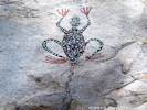
Some rock art in a picnic area of Lundy Canyon. | ||||||||||||||||||||||||||||||||||||||||||||||||||||
|
Other articles:
Locations:
Coyote Spring.
|
851 |
Coyote Spring, Mono County, California. Along the water course above Coyote Spring and about 50 m northwest of Bridgeport Canyon Road. 38.12°N, 119.0857°W. WGS 1984. Elev. 2183 m. Coll. No. 851, 21 June 2012, characters observed while keying: Perennial geophyte to 45 cm.; Leaves 4-5; Bracts subtending inflorescence and individual pedicels; Flowers in umbellate clusters; Perianth free at base; Filaments 4.5 mm., much wider at base; Anthers 1 mm. yellow; Ovary superior. | |||||||||||||||||||||||||||||||||||||||||||||||||||
|
Other articles:
Locations: Coyote Spring. |
852 |
Potentilla gracilis Hook. var. fastigiata (Nutt.) S. Watson. Slender Cinquefoil.
Coyote Spring, Mono County, California. Along the water course above Coyote Spring and about 40 m west of Bridgeport Canyon Road. 38.1199°N, 119.0854°W. WGS 1984. Elev. 2183 m. Coll. No. 852, 21 June 2012, characters observed while keying: Perennial herb to 40 cm.; Stolons 0; Stem (and petiole) hairs spreading; Leaf palmate compound; Leaflets 5, pinnate-lobed to base, 1/2 to mid-vein; Inflorescence many-flowered; Style 1.4 mm., attached near top of achene, base slightly larger, not warty; Achene glabrous. | |||||||||||||||||||||||||||||||||||||||||||||||||||
|
Other articles:
Locations:
Coyote Spring.
|
853 |
Brassicaceae. Mustard Family. Coyote Spring, Mono County, California. Adjacent to the pool in the main part of the Coyote Spring, next to Bridgeport Canyon Road. 38.1199°N, 119.0852°W. WGS 1984. Elev. 2181 m. Coll. No. 853, 21 June 2012, characters observed while keying: Annual or short-lived perennial, terrestrial, wetlands; Root tap; Rhizomes present(?); Hairs 0; Glands, very few dark glands on both surfaces of leaves; Leaves basal 0, cauline present, auriculate, compound, leaflets 5-7; Inflorescence not bracted, Pedicels narrower than fruit; Flowers radial; Perianth yellow; Petals 4 mm. x 1.5 mm., narrowed to base, not dark-veined; Stamens 6, included, unequal length, not 4 long and 2 short, more like 2 long and 4 short, possibly 3 pair of different length; Ovary (and young fruit) linear, unsegmented, overtopping petals; Fruit 11-12 mm., cylindric; Stigma 2-lobed (more like draped over end of style on 2 sides); Seeds wing 0 | |||||||||||||||||||||||||||||||||||||||||||||||||||
|
Other articles:
Locations:
Coyote Spring.
|
854 |
Coyote Spring, Mono County, California. At Coyote Spring in Bridgeport Canyon, adjacent to Bridgeport Canyon Road, 4.1 miles by road from the intersection of Cottonwood Canyon Road and California Highway 167. 38.1199°N, 119.085°W. WGS 1984. Elev. 2182 m. Coyote Spring has an disused water trough, near-by meadows are grazed by sheep. Coll. No. 854, 21 June 2012, characters observed whilst keying: Annual, to 50 cm., not scapose; Tap root; Stem simple at base, branched distally; Hairs many-branched; Leaves basal 0, cauline compound, 2-pinnate dissected, sessile, not lobed, saggitate, or clasping at base; Inflorescence bracts 0; Pedicel, in fruit widely spreading; Petals yellow; Ovary linear; Stigma entire; Fruit 7-15 mm, linear (not fusiform or club-shaped), glabrous. Fruit is quite short for D. sophia, but definitely not fusiform (D. californica) or club-shaped (D. pinnata). | |||||||||||||||||||||||||||||||||||||||||||||||||||
|
Other articles:
Locations:
Bridgeport Canyon.
|
855 |
| |||||||||||||||||||||||||||||||||||||||||||||||||||
|
Other articles:
Locations:
Bodie Hills.
|
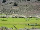
Continued on Coyote Springs Road to Mormon Meadow past this brightly colored outcrop. | ||||||||||||||||||||||||||||||||||||||||||||||||||||
|
Other articles:
Locations:
Bodie Hills.
|
Sheep at the lower end of Mormon Meadow | ||||||||||||||||||||||||||||||||||||||||||||||||||||
|
|
Friday, June 22nd | ||||||||||||||||||||||||||||||||||||||||||||||||||||
|
Other articles:
Locations:
Jordan Spring.
|
| ||||||||||||||||||||||||||||||||||||||||||||||||||||
|
Other articles:
Locations:
Jordan Spring.
|
856 |
Allium biseptrum S. Watson. Twincrest Onion.
Jordan Spring, Mono County, California. Dry area beside lower part of the spring. 38.0559°N, 119.2097°W. WGS 1984. Elev. 2742 m. Coll. No. 856, 22 June 2012, characters observed: Geophyte, onion odor present, to 20 cm. from base of bulb to top of inflorescence; Bulbs, 12 mm., ovoid, bulblets, many, << bulb, not clustered on short rhizome; Leaves, > 1 per stem (obs: 3), not fully withered at flowering; Inflorescence, many-flowered (obs: 27), without bulblets; Pedicels, 11 mm.; Perianth, parts free, lanceolate, pink, without a darker crescent adaxially, not or weakly keeled, tip margins inrolled (eek!), acuminate, papery in fruit; Stamens, included; Filaments unappendaged; Ovary 2 mm. x 2.5 mm wide, prominently crested; Style, 4 mm. from top of ovary, simple, arising from base of ovary. | |||||||||||||||||||||||||||||||||||||||||||||||||||
|
Other articles:
Locations:
Jordan Spring.
|
857 |
Jordan Spring, Mono County, California. Dry areas around the spring, 8.4 miles by air north northwest of Lee Vining, California, accessed by way of Virginia Lakes Road from US Highway 395 at Conway Summit. 38.0559°N, 119.2097°W. WGS 1984. Elev. 2742 m. Common here and on upper slopes to the south. Coll. No. 857, 22 Jun 2013, characters observed: Herbaceous perennial, woody below, densely short hairy at proximal ends of internodes and on proximal leaf surfaces, less densely hairy on herbaceous surfaces elsewhere; Leaves opposite, primary fused by membrane (though generally not so in Leptosiphon), palmately lobed, lobes 5, 11 mm., secondary leaves difficult to separate and count lobes; Calyx, lobes 5, equal, 9 mm., fused 1/2, short white hairy; Corolla, tube 8 mm. + blade 5 mm., tube < calyx, open in day; Stamens, all attached in throat, barely exserted; Filaments, 1.0 mm. | |||||||||||||||||||||||||||||||||||||||||||||||||||
|
Locations: Jordan Spring. |
858 |
Hackelia micrantha (Eastw.) J. L. Gentry. Jessica Sticktight.
Jordan Spring, Mono County, California. Growing around bases of trees just a few meters west of and above the spring, about 8.5 miles by air north northwest of Lee Vining, California, accessed by way of Virginia Lakes Road from US Highway 395 at Conway Summit. 38.0567°N, 119.2118°W. WGS 1984. Elev. 2761 m. Coll. No. 858, 22 June 2012, characters observed: Perennial or biennial, from ±woody caudex, erect, to 60 cm., green, photosynthetic; Stem hairy, not photosynthetic; Leaves basal 16 cm, >> cauline leaves, petiole winged, oblanceolate, margins entire, green at flowering, cauline alternate, ±sessile, narrowly oblong; Inflorescence coiled, unrolling in development; Perianth 2+ whorls, parts in 5s; Flowers open, bisexual; Calyx lobes equal; Corolla radial, petals fused to form tube, tube 2.5 mm. + lobes 3 mm., throat constricted by petal appendages; Ovary 1, superior, 1 mm, round, entire; Style short, < 1 mm.; Stamens 5, included; Filaments free (from each other), fused to corolla throat, 1 mm.; Fruit -- not developed. | |||||||||||||||||||||||||||||||||||||||||||||||||||
|
Other articles:
|
View from overlook on north shoulder of Copper Mountain. | ||||||||||||||||||||||||||||||||||||||||||||||||||||
|
Other articles:
Locations:
Deer Creek.
|
| ||||||||||||||||||||||||||||||||||||||||||||||||||||
|
|
Saturday, June 23rd | ||||||||||||||||||||||||||||||||||||||||||||||||||||
|
Other articles:
Locations:
Walker Lake.
|
| ||||||||||||||||||||||||||||||||||||||||||||||||||||
| 859 |
Leptosiphon nuttallii (Gray) J. M. Porter & L. A. Johnson ssp. pubescens (R. Patt.) J. M. Porter & L. A. Johnson. Nuttall's Linanthus.
Walker Lake, Mono County, California. Widely distributed on the north slope of the southern moraine of Bloody Canyon, from the Walker Lake Trailhead down to the lake. 37.8719°N, 119.1662°W. WGS 1984. Elev. 2447 m. | ||||||||||||||||||||||||||||||||||||||||||||||||||||
|
Other articles:
|
860 |
Poa pratensis L. ssp. pratensis. Kentucky Bluegrass.
Parker Creek, Mono County, California. In a small wetland near the Parker Creek intake to the Los Angeles aqueduct, just above the aqueduct road, about 2 miles southwest of the intersection of California Highway 158 and US Highway 395. 37.875°N, 119.1197°W. WGS 1984. Elev. 2204 m. Coll. No. 860, 23 Jun 2012, characters observed: Perennial to 40-50 cm., dioecious; Roots fibrous; Rhizomes slender; Leaf blades and sheath differentiated, soft, folded, not inrolled, tips ±prow-shaped; Sheath open ± ½; Ligule membraneous, <= 1 mm.; Inflorescence 10-13 cm., > leaves; Spikelets many, similar, on 1° or 2° branches, with both pistillate and staminate florets; Florets per spikelet 3-4, flowers mostly unisexual; Glumes 2, 2.5-2.7 mm., < lemma, keeled, glabrous; Callus with long cobwebby hairs; Lemma 2.7 mm, >= 5, shory hairy; Palea keel serrate; Anthers 1 mm., purple streaked. | |||||||||||||||||||||||||||||||||||||||||||||||||||
|
Other articles:
|
861 |
Poa compressa L. Canada Bluegrass.
Parker Creek, Mono County, California. Dry roadside on the edge of a small wetland near the Parker Creek intake to the Los Angeles aqueduct, just above the aqueduct road, about 2 miles southwest of the intersection of California Highway 158 and US Highway 395. 37.8751°N, 119.1197°W. WGS 1984. Elev. 2185 m. Coll. No 861, 23 Jun 2012, characters observed: Perennial, to 80 cm.; Root fibrous; Rhizomes not seen; Leaf blade and sheath differentiated, soft; Sheath open; Ligule membraneous, 4 mm.; Inflorescence 1, panicle, > leaves, spikelets many; Compression lateral; Spikelets similar, 1 per node, 1°-3° branches, bisexual; Florets per spikelet 3-4; Glumes 2, 3 mm., < lemma; Callous glabrous; Lemma veins 5 (much easier to see if you soften the lemmas with Pohl's solution!), awns 0; Palea keels serrate; Anthers 3; Ovary glabrous. Rhizomes form in late summer and early fall. While a useful character, the rhizomes may not be evident on specimens merely picked or pulled hastily from ground. | |||||||||||||||||||||||||||||||||||||||||||||||||||
|
Other articles:
|
862 |
Stellaria longipes Goldie ssp. longipes. Longstalk Starwort.
Parker Creek, Mono County, California. In a small wetland near Parker Creek intake to the Los Angeles aqueduct, just below the aqueduct road, about 2 miles southwest of the intersection of California Highway 158 and US Highway 395. 37.8751°N, 119.1192°W. WGS 1984. Elev. 2175 m. Coll. No. 862, 23 Jun 2012, characters observed: Perennial herb, to 20 cm.; spreading by rhizomes, without tuber-like thickening or vertical fleshy root; Leaves opposite; Stipules 0; Inflorescence panicle; Flowers 4-9(10); Pedicels ascending; Sepals free; Petals 2-lobed, > sepals; Fruit a capsule, ovoid (turns wetting solution purple); Seed many, 0.8 mm, ovoid, light brown, slightly rugose. | |||||||||||||||||||||||||||||||||||||||||||||||||||
|
Other articles:
|
863 |
Parker Creek, Mono County, California. On the edge of a small wetland near the Parker Creek intake to the Los Angeles aqueduct, just below the aqueduct road, about 2 miles southwest of the intersection of California Highway 158 and US Highway 395. 37.8751°N, 119.1194°W. WGS 1984. Elev. 2175 m. Coll. No. 863, 23 June 2012, characters observed: Woody spreading tree, to 2.5 m.; Twigs glaucus (and feel waxy); Bud scale margins fused; Petiole 5 mm., glabrous, not glandular; Leaves, alternate, young leaves reddish and adaxially hairy, hairs decreasing as leaves mature, mature leaves largest 4 cm x 1 cm wide, lanceolate to elliptic, margins generally flat, occasionally ±rolled basally, tip acute (some rounded), adaxially dull with thinning hairs, abaxially glaucus; Flower bracts deciduous; Ovary not hairy, beak gradually tapered to style. | |||||||||||||||||||||||||||||||||||||||||||||||||||
|
Other articles:
|
864 |
Penstemon rydbergii A. Nelson var. oreocharis (Greene) N. H. Holmgren. Rydberg's Penstemon.
Parker Creek, Mono County, California. In a small wetland near the Parker Creek intake to the Los Angeles aqueduct, just below the aqueduct road, about 2 miles southwest of the intersection of California Highway 158 and US Highway 395. 37.875°N, 119.1193°W. WGS 1984. Elev. 2176 m. Coll. No. 864, 23 June 2012, characters observed: Herbaceous perennial, to 45 cm., Stem, ascending, unbranched, base above ground; Herbage glabrous; Leaves opposite, basal and cauline, thin, basal oblanceolate, cauline well-developed, sessile, lanceolate; Inflorescence glabrous; Corolla 10 mm., mouth open, floor hairy; Anther sacs, 0.5 mm., dehiscing full length, glabrous. | |||||||||||||||||||||||||||||||||||||||||||||||||||
|
Other articles:
|
865 |
The smaller willow
Salix exigua Nutt. var. exigua. Coyote Willow, Narrow-Leaved Willow. Parker Creek, Mono County, California. In a small wetland near the Parker Creek intake to the Los Angeles aqueduct, just below the aqueduct road, about 2 miles southwest of the intersection of California Highway 158 and US Highway 395. 37.8749°N, 119.1194°W. WGS 1984. Elev. 2172 m. Coll. No. 865, 23 Jun 2012, characters observed: Woody perennial shrub, Bud scale margins fused; Petiole very short = 1 mm., glands 0; Leaf linear, 45 mm. x 3.5 mm. wide, length 12-13 x width, abaxial surface obscured by hair. | |||||||||||||||||||||||||||||||||||||||||||||||||||
|
Other articles:
|
866 |
Sisyrinchium idahoense E. P. Bicknell var. occidentale (Bicknell) Hend. Idaho Blue-Eyed Grass.
Parker Creek, Mono County, California. In a small wetland near the Parker Creek intake to the Los Angeles aqueduct, just below the aqueduct road, about 2 miles southwest of the intersection of California Highway 158 and US Highway 395. 37.8749°N, 119.1194°W. WGS 1984. Elev. 2340 m. Coll. No. 866, 23 June 2013, characters observed; Herbaceous perennial; Rhizome, 19 mm. x 1.5 mm. dia., compact(?); Stem, not branched, 1.8-1.9 mm. wide at widest, distal margin entire; Leaves, basal; Bracts, outer 18 mm., inner 15 mm., translucent margin < tip; Perianth, blue, outer parts 7 mm. | |||||||||||||||||||||||||||||||||||||||||||||||||||
|
Other articles:
|
867 |
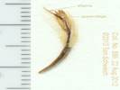
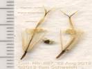
Thalictrum sparsiflorum Turcz. Fewflower Meadow-Rue.
Parker Creek, Mono County, California. Just upstream from the informal campground on Parker Creek, 3.5 miles by air southwest of the intersection of US Highway 395, and California Highway 158. 37.8558°N, 119.1381°W. WGS 1984. Elev. 2340 m. | |||||||||||||||||||||||||||||||||||||||||||||||||||
|
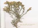
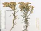
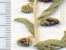
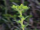
Other articles:
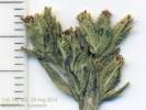
|
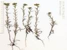
868 |
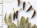
Carex multicostata Mack. Manyrib Sedge.
Parker Creek, Mono County, California. Just upstream from the informal campground on Parker Creek, 3.5 miles by air southwest of the intersection of US Highway 395, and California Highway 158. 37.8558°N, 119.1381°W. WGS 1984. Elev. 2340 m. Shaded streamside. Coll. No. 868, 23 June 2012, characters observed: Perennial herb, aquatic, strongly emergent, glabrous, Stem hollow; Leaf veins parallel, differentiated into sheath and blade; Sheath front with extensive white-translucent area; Blade flattened, iris-like, oriented edge toward stem; Inflorescence terminal, composed of many spikelets; Spikelets 25-30 flowered, 12 mm wide; Perianth scale-like; Flowers, pistillate above staminate flowers; Scales, pistillate with hyaline margin; Perigynum, 4.7 mm., winged 0.3 mm. at mid-fruit, veins 4-6, 0 exceeding perigynum; Stigmas 2. | |||||||||||||||||||||||||||||||||||||||||||||||||||
|
Other articles:
|
869 |
Glyceria elata (Rydb.) M. E. Jones. Fowl Manna Grass.
Parker Creek, Mono County, California. Just upstream from the informal campground on Parker Creek, 3.5 miles by air southwest of the intersection of US Highway 395, and California Highway 158. 37.8558°N, 119.1381°W. WGS 1984. Elev. 2340 m. Shaded streamside. Coll. No. 869, 23 Jun 2012, characters observed: Perennial grass, to 60-70 cm., of wetlands; Leaf sheath and blade differentiated, Sheath closed to near top; Ligule membraneous; Blade 25-30 cm. x 8 mm. wide, soft, thin, rows of dots parallel to veins; Inflorescence well-developed, open; Compression weak lateral; Spikelets, many, similar, 1 per node on 1° and 2° branches, ovoid (not cylindric), many florets; Glumes, reduced to small scales, glabrous, awns 0; Lemma, glabrous, veins many, awns 0, tip boat-shaped; Ovary (can't visualize, immature?). | |||||||||||||||||||||||||||||||||||||||||||||||||||
|
Other articles:
|
870 |
Ribes inerme Rydb. var. inerme. White Stem Gooseberry.
Parker Creek, Mono County, California. Just upstream from the informal campground on Parker Creek, at the end of Forest Road 01S25 "Parker Creek Road," 3.5 miles by air southwest of the intersection of US Highway 395, and California Highway 158. 37.8558°N, 119.1381°W. WGS 1984. Elev. 2340 m. Shaded streamside. Coll. No. 870, 23 Jun 2012, characters observed: Woody perennial, to 50 cm., shaded streamside; Stem erect; Nodal spines present (single spine, just below node, often dehiscent); Internode prickles sparse; Leaves 3-4 cm., deeply lobed, toothed, not glandular; Inflorescence 1-flowered; Pedicel, joint absent; Stamen, = petals; Ovary glabrous in fruit; Style, 6 mm., hairy proximal 1/2; Fruit dark reddish-purple(?), brown when dry. | |||||||||||||||||||||||||||||||||||||||||||||||||||
|
Other articles:
|
870.1 |
Equisetum arvense L. Field Horsetail.
Parker Creek, Mono County, California. Just upstream from the informal campground on Parker Creek, at the end of Forest Road 01S25 "Parker Creek Road," 3.5 miles by air southwest of the intersection of US Highway 395, and California Highway 158. 37.8558°N, 119.1381°W. WGS 1984. Elev. 2340 m. Deep shade at streamside. | |||||||||||||||||||||||||||||||||||||||||||||||||||
|
Other articles:
|
Small creek and wetland tributary to Parker Creek. | ||||||||||||||||||||||||||||||||||||||||||||||||||||
|
Other articles:
|
871 |
Descurainia californica (A. Gray) O. E. Schulz. Sierra Tansymustard.
Parker Creek, Mono County, California. Near the intersection of Parker Creek Trail Road (01S25A) and Parker Creek Road (01S25), 3.1 miles south southwest of the intersection of California Highway 158 and US Highway 395. 37.8569°N, 119.1261°W. WGS 1984. Elev. 2301 m. Coll. No. 871, 23 Jun 2012, characters observed: Annual, to 90 cm.; tap root; Hairs branched, but not stellate; Leaves basal ? withered; cauline many, petioled, pinnate dissected, not rigid; Infloresence not bracted; Stigma simple, entire; Fruit a silique, 3-4 mm x < 1 mm. dia., fusiform, cylindric in cross-section, many have a little circum-silique dimple or crimp, surface glabrous. | |||||||||||||||||||||||||||||||||||||||||||||||||||
|
Other articles:
|
872 | 942
Salix geyeriana Andersson. Geyer Willow.
Parker Creek, Mono County, California. Along Parker Creek Road (F. R. 01S25), where it crosses a small unnamed creek, 3.2 miles southwest of the intersection of California Highway 158 and US Highway 395. 37.8571°N, 119.1261°W. WGS 1984. Elev. 2298 m. Coll. No. 872, 23 Jun 2012, characters observed while keying: Shrub, 1m.; Twigs, glaucus, brittle at base when dry; Bud scale margins fused; Leaves, alternate, 40 mm x 9 mm, entire, margins not rolled, young white hairy, adaxial and abaxial surfaces equally hairy; Catkins; on leafy shoots, 14 mm.; Bracts, persistent, wider distally, tip entire, medium brown; Stipe, length 1.5 mm. when mature; Ovary sparsely hairy; Style 0.4 mm.; Stigma deciduous. | |||||||||||||||||||||||||||||||||||||||||||||||||||
|
Other articles:
|
873 |
Salix lasiolepis
Parker Creek, Mono County, California. Along Parker Creek Road (F. R. 01S25), where it crosses a small unnamed creek, 3.2 miles southwest of the intersection of California Highway 158 and US Highway 395. 37.8571°N, 119.1261°W. WGS 1984. Elev. 2298 m. large willow This is the large willow at this location, which was collected again, with no flowers, as my collection number 941.
Coll. No. 873, 23 June 2012, characters observed while keying: Twigs green, aging brown, to mottled black and green; Bud scales (those forming ? appear fused); Stipules leaf-like, deciduous; Petiole 5 mm., glandless; Leaf 40-42 mm. x 11-12 mm. wide, length to width ratio 3.5-3.7:1, base acute to rounded; young leaves with white soft straight hairs on both surfaces; mature leaves dull above, glaucus below, with few hairs remaining around mid-vein; margins rolled slightly, not revolute, gland-dotted giving a slight crenulate appearance. | |||||||||||||||||||||||||||||||||||||||||||||||||||
|
Other articles:
|
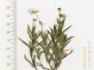
874 |
Senecio triangularis Hook. Arrowleaf Ragwort.
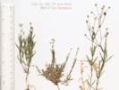
Parker Creek, Mono County, California. Along Parker Creek Road (F. R. 01S25), where it crosses a small unnamed creek, 3.2 miles southwest of the intersection of California Highway 158 and US Highway 395. 37.8572°N, 119.1263°W. WGS 1984. Elev. 2297 m. Perennial, bank of creek, shade. Very sticky when collected, dried leaves are very thin, and have a glandular exudate on adaxial surface. Coll. No. 874, 23 June 2013, characters observed while keying: Perennial herb, to 80 cm., in shaded streamside, not strongly scented; Root and caudex unknown; Petiole 100 mm.; Leaves alternate, largest 100 mm. x 60 mm., distributed along stem gradually becoming smaller, ovate, base truncate, margin toothed, adaxial surface sticky with glandular exudate, glands inconspicuous; Inflorescence gen. flat-topped, 10-15 flowers; Phyllaries, in 1-series, few short narrow outer phyllaries, tips dark brown macroscopically; Receptacle palea 0; Flowers of 2 kinds, both ray and disk; Pappus of bristles (no scales or needle-like awns), well developed on ray and disk flowers; Ray flowers yellow, exceeding involucre. | |||||||||||||||||||||||||||||||||||||||||||||||||||
|
Other articles:
|
875 |
Cardamine breweri S. Watson. Brewer's Bittercress.
Parker Creek, Mono County, California. Along Parker Creek Road (F. R. 01S25), where it crosses a small unnamed creek, 3.2 miles southwest of the intersection of California Highway 158 and US Highway 395. 37.8572°N, 119.1263°W. WGS 1984. Elev. 2297 m. Coll. No. 875, 23 June 2012, characters observed whilst keying: Perennial herb, to 50 cm., erect, terrestrial, growing in a shaded streamside; Rooting at nodes; Hairs 0; Leaves cauline, compound, pinnate lobed, leaflets 3, lower cauline leaves withering at flowering; Flowers radial; Petals white, 5 mm. x 2.5 mm. wide, blade wider than claw; Stamens 6, 4 long 2 short; Ovary linear; Fruit a silique, linear 28 mm. x 1 mm wide, dehiscent by valves, not stipitate; Seeds 14, wingless. | |||||||||||||||||||||||||||||||||||||||||||||||||||
|
Other articles:
|
876 |
Parker Creek, Mono County, California. Along Parker Creek Road (F. R. 01S25), where it crosses a small unnamed creek, 3.2 miles southwest of the intersection of California Highway 158 and US Highway 395. 37.8572°N, 119.1263°W. WGS 1984. Elev. 2297 m. Coll. No. 876, 23 June 2013, characters observed while keying: Perennial, sprawling over a small stream, stems to 25 cm.; Leaves in whorls of 4, ±equal in size; Inflorescence, branchlets > thread-like; Flowers bisexual; Corolla lobes 3; Fruit, 1 mm. dia., in pairs, hairs 0, black when dry. | |||||||||||||||||||||||||||||||||||||||||||||||||||
|
Other articles:
Locations:
Mount Trashmore, Alameda.
|
877 |
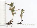
Bay Farm Island, City of Alameda, Alameda County, California. About 25 m west of golf course lagoon outfall. 37.748°N, 122.2324°W. WGS 1984. Elev. 3 m. Three plants seen in immediate area. Collection No. 877, 7 August 2012, characters observed while keying: Perennial herb, Stem decumbent, hairy, Leaves alternate, cordate on short petioles, Pedicels, 6 mm., ± straight with sharp curve at distal end, Bracts 5, overlapping, Flowers bilateral, 6 mm. (excl. spur), upper lip 2-lobed, purple, lower lip 3-lobed, yellow, spurred to 5 mm., Stamens 4 each with 1 pollen sack, Ovary superior, Dry gravelly habitat. | |||||||||||||||||||||||||||||||||||||||||||||||||||
|
Other articles:
|
878 |
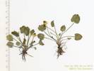
Bay Farm Island, City of Alameda, Alameda County, California. Just east of the intersection of the bicycle bridge with the Veterans Court bicycle path. 37.748°N, 122.2355°W. WGS 1984. Elev. 3 m. Gravelly side of bicycle path, subject to foot and bicycle traffic. Five plants seen in the immediate area. Collection No. 878, 7 August 2012, characters observed while keying: Perennial herb, faint citrus smell, Leaf spine-tipped, margins sparsely ciliate, Receptacle bearing scale-like bracts, Phyllaries in 2+ series, not all subtending ray flowers, inner phyllary margins folded, ± clasping ray ovaries, Head radiate, with two kinds of flowers, Ray flowers yellow, fruiting, compressed side-to-side, Disk flowers yellow, paleae each folded around disk flower ovary, style short-hairy. | |||||||||||||||||||||||||||||||||||||||||||||||||||
|
Other articles:
|
879 |
Distichlis spicata (L.) E. Greene. Saltgrass.
Bay Farm Island, City of Alameda, Alameda County, California. Along the northern shoreline of Bay Farm Island, about 40 meters west of the Veterans Court cul de sac. 37.7479°N, 122.2374°W. WGS 1984. Elev. 1 m. | |||||||||||||||||||||||||||||||||||||||||||||||||||
|
Other articles:
|
880 |
Centaurea solstitialis
Adjacent to the short spur bicycle path that connects the Bay Farm Bicycle Bridge to Doolittle Drive. Collection No. 880, 10 August 2012, characters observed while keying: Annual, Stem winged, tomentose, Phyllaries graduated in 5-6+ series, tip appendages palmately spined, lower phyllaries have central spine to 2 cm, straw colored, Head of disc flowers, Receptacle flat with pappus of hairs, Flowers outer sterile, inner fertile bisexual, Fruit crown of soft bristles. | |||||||||||||||||||||||||||||||||||||||||||||||||||
|
Other articles:
|
881 |
Brassica nigra
Adjacent to the short spur bicycle path that connects the Bay Farm Bicycle Bridge to Doolittle Drive. Collection No. 881, 10 August 2012, characters observed while : Annual, Hairs simple, Leaves basal and cauline, Cauline leaves sessile but not basally lobed, sagittate, or clasping, barely compound, sometimes appearing dentate, Inflorescence not bracted, Sepals erect (not spreading or reflexed), Petals 4 Stamens 6, 4 long, 2 short, Style 4-5 mm., Stigma entire, Fruit linear when young, | |||||||||||||||||||||||||||||||||||||||||||||||||||
|
Other articles:
|
882 |
Grindelia hirsutula Hook. & Arn. Salt Marsh Gumplant.
Keys to G. stricta DC. var. angustifolia (A. Gray) M. A. Lane. in the Jepson Manual, 2nd Edition, but treated as G. hirsutula Hook. & Arn. in FNANM and other collections of this taxon in Alameda have annotated as such. Bay Farm Island, City of Alameda, Alameda County, California. In a small salt marsh near Veterans Park, accessed from Veterans Court across the sea wall. 37.7475°N, 122.2367°W. WGS 1984. Elev. 1 m. Perennial shrub, faint camphor scent, to 50-60 cm, glabrous throughout, Leaves alternate, coriaceous, lanceolate to 8 cm., entire, Involucre gummy, 12-13 mm. dia., Phyllaries in 4-5 series, outer phyllary without oil glands, gradually narrowing to tips, tips acute, erect, not coiled, Heads radiate, with both ray and disk flowers, Rays 20, yellow, Disk flowers yellow, Pappus bristles, "flattened" (actually appear triangular in cross-sections, but definitely not cylindric), Habitat salt marsh and tidal flat. | |||||||||||||||||||||||||||||||||||||||||||||||||||
|
Other articles:
|
883 |
Heterotheca grandiflora Nutt. Telegraph Weed.
Harbor Bay Business Park, Alameda, Alameda County, California. In disturbed areas along North Loop Road. 37.7289°N, 122.2405°W. WGS 1984. Elev. 4 m. Collection No. 883, 17 August 2012, characters observed while keying: Annual, scent reminiscent of Pine-Sol, Leaves alternate, distal leaves not clasping, Phyllaries in 4 series, tip not adorned, Heads radiate with both ray and disk flowers, Receptacle epaleate, Ray flowers, yellow, pappus 0, fruit glabrous, Disk flowers pappus of hairs well developed. | |||||||||||||||||||||||||||||||||||||||||||||||||||
|
Other articles:
|
884 |
Lathyrus latifolius
Collection No. 884, 17 August 2012, characters observed while keying: Vine, Stem winged to 3 mm., Leaves pinnate compound, main leaf axis extended as tendril, Leaflets 2, Inflorescence of 9-11 flowers, Sepals fused at base, Flower bilateral, Corolla 20 mm., wing 33 mm. wide, Stamens 10, Filaments top free, bottom 9 fused. | |||||||||||||||||||||||||||||||||||||||||||||||||||
 Tarweed Class with Bruce Baldwin and John Strother, August 18-19, 2012 Tarweed Class with Bruce Baldwin and John Strother, August 18-19, 2012
|
Tarweed Class with Bruce Baldwin and John Strother, August 18-19,2012. | ||||||||||||||||||||||||||||||||||||||||||||||||||||
|
Other articles:
|
885 |
Ericameria nauseosa (Pursh) G. L. Nesom & G. I. Baird var. hololeuca (A. Gray) Nesom & Baird.
Rubber Rabbitbush.
Sagehen Meadow, Mono County, California. Northwest edge of the meadow, in an area of mixed Sagebrush and Jeffrey pines. 37.8727°N, 118.8588°W. WGS 1984. Elev. 2545 m. Coll. No. 885, 22 August 2012, characters observed while keying: Shrub, ±1 m,; Stem, tomentose through 2nd-3rd year; Leaves, 21 mm. x 2.5 mm. wide, sessile, erect, strap-shaped, entire; Involucre bell-shaped; Phyllaries, unequal, several series, but not in 5± ranks, margins thick(?), mid-ribs brown; Flowers of 1 kind, ray flowers; Receptacle epaleate; Corolla 7 mm., yellow, lobes 1 mm.; Pappus of many well-developed bristles; Style appendages (1.0 mm.) < stigma (2.2 mm.); Fruit (silky) hairy. | |||||||||||||||||||||||||||||||||||||||||||||||||||
|
Other articles:
|
886 |
Ericameria nauseosa (Pursh) G. L. Nesom & G. I. Baird var. hololeuca (A. Gray) Nesom & Baird. Rubber Rabbitbush.
Sagehen Meadow, Mono County, California. In a recently disturbed area of brush just north-northwest of the meadow. 37.8729°N, 118.8583°W. WGS 1984. Elev. 2545 m. Coll. No. 886, 22 Aug 2013, characters observed while keying: Perennial shrub, 1 m., lacking resin pits or translucent oil glands; Stem tomentose; Leaves alternate, 21 mm. x 1.5 mm. wide, linear, sharp-pointed, folded, ±keeled; Involucre obconic; Phyllaries in several series, appearing spiral (but involucre is not elongate), unequal, entire, tips acute to acuminate, margins not papery; Flowers 1 kind, rays 0; Receptacle epaleate; Pappus of many bristles; Corolla yellow, 7-8 mm., lobes ≤1 mm.; Style appendages (1.8 mm.) < stigmas (2.2 mm.); Fruit silky hairy. | |||||||||||||||||||||||||||||||||||||||||||||||||||
|
Other articles:
|
887 |
Chrysothamnus viscidiflorus (Hook.) Nutt. Ssp. puberulus (D. C. Eaton) H. M. Hall & Clem. Yellow Rabbitbrush.
Sagehen Meadow, Mono County, California. North of the meadow, in sagebrush, just at the edge of the Jeffrey pines. 37.8726°N, 118.859°W. WGS 1984. Elev. 2547 m. Coll. No. 887, 22 Aug 2012, characters observed while keying: Perennial shrub, to 1 m., juice with latex, not thistle-like; Stem generally glabrous (very few hairs), young stem few hairs (but not tomentose); Leaves alternate, linear, 30 mm. x 0.8-1.2 mm. wide, margins entire, not ciliate, adaxial surface with tangled hairs, oil glands 0; Heads, conical, not overtopped by distal leaves, ray flowers 0, disc flowers present; Involucre obconic, 8-9 mm.; Phyllaries in 3 distinct vertical ranks, graduated in size, lower << rest of involucre, opaque, tips acute, oil glands 0; Flowers 6; Pappus of many bristles, ±cylindric; Corollas yellow; Style, appendages (2.0 mm.) > stigmatic portion (1.6 mm.); Fruit moderately hairy. | |||||||||||||||||||||||||||||||||||||||||||||||||||
|
Locations:
Sagehen Meadow.
|
| ||||||||||||||||||||||||||||||||||||||||||||||||||||
|
|
Thursday, 23 August 2012 | ||||||||||||||||||||||||||||||||||||||||||||||||||||
|
Locations:
Sagehen Meadow.
|
Clear morning. | ||||||||||||||||||||||||||||||||||||||||||||||||||||
|
Other articles:
Locations:
Mono Basin.
|
Driving into the Mono Lake basin on the way to Indian Spring. | ||||||||||||||||||||||||||||||||||||||||||||||||||||
|
Other articles:
Locations:
Indian Spring.
|
Driving into Indian Spring. | ||||||||||||||||||||||||||||||||||||||||||||||||||||
|
Other articles:
Locations:
Indian Spring.
|
Indian Spring after the Indian Fire. | ||||||||||||||||||||||||||||||||||||||||||||||||||||
|
Other articles:
|
888 |
Urtica dioica L. ssp. holosericea (Nutt.) Thorne. Stinging Nettle.
Indian Spring, Mono County, California. About 4.1 miles by air north of Sagehen Summit, collected near the water tank about 350 m downstream from the GNIS location of Indian Spring. 37.9504°N, 118.8626°W. WGS 1984. Elev. 2278 m. Collected about a week after the Indian Fire of August 8-15,2012. Coll. No. 888, 23 Aug 2013, characters observed whilst keying: Perennial herb, to 50 cm., with stinging hairs; Stem gray-green, stinging and non-stinging hairs, non-stinging hairs 0.2-0.4 mm.; Leaves opposite to 70 mm., non-stinging hairs on abaxial veins erect; Petioles to 23 mm.; Inflorescence axillary, to 35 mm., structure indistinct; Staminate flowers: Sepals 4, fused at base, free otherwise; Stamens 4, incurved in bud, surrounding a cup-like abortive ovary (?); Pistillate flowers: Sepals 4, fused at base, ±free otherwise, paired size differential indistinct; Stigmas 1, hairy, hairs tangled purple; Fruit, 1.5 mm., ovate. | |||||||||||||||||||||||||||||||||||||||||||||||||||
|
Other articles:
|
889 |
Nasturtium officinale R. Br. Watercress.
Indian Spring, Mono County, California. About 4.1 miles by air north of Sagehen Summit, collected near the water tank about 350 m downstream from the GNIS location of Indian Spring. 37.9503°N, 118.8625°W. WGS 1984. Elev. 2279 m. Collected about a week after the Indian Fire of August 8-15,2012. Coll. No. 889, 23 August 2012, characters observed whilst keying: Perennial herb to 15 cm., aquatic, hairs 0; Caudex 0; Roots, fibrous, rooting at nodes; Stem decumbent, leafy; Leaves cauline, compound, pinnately divided, petioled, Inflorescence not bracted, not one-sided; Flowers radial; Sepals 2mm., ovate to obovate; Petals 2.5-2.7 mm., white, obovate to spoon-shaped, margins entire; Stamens 6; Filaments plain; Fruit, young linear, mature 13 mm. x 1.8 mm. wide; Ovules (seeds) many, 2 rows. | |||||||||||||||||||||||||||||||||||||||||||||||||||
|
Other articles:
|
At the top of the McPherson Grade, we walked to the top of a little hill for a view. | ||||||||||||||||||||||||||||||||||||||||||||||||||||
|
Other articles:
|
The gate at the south end of the meadow was missing. | ||||||||||||||||||||||||||||||||||||||||||||||||||||
|
Other articles:
|
The spring at the north end of the meadow has two spring boxes. | ||||||||||||||||||||||||||||||||||||||||||||||||||||
|
Other articles:
|
890 |
Carex aquatilis Wahlenb. var. aquatilis. Water Sedge.
Dry Creek, Mono County, California. 2 miles south southeast of the outlet of Dry Creek onto Big Sand Flat at California Highway 120. Small marshy area in Dry Creek, just below the crossing of Dry Creek by the former (now closed) Forest Road 1S438. 37.8575°N, 118.8655°W. WGS 1984. Elev. 2562 m. Coll. No. 890, 23 Aug 2012, characters observed while keying: Perennial herb to 50-60 cm., monecious, aquatic, generally glabrous, except veins on older leaf blades scabrous, rhizomed; Leaves, lower sheaths not scabrous, blades to 7 mm wide; Inflorescence, 1-5 spikelets; proximal bract, sheath short, blade longer than inflorescence; pistillate and staminate flowers on same stem, terminal spikelet staminate, lateral spikelets pistillate, spikelets erect, peduncle of lowest proximal spikelet 1.5 cm; Flowers unisexual, enclosed in a sac-like structure (perigynum); Bracts (scales), > perigynum, brown, pale mid-vein, margins brown; Perigynum 2.7 mm + beak 0.3 mm = 3.0 mm x 1.5-2.0 mm wide, obovoid, not fleshy, flat, open at tip, weakly or diffusely veined, minutely papillate; Beak brown, barely notched, a few small hairs on some beaks; Stigmas 2. | |||||||||||||||||||||||||||||||||||||||||||||||||||
|
Other articles:
Locations:
Crooked.
|
| ||||||||||||||||||||||||||||||||||||||||||||||||||||
|
Locations:
Crooked Meadows.
|
|||||||||||||||||||||||||||||||||||||||||||||||||||||
|
Other articles:
|
891 |
Muhlenbergia richardsonis (Trin.) Rydb. Mat Muhly.
Dry Creek, Mono County, California. Uppermost Dry Creek, along Forest Road 01S56 Dexter Canyon Cutoff, ½ mile north of Crooked Meadows, 1.4 miles south of Sagehen Peak, 17.2 air miles southeast of Lee Vining. 37.8334°N, 118.847°W. WGS 1984. Elev. 2693 m. Coll. No. 891, 23 August 2013, characters observed while keying: Perennial, to 15 cm, terrestrial, spreading by scaly rhizomes; Stem, nodes green; Leaf, sheath and blade differentiated, ligule membraneous, 1 mm; Inflorescence, exceeding upper leaves, 3 mm wide, axis partially hidden by branches and spikelets, not extended above spikelets; Spikelets, many in a well-developed inflorescence, attached to 1° and 2° branches, not subtended by bristles or long silky hairs, all spikelets similar, 1- flowered, laterally compressed, breaking apart above glumes; Glumes, 2, 1 mm, ±½lemma, equal, not: keeled, ciliate keeled, winged, or tapered to points; Lemma, glabrous, veins 1 obvious + 2 faint, not hardened, awns 0; Palea, well-developed. | |||||||||||||||||||||||||||||||||||||||||||||||||||
|
Other articles:
|
892 |
Eriogonum baileyi S. Watson var. baileyi. Bailey's Buckwheat.
Pumice Valley, Mono County, California. South side of California Highway 120, 3 miles east of US Highway 395. 37.9125°N, 119.0483°W. WGS 1984. Elev. 2111 m. Large plants growing in high density. Pumice derived sand near north end of Mono Craters. This area burned in the Mono Fire of July 26-29, 2010. Coll. No. 892, 23 August 2012, characters observed while keying: Annual, to 30 cm; Stem glabrous; Leaves, basal, ±round, tomentose, but withered at anthesis; Peduncles 0; Involucre, 2 mm, 5-toothed, slightly ribbed, sessile, appressed along branched and at tips of branchlets, glabrous, ciliate at margins; Flowers 1.8-2.0 mm; Petals, oblong, constricted toward middle giving the perianth a bell shape, small patches of color tending toward red rather than yellow, should be minutely glandular but not visible at 50x. | |||||||||||||||||||||||||||||||||||||||||||||||||||
|
|
Friday, August 24, 2012 | ||||||||||||||||||||||||||||||||||||||||||||||||||||
|
Other articles:
|
893 |
Grindelia squarrosa (Pursh) Dunal var. serrulata (Rydb.) Steyerm. Curlycup Gumweed.
Conway Summit, Mono County, California. East side of US Highway 395 just north of Conway Summit. 38.089°N, 119.1816°W. WGS 1984. Elev. 2450 m. Coll. No. 893, 24 Aug 2013, characters observed while keying: Perennial shrub, to 40 cm; Stem glabrous; Leaves alternate, 5 cm x 9 mm wide, oblanceolate, margins serrulate, margin teeth glandular; Inflorescence, head enclosed by involucre, flat-topped, not overtopped by leaves, heads with gummy exudate; Phyllaries in 4-6 series, unequal, eglandular, tips acute, coiled 360°; Receptacle epaleate; Flowers of 2 kinds, many; Pappus, few well-developed awns; Corolla yellow. | |||||||||||||||||||||||||||||||||||||||||||||||||||
|
Other articles:
Locations:
Bodie Hills.
|
| ||||||||||||||||||||||||||||||||||||||||||||||||||||
|
Other articles:
Locations:
Bodie Hills.
|
894 |
Bodie Hills, Mono County, California. Outside the Mono Lake basin, along Coyote Springs Road, 0.9 miles south of California Highway 270. 38.1502°N, 119.1295°W. WGS 1984. Elev. 2284 m. This collection was an attempt to relocate Tim Messick #1155 of Madia gracilis (HSC81306). Coll. No. 894, 24 August 2012, characters observed while keying: Annual herb to 25 cm; Stem, proximal soft-hairy or peeling, distal hairy and glandular, full glands yellow; Leaves, alternate, tips not spiny; Inflorescence, heads not showy, involucre narrowly ellipsoid; Phyllaries, margins folded, enclosing ovaries; Flowers ±4, 2 kinds, rays ±1, disc ±3, mature ray flower pie-shaped in x-section; Pappus 0; Fruit, 5 mm x 1 mm wide, dull black, beakless | |||||||||||||||||||||||||||||||||||||||||||||||||||
|
Other articles:
Locations:
Bridgeport Canyon.
|
This meadow was pretty well cleaned out. | ||||||||||||||||||||||||||||||||||||||||||||||||||||
|
Other articles:
Locations:
Coyote Spring.
|
The water level was very low in the pool at Coyote Spring. | ||||||||||||||||||||||||||||||||||||||||||||||||||||
|
Other articles:
|
895 |
Coyote Spring, Mono County, California. 60 m west of Coyote Spring in Bridgeport Canyon, 4.1 miles by road, north northwest of the intersection of Cottonwood Canyon Road and California Highway 167. 38.12°N, 119.0859°W. WGS 1984. Elev. 2187 m. Coll. No. 895, 24 August 2013, characters observed while keying: Perennial, herb, to 50 cm; Stems ascending; Leaves alternate, all cauline, lanceolate, 20 mm x 5 mm wide, margin entire, tendrils 0; tip obtuse, both faces alike, strigose, gland-dotted, petiole 2 mm; Inflorescence, a head enclosed in an involucre, head disciform (ray flowers 0); [Perianth, 2 or more whorls, 4 or 5 parts per whorl;] Phyllaries, few, 1 series, fused, margins green; Flowers, not imbedded in wooly hairs, open, of 2 kinds, all with corollas, staminate and pistillate flowers in same head, outer flowers pistillate; Palea, linear; Ovary inferior; Pappus 0; Petals fused into a ring; Pistil 1; Style tip branched (should be truncate or tack-shaped); Stamens, number equals corolla lobes; Anthers fused (?). | |||||||||||||||||||||||||||||||||||||||||||||||||||
| 896 |
the dimorphic "grass" that's probably a Carex
turned out to be:
Distichlis spicata (L.) E. Greene. Saltgrass. Hector Station, Mono County, California. 38.0828°N, 119.085°W. WGS 1984. Elev. 2059 m. Destroyed, Pistillate stems only. | ||||||||||||||||||||||||||||||||||||||||||||||||||||
|
Other articles:
Locations:
Rattlesnake Gulch.
|
Drove into Rattlesnake Gulch and parked at the upper cabin. | ||||||||||||||||||||||||||||||||||||||||||||||||||||
| 897 |
Castilleja miniata Hook. ssp. miniata. Giant Red Indian Paintbrush.
Rattlesnake Gulch, Mono County, California. About 300 m east of the GNIS location of Mono Diggings, 10.6 miles by road north of Lee Vining. 38.0928°N, 119.085°W. WGS 1984. Elev. 2282 m. Coll. No. 897, 24 August 2012, characters observed while keying: Perennial herb to 50 cm; Stems ascending, hairs unbranched, not glandular below spike; Leaves entire Inflorescence reddish; Calyx cleft equally half-way on dorsal (adaxial) and ventral (abaxial) side. | ||||||||||||||||||||||||||||||||||||||||||||||||||||
|
Other articles:
|
898 |
Artemisia ludoviciana Nutt. ssp. ludoviciana. White Sagebrush.
Rattlesnake Gulch, Mono County, California. Along the watercourse at a cabin, about 300 m east of the GNIS location of Mono Diggings, 10.6 miles by road north of Lee Vining. 38.0908°N, 119.1567°W. WS 1984. Elev. 2283 m. Coll. No. 898, 24 August 2012, characters observed while keying: Perennial herb, to 40 cm, unarmed, spreading by rhizomes; Leaf tomentose abaxially, sparse tomentose adaxially, proximal wedge-shaped, 40 mm × 15 mm wide, 3+-toothed, ≤⅓ leaf-width, distal lanceolate, entire; Frequency and depth of leaf lobing distinguishes between ssp. ludoviciana and ssp. incompta. These leaves are neither 2°-divided, nor deeper than ⅓-width, nor divided nearly to the mid-rib. Therefore, ssp. ludoviciana is applied rather than ssp. incompta. | |||||||||||||||||||||||||||||||||||||||||||||||||||
| 899 |
Geum macrophyllum Willd. Large-leaf Avens.
Rattlesnake Gulch, Mono County, California. Along the watercourse at a cabin, about 300 m east of the GNIS location of Mono Diggings, 10.6 miles by road north of Lee Vining. 38.0909°N, 119.1566°W. WGS 1984. Elev. 2283 m. | ||||||||||||||||||||||||||||||||||||||||||||||||||||
|
Other articles:
|
900 |
Originally described as a “giant Carex”, turned out to be:
Scirpus microcarpus J. Presl & C. Presl. Panicled Rush. Rattlesnake Gulch, Mono County, California. Along the watercourse at a cabin, about 300 m east of the GNIS location of Mono Diggings, 10.6 miles by road north of Lee Vining. 38.091°N, 119.1566°W. WGS 1984. Elev. 2283 m. Also collected here: Artemisia ludoviciana Nutt. ssp. ludoviciana, Castilleja miniata Hook. ssp. miniata, and Geum macrophyllum Willd. Coll. No. 900, 24 Aug 2012, characters observed while keying: Perennial terrestrial herb of wet places, to 50 cm, glabrous throughout; Stem leafy, flowering stems with cauline leaves > 1; Inflorescence of many spikelets on pedicels up to 3 cm; Spikelets not flat; Flowers many per spikelet, open, pistillate and staminate flowers in same spikelet; Perigynium absent; Perianth bristles ≥fruit, slightly recurved, uniformly finely-toothed; Pistils 1; Stigmas 2; Fruit, achene, 1-seeded, 2-angled. | |||||||||||||||||||||||||||||||||||||||||||||||||||
|
Other articles:
|
901 |
Juniperus grandis R. P. Adams. Sierra Juniper, Western Juniper.
Grant Lake, Mono County, California. At the Grant Lake Overlook day use area at the south end of Grant Lake. 37.8146°N, 119.1117°W. WGS 1984. Elev. 2194 m. Leaves scale-like, whorls of 3, berries blue-black, bark red-brown. | |||||||||||||||||||||||||||||||||||||||||||||||||||
|
Other articles:
|
902 |
Reversed Creek, Mono County, California. In a open field at the west end of Minaret Road, Peterson Tract, south of the Reverse Creek Lodge, and 2 miles west of the town of June Lake (as measured from the Tiger Bar). 37.7653°N, 119.1022°W. WGS 1984. Elev. 2258 m. Open sunny waste place that may have been mowed earlier in the season. Coll. No. 902, 25 August 2012, characters observed while keying: Annual, Leaves, basal 0, cauline linear, 15 mm. × 2 mm. wide, sessile, spine 0; Heads not showy; Phyllaries in 1 series, individually subtending ray flowers, margins folded ±clasping ray ovaries; Rays yellow, mature ray flowers 3-angled, or “pie-shaped”; Pappus 0. | |||||||||||||||||||||||||||||||||||||||||||||||||||
| 903 | Frasera puberulenta | ||||||||||||||||||||||||||||||||||||||||||||||||||||
|
Other articles:
Locations:
East Craters Sand Flat.
|
|||||||||||||||||||||||||||||||||||||||||||||||||||||
|
Other articles:
Locations:
Airfield Flat.
|
South through Airfield Flat. | ||||||||||||||||||||||||||||||||||||||||||||||||||||
|
Other articles:
Locations:
Obsidian Dome.
|
| ||||||||||||||||||||||||||||||||||||||||||||||||||||
|
|
Sunday, August 26, 2012 | ||||||||||||||||||||||||||||||||||||||||||||||||||||
|
Other articles:
Locations:
Rush Creek delta.
|
| ||||||||||||||||||||||||||||||||||||||||||||||||||||
|
Other articles:
|
904 |
Symphyotrichum frondosum (Nutt.) G. L. Nesom. Short-Rayed Alkali Aster. Rush Creek delta, Mono County, California. On low-lying very wet strands in the Rush Creek delta. 37.9554°N, 119.0526°W. WGS 1984. Elev. 1952 m. Annual herb, to 30 cm., sap milk unknown; Root neither clearly fibrous nor a single tap root; Stem branched at base or not, young stem sparsely hairy; Leaves cauline, alternate, 4 cm × 6 mm wide, oblanceolate, puberulent, sparsely ciliate; Inflorescence, head enclosed by involucre, not overtopped by leaves; Involucre bell- or conic-shaped; Phyllaries unequal, in 3± series, inner thin, nearly transparent; Receptacle epaleate; Flowers of 2 kinds, ray flowers, blade 2 mm, lavender, inconspicuous; disc flowers ...; Pappus of many well-developed bristles, ±equal, barely plumose, some disc flowers also have a single long scale. | |||||||||||||||||||||||||||||||||||||||||||||||||||
| 905 |
Ranunculus cymbalaria Pursh. Alkali Buttercup.
Rush Creek delta, Mono County, California. On low-lying very wet strands in the Rush Creek delta. 37.9553°N, 119.0518°W. WGS 1984. Elev. 1948 m. | ||||||||||||||||||||||||||||||||||||||||||||||||||||
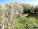 Habitat of Coll. Nos. 906 and 907, Senecio hydrophilus Nutt. Habitat of Coll. Nos. 906 and 907, Senecio hydrophilus Nutt.
|
906 |
Veronica anagallis-aquatica L. Water Speedwell.
Rush Creek delta, Mono County, California. On the edge of a fresh-water lagoon, southeast side of the Rush Creek delta, very near the alkaline water of Mono Lake. 37.9552°N, 119.0514°W. WGS 1984. Elev. 1950 m. Coll. No. 906, 26 Aug 2012, characters observed while keying: Terrestrial herb of very wet and possibly alkaline places, to 35 cm; Leaves cauline, opposite 20 mm × 12 mm wide, length 1.67 × width, elliptical to obovate, pinnate-veined, few proximally petioled 2 mm to sessile above; Inflorescence racemes axillary; Pedicels 5 mm, curved; Calyx sepals 4; Corolla petal-like, 4-lobed, deciduous in fruit; Stamens 2, staminodes 0; Fruit 2.5 mm × 2.5 mm wide, rounded (not notched). | |||||||||||||||||||||||||||||||||||||||||||||||||||
| 906.1 |
Veronica serpyllifolia L. ssp. humifusa (Dickson) Syme. Bright Blue Speedwell.
Rush Creek delta, Mono County, California. On the edge of a fresh-water lagoon, southeast side of the Rush Creek delta, very near the alkaline water of Mono Lake. 37.9552°N, 119.0514°W. WGS 1984. Elev. 1950 m. Found in Collection No. 906, Veronica anagalis-aquatica. Coll. No. 906.1, 26 Aug 2012, characters observed while keying: Herb, annual/perennial unknown, appressed hairy; Main stem terminated by inflorescence; Pedicels 3-5 mm; Calyx 2.5 mm; Style short; Capsule not exceeding calyx. | ||||||||||||||||||||||||||||||||||||||||||||||||||||
|
Habitat of Coll. Nos. 906 and 907, Senecio hydrophilus Nutt.
|
907 |
Large comp., keyed out somewhat vaguely as:
Senecio hydrophilus Nutt. Alkali-Marsh Butterweed. Rush Creek delta, Mono County, California. On the edge of a fresh-water lagoon, southeast side of the Rush Creek delta, very near the alkaline water of Mono Lake. 37.9552°N, 119.0514°W. WGS 1984. Elev. 1980 m. Coll. No. 907, 26 Aug 2012, characters observed while keying: Herbaceous plant of sand bar in Rush Creek delta, likely with some alkali, life history, rhizome, or caudex unknown, mostly glabrous; Leaves, basal: rosette unknown, lower: petiole 10 cm, not winged, blade to 33 cm × 6.5 cm wide, lanceolate, entire, upper: reduced in size, to 11 cm × 3 cm wide, sessile, denticulate; Heads radiate; Phyllaries in 1 series, tip dark, margin scarious; Receptacle epaleate; Flowers, ray pistillate, 11 mm, disc bisexual; Pappus of well-developed equal bristles in a single series; Corolla yellow; cypsela 3 mm, glabrous. | |||||||||||||||||||||||||||||||||||||||||||||||||||
|
Other articles:
Locations:
Rush Creek (in Horseshoe Canyon).
|
908 |
The scale prickles hang straight down, the adaxial surface of the cone scales are lighter than the abaxial surface, and the leaves are green without any blue. | |||||||||||||||||||||||||||||||||||||||||||||||||||
|
Other articles:
Locations:
Silver Lake.
|
|||||||||||||||||||||||||||||||||||||||||||||||||||||
|
Other articles:
|
909 |
Dittrichia graveolens (L.) Greuter. Stinkwort.
Mount Trashmore, Alameda, Alameda County, California. Beside the bicycle path connecting the intersection of Doolittle Drive and Island Way to the intersection of the Veterans Way bicycle path and the Bay Farm bicycle bridge. 37.7476°N, 122.2357°W. WGS 1984. Elev. 6 m. Sticky glandular, strongly aromatic. Collection No. 909, 3 October 2012, characters observed while keying: Annual sticky-glandular, strongly aromatic, Leaves alternate throughout, lanceolate, entire, Phyllaries in many series, unequal, Phyllary tip without a prominent tack-shaped gland, Receptacle epaleate (not a tarweed!), Flowers of two types, some flowers have strap-shaped corollas, Ray and disc flowers yellow, Pappus of bristles on ray and disc flowers, single layer of bristles, ± cylindric, Fruit not long-tapered distally. First collected in the San Francisco Bay Area in 1984; spreading rapidly. | |||||||||||||||||||||||||||||||||||||||||||||||||||
|
Other articles:
|
910 |
Bay Farm Island, City of Alameda, Alameda County, California. Growing in a crack in the curb, at the cul-de-sac of Veterans Court. 37.7479°N, 122.237°W. Elev. 1 m. Collection No. 910, 4 Oct 2012, characters observed while keying: Perennial terrestrial herb, Stem hairs simple, Leaves alternate, stipules 0, pinnate-veined, hairs simple, Flowers in axillary clustered involucres, Involucral bracts 4, Male and female flowers in same involucre, Male flowers stalked, developing first, petals white, Female flowers sessile, petals fused, petals white, Ovary superior, 4-lobes(?) but lobes concave, Stigma not obviously lobed. | |||||||||||||||||||||||||||||||||||||||||||||||||||
| 911 |
Lactuca serriola L. Prickly Lettuce.
Mount Trashmore, Alameda, Alameda County, California. Along the Veterans Court bicycle path, very close to the southern landing of the Bay Farm bicycle bridge on Bay Farm Island. 37.748°N, 122.2354°W. WGS 1984. Elev. 5 m. Collection No. 911, 4 Oct 2012, characters observed while keying: Annual herb, Stems erect, Leaves basal 0 at flowering, cauline coarsely lobed, margins prickly-toothed, Fruit beak slender, many-ribbed, ~8 adaxial, ~5 abaxial. | ||||||||||||||||||||||||||||||||||||||||||||||||||||
| 912 |
Spergularia rubra (L.) J. Presl & C. Presl. Red Sand Spurry.
Alameda, Alameda County, California. In the parkway in front of 2936 Southwood Drive. 37.7626°N, 122.2318°W. WGS 1984. Elev. 5 m. Coll. No. 912, 28 Oct 2012, characters observed while keying: Annual; Leaves opposite, 2-ranked, simple, awl-like; Inflorescence terminal; Sepals 5, free; Petals 5, free, magenta; Stamens 10 in 2 series of 5; Ovary superior; Stigmas 3, partly fused; Seed 0.6 mm., dark brown. | ||||||||||||||||||||||||||||||||||||||||||||||||||||
|
Literature Cited:
|
The Paleogene California River U-Pb age spectra of detrital zircons in samples from the Paleogene Colton Formation in the Uinta Basin of northeastern Utah and the Late Cretaceous McCoy Mountains Formation of southwestern Arizona (United States) are statistically indistinguishable. This finding refutes previous inferences that arkosic detritus of the Colton was derived from cratonic basement exposed by Laramide tectonism, and instead establishes the Cordilleran magmatic arc (which also provided sediment to the McCoy Mountains Formation) as the primary source. Given the existence of a north-southtrending drainage divide in eastern Nevada and the north-northeast direction of Laramide paleofl ow throughout Arizona and southern Utah, we infer that a large river system headed in the arc of the Mojave region fl owed northeast ~700 km to the Uinta Basin. Named after its source area, this Paleogene California River would have been equal in scale but opposite in direction to the modern Green RiverColorado River system, and the timing and causes of the subsequent drainage reversal are important constraints on the tectonic evolution of the Cordillera and the Colorado Plateau. | ||||||||||||||||||||||||||||||||||||||||||||||||||||
|
Other articles:
|
913 |
Alameda, Alameda County, California. Multiple places along the southwest side of Blanding Avenue, from 2510 to 2520 Blanding Avenue. Also around the corner at 1914-1926 Everett Street, and 2516 Clement Avenue. 37.7694°N, 122.2353°W. WGS 1984. Elev. 4 m. Mostly growing in cracks of sidewalks at the edge of a building. Coll. No. 913, 6 Nov 2012, characters observed while keying: Perennial herb, stinging hairs 0; Stem decumbent to erect, maybe becoming woody(?); Petiole to 25 mm.; Leaves alternate, to 70 mm., simple, veins pinnate, simple hairs ad/abaxial; Inflorescence monoecious (male and female flowers on the same plant); Sepals 4; Flowers 4 male flowers and 1 female flower contained in each calyx; Male flowers developing before female flower, coiled introrse, flinging pollen everywhere when snapping to an uncoiled position; Ovary superior; Ovule 1; Fruit shiny black, tip acute. | |||||||||||||||||||||||||||||||||||||||||||||||||||
|
Literature Cited:
Locations:
Cave Spring.
|
Received the following:
Tue, 27 Nov 2012 11:38:29 -0800
From: John
Subject: Re: Cave Spring
A few years back I visited Death Valley while doing some research about Ernie Pyle's travels in the area. He wrote a fascinating piece about the dwelling a guy named Adrian Egbert had blasted out of the rock at Cave Spring on the southern rim of Death Valley. I understand he lost the place when the Army moved to create Fort Irwin in 1940 or so. I see you've got a photo of Cave Spring on your website, so I guess you visited? I'm interested in gleaning any information I can on what the Army did with Egbert's unusual dwelling, and I would appreciate any information or contacts you can provide that might help.
And would you give me permission to use your photograph on my blog, which practically no one reads?
John Sent the following information: From: Thompson, David G. 1929. The Mohave Desert Region, California. Water-Supply Paper 578. Washington, DC: United States Geological Survey, 1929, p. 589. Cave Springs.Cave Springs are near the enter of T. 17 N. R. 5 E (unsurveyed), on the road from Barstow to South Death Valley. They are about 65 miles northeast of Barstow by the road by way of Paradise Springs and Garlic Springs, and 9 miles almost due south of Saratoga Springs (11 1/2 miles by road). The springs are on the east side of the wash 2 miles north of the point where the road crosses the divide of the Avawatz Mountains. They consist of two caves or short tunnels, about 40 feet apart, dug about 10 feet into the low wall of the canyon. Apparently there is seldom, if ever, any overflow from the springs. The water is clear and cool. As shown by analyis 3, the water is only moderately mineralized. Although the water would be rated as only fair for domestic use as compared to waters In many other parts of the Mohave Desert region it is of better quality than samples collected by the writer from other watering places in the Lower Amargosa Basin. A number of mesquite growing in the wash near the spring indicate that water is probably near the surface in the vicinity of the springs. A huge block of quartzite crops out on the west side of the wash, and Probably a rock barrier lies near the surface in the wash, behind which some water is impounded. From Vredenburgh, Larry M. 1994. Fort Irwin and Vicinity: History of Mining Development. Pp. in Reynolds, Robert E. (ed.) 1994.. Off limits in the Mojave Desert: Field Trip Guidebook and Volume for the 1994 Mojave Desert Quaternary Research Center Field Trip to Fort Irwin and Surrounding Areas. San Bernardino County Museum Association Special Publication 94-1, p. 85. Cave Spring. Between 1883 and 1887 Cave Spring was a water and rest stop for wagons laden with borax from William T. Coleman's operation at Shoshone. During the hot summer months, mining was shifted from the Harmony Borax works at Furnace Creek in Death Valley to the cooler Amargosa works just south of Shoshone (Lingenfelter, 1986, p. 181-182). Spears (1891, p. 139-140) reported that a mining claimant who had filed on Cave Spring sold water to the borax teamster for 25 cents per man and per animal for each night. At the time of Spear's visit to Cave Spring in 1891 he found a stone corral erected by Borax Smith's borax company and a ruined hut. The Spears reference is: Spears, John R., 1892, Illustrated Sketches of Death Valley and other Borax deserts of the Pacific Coast. Rand, McNally and Company: New York. | ||||||||||||||||||||||||||||||||||||||||||||||||||||
|
Other articles:
|
Lupines collected in White Pine County, Nevada, per SEIN, 1 Dec 2012.
| ||||||||||||||||||||||||||||||||||||||||||||||||||||
|
Other articles:
|
| ||||||||||||||||||||||||||||||||||||||||||||||||||||
|
Other articles:
|
High tide on December 13th. | ||||||||||||||||||||||||||||||||||||||||||||||||||||
|
Other articles:
|
Artificial tide pool at Crab Cove at low tide. | ||||||||||||||||||||||||||||||||||||||||||||||||||||
|
Other articles:
|
914 |
Alameda, Alameda County, California. In a vacant lot near the corner of Buena Vista Avenue and Hibbard Street, on former Alameda Belt Line property. 37.7751°N, 122.2546°W. WGS 1984. Elev. 16 ft. No fruit observed in tree or on ground. Not a mature tree, one of several in the neighborhood. Coll. No. 914, 19 Dec 2012, characters observed: Tree; d.b.h. 22 cm; Bark gray-brown (not light gray or white); Leaf, to 5.5 cm., entire, pinnately-veined, (5) 7 (9) short spines at ends of veins including midrib, abaxial vein axils hair tufted; Fruit none seen on plant or surrounding ground. | |||||||||||||||||||||||||||||||||||||||||||||||||||
|
Other articles:
|
View of Beckwith Plateau from Amtrak's California Zephyr on a winter morning. | ||||||||||||||||||||||||||||||||||||||||||||||||||||
|
[Previous Page]
[Next Page]
Go to page: [1800s] [1900s] [1910s] [1920s] [1930s] [1940s] [1950s] [1960s] [1970s] [1980s] [1990] [1991] [1992] [1993] [1994] [1995] [1996] [1997] [1998] [1999] [2000] [2001] [2002] [2003] [2004] [2005] [2006] [2007] [2008] [2009] [2010] [2011] [2012] [2013] [2014] [2015] [2016] [2017] [2018] [2019] [2020] [2021] [2022] [2023] [2024] [A] | |||||||||||||||||||||||||||||||||||||||||||||||||||||
| If you have a question or a comment you may write to me at: tas4@schweich.com I sometimes post interesting questions in my FAQ, but I never disclose your full name or address. |
Date and time this article was prepared: 4/27/2024 3:25:13 PM |
||||||||||||||||||||||||||||||||||||||||||||||||||||