
Topics in this Article:
1800s
1900s
1910s
1920s
1930s
1940s
1950s
1960s
1970s
1980s
1990
1991
1992
1993
1995
1996
1997
1998
1999
2000
2001
2002
2003
2004
2005
2006
2007
2008
2008 Tour de Swertia albomarginata
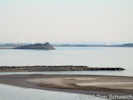
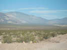
Mono Lake, August 2008
2009
2010
2011
2012
2013
2014
2015
2016
2017
2018
2019
2020
2021
2022
2023
2024
Contents
Literature Cited
|
|
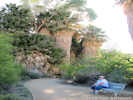
When I first read the field notes of Annie Alexander and Louise Kellogg, I was fascinated by the descriptions they wrote about the places they went and the plants and animals they found there. By publishing my field notes on the Internet I hope to follow a little bit in their tradition.
|
|
|
|
2008
|
|
|
|
3 April 2008
|
|
Other articles:
• Mono Lake Basin Flora:
Chesnut and Drew;
Locations:
Bloody Canyon.
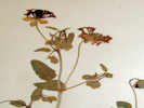
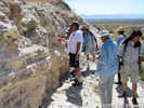
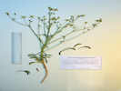
 A portion of the Chesnut and Drew collection of Abronia turbinata A portion of the Chesnut and Drew collection of Abronia turbinata
|
|
At the UC/JEPS Herbaria, I looked at the Chesnut and Drew collection determined as Abronia fragrans Nutt., made July 18, 1889. While most of Chesnut and Drew's collections were made in Bloody Canyon or at the foot of Bloody Canyon, the location of this collection is merely "near Mono Lake." Regardless of the location, the collection is unusual because the taxon, Abronia fragrams is not found in California, and is therefore likely misidentified. This collection certainly looks to me as A. turbinata. It has small ovoid leaves and the bracts are quite small. This voucher also has a small hand-written annotation of "A. turbinata," so at least one other person has the same opinion. Therefore, I have listed this collection as A. turbinata in my Mono Lake checklist flora.
|
|
|
|
Just out of interest, I found collections of A. fragrans from: Arizona, Colorado, Idaho, New Mexico, Texas, Utah including Zion National Park, and Wyoming.
|
|
Locations:
Saint George.
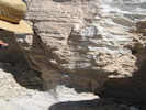
 A portion of the Marcus E. Jones collection of Abronia fragrans A portion of the Marcus E. Jones collection of Abronia fragrans
|
|
There are no collections from Nevada or California. The closest collection to California is a Marcus E. Jones collection, No. 5906, made at Saint George, Utah, April 26, 1894.
|
|
Locations:
Milford.
|
|
In Utah, the closest collection of A. fragrans to California was made east of Milford, Utah, by P. A. Rydberg and E. C. Carlton, No. 6272, on June 22, 1905.
|
|
|
|
Looking through the North American collections, Abronia turbinata has been collected near Weiser, Idaho, and in the Alvord Desert and Harney County of Oregon.
|
|
|
|
In northern Nevada, A. turbinata has been collected in Churchill, Humboldt, Pershing, Storey and Washoe counties.
|
|
Locations:
Candelaria.
Pinyon Hill.
Sand Spring.
Tonopah.
|
|
Closer to Mono Lake, the closest locations in Esmeralda County are 10 miles northwest of Tonopah, 2.3 miles NE of Sand Spring in Fish Lake Valley, and north of Pinyon Hill at 2000 m elevation (White Mtns, Collector: Duran). There is one collection from Candelaria in Mineral County. There are collections from Nye County at Tonopah, and 10 miles south of Beatty.
|
|
Locations:
Spring Mountains.
|
|
In Clark County, there are numerous collections from the Spring Mountains (Cottonwood Springs, Vic Wilson's Ranch, and south of Red Rocks), and a single collection from Jean, Nevada.
|
|
|
|
There is a single Marcus E. Jones collection from Salt Lake City, Utah, and there are also collections from Dona Ana County, New Mexico, and El Paso, Texas.
|
|
Locations:
Darwin.
|
|
The collection at UC also includes an undetermined Abronia: UC128940, was collected by H. M. Hall and H. P. Chandler No 7166, 10 miles north of Darwin, May 24, 1906. This looks very much like A. turbinata.
|
|
|
|
April 17, 2008
|
|
Other articles:
• Pine Tree Canyon Road:
near CA Hwy 14;
• FAQ:
Pine Tree Canyon;
Locations:
Pine Tree Canyon.
 Lower Pine Tree Canyon Lower Pine Tree Canyon
|
|
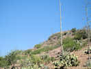
In February, I received a query about Pine Tree Canyon from Cliff, wanting directions into and out of Pine Tree Canyon. I wasn't able to help because I had never visited Pine Tree Canyon. The canyon was listed on my web site only because of a collection of Salvia dorrii there.
|
|
Other articles:
• California Highway 14:
in mouth of Pine Tree Cyn;
• Pine Tree Canyon Road:
near CA Hwy 14;
Locations:
Fremont Valley.
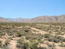
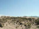
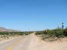
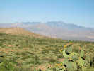
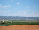
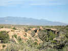
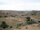
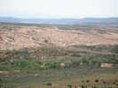
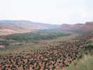
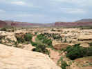
 Fremont Valley from the mouth of Pine Tree Canyon Fremont Valley from the mouth of Pine Tree Canyon
|
|
On my way to Zzyzx, I detoured slightly to check out Pine Tree Canyon.
|
|
Other articles:
• Pine Tree Canyon Road:
at aqueduct;
Locations:
Pine Tree Canyon.
 Los Angeles Aqueduct crosses Pine Tree Canyon Los Angeles Aqueduct crosses Pine Tree Canyon
|
|
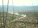
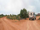
The lower canyon is open to the public. It seems to be a popular OHV location and there are many camp sites and OHV trails. The upper portion of the canyon is apparently private property, and there is a locked gate with a "No Trespassing" sign.
|
|
Other articles:
• Pine Tree Canyon Road:
at gate;
Locations:
Pine Tree Canyon.
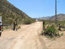 Pine Tree Canyon at the locked gate. Pine Tree Canyon at the locked gate.
|
|
This "locked gate" is fairly low in Pine Tree Canyon. Even though it was open when I was there, I did not go through, as I assumed it was unlocked only for the construction workers.
|
|
Literature Cited:
- Bureau of Land Management, 2005.
Other articles:
• Pine Tree Canyon Road:
in construction zone;
Locations:
Pine Tree Canyon.
|
|
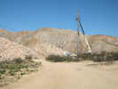
Construction on a power line for a wind energy project |
There was a construction crew working in the canyon, stringing power lines for the Pine Tree Wind Development Project.
|
 Coll. No. 531, Caulanthus cooperi Coll. No. 531, Caulanthus cooperi
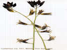 Coll. No. 531, Caulanthus cooperi sp. From Pine Canyon California. Coll. No. 531, Caulanthus cooperi sp. From Pine Canyon California.
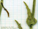 Coll. No. 531, Caulanthus cooperi Coll. No. 531, Caulanthus cooperi
|
531
|
Collection No. 531, Caulanthus, possibly C. coulteri var. coulteri, in canyon on north side of Pine Tree Canyon, 11S 0400485 4899939, 35.23989°N -118.08823°W WGS84, 857 m elev.
Caulanthus cooperi (S. Watson) Payson. Cooper's Wild Cabbage.
Pine Tree Canyon, Kern County, California. Small canyon on north side of Pine Tree Canyon, 17 miles by California Highway 14 northeast from Mojave, then 2.3 miles west on Pine Tree Canyon Road, and 0.4 miles north on the aqueduct service road. 35.2399°N, 118.0882°W. WGS1984 Elev. 857 m.
Coll. No. 531, 17 April 2008, characters observed:
Annual, tap-rooted, 40-50 cm.;
Stem, not inflated.
Hairs, mostly basal, simple;
Leaves, basal and cauline, cauline leaves lobed at base,
lance-linear;
Corollas, purple or violet, petals, 12 mm.;
Stamens 6, 4 short and 2 long, included;
Filaments of longer pair of stamens fused;
Anthers on 2 longer stamens are much smaller;
Ovary linear;
Fruit, linear, 70 mm., >6 ovules, reflexed;
Seeds, oblong, 2 mm. × 1 mm. wide.
|
|
Other articles:
• California Highway 14:
near mouth of Pine Tree Cyn;
Locations:
Jawbone Canyon.
 CA Hwy 14 at Pine Tree Canyon CA Hwy 14 at Pine Tree Canyon
|
|
|
|
|
|
April 19, 2008
|
|
Literature Cited:
- Reynolds, Robert E., 2008.
Other articles:
• U. S. Highway 66:
just north of Amboy;
Locations:
Amboy.
Bristol Lake.
|
|
Bristol Basin from north slope |
|
|
Other articles:
• Glossary:
desert_pavement;
• Eastern Mojave Geology:
Peach Spr Tuff;
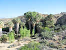
 Desert pavement Desert pavement
|
|
|
 Bouse Formation near Amboy Bouse Formation near Amboy
|
|
|
|
Other articles:
• U. S. Highway 66:
just north of Amboy;
 Examining the Bouse Formation Examining the Bouse Formation
|
|
|
 Lawlor Tuff (Sonoma Volcanics) in the Bouse Formation Lawlor Tuff (Sonoma Volcanics) in the Bouse Formation
|
|
|
|
Other articles:
• Glossary:
stromatolite;
 Stromatolite at base of Bouse Formation Stromatolite at base of Bouse Formation
|
|
|
|
Other articles:
• Cadiz Road:
near Ship Mtns;
Locations:
Cadiz Valley.
 View southeast along Cadiz Road View southeast along Cadiz Road
|
|
|
|
Other articles:
• Cadiz Road:
near Ship Mtns;
Locations:
Cadiz Dunes.
 Cadiz Dunes Cadiz Dunes
|
|
|
|
Literature Cited:
- Reynolds, Robert E., 2008.
Other articles:
• Cadiz Road:
near Ship Mtns;
 Field Trip Stop, Groundwater Discharge Field Trip Stop, Groundwater Discharge
|
|
|
|
Other articles:
• Cadiz Road:
near Ship Mtns;
Locations:
Ship Mountains.
 Arizona and California Railroad Arizona and California Railroad
|
|
|
|
|
|
April 20, 2008
|
|
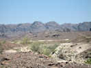
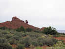
Locations:
Mule Mountains.
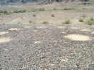
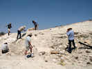
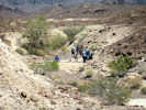
 Mule Mountain Archaeological Area Mule Mountain Archaeological Area
|
|
|
|
Literature Cited:
- Reynolds, Robert E., 2008.
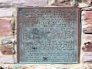
Locations:
Mule Mountains.
 Plaque at Mule Mountain Archaeological Area Plaque at Mule Mountain Archaeological Area
|
|
|
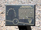
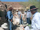
Mule Mountain Archaeological Site
| |
This terrace contains a branching Indian trail and trail circle worn into the desert pavement. Although the purpose of trail circles in not definitely known, then may have been used by the Indians for performing dances called "circle dances." The terrace also contains groups of circles in parallel rows and horseshoe shapes scraped into the pavement surface. When these circles were made or for what purpose is at present unknown. They may be aboriginal or they may be a result of General Pattons' desert training activities during World War II. The terrace has been fenced to protect these cultural manifestations from damage by wheeled vehicles.
For further information contact the nearest BLM office or the patrolling ranger.
Cultural resources are protected by the 1979 Archaeological Resources Protection Act.
|
|
|
Locations:
Mule Mountains.
 Mule Mountain Archaeological Area Mule Mountain Archaeological Area
|
|
|
|
Literature Cited:
- Reynolds, Robert E., 2008.
Other articles:
• Hart Mine Road:
at Bouse Fm locality;
 Stop 2-4. Barnacles. Stop 2-4. Barnacles.
|
|
|
|
Literature Cited:
- Reynolds, Robert E., 2008.
 Stop 2-5. Quarry Wash Stop 2-5. Quarry Wash
|
|
|
|
Locations:
Trigo Mountains.
 Trigo Mountains behind the Quarry Wash fossil locality. Trigo Mountains behind the Quarry Wash fossil locality.
|
|
|
|
Other articles:
• California Highway 78:
at Ben Hulse Monument;
Locations:
Ben Hulse Monument.
 Monument on Ben Hulse Highway Monument on Ben Hulse Highway
|
|
| BEN HULSE HIGHWAY |
| Dedicated For Public Use |
| MARCH 21, 1964 |
| This highway parallels the old Indian trail, still visible from here, connecting the Imperial and Palo Verde Valleys.
The grateful people of Imperial County honor the memory of our beloved Senator Ben Hulse, who worked untiringly for the people of the State of California.
Ben Hulse Highway completes the four state system from Canada to Mexico which culminates twenty five years of work by countless civic minded citizens.
Erected by the Native Sons of the Golden West.
|
| De Anza Parlor No. 312.
Grand President
Joseph G. Oeschger
|
|
|
Other articles:
• California Highway 78:
north of Ben Hulse Mnt;
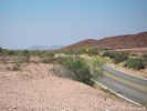 CA Hwy 78 north of Ben Hulse Monument CA Hwy 78 north of Ben Hulse Monument
|
|
California Highway 78, north of Ben Hulse Monument.
|
|
Other articles:
• California Highway 78:
south of Ben Hulse Mnt;
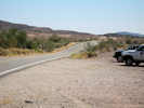 CA Hwy 78 south of Ben Hulse Monument CA Hwy 78 south of Ben Hulse Monument
|
|
California Highway 78, south of Ben Hulse Monument.
|
|
Literature Cited:
- Reynolds, Robert E., 2008.
Other articles:
• California Highway 78:
east of Ben Hulse Mnt;
 Bouse Formation outcrop near the Ben Hulse Monument Bouse Formation outcrop near the Ben Hulse Monument
|
|
|
|
Other articles:
• Sinclair Road:
at Gentry;
Locations:
Sonny Bono Salton Sea National Wildlife Refuge.
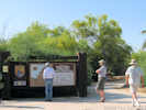 Entrance to Sonny Bono National Wildlife Refuge Entrance to Sonny Bono National Wildlife Refuge
|
|
|
|
Other articles:
• Sinclair Road:
at Gentry;
Locations:
Sonny Bono Salton Sea National Wildlife Refuge.
 Geology talk at Sonny Bono Salton Sea National Wildlife Refuge Geology talk at Sonny Bono Salton Sea National Wildlife Refuge
|
|
|
|
Other articles:
• Sinclair Road:
at Gentry;
Locations:
Sonny Bono Salton Sea National Wildlife Refuge.
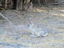 Cottontail rabbit at Sonny Bono Salton Sea National Wildlife Refuge Cottontail rabbit at Sonny Bono Salton Sea National Wildlife Refuge
|
|
|
|
Other articles:
• Sinclair Road:
at power plant;
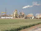 Elmer Power Plant of the California Energy Company Elmer Power Plant of the California Energy Company
|
|
|
|
Literature Cited:
- Schmitt, Axel K., Arturo Martín, Bodo Weber, Daniel F. Stockli, Haibo Zou, and Chuan-Chou Shen, 2013.
Other articles:
• Red Hill Road:
Red Hill;
Locations:
Obsidian Butte.
Red Island.
Rock Hill.
|
|
Rock Hill and Obsidian Butte from Red Island |
Geochemical data support the idea that the Salton Buttes are formed by MORB-type magma, thus suggesting that oceanic rifting has initiated in the Salton Trough (Schmitt, et al., 2013).
|
|
Other articles:
• Davis Road:
Mud Volcanoes;
 Mud Volcanoes Mud Volcanoes
|
|
Water-, mud-, gas-, and petroleum-bearing seeps are part of the
Salton Sea geothermal system (SSGS) in Southern California. Seeps
in the Davis-Schrimpf seep fi eld (~14,000 m2) show considerable variations
in water temperature, pH, density, and solute content. Water-rich
springs have low densities (<1.4 g/cm3), Cl contents as high as 45,000
ppm, and temperatures between 15 and 34 °C. Gryphons expel denser
water-mud mixtures (to 1.7 g/cm3), have low salinities (36005200
ppm Cl), and have temperatures between 23 and 63 °C. The main
driver for the seep system is CO2 (>98 vol%). Halogen geochemistry of
the waters indicates that mixing of deep and shallow waters occurs and
that near-surface dissolution of halite may overprint the original fl uid
compositions. Carbon isotopic analyses suggest that hydrocarbon seep
gases have a thermogenic origin. This hypothesis is supported by the
presence of petroleum in a water-dominated spring, composed of 53%
saturated compounds, 35% aromatics, and 12% polar compounds. The
abundance of polyaromatic hydrocarbons and immature biomarkers
suggests a hydrothermal formation of the petroleum, making the SSGS
a relevant analogue to less accessible hydrothermal seep systems, e.g.,
the Guaymas Basin in the Gulf of California (Svensen, et al., 2007, authors' abstract).
|
|
Other articles:
• Davis Road:
Mud Volcanoes;
 Mud Volcanoes Mud Volcanoes
|
|
|
|
Other articles:
• Davis Road:
Mud Volcanoes;
 Mud Volcanoes Mud Volcanoes
|
|
|
|
|
|
April 21, 2008
|
|
Other articles:
• Fish Creek Wash:
Fish Creek Campground;
Locations:
Fish Creek Campground.
 Fish Creek Campground Fish Creek Campground
|
|
|
|
Other articles:
• Fish Creek Wash:
80839;
 Field Trip Stop 3-1. Fish Creek Gypsum Field Trip Stop 3-1. Fish Creek Gypsum
|
|
The Fish Creek Gypsum is present at the base of the Imperial Group. It interfingers with the top of the Elephant Trees Conglomerate at its base and is laterally equivalent to the fossiliferous near-shore Latrania Formation. It has been interpreted as a sabkah-like deposit, but largely lacks calcite, and otherwise has a distinctive metallic trace element signal of a geothermal vent. The gypsum is 90% pure, over 30 m thick, and has been mined since the 1920s.
|
|
Other articles:
• Fish Creek Wash:
77948;
 Field Trip Stop 3-2. Elephant Trees Conglomerate. Field Trip Stop 3-2. Elephant Trees Conglomerate.
|
|
Dorsey, et al., 2007 provide a the most recent stratigraphic column for the Vallecito Creek / Fish Creek stratigraphic section.
|
|
Literature Cited:
- Dorsey, Rebecca J., Amy Fluette, Kristin McDougall, Bernard A. Housen, Susanne U. Janecke, Gary J. Axen, and Catherine R. Shirvell, 2007.
Other articles:
• Fish Creek Wash:
70924;
 Field Trip Stop 3-3. Srutzstrom Field Trip Stop 3-3. Srutzstrom
|
|
|
 Fagonia laevis in Fish Creek. Fagonia laevis in Fish Creek.
|
|
|
|
Other articles:
• Fish Creek Wash:
70924;
 Field Trip Stop 3-3. Base of the Latrania Formation Field Trip Stop 3-3. Base of the Latrania Formation
|
|
|
 Axis of drag fold Axis of drag fold
|
|
|
|
Other articles:
• Fish Creek Wash:
66473;
 Field Trip Stop 3-4. First Evidence of Ancestral Colorado River Field Trip Stop 3-4. First Evidence of Ancestral Colorado River
|
|
|
 Wind Caves in sandstone above Fish Creek Wind Caves in sandstone above Fish Creek
|
|
|
|
Other articles:
• Fish Creek Wash:
63918;
 Fossil Reef Interpretive Sign Fossil Reef Interpretive Sign
|
|
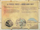
| Fossil Reef -- High and Dry |
|
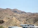
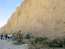
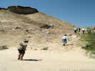
Twenty million years ago, where you are standing was the bottom of a warm shallow sea. The Gulf of California covered the region.
Thriving in the warm waters were many varieties of fish, corals, and shellfish. Over thousands of years shells of oysters and pectens accumulated on the sea bottom and were covered with shofting sands. Thick deposits of shells formed reefs in the shallow sea. The Gulf retreated, faults shofted, and the land uplifted, leaving the ancient reefs high and dry.
The ridge to the south has a dark brown crust which is composed entirelyt of fossil mollusks. The reef is hard compated to the soft silts beneath it, and is more resistant to erosion. Can you see that erosion has weathered trhe softer sediment and brought them tight here to your feet. The buttresses beneath the ancient reef are known as Elephant Knees.
As you proceed up Fish Creek be on the lookout for signs of the fossil reef. It can be spotted in the overhanging cliffs above Loop Wash, just a few miles west of here.
|
|
|
Other articles:
• Fish Creek Wash:
56345;
 Field Trip Stop 3-6. Colorado River delta rythmites Field Trip Stop 3-6. Colorado River delta rythmites
|
|
|
|
Other articles:
• Fish Creek Wash:
50830;
 Field Trip Stop 3-7. Yuha Formation. Field Trip Stop 3-7. Yuha Formation.
|
|
|
|
Other articles:
• Loop Wash Jeep Trail:
in Loop Wash;
 Field Trip Stop 3-8. Arroyo Diablo Formation. Field Trip Stop 3-8. Arroyo Diablo Formation.
|
|
|
|
Other articles:
• Loop Wash Jeep Trail:
in Loop Wash;
 Vallecito Mountains above Fish Creek Vallecito Mountains above Fish Creek
|
|
|
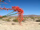
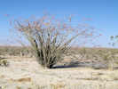 Ocotillo on Borrego Springs Road Ocotillo on Borrego Springs Road
|
|
|
|
|
|
April 22, 2008
|
|
Other articles:
• Cottonwood Springs Road:
at Cottonwood Sprs;
Locations:
Cottonwood Spring.
 Cottonwood Spring Cottonwood Spring
|
|
|
|
Other articles:
• Cottonwood Springs Road:
Cottonwood Springs;
Locations:
Cottonwood Spring.
 Cottonwood Spring Cottonwood Spring
|
|
|
|
Other articles:
• Pinto Basin Road:
Pinto Basin;
Locations:
Pinto Basin.
 Interpretive Sign About Pinto Basin Interpretive Sign About Pinto Basin
|
|
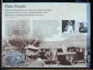
| Pinto People |
| In the Pinto Basin there lies an extinct river along whose banks we found, for nearly six miles, camps containing a culture different from anything we had already encountered. |
| Elizabeth Campbell (1893-1971) |
| It is hard to imagine the existence of large bodies of water anywhere in this parched landscape, but exist they did. Here in the Pinto Basin evidence of old shorelines lends proof to a cooler, wetter period when a shallow river coursed the basin. The river attracted life, which explains the fossil bones of extinct camel, horse, llama, sheep, tortoise, and rabbit found here. It also explains the discovery of a distinct human culture that camped along the riverbanks. |
| Between 1931 and 1935, self-taught archaeologists Elizabeth and William Campbell searched up and down this valley. They followed the ancient riverbank terraces for miles, discovering many small campsites and collecting chipped stone tools -- leaf-shaped points, scrapers, and choppers. The Campbells recognized that these tools were different from others of the region. When the artifacts were radiocarbon tested years later, they registered more than 9,000 years old and confirmed the existence of a vanished people -- the Pinto Culture. |
|
|
Other articles:
• Pinto Basin Road:
in Pinto Basin;
Locations:
Pinto Basin.
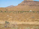
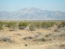 Pinto Mountain, the highest peak in the Pinto Mountains, as seen across the Pinto Basin Pinto Mountain, the highest peak in the Pinto Mountains, as seen across the Pinto Basin
|
|
|
|
Other articles:
• Pinto Basin Road:
65000;
Locations:
Turkey Flat.
 Turkey Flats Turkey Flats
|
|
|
|
Other articles:
• Pinto Basin Road:
65000;
Locations:
Turkey Flat.
 Turkey Flats Turkey Flats
|
|
|
|
Other articles:
• Pinto Basin Road:
55000;
 Ocotillo in the Pinto Basin Ocotillo in the Pinto Basin
|
|
|
|
Other articles:
• Pinto Basin Road:
55000;
 Ocotillo in the Pinto Basin Ocotillo in the Pinto Basin
|
|
|
|
Other articles:
• Pinto Basin Road:
50000;
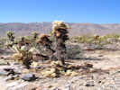
 Desert Lavender in Pinto Basin. Desert Lavender in Pinto Basin.
|
|
|
|
Other articles:
• Pinto Basin Road:
45000;
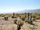 Teddy Bear Cholla Teddy Bear Cholla
|
|
|
|
Other articles:
• Pinto Basin Road:
45000;
 Teddy Bear Cholla Teddy Bear Cholla
|
|
|
|
Other articles:
• Pinto Basin Road:
near Silver Bell Mine;
Locations:
Silver Bell Mine.
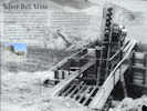 Silver Bell Mine Silver Bell Mine
|
|
| Silver Bell Mine |
| On the slopes to the south you can see the remains of the Silver Bell Mine, with its tipples still standing. These ore bins held and fed rock to a stamp battery that crushed the ore into a sandy-watery pulp and pushed it onto an amalgamation table where the precious metals were extracted. Though the mines operated some 40 years, ownership and details about the mine's riches are sketchy. Nevertheless, it was a versatile mine: gold in the 1930s, lead in the 1940s, and copper in the 1950s. |
| Prospectors began staking claims in this desert region around 1865. Gold fever gave rise to mine names like Fore Aces, Big Bozo Claim, Lucky Turkey #2, and Hard Digging. Mining reached its peak here by 1917 and tapered off by the 1960s. |
| Ore was hoisted from the Silver Bell Mine by the skip and dumped onto the grizzly, which sorted ore into the tipple. A 1958 assay report showed the Silver Bell Mine as having low gold and silver values, but high copper values -- worth about $90 a ton. | |
|
|
Other articles:
• Pinto Basin Road:
near Silver Bell Mine;
Locations:
Silver Bell Mine.
 Silver Bell Mine Silver Bell Mine
|
|
|
|
Other articles:
• Amboy Road:
at Iron Age Rd;
Locations:
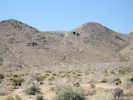
Sheep Hole Mountains.
 Amboy Road toward Sheephole Pass Amboy Road toward Sheephole Pass
|
|
|
|
Other articles:
• Amboy Road:
Sheep Hole Pass;
• Glossary:
pediment;
Locations:
Sheep Hole Pass.
 Pediment in Sheephole Pass Pediment in Sheephole Pass
|
|
|
|
Literature Cited:
- Standard Lithium, 2017.
Other articles:
• Amboy Road:
on Bristol Lk Playa;
Locations:
Bristol Lake.
|
|
Salt Plant on Bristol Lake |
|
|
Literature Cited:
- Standard Lithium, 2017.
Other articles:
• Amboy Road:
20000;
Locations:
Bristol Lake.
|
|
National Chloride Company |
|
|
Literature Cited:
- Brown, Howard, 2003.
Other articles:
• Kelbaker Road:
near Amboy Limestone Quarry;
• Eastern Mojave Geology:
at Amboy Limestone Deposit;
 Snowcap Limestone Mine Snowcap Limestone Mine
|
|
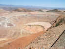
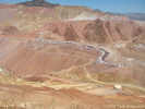
Omya (California) operates the Amboy Limestone quarry located 6 miles east of Amboy, California, in the southern Bristol Mountains. The Amboy Limestone deposit, a very high purity, high brightness (white) crystalline limestone deposit is of such high purity it is suitable for pharmaceutical and food grade limestone applications, and can be utilized in products for human consumption. The limstone is mined from an extensive dip slope of Mississippian age Monte Cristo Limestone, Bullion Member, up to 300 feet thick, and 1500 feet long. Current mine life is 55 years, plus reclamation phases for a total operation life of 70 years. The current Phase 1 quarry development occurs in an area of about 10 acres. The ultimate quary will cover approximately 50 acres.
|
|
Other articles:
• Kelbaker Road:
near Kelso Dunes;
Locations:
Kelso Valley.
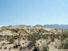
 Looking north toward Kelso Looking north toward Kelso
|
|
|
|
Other articles:
• Kelbaker Road:
near Kelso Dunes;
 Desert Lily beside Kelbaker Road Desert Lily beside Kelbaker Road
|
|
|
|
|
|
April 23, 2008
|
|
Other articles:
• North Highway:
Mesquite Spring Campground;
 Mesquite Spring Campground Mesquite Spring Campground
|
|
|
|
Other articles:
• Racetrack Valley Road:
near Ubehebe Crater;
 Northern part of Death Valley from Ubehebe Crater Northern part of Death Valley from Ubehebe Crater
|
|
|
|
Locations:
Dry Mountain.
 Dry Mountain from Ubehebe Crater Dry Mountain from Ubehebe Crater
|
|
|
|
Locations:
Tin Mountain.
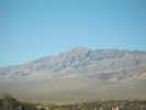
 Tin Mountain from Ubehebe Crater Tin Mountain from Ubehebe Crater
|
|
|
|
Other articles:
• Death Valley Road:
on Death Valley Road;
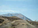
 Foothills of the Grapevine Mountains along Death Valley Road Foothills of the Grapevine Mountains along Death Valley Road
|
|
|
|
Other articles:
• Death Valley Road:
on Death Valley Road;
 View into the most northern end of Death Valley View into the most northern end of Death Valley
|
|
|
|
Literature Cited:
- Wrucke, C.T. ; Werschky, R.S. ; Raines, G.L. ; Blakely, R.I. ; Hoover, D.B. ; Miller, M.S., 1984.
Other articles:
• Death Valley Road:
near Little Sand Spring;
Locations:
Little Sand Spring.
|
|
General view of Little Sand Spring |
|
|
Other articles:
• Death Valley Road:
near Little Sand Spring;
Locations:
Little Sand Spring.
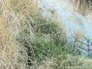 Vegetation in Little Sand Spring Vegetation in Little Sand Spring
|
|
|
|
Literature Cited:
- Fish and Wildlife Service, 1998.
Other articles:
• Death Valley Road:
Sand Spring;
Locations:
Sand Spring.
|
|
General view of Sand Spring |
|
|
Other articles:
• Death Valley Road:
near Crankshaft Crossing;
 General view south into Death Valley. General view south into Death Valley.
|
|
|
|
Other articles:
• Death Valley Road:
Crankshaft Junction;
Locations:
Crankshaft Crossing.
 Crankshaft Crossing Crankshaft Crossing
|
|
|
|
Other articles:
• Death Valley Road:
near Crankshaft Crossing;
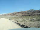
 Death Valley Road climbs the Last Chance Range Death Valley Road climbs the Last Chance Range
|
|
|
|
Other articles:
• Death Valley Road:
on Death Valley Road;
 Northern end of Death Valley. Northern end of Death Valley.
|
|
|
|
Other articles:
• Death Valley Road:
on Death Valley Rd;
 Death Valley Road traverses the Last Chance Range Death Valley Road traverses the Last Chance Range
|
|
|
|
Other articles:
• Death Valley Road:
near Crater;
Locations:
Crater.
 General view of Crater General view of Crater
|
|
|
|
Other articles:
• Death Valley Road:
near Little Cow Horn Valley;
Locations:
Little Cow Horn Valley.
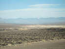
 View west of Little Cow Horn Valley View west of Little Cow Horn Valley
|
|
|
|
|
|
2008 Tour de Swertia albomarginata
Tuesday, May 27th
|
|
Other articles:
• Frasera albomarginata:
129000;
|
|
Left home on Tuesday May 27th, bound for the Eastern Mojave. Stopped for gas at Avenal, lunch in Bakersfield, gas at Kramer Junction, again at Valley Wells.
|
|
Other articles:
• Kessler Springs Road:
at Veterans Cross;
 The Cross-In-A-Box in May, 2008 The Cross-In-A-Box in May, 2008
|
|
On the way in to Mojave National Preserve I stopped for my annual photo of the "Cross in a Box" (#9). A cross was installed on this rock in the 1930s as a memorial to veterans, long before this area became a park. In the 1990s a disgruntled Park Service employee took offense at the cross in the newly formed national park, and the matter has bounced back and forth between the courts and congress ever since. In the meantime, so as not to offend further, our Park Service has installed a wooden box to cover the cross. This is a continuing saga as the box has been sawn off, burned off, painted with alternative religious symbols, etc.
|
|
|
|
It is unfortunate that we cannot just allow the original sentiment of a memorial be, but instead we get threatened by the religiosity of the symbol.
|
|
|
|
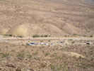
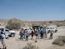
In the Mid Hills Campground, I am one of three campers, and we are well-dispersed throughout the campground.
|
|
|
|
Wednesday, May 28th.
|
|
Literature Cited:
- Ausmus, Bob, 1989.
Other articles:
• Black Canyon Road:
at Holliman Well;
Locations:
Holliman Well.
|
|
Holliman Well |
In the burned area of Round Valley, e.g., around Holliman Well, the Apricot Mallow (Sphaeralcea ambigua) has filled in the areas formerly occupied by Sagebrush.
|
|
|
|
Today, I started at my Pinto Mountain plot. There was one Frasera albomarginata in bloom, outside the plot.
|
|
|
|
The Cliff Rose at Pinto Mountain is not coming back. That's too bad, as that was one location where Cliff Rose was easy to find. There was lots of Sandwort (Eremogene, formerly Arenaria) in bloom at Pinto Mountain and at Wild Horse Mesa, along with Eaton's Fire Cracker (Penstemon eatonii) and Dalea searlsii.
|
|
|
|
I looked for the little Portulaca family plant down where I park my car, but was unable to find any.
|
|
Other articles:
• Winkler's Cabin Road:
29987;
 Road to Winkler's Cabin, May 29, 2008 Road to Winkler's Cabin, May 29, 2008
 Road to Winkler's Cabin, May 29, 2008 Road to Winkler's Cabin, May 29, 2008
|
|
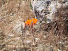
Calochortus kennedyi on north face of Wild Horse Mesa |
Then I drove to the Wild Horse Mesa plot. I can't actually drive all the way there. But I was able to drive with to camper to my usual parking spot. From there the walk is about 20 minutes up the hill to my plot. Along the way I saw lots of Calochortus in bloom. The single Single-Leaved Ash is coming back from the fire, as are the Oaks in the creekbed.
|
|
|
|
I drove into Opal Wash for lunch. The road continues to deteriorate with lack of traffic.
|
|
|
|
Back out at my burned plot, there are far fewer plants growing than the first year after the fire. I think this is because there was a good rainfall immediately after the fire, but it's been generally dry sense.
|
|
|
|
There were very few Verbena gooddingi. I have assumed it is a perennial, and it is so litsted in the Jepson manual, but there are far fewer of them in this plot than immediately after the fire.
|
|
Other articles:
• Wild Horse Canyon Road:
in Wild Horse Cyn;
 View across Wild Horse Canyon View across Wild Horse Canyon
|
|
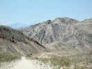
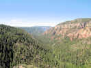
I have seen some collections made in Wild Horse Canyon, that gave an ecological association of "Joshua tree woodland." However, I don't think I have ever seen Joshua trees in Wild Horse Canyon. I contacted the collector who was quite certain that there were Joshua trees in the area, but that they were not recovering well from the 2005 Hackberry Complex fire. So I went to the location of the collections, as given in geographic coordinates, and searched for Joshua trees. The location is shown in the photograph at left. I searched both sides of the road, across the wash and up on the benches on either side of the wash. I did not find Joshua trees. I did find burned stumps and sprouts of Banana Yucca (Yucca baccata) and Mohave Yucca (Y. schidigera), but not Joshua trees (Y. brevifolia). I'm not saying the Joshua trees aren't there. I'm just saying that I could not find them.
You might wonder, of course, what difference does it make? In my observation, Joshua trees occur on the northwest side of the Mid Hills ridge. They also are found on the ridge line. However, Joshua trees are not found on the southeast side of the Mid Hills ridge, until one reaches the higher elevations of Pinto Valley.
I want to hypothesize that the Mid Hills ridge creates a small orographic precipation increase on the side from which winter storms come, the northwest side. The ridge also casts a small rain shadow on the lee side, the southeast side. The orographic effect and rain shadow are enough to affect Joshua tree distribution in this area. If there are Joshua trees in Wild Horse Canyon, then they provide a counter-example to my hypothesis.
|
|
|
|
|
|
|
|
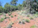
In the eastern Mojave, my little plants are OK, a few more deaths than births, but no plants were flowering in my study areas. I did see one in bloom just outside my study area (#7). The study area that burned in 2005 seems to have fewer and fewer plants each year. Maybe that is because it rained a lot right after the fire, and since then it hasn't rained so much. There were a lot of Calochortus (Mariposa Lily, #8) in bloom on Wild Horse Mesa.
|
|
|
|
Thursday, May 29th
|
|
|
|
As I was leaving the Mid Hills, the weight of my laptop and my "office" bag were making contact in the passenger seat sensor. Then the passenger seat belt light and alarm would sound. Until, I hit another bump and the reduced pressure would silence the alarm, then set if off again as we hit bottom of the bump. Really annoying! When I get home, I'm going to rig some was to disable (temporarily) the passenger seat alarm.
|
|
|
|
At Goffs, the General Store and gas station are closed.
|
|
Other articles:
• U. S. Interstate 40:
near Colorado R.;
Locations:
The Needles.
 The Needles from Topock, Arizona The Needles from Topock, Arizona
|
|
|
|
Other articles:
• U. S. Highway 66:
30250;
 View of Mohave Valley to the southwest View of Mohave Valley to the southwest
|
|
View southeast to Mohave Valley and Needles.
|
|
Other articles:
• U. S. Highway 66:
near Oatman;
Locations:
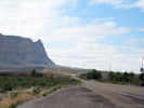
Boundary Cone.
 Boundary Cone along Old US Highway 66 Boundary Cone along Old US Highway 66
|
|
Boundary Cone ahead on Old US Highway 66.
|
|
Other articles:
• U. S. Highway 66:
30600;
 Teddy-Bear Cholla (Opuntia bigelovii) near Boundary Cone Teddy-Bear Cholla (Opuntia bigelovii) near Boundary Cone
|
|
Teddy-Bear Cholla (Opuntia bigelovii) is found at several places along Old US Highway 66.
|
|
Other articles:
• U. S. Highway 66:
near Oatman;
 Burro near Oatman, Arizona Burro near Oatman, Arizona
|
|
|
|
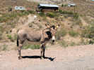
Other articles:
• U. S. Highway 66:
in Oatman;
Locations:
Oatman.
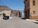
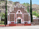
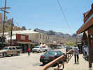 Main street of Oatman, Arizona. Main street of Oatman, Arizona.
|
|
Oatman was kind of cute, maybe like a junior Virginia City. Burros in town are protected, so they wander the streets unmolested (#6). Outside of town they get rounded up and shot by the BLM.
|
|
Other articles:
• U. S. Highway 66:
at Goldroad Mine;
Locations:
Goldroad Mine.
 Goldroad Mine Goldroad Mine
|
|
|
|
Other articles:
• U. S. Highway 66:
above Goldroad Mine;
 Old US Highway 66 Old US Highway 66
|
|
|
|
Other articles:
• U. S. Highway 66:
at Sitgreaves Pass;
Locations:
Sitgreaves Pass.
 View east from Sitgreaves Pass View east from Sitgreaves Pass
|
|
|
|
Other articles:
• U. S. Highway 66:
along Old US Hwy 66;
 Beargrass (Nolina) along Old Highway 66 Beargrass (Nolina) along Old Highway 66
|
|
|
|
Literature Cited:
- Wilson, E. D., and R. T. Moore, 1959.
Other articles:
• Frasera albomarginata:
in the Hualapai Mtns;
Locations:
Hualapai Mountains.
|
|
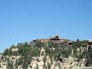
Hualapai Peak in Hualapai Mountain Park. |
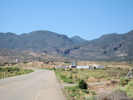
Tonight I am staying at Hualapai Mountain Park. This is a Mohave county Park, and has cabins, camping, picnic areas, and several reservable recreation areas.
|
|
|
|
Friday, May 30th
|
|
Literature Cited:
- Wilson, E. D., and R. T. Moore, 1959.
Other articles:
• Frasera albomarginata:
in the Hualapai Mtns;
Locations:
Hualapai Mountains.
|
|
Kingman from Hualapai Mountain Road. |
Today I traveled from Hualapai Mountain Park near Kingman Arizona to the Grand Canyon.
|
|
|
|
The sun came up and entered the camper about 6:08 AM this morning. I remember as it shown directly into my eyes. I got up and did my usual consitutionals. I re-arranged the truck cab a little bit, spreading out the presses to a single layer but four presses across. This makes more room for other stuff.
|
|
Other articles:
• U. S. Highway 66:
near Walapai;
Locations:
Hualapai Mountains.
 Hualapai Mountain from Old US Highway 66 Hualapai Mountain from Old US Highway 66
|
|
Returning to Kingman from Hualapai Mountain Park, I gassed up in town, and then headed out of town on the old route 66. The beginning part of the drive crosses Hualapai Valley, a broad fairly flat valley. I'm not sure where, or whether, Hualapai Vallry drains.
|
|
Other articles:
• Frasera albomarginata:
in the Music Mtns;
• U. S. Highway 66:
at IRR 1;
 Buck and Doe Road from US Highway 66 Buck and Doe Road from US Highway 66
|
|
Then the old highway climbs a valley past Valentine before topping out on a plateau. At the east end of this plateau is Peach Springs. I saw Buck and Doe Road, and took photos, but did not travel out onto it.
|
|
Other articles:
• U. S. Highway 66:
Peach Springs;
Locations:
Peach Springs.
 Downtown Peach Springs Downtown Peach Springs
|
|
Peach Springs is a post office, a market, a motel and restaurant, and some tribal offices.
|
|
|
|
The highway climbs over a small divide, and then along the Aubrey Cliffs. After rounding the corner of the Aubrey Cliffs, one comes to Seligman, all done up in historic Route 66 regalia and miscellaneous kitsch. Lots of tourists and tour busses here. I got on I-40 at Seligman, stopped at Ash Fork to pee, and then went on to Williams.
|
|
|
|
Cruised the old town of Williams, and then went out to the highway to get gas.
|
|
|
|
The road north from Williams to Grand Canyon mostly traverses a high rolling plateau with little of interest, right up to the edge of the chasm itself.
|
|
|
|
The Grand Canyon was very nice weather-wise, temperatures in the 70s, but full of tourists as you might imagine.
|
|
|
|
The condors were there also; I saw four roosting on the cliffs, and several more in flight.
|
|
|
|
I stopped to take a photograph of the El Tovar Hotel (#2) because Alice Eastwood collected Frasera albomarginata there in 1913. Now the hotel is surrounded by lawn and tourist-encrusted sidewalks.
|
|
Other articles:
• Frasera albomarginata:
by Alice Eastwood;
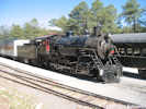 Grand Canyon Railroad. Grand Canyon Railroad.
 El Tovar Hotel at Grand Canyon El Tovar Hotel at Grand Canyon
|
|
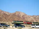
Miss Eastwood probably arrived on the Santa Fe Railroad from the main line at Williams, Arizona. Today, that branch line is operated as the Grand Canyon Railroad. They were running two trains, one pulled by a 2-8-0 steam engine (#3), and the other by a diesel. I watched the steam engine depart, and then made my way to other vistas.
|
|
Other articles:
• Frasera albomarginata:
at Rowes Well;
Locations:
Rowes Well.
 The Rowe Well entrance to Grand Canyon National Park The Rowe Well entrance to Grand Canyon National Park
|
|
I also tried to visit Rowe's Well, a nearby place, where someone else collected Frasera albomarginata in 1938. However, now the site looks to be privately owned, and well locked up. I had a nice drive in the woods, with some nice short walks, but I couldn't find my little plant.
|
 Locked Gate Locked Gate
|
|
However, while reviewing maps after my return home, I discovered that I was never at Rowe's Well, but at another location several miles south of Rowe's Well.
|
|
|
|
Saturday, May 31st.
|
|
Other articles:
• US Highway 180:
080000;
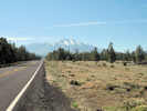 San Francisco Peaks from US Highway 180. San Francisco Peaks from US Highway 180.
|
|
View of San Francisco Peaks from US Highway 180
|
|
Other articles:
• Arizona Highway Alternate-89:
20000;
Locations:
Oak Creek Canyon.
 Oak Creek Canyon from Overlook Oak Creek Canyon from Overlook
|
|
View of Oak Creek Canyon from the Overlook.
|
|
Other articles:
• Arizona Highway Alternate-89:
at Midgely Bridge;
• Frasera albomarginata:
in Oak Ck Cyn;
 Frasera albomarginata habitat in Oak Creek Canyon, but no Frasera albomarginata Frasera albomarginata habitat in Oak Creek Canyon, but no Frasera albomarginata
|
|
No Frasera albomarginata here.
|
|
|
|
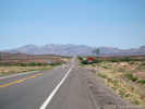
Benson Arizona, a town that exists because it's where the Southern Pacific crossed the San Pedro River in the 1880's. Benson was the name of the first railroad agent in town. Down river a few miles is St. David, the first white settlement in this area, settled by a contingent of Mormon farmers sent from Salt Lake City.
|
|
|
|
I'm ensconced in this garden spot after a day's drive from the Grand Canyon, by way of Oak Creek Canyon (#1) and Sedona (to look for Frasera albomarginata) and by way of Phoenix, because there was no way to get here without going through the 60 miles (100 km) of that sprawling metropolis.
|
|
|
|
Sunday, June 1st.
|
|
Other articles:
• North Johnson Road:
29800;
• Frasera albomarginata:
in southeastern Arizona;
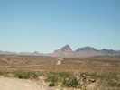
 Johnson Mine and Little Dragoon Mountains Johnson Mine and Little Dragoon Mountains
|
|
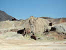
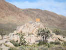
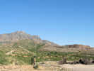
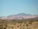
Left Benson this morning, headed east up I-10 for Dragoon Summit, and the former town of Johnson. On the way I detoured through Dragoon in time to see a westbound freight. Found the Amerind Museum, recommended by Pat P., but the hour was 800 AM and the sign gave the hours as 10 to 4, closed Mondays. Would like to have seen it, as the restaurant cashier also recommended it. Headed north to Johnson but, here, I ran into locked gates at all three roads north from I-10. The Johnson Mine, which appeared to be in the middle of my route to the Little Dragoon Mountains, was locked up tight, and not a soul in sight. Maybe on a weekday I could have obtained permission to pass through, but not today. The mountains above the mine appeared to be Pinyons and Junipers on limestone, the right environment for Frasera albomarginata.
|
|
Other articles:
• North Cascabel Road:
70000;
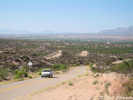 Looking south toward Benson from Cascabel Road Looking south toward Benson from Cascabel Road
|
|
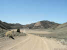
So Plan B was to go back to Benson, and go north up Pomerene and Cascabel Roads. "Cascabel" is Spanish for "rattlesnake." I and then turned east on 3 Links Road, headed for the 3 Links Ranch, trying to find another location. At the little pass there was limestone and a *few* Junipers, so I did the routine of stopping every 1/2 mile and walking a little figure 8 path on both sides of the road. Found lots of interesting stuff, but not my little plants.
|
|
Other articles:
• North Cascabel Road:
at 3 Links Rd;
 Intersection of Cascabel and Three Links Roads Intersection of Cascabel and Three Links Roads
|
|
Intersection of Cascabel Road and Three Links Road.
|
|
Other articles:
• Three Links Road:
near summit;
• Frasera albomarginata:
at Hookers Hot Springs;
 Vegetation at summit of 3 Links Road Vegetation at summit of 3 Links Road
|
|
Vegetation at summit of 3 Links Road.
|
|
Other articles:
• Three Links Road:
near summit;
• Frasera albomarginata:
at Hookers Hot Springs;
 Vegetation at summit of 3 Links Road Vegetation at summit of 3 Links Road
|
|
|
|
Other articles:
• Three Links Road:
45000;
• Frasera albomarginata:
at Hookers Hot Springs;
 Truck speeds along 3 Links Road. Truck speeds along 3 Links Road.
|
|
|
|
Other articles:
• US Highway 191:
85000;
 US Highway 191 north from US I-10. US Highway 191 north from US I-10.
|
|
About Noon, I marked it off as another Snipe Hunt and went on to Willcox, then north to Safford, then northeast to Clifton and Morenci, a huge copper mine still in operation.
|
|
Other articles:
• US Highway 191:
79890;
 Morenci Copper mine from the south. Morenci Copper mine from the south.
|
|
View of Clifton-Morenci mines from the south.
|
|
Other articles:
• US Highway 191:
in Clifton;
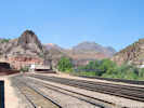 Railyard in Clifton Railyard in Clifton
|
|
View of rail yard in Clifton.
|
|
Other articles:
• US Highway 191:
in Clifton;
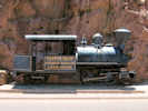 Small tank locomotive on display in Clifton Small tank locomotive on display in Clifton
|
|
Locomotive on display in Clifton.
|
|
Other articles:
• US Highway 191:
Clifton;
Locations:
Clifton.
 Main street in Clifton. Main street in Clifton.
|
|
Main street in Clifton.
|
|
Other articles:
• US Highway 191:
in Clifton;
 Catholic church in Clifton Catholic church in Clifton
|
|
Catholic church in Clifton.
|
|
Other articles:
• US Highway 191:
between Clifton and Morenci;
 US Highway 191 between Clifton and Morenci US Highway 191 between Clifton and Morenci
|
|
Highway between Clifton and Morenci.
|
|
Other articles:
• US Highway 191:
above Morenci;
 Copper mill along US Highway 191 Copper mill along US Highway 191
|
|
Copper mill above Morenci.
|
|
Other articles:
• US Highway 191:
79750;
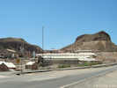
 Open pit at Morenci Copper Mine Open pit at Morenci Copper Mine
 Open pit at Morenci Copper Mine Open pit at Morenci Copper Mine
|
|
Watched the shovels and huge mine trucks (#1) for while I ate a sandwich and then set off north on US Hwy 191.
|
|
|
|
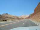
This is the highway that used to be Highway 666. Of course, someone took offense at having a highway numbered the Number of the Beast, so our Federal government split it up into Highways 191 and 491. Today's portion of Highway 191 was a long slow drive through the mountains. The road was high enough for there to be small patches of snow along the road. I think this area is called the Mogollon Rim, which is the southwest edge of the Colorado Plateau.
|
|
Other articles:
• US Highway 191:
near Four Bar Mesa;
Locations:
Four Bar Mesa.
 Four Bar Mesa Four Bar Mesa
|
|
View of Four Bar Mesa to the north.
|
|
|
|
Settled for the night at a very nice, little USFS campground called Hannagan Meadow (#2). This looks to be a recreation site for hikers, riders, and cross-country skiing in the winter.
|
|
|
|
Monday, June 2nd.
|
|
Other articles:
• US Highway 191:
Hannagan Meadow;
Locations:
Hannagan Meadow.
 Hannagan Meadow Hannagan Meadow
|
|
This morning I left Hannagan Meadow, and headed north, going through Alpine, Springerville, and St. Johns before arriving at Petrified Forest National Park. There are a few collections of Frasera albomarginata from here. Again I did the Figure 8 Snipe Hunt Routine every half mile, or anythere that looked possible. No Snipe. Asked a Ranger, but learned that they have Law Enforcement Rangers here, not Interpretive Rangers or (heaven forbid!) a biologist on staff. Their volunteer "wildflower lady" had a nice poster in the Museum, but not with my little plant. This little guy was the prettiest thing I found (#3). Had a nice lunch, though, overlooking the Painted Desert.
|
|
Other articles:
• US Highway 191:
near Hannagan Mdw;
 Plaque for the Clifton-Springerville Highway. Plaque for the Clifton-Springerville Highway.
|
|
| Clifton-Springerville Highway"The Coronado Trail"Dedicated June 19, 1926 |
|
|
Other articles:
• US Highway 191:
near Alpine;
 View southeast toward Alpine. View southeast toward Alpine.
|
|
After having passed through Alpine I stopped for this photo looking back southeast toward the town.
|
|
Other articles:
• US Highway 191:
near Alpine;
 Countryside west of Alpine, Arizona Countryside west of Alpine, Arizona
|
|
Looking the other way is this fine pastoral view.
|
|
Other articles:
• US Highway 191:
northwest of Springerville;
 Countryside northwest of Springerville. Countryside northwest of Springerville.
|
|
View of Springerville from rest stop to the northwest of town.
|
|
Other articles:
• US Highway 180:
near Little Colorado River;
 Little Colorado River Little Colorado River
|
|
Stopped for a look at the Little Colorado River.
|
|
Other articles:
• Petrified Forest Road:
near S. Entrance Visitor Ctr;
• Frasera albomarginata:
at Petrified Forest Natl Pk;
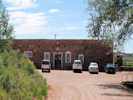
 South entrance of Petrified Forest National Park. South entrance of Petrified Forest National Park.
|
|
South entrance visitor center.
|
|
Other articles:
• Petrified Forest Road:
near south entrance;
• Frasera albomarginata:
at Petrified Forest Natl Pk;
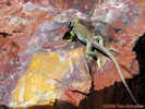 Hey baby! Want a date? Hey baby! Want a date?
|
|
Collared lizard in breeding plumage. This was his rock, and he wasn't going to leave it, even for me.
|
|
Other articles:
• Petrified Forest Road:
near south entrance;
• Frasera albomarginata:
at Petrified Forest Natl Pk;
 Lake beds near south entrance. Lake beds near south entrance.
|
|
|
|
Other articles:
• Petrified Forest Road:
in middle of park;
• Frasera albomarginata:
at Petrified Forest Natl Pk;
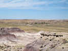
 Higher area with a few junipers Higher area with a few junipers
|
|
Stopped in an area with a few junipers to look for Frasera albomarginata.
|
|
Other articles:
• Petrified Forest Road:
15000;
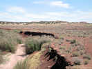
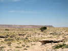
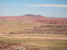 Painted Desert at north end of Petrified Forest National Park. Painted Desert at north end of Petrified Forest National Park.
|
|
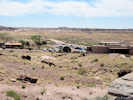
After lunch I headed east, and north, then west, and north, then east, and north, then west, and ... well you get the idea ... through Ganado where I stopped for a short time at the Hubbell Trading Post National Monument. Lot of stuff for sale, and very squeeky floors. Then on to Chinle, where I plan to settle for the night.
|
|
Other articles:
• US Highway 191:
near Ganado;
 Hubbell Trading Post National Historic Site Hubbell Trading Post National Historic Site
|
|
|
|
Locations:
Canyon de Chelly.
 View of Canyon de Chelly from the south rim. View of Canyon de Chelly from the south rim.
|
|
Arriving at Chinle in late afternoon, I drove the south rim road of Canyon de Chelly, stopping at every overlook to look down into the canyon. At first the canyon did not seem so deep. But, the last overlook I did, Sliding House Overlook (#4), was signed as being a 700 foot sheer cliff.
|
|
|
|
Back in Chinle, I tried to enter my room at the Best (or Worst) Western, and discovered that my room key would not work. Went back to the office and requested a functional key, went back to "my" room and surprised a guy sound asleep with the TV on. Realizing that I should have asked for a functional key for vacant room, I went back to the office, made the request, and received such an assignment.
|
|
|
|
For dinner I went to the local cafe, and ordered the house special, the Mutton Stew. Years ago when staying at the Hopi Cultural Center, I ordered this delicacy and received a bowl of warm water, a lamb chunk, 6 or so garbanzo beans, and a couple of slices of potato. This was accompanied by a whole baked chile wrapped in aluminum foil.
|
|
|
|
However, the Navajo version of Mutton Stew seems to have a little more substance, as it was an overflowing bowl of chunks of lamb, celery, potato and carrot. I think I may have found a snippet of onion, but that's debatable. No food is served with a knife so the chunks must be gnawed off, or eaten one chunk at a time. The flavor was not bad, it was just really bland. When no one was looking, I added a tiny bit of salt which helped immensely. Maybe next time, I'll bring my own garlic. The stew was served with choice of fry bread or Navajo tortilla. I learned that a Navajo tortilla is fry bread that has been grilled instead of deep fat fried. In deference to my cardiologist I went with the Navajo tortilla. It was a lot of food, and I observed no skinny people of any ethnic origin in the place.
|
|
|
|
Tuesday, June 3rd
|
|
|
|
The motel where I'm staying is workman's motel, so all the workmen were out early, clanging their tools, revving their engines, and testing their backup alarms (they all worked). I got up and went to the restaurant and discovered it wouldn't open for another half hour. Now I knew why the workmen got up, loaded their trucks, and went out to get gas for the day. I decided to emulate a working man, and took my truck down to the Gas'n'Go (per the Robert Earle Keen song), to get gas and check my tires. Getting gas was OK, but the pressure generated by the air machine turned out to be less than the pressure in my tires (45 psi is the target pressure). Consequently, my tires had less air than when I started. The next station, the Conoco/Giant had an "Out of Service" air machine, a good idea but short on execution, and the last gas station in the lineup did not even bother with the pretense of having air for its customers.
|
|
|
|
This is not why I carry a little air compressor, but it turned out to be a good thing to have. So I went back to the motel, parked in the line of workmen's trucks waiting for the restaurant to open, got out my little air compressor, and proceeded to pump up my tires. This created a small stir, and a little attention from the workmen, but a good time was had by all.
|
|
|
|
Leaving Chinle, I headed north through some wide open country with a shack and a hogan now and then, then over to Four Corners. I took a photo for a family. and they offered to take one of me, but I declined. Somehow, though, my camera had a photo of this dorky lookin' dude, standing mostly in Colorado with a small toehold in Utah (#5).
|
|
Other articles:
• US Highway 160:
near TeecNosPos;
 Area of Teec Nos Pos, Arizona Area of Teec Nos Pos, Arizona
|
|
|
|
Other articles:
• US Highway 160:
near Four Corners;
Locations:
Four Corners.
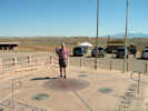 Mostly in Colorado, with a small toehold in Utah. Mostly in Colorado, with a small toehold in Utah.
|
|
|
|
Other articles:
• US Highway 160:
near Four Corners;
Locations:
Four Corners.
 Four Corners Monument Navajo Tribal Park Four Corners Monument Navajo Tribal Park
|
|
|
|
Other articles:
• US Highway 160:
south of Towaoc;
 Montezuma Valley, south of Towaoc, Ute Mountain Indian Reservation Montezuma Valley, south of Towaoc, Ute Mountain Indian Reservation
|
|
Montezuma Valley south of Towaoc.
|
 Mancos Valley view from Mesa Verde Mancos Valley view from Mesa Verde
|
|
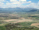
Onward to Mesa Verde National Park, from which the view of Mancos Valley with the San Juan Mountains in the distance was very pretty.
|
|
|
|
The park botanist admitted she had seen Frasera albomarginata in the park, but would not tell me where, and would have to accompany me there anyway, and she could not do that today. Eventually it came out that Weatherill Mesa was the place. Well, that was about an hour and a half drive in and more time to get out, so I decided to tuck my little nugget of information away for another trip. Besides, I told Cheryl that I would save (good) places for her to go with me. One place we haven't been in Mesa Verde is Weatherill Mesa, which has good tours of cliff dwellings in addition to ... you know what.
|
|
Locations:
Pleasant View.
 Pleasant View, Colorado Pleasant View, Colorado
|
|
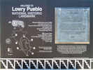
From Mesa Verde back to Cortez, Colorado, and then northeast to a town now called Pleasant View, but used to be called Ackmen. Someone collected Frasera albomarginata 8 miles west of Ackmen. This is very close to the Lowry Ruin. I think Lowry was a famous archeologist with the University of Chicago and his team excavated many sites in this area during the 1920s and 1930s.
|
|
Other articles:
• Montezuma County Road CC:
at Road 7.25;
Locations:
Lowry Pueblo Ruins.
 Interpretive sign at Lowry Ruin. Interpretive sign at Lowry Ruin.
|
|
I examined the Lowry Ruin, and found it to be very interesting. There are two kivas you can enter.
|
|
Other articles:
• Montezuma County Road CC:
near Lowry Ruin;
 Montezuma County Road CC crosses Cow Canyon west of Lowry Ruin Montezuma County Road CC crosses Cow Canyon west of Lowry Ruin
|
|
|
|
Other articles:
• Montezuma County Road CC:
near Lowry Ruin;
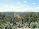
• Frasera albomarginata:
near Lowry Ruin;
 Prime Frasera albomarginata habitat in road cut. Prime Frasera albomarginata habitat in road cut.
|
533
|
Then I went a little further down the road and found Frasera albomarginata in the cut bank of this road (#7). Not anywhere else, just in the cut bank area of the road, in very poor, almost ashy soil.
|
|
|
|
I made no collection here, but the location is approximately 9 miles west of Pleasant View, Colorado, on Montezuma County Road CC, just past Road 7.25 that goes to Lowry Ruin, 37.58825N, 108.91966W.
|
|
Other articles:
• Montezuma County Road CC:
at Cty Rd 10;
• Montezuma County Road 10:
at CR CC;
• Frasera albomarginata:
just west of Lowry Ruin, Colorado;
 View northeast of Pleasant View. View northeast of Pleasant View.
|
|
|
|
Locations:
Hovenweep National Monument.
Hovenweep National Monument.
 View south of Little Ruin Canyon View south of Little Ruin Canyon
|
|
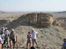
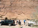
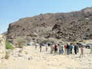
From there I followed a minor road to Hovenweep National Park. The walking tour was about two miles, and quite interesting (#8). But the park has little biting midges that swarm all around you, and the bites leave a welt in a red area. Hurts, and very ugly. I discovered they didn't like sunscreen, so I slathered that all over, but they were getting in my eyes, my ears, anywhere that didn't have sunscreen. I've run into these once in Mojave National Preserve. Anyway, the midges are not active after dark, so most of the campers, including me, were in their tents, cars, or campers until the sun went down.
|
|
|
|
Wednesday, June 4th
|
|
Other articles:
• Hovenweep Road:
near Alkali Creek;
 Canyon near Alkali Creek. Canyon near Alkali Creek.
|
|
This morning, I left Hovenweep early, chased out by the biting midges. From there west to White Mesa and north to Blanding, Utah, I did the Figure 8 Snipe Hunt Routine, wherever the area looked like it could be Frasera albomarginata habitat, as there are several collections from this area. Found neither Frasera albomarginata nor Snipe.
|
|
|
|
I stopped in Blanding for gas and groceries. I need ice for the icebox every day when it is hot, like in the 90s, and less often if it is cooler. There was a marked absence of beer in the market. When I asked the grocery clerk, she said Blanding was a dry town. But at the Gas'n'Go three miles south of town, they sell beer. It was on my way, so I stopped there, and bought a six-pack of Wagging Tale Ale. I thought I would be ready to give a report on its quality, but since I'm not camping tonite, the report will have to wait for another time.
|
|
|
|
Then headed east toward Lake Powell. The road passed by Natural Bridges National Park, but I am saving that for another trip. My objective, if a retired person can be seriously thought of as having an objective, was another collection made at the Sunrise Trailhead into the Dark Hollow Wilderness near Squaw and Papoose Rock (#9). Getting into the vicinity was about 12 miles of dirt roads under threatening skies. I made a few wrong turns, corrected myself, and found Frasera albomarginata growing in the middle of a clump of cactus alongside the road (#10).
|
|
Other articles:
• Utah Highway 95:
near Comb Ridge;
 Comb Creek from Highway 95 Comb Creek from Highway 95
|
|
|
|
Other articles:
• Utah Highway 95:
near Comb Ridge;
 Monocline west of Comb Ridge Monocline west of Comb Ridge
|
|
Comb Ridge
|
|
Other articles:
• Utah Highway 95:
59998;
 Commerative sign about Battle of Paiute Pass Commerative sign about Battle of Paiute Pass
|
|
Battle of Paiute Pass.
|
|
Other articles:
• Utah Highway 95:
in White Canyon, UT;
 View northwest (down) White Canyon View northwest (down) White Canyon
|
|
View down White Canyon to the northwest.
|
|
Other articles:
• Frasera albomarginata:
at the Sundance Trailhead;
• Utah Highway 95:
along White Canyon;
• Fortknocker Canyon Road:
at Jacks Loop Rd;
 Which way to go? Junction of Fortknocker Canyon and Jacks Loop Roads Which way to go? Junction of Fortknocker Canyon and Jacks Loop Roads
 Map showing collections of Frasera albomarginata near Squaw and Papoose Rock Map showing collections of Frasera albomarginata near Squaw and Papoose Rock
|
|
Just north of the bridge over White Canyon, I turned off of Utah Highway 95 to the east. The DeLorme atlas identifies this as Horse Tanks Road. Later, I would learn that this is White Canyon North Road.
White Canyon North Road winds around a bit, then drops over a small ridge to join with Fortknocker Canyon Road. I stayed on Fortknocker Canyon Road headed to the southeast, until I came to another fork in the road.
Most of the roads out here are numbered, with black letters on a white Carsonite posts. For example, the road in the photo at left was Road 2641. These are county unique road numbers. So far, the only place I have seen these numbers is in the Streets data from the Utah State Geographic Information Database (SGID).
By accident I detoured on Jacks Loop Road (B2641). Here I had lunch while I watched the weather deteriorate. After lunch, I continued on around Jacks Loop where I joined Wooden Shoe Road, although at the time I thought it was Squaw Rock Road. It seemed to be heading toward Squaw and Papoose Rock, so I stayed on it until I saw Frasera albommarginata along the road.
|
|
Other articles:
• Wooden Shoe Road:
near Squaw and Papoose Rock;
Locations:
Squaw and Papoose Rock.
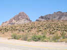
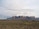
 Squaw and Papoose Rock from the southwest. Squaw and Papoose Rock from the southwest.
|
|
View of Squaw and Papoose Rock from the southwest.
|
|
Other articles:
• Frasera albomarginata:
near Squaw and Papoose Rock;
 Location of Collection No. 532 of Frasera albomarginata near Squaw and Papoose Rock. Location of Collection No. 532 of Frasera albomarginata near Squaw and Papoose Rock.
 Frasera albomarginata habitat near Squaw and Papoose Rock. Location of Collection No. 532. Frasera albomarginata habitat near Squaw and Papoose Rock. Location of Collection No. 532.
|
532
|
Collection No. 532, Frasera albomarginata |
#532 37.83810N, 110.20411W, 11 miles from Utah Highway 24 by way of Road 2081 and Road 256, near the turnoff to the Sunrise Trailhead.
|
|
Other articles:
• Wooden Shoe Road:
near Squaw and Papoose Rock;
Locations:
Squaw and Papoose Rock.
 Squaw and Papoose Rock from the northeast Squaw and Papoose Rock from the northeast
|
|
View of Squaw and Papoose Rock from northeast.
|
|
|
|
This would be a new locality for the plant, as the previous collections were made a few miles further on. Of course, as you might expect, it started to rain just as I found the little plants. In my head is the possibility of 12 miles of wet, sticky red roads back to the highway. Fortunately, the rain held off enough, so that my windshield wipers were on intermittent, while the truck was still raising dust from the road.
|
|
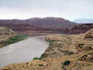
Locations:
Colorado River.
|
|
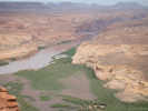
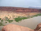
From there, I crossed the Colorado River at Hite. The river is just entering Lake Powell here, but you can see the "bathtub ring" of the highwater mark that must be 50 to 80 feet higher that the lake surface now.
|
|
Other articles:
• Utah Highway 95:
near Hite Bridge;
 Colorado River just below the Hite bridge. Colorado River just below the Hite bridge.
|
|
|
|
Other articles:
• Utah Highway 95:
near Hite;
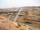 Hite Bridge Hite Bridge
|
|
Crossed the Hite Bridge, and then stopped on the north side for this photo.
|
|
Other articles:
• Utah Highway 95:
at viewpoint across from Hite;
 Hite Bridge from highway overlook. Hite Bridge from highway overlook.
|
|
|
|
Other articles:
• Utah Highway 95:
near Hite;
 Hite from highway overlook. Hite from highway overlook.
|
|
|
|
|
|
From Hite the road goes to Hanksville. I was thinking of staying at an RV Park in Hanksville, or maybe Goblin Valley State Park. However, the skies were very dark, the sand was blowing over the road. I decided to head for Green River, and a motel. Good idea, as lightning was striking Beckwith Plateau as I went by, and it started to rain just as I was unloading the truck. It rained hard for about an hour and a half, and I can still hear the thunder out there. I'm sure glad I'm not out there in the wind, dust, and rain. And, the Wagging Tale Ale can wait.
|
|
Other articles:
• Utah Highway 24:
18000;
 Small butte highlighted by sun through storm clouds. Small butte highlighted by sun through storm clouds.
|
|
|
|
Other articles:
• Utah Highway 24:
along UT Hwy 24;
Locations:
San Rafael Swell.
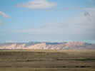
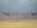 Tilted sediments at southeastern edge of San Rafael Swell Tilted sediments at southeastern edge of San Rafael Swell
|
|
Tilted sediments on southeastern edge of San Rafael Swell in a rain storm.
|
|
|
|
Tomorrow, my plans were to go north on US Hwy 6, making stops at Beckwith Plateau (dirt road), Mounds (dirt road), Miller Canyon (dirt road) and end at Scofield Reservoir (paved road). The forecast is for continued storms in the morning, but clearing in the afternoon. I'll just have to see how the roads are in the morning.
|
|
|
|
Thursday, June 5th
|
|
|
|
It was still raining in the morning, but the forecast was for clearing skies after Noon. After breakfast, I stayed in my room, doing whatever paperwork or computer work would occur to me. That filled about a half hour, and it was still raining lightly. I was looking at the weather data, and Hanksville got 0.18 inch of rain, and Price got 0.40 inch of rain.
|
|
|
|
Across the street is the John Wesley Powell Museum. This Powell was the first recorded person to have followed the Green and Colorado River from Green River, Wyoming, through the Grand Canyon, to the Virgin River in Nevada. They had a nice video, some pretty good displays, and some of the old boats that people took through the canyon. There was also a River Runner's Hall of Fame showing various people whose innovations made travel through the river easier or safer.
|
|
|
|
Having stretched out the museum to the maximum, I went to the Gas'n'Go for some gas, then headed north on US Hwy 6 for Price. Beckwith Plateau was still under a few clouds as I went by (#1). The rain had stopped by this time, and there were patches of sun. Along the way I stopped briefly to test one dirt road. Parts of it were OK, but there were long stretches of mud. At Woodside was the turnoff for Beckwith Plateau. Somone else had already traversed that road and made a mess of it, so I decided that it would have to be saved for another trip.
|
|
Other articles:
• U. S. Highway 6:
just north of I-70;
 Beckwith Plateau as seen from the south, near Green River, Utah Beckwith Plateau as seen from the south, near Green River, Utah
|
|
Just after starting up US Highway 6 from Interstate 70, I stopped at a small rise for some photography.
|
|
Other articles:
• U. S. Highway 6:
near Interstate 70;
Locations:
San Rafael Swell.
 San Rafael Swell, southeast edge, in the morning sun. San Rafael Swell, southeast edge, in the morning sun.
|
|
View of the southeast edge of the San Rafael Swell.
|
|
Other articles:
• U. S. Highway 6:
at EM401;
 Green River Cut-Off Road Green River Cut-Off Road
|
|
Stopped to look at the Green River Cut-Off (EM401). Even drove a little bit of it that was gravelled. As soon as the gravel ran out, though, the road was too muddy for me to continue. In the distance you can see the top of Cedar Mountain, where I will be tomorrow.
|
|
|
|
In the eastern Mojave the roads are mostly made of granite sands, or of limestone gravel. They tend not to get muddy with just the little bit of rain that fell last night. In this part of Utah, though, the roads have major portions made of clay and coal that make a sticky, gooey mess when wet.
|
|
Other articles:
• U. S. Highway 6:
in Woodside;
 Profile of Beckwith Plateau seen from Woodside, Utah Profile of Beckwith Plateau seen from Woodside, Utah
|
|
|
|
|
|
Continued north towards Mounds. I got to one turnoff, and was scared off by the Impassible During Storm sign. The second turnoff was blocked by construction equipment as another lane is being added to this part of US Highway 6. The map showed another little road heading back toward Mounds from Wellington. While I was checking it out, someone blew by in a little Toyota, or a Honda, and went speeding down that road. I followed. Had to traverse a few muddy areas, but eventually arrived at Mounds. Mounds is not a place where Frasera albomarginata occurs. It is open grassland. To be fair, Marcus E. Jones' description for his collection location was "near Mounds." He didn't day how near. Across the tracks were some Junipers, so I drove over there, across the muddy top of a small earthen dam, to see what I could find. The habitat just did not look right over here, just too much grass (#2). Returned back across the dam, then back to the highway, and on to Price.
|
|
Other articles:
• U. S. Highway 6:
near Wellington;
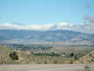 Wellington, Utah, from the east. Wellington, Utah, from the east.
|
|
View of Wellington, Utah, from beside US Highway 6.
|
|
Locations:
Mounds.
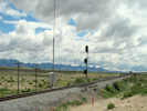 Mounds, Utah, on the Union Pacific Railroad. Mounds, Utah, on the Union Pacific Railroad.
|
|
View of Mounds station on the Union Pacific Railroad.
|
|
Other articles:
• Frasera albomarginata:
near Mounds;
Locations:
Mounds.
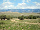 General view of Mounds, Utah General view of Mounds, Utah
|
|
General view of Mounds. The Mounds station on the Union Pacific is at the railroad in the middle ground.
|
|
|
|
In Price I had lunch in the main city park. Adjacent to the park was the city pool with one of those wave making machines. The machine makes a very low frequency heavy vibration that I was not aware of at first, but after a while it gets very irritating.
|
|
|
|
From Price I drove up the canyon past Helper and then turned on the highway to Scofield. My objective here was another Marcus E. Jones collection, this one in "Miller Canyon." I found Miller Canyon, but it was locked tight. The habitat doesn't look right either. It's up in the higher elevations where sagebrush gives was to aspens.
|
|
Other articles:
• U. S. Highway 6:
at south side of Helper;
Locations:
Helper.
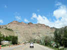 Coming into Helper, Utah, on US Highway 6 Coming into Helper, Utah, on US Highway 6
|
|
|
|
Other articles:
• UT Highway 96:
north of Scofield Reservoir;
Locations:
Scofield Reservoir.
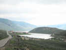 North end of Scofield Reservoir. North end of Scofield Reservoir.
|
|
|
|
Other articles:
• UT Highway 96:
north of Scofield Reservoir;
Locations:
Scofield Reservoir.
North end of Scofield Reservoir.
|
|
Entering Helper on US Highway 6.
|
|
Other articles:
• UT Highway 96:
in Scofield;
Locations:
Scofield.
 Interpretive Display in Scofield Interpretive Display in Scofield
|
|
|
Scofield: One of Utah's First Coal Towns
|
|
Founded in 1879 -- a few years after coal was discovered in Pleasant Valley, Scofield was one of the earliest coal mining towns in Utah. With a number of mines in the vicinity providing employment, Scofield boasted nearly 2,000 citizens in its heydey. Miners and their families also lived in surrounding communities.
|
|
Scofield was the center of mining activity in Pleasant Valley from 1879 until the 1920s. After that, mining activity dwindled, and the town's population declined to only a few hundred. Mining in the area has made a comeback, possible leading to a re-birth of this picturesque high-county community.
|
|
|
Other articles:
• UT Highway 96:
near Scofield;
 Interpretive Display about the Winter Quarters Mine Disaster Interpretive Display about the Winter Quarters Mine Disaster
|
|
|
Winter Quarters: Portrait of a Disaster
|
|
Located up a canyon west of here, Winter Quarters was
a small mining community founded about the same time
as Scofield. At 10:25 a. m. on May 1, 1900, miners
outside shaft No. 4 of the Winter Quarters Mine heard
a dull thud. Experienced miners knew there had been an
explosion. Working in coal dust sometimes ankle-deep,
199 of the 312 men inside the mine were quickly
overcome by lethal gas produced when the dust was
ignited by the explosion.
|
|
The Winter Quarters tradegy was the deadliest coal
mine accident in U. S. history to that time. It left
107 widows, and 268 children fatherless, affecting
virtually every family in Winter Quarters and
Scofield. In spite of the disaster, the burning
portion of the mine was sealed off and, after
appropriate condolences to the families, surviving
miners went back to work. The mines produced for
another thirty years.
|
|
|
Other articles:
• UT Highway 96:
in Scofield;
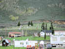 Scofield Cemetary Scofield Cemetary
|
|
Scofield Cemetary across town.
|
|
Other articles:
• Field Notes:
24-Feb-09 at CAS;
• Frasera albomarginata:
near Scofield Res.;
• UT Highway 96:
at Long Canyon Road;
Locations:
Miller Canyon.
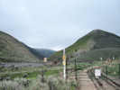 Entrance to Miller Canyon. Entrance to Miller Canyon.
|
|
|
|
|
|
This makes four Marcus E. Jones collections that have something unusual (suspect?) about the location; the collections at Mounds and Scofield, a collection said to be from near Parker, AZ, and one from northern Elko County, Nevada. I think I need to do some more research on where Jones collected, by putting together the series of collections made on adjacent dates.
|
|
|
|
Regardless, I continued into the semi-ghost town of Scofield. It's pretty ramshackle, with a new or nicely cared-for house here and there. I found the memorial plaques for the Winter Quarters mine disaster that Utah Philips talked and sang about on his CD with Ani DiFranco. Then I returned back down the canyon to Helper.
|
|
Other articles:
• U. S. Highway 6:
at Helper;
Locations:
Helper.
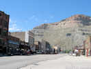 Main Street, Helper, Utah Main Street, Helper, Utah
|
|
In Helper (#3), a long-time coal mining and railroad town, is the Western Railroad and Mining Museum. It occupies four stories, well actually three stories and the basement of an old hotel in Helper. There are also numerous pieces of mining equipment on display outside the building. This is a privately-funded museum, but it's one of the better ones, for the extensive collections.
|
|
|
|
After leaving Helper, it was time to find a place to stay for the night. I settled at Huntington Reservoir State Park, a nicely kept campground, picnic ground, boat ramp, and swimming beach. I only did the camping part, no swimming as it was very windy, and quite cool.
|
|
|
|
Friday June 6th
|
|
Other articles:
• Utah Highway 10:
north of Huntington;
Locations:
Huntington Lake.
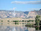 View across Huntington Reservoir in the early morning. View across Huntington Reservoir in the early morning.
|
|
This morning was clear and calm. Across the Huntington Reservoir was a pretty view with a coal-fired power plant (#4); another reminder that central Utah is coal country, something that the local talk station, KOAL, won't let you forget.
|
|
Other articles:
• EM206:
on Cedar Mountain;
Locations:
San Rafael Swell.
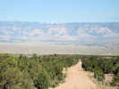 View west off of Cedar Mountain. View west off of Cedar Mountain.
|
|
After leaving Huntington Reservoir, I headed straight east for a place called Cedar Mesa. Cedar Mesa is also west of there I was yesterday, so I am kind of zig-zagging through this area called the San Rafael Swell. Drove 18 miles to the top of the mesa, collecting beautiful views, but nothing else. On the way back down, though, I spied some likely Frasera albomarginata habitat, and sure enough there it was.
|
|
Literature Cited:
- Bureau of Land Management, 2006.
Other articles:
• EM206:
at Overlook;
Locations:
Point of Cedar Mountain.
San Rafael Swell.
|
|
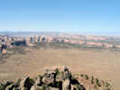
View to south of San Rafael Swell from Cedar Mountain Overlook |
View from Overlook.
|
|
Other articles:
• EM206:
at Cedar Mountain Overlook;
Locations:
Beckwith Plateau.
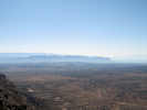 Beckwith Plateau from Cedar Mountain Overlook Beckwith Plateau from Cedar Mountain Overlook
|
|
View of Beckwith Plateau to the southeast from Cedar Mountain Overlook.
|
|
Literature Cited:
- Bureau of Land Management, 2006.
|
|
This is a new collection locality in my list of places where S. a. is found. While I was at it, I collected other plants growing with the S. a., Caulanthus (wild cabbage), Physaria (twinpod), Penstemon, Ipomopsis (Skyrocket), an Oenothera (Evening Primrose) and a couple of composites.
|
|
Other articles:
• EM206:
on Cedar Mountain;
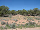 Frasera albomarginata habitat. Frasera albomarginata habitat.
|
|
|
|
Other articles:
• EM206:
near Wimmer Flat;
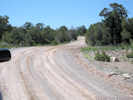 Up the road from the Frasera albomarginata locality. Up the road from the Frasera albomarginata locality.
|
|
|
|
Other articles:
• Frasera albomarginata:
on Cedar Mountain;
• EM206:
near the south end of Wimmer Flat;
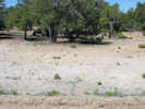 Frasera albomarginata on Cedar Mountain Frasera albomarginata on Cedar Mountain
|
|
Habitat south of the road. There is a Frasera albomarginata growing in the road berm in center foreground.
|
|
Other articles:
• EM206:
near the south end of Wimmer Flat;
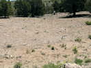 Frasera albomarginata on Cedar Mountain Frasera albomarginata on Cedar Mountain
|
|
Habitat north of the road.
|
|
Other articles:
• Frasera albomarginata:
on Cedar Mountain;
• EM206:
near Wimmer Flat;
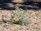 Frasera albomarginata on Cedar Mountain Frasera albomarginata on Cedar Mountain
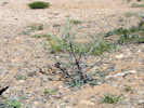 Frasera albomarginata on Cedar Mountain Frasera albomarginata on Cedar Mountain
|
534
|
534 Frasera albomarginata
|
|
Other articles:
• EM206:
near Wimmer Flat;
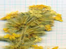 Collection No. 535, Cryptantha, at Wimmer Flat on San Rafael Swell, Utah Collection No. 535, Cryptantha, at Wimmer Flat on San Rafael Swell, Utah
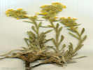 Coll. No. 535, Cryptantha Coll. No. 535, Cryptantha
|
535
|
Yellow Cryptantha.
Wimmer Flat, Emery County, Utah. On Cedar Mountain, northern San Rafael Swell, at south edge of Wimmer Flat, along Emery County Route 206, 9.1 miles east of intersection of EM 206 and EM215, 39.2206°N, 110.6788°W. WGS1984 Elev. 2191 m. Perennial. Growing with Frasera albomarginata Boraginaceae
Coll. No. 535, keyed 24 Jan 2013, characters observed:
Perennial, to 20 cm., short straight appressed hairs, longer pustular hairs;
Leaves, 5 cm., oblanceolate, entire, pustular hairy on adaxial surface only;
Inflorescence subcapitate, 4 cm.;
Calyx lobes 5, 8 mm., short appressed white, long yellow pustular;
Corolla tube elongate, surpassing calyx, 9 mm. + lobes (5) 2.5 mm. = 11.5 mm., throat with intruded appendages;
Style 9 mm., from top of ovary;
Stigma 1, sort of a muffin-top shape;
Stamens 5, included, 2 mm.;
Filaments fused to corolla tube;
Nutlets rugose (?), not developed well enough to key;
Keyed in Welch, et al., 1993.
|
|
Other articles:
• EM206:
near Wimmer Flat;
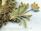 Coll. No. 536, Tetraneuris acaulis var. arizonica Coll. No. 536, Tetraneuris acaulis var. arizonica
 Coll. No. 536, Tetraneuris acaulis var. arizonica Coll. No. 536, Tetraneuris acaulis var. arizonica
|
536
|
Coll. No. 536, Tetraneuris acaulis var. arizonica |
Composite, same as Coll. No. 543.
Tetraneuris acaulis (Pursh) Greene var. arizonica (Greene) K. F. Parker.
Wimmer Flat, Emery County, Utah. on Cedar Mountain, at south edge of Wimmer Flat, along Emery County Route 206, 9.1 miles east of intersection of EM 206 and EM215, 29 km east of Castle Dale, Utah. 39.2206°N, 110.6788°W. WGS1984 Elev. 2191 m. with Frasera albomarginata. Characters consistent with var. nana per Welch (1993), which is a synonym for var. arizonica per FNA (vol. 21, 2006).
Coll. No. 536, 6 June 2008, characters observed while keying:
Perennial, caespitose, tap-rooted, scapose, to 5 cm.;
Leaves, 14 mm. × 2.5 mm. wide, linear-oblanceolate, margins entire, both
surfaces hairy and punctate;
Peduncle, 15 mm.;
Inflorescence, solitary heads;
Phyllaries, in 2 ±equal series, 5 mm., hairy;
Rays, blade partially developed, prominent veins becoming visible.
|
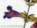 Collection No. 537, Penstemon carnosus, in Wimmer Flat, San Rafael Swell, Utah. Collection No. 537, Penstemon carnosus, in Wimmer Flat, San Rafael Swell, Utah.
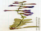 Collection No. 537, Penstemon carnosus, in Wimmer Flat, San Rafael Swell, Utah. Collection No. 537, Penstemon carnosus, in Wimmer Flat, San Rafael Swell, Utah.
|
537
|
Penstemon Pennell. Fleshy Penstemon. on Cedar Mountain, at south edge of Wimmer Flat, along Emery County Route 206, 9.1 miles east of intersection of EM 206 and EM215, 28 km east of Castle Dale, Utah. with Frasera albomarginata. 6/6/2008 Wimmer Flat, Emery County, Utah. (Alameda).
|
 Collection No. 537, Penstemon carnosus, in Wimmer Flat, San Rafael Swell, Utah. Collection No. 537, Penstemon carnosus, in Wimmer Flat, San Rafael Swell, Utah.
|
|
1'. Anthers sacs dehiscing throughout their length
dehiscing from the distal end and remaining indehiscent at the apex
2(1). Anther sacs opening
the full length
the connective indehiscent
Key 2.
|
|
Other articles:
• Glossary:
crisped;
|
|
Key 2.
1'. Corolla not red, some shade of blue, lavender, or pink.
3(1)'. Anthers pubescent on surface
13(3)'. Anthers .. Hardly woolly.
15(13)'. Anthers
straight hairs shorter than the width of the sac
21(15)'. Herbage glabrous or nearly so
not of Unita Basin. --22
22(21)'. Leaf margins not noticeably crisped. -- 23
23(22)'.
anther sacs diverging at nearly 180 degrees, dehiscing fully (but not across the connective) --- leads to P. subglaber which doesnt look correct.
|
 Collection No. 538, Caulanthus crassicaulis, from Wimmer Flat, San Rafael Swell, Utah. Collection No. 538, Caulanthus crassicaulis, from Wimmer Flat, San Rafael Swell, Utah.
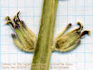 Collection No. 538, Caulanthus crassicaulis, from Wimmer Flat, San Rafael Swell, Utah. Collection No. 538, Caulanthus crassicaulis, from Wimmer Flat, San Rafael Swell, Utah.
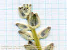 Collection No. 538, Caulanthus crassicaulis, from Wimmer Flat, San Rafael Swell, Utah. Collection No. 538, Caulanthus crassicaulis, from Wimmer Flat, San Rafael Swell, Utah.
|
538
|
Collection No. 538, Caulanthus crassicaulis, from Wimmer Flat, San Rafael Swell, Utah. |
538 Streptanthus
|
 Collection No. 539, Ipomopsis aggregata, in Wimmer Flat, San Rafael Swell, Utah. Collection No. 539, Ipomopsis aggregata, in Wimmer Flat, San Rafael Swell, Utah.
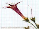 Collection No. 539, Ipomopsis aggregata, in Wimmer Flat, San Rafael Swell, Utah. Collection No. 539, Ipomopsis aggregata, in Wimmer Flat, San Rafael Swell, Utah.
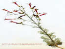 Collection No. 539, Ipomopsis aggregata, in Wimmer Flat, San Rafael Swell, Utah. Collection No. 539, Ipomopsis aggregata, in Wimmer Flat, San Rafael Swell, Utah.
|
539
|
539 Ipomopsis
|
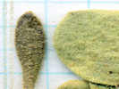 Collection No. 540, Physaria chambersi, from Cedar Mtn, Emery County, Utah Collection No. 540, Physaria chambersi, from Cedar Mtn, Emery County, Utah
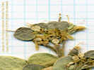 Collection No, 540, Physaria chambersi, from Cedar Mtn, Emery County, Utah Collection No, 540, Physaria chambersi, from Cedar Mtn, Emery County, Utah
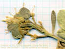 Collection No, 540, Physaria chambersi, from Cedar Mtn, Emery County, Utah Collection No, 540, Physaria chambersi, from Cedar Mtn, Emery County, Utah
|
540
|
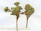
Collection No, 540, Physaria chambersi, from Cedar Mtn, Emery County, Utah |
540 Physaria chambersii var. chambersii Chambers twinpod. Caudex simple (not diagnostic). Basal leaves are entire obovate, cauline leaves are oblanceolate and reduced (not diagnostic). Styles uniformly 2 mm (P. newberryi). Valves when immature tapering to base and obcordate in outline (P. chambersi). Colorado River drainage system (P. acutifolia).
For comparison, look at L Mestman 21 May 1999, Physaria chambersii Rollins var. chambersii UVSC 03774. Don't look at CalPhotos, they look a lot different.
Kimball T. Harper (03-153) 9 May 2003, collected Physaria intermedia (Maguire) O'Kane & Al-Shehbaz, "Watson's bladderpod" UVSC 08234 at the nearby Cedar Rim Overlook, at BLM recreation site. However, this plant is constructed differently with longer petioles and much narrower leaves.
|
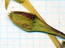 Collection No. 541, Calylophus lavandulifolius, in Wimmer Flat, San Rafael Swell, Utah. Collection No. 541, Calylophus lavandulifolius, in Wimmer Flat, San Rafael Swell, Utah.
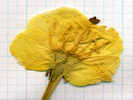 Collection No. 541, Calylophus lavandulifolius, in Wimmer Flat, San Rafael Swell, Utah. Collection No. 541, Calylophus lavandulifolius, in Wimmer Flat, San Rafael Swell, Utah.
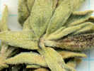 Collection No. 541, Calylophus lavandulifolius, in Wimmer Flat, San Rafael Swell, Utah. Collection No. 541, Calylophus lavandulifolius, in Wimmer Flat, San Rafael Swell, Utah.
|
541
|
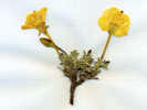
Collection No. 541, Calylophus lavandulifolius, in Wimmer Flat, San Rafael Swell, Utah. |
Coll. No. 541, Calylophus lavandulifolius |
Collection No. 541, Calylophus lavandulifolius, in Wimmer Flat, San Rafael Swell, Utah. |
Calylophus lavandulifolius (T. & G.) Raven. Lavender-Leaf Suncup.
Wimmer Flat, Emery County, Utah. On Cedar Mountain, at south edge of Wimmer Flat, along Emery County Route 206, 9.1 miles east of intersection of EM 206 and EM215, 18 miles by air east of Castle Dale, Utah. 39.2206°N, 110.6788°W. WGS 1984. Elev. 2191 m. Growing with Frasera albomarginata.
Coll. No. 541, keyed 11 Dec 2012, characters observed:
Perennial, branched caudex;
Stem pilose;
Stipules 0;
Leaves 6 mm x 2-3 mm wide, elliptical to oblanceolate, entire, pilose;
Sepals 4, reflexed;
Hypantheum 3.5 cm.;
Petals 4, 2 cm., yellow;
Stamens 8;
Ovary tip projection 0;
Stigma 4-lobed;
Fruit: n/a;
Seeds n/a.
|
Other articles:
• Glossary:
decurrent;
malpigian hairs;
 Collection No. 542, Astragalus kentrophyta, on Wimmer Flat, San Rafael Swell, Utah. Collection No. 542, Astragalus kentrophyta, on Wimmer Flat, San Rafael Swell, Utah.
 Collection No. 542, Astragalus kentrophyta, on Wimmer Flat, San Rafael Swell, Utah. Collection No. 542, Astragalus kentrophyta, on Wimmer Flat, San Rafael Swell, Utah.
|
542
|
Collection No. 542, Astragalus kentrophyta, on Wimmer Flat, San Rafael Swell, Utah. |
Astragalus kentrophyta A. Gray var. tegetarius (S. Watson) Dorn. Mat Milkvetch or Mountain Kentrophyta.
Mat-forming, leaflets spinulose, and decurrent along rachis. No sign of Malphigian hairs.
| |
Other articles:
• EM206:
near Wimmer Flat;
 Collection No. 543, Tetraneuris acaulis var. arizonica on Cedar Mountain. Collection No. 543, Tetraneuris acaulis var. arizonica on Cedar Mountain.
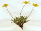 Collection No. 543, Tetraneuris acaulis var. arizonica on Cedar Mountain. Collection No. 543, Tetraneuris acaulis var. arizonica on Cedar Mountain.
|
543
|
Tetraneuris acaulis (Pursh) Greene var. arizonica (Greene) K. F. Parker.
Wimmer Flat, Emery County, Utah. On Cedar Mountain, at south edge of Wimmer Flat, along Emery County Route 206, 9.1 miles east of intersection of EM 206 and EM215, 18 air miles east of Castle Dale, Utah, 39.2206°N, 110.6788°W. WGS1984 Elev. 2191 m. with Frasera albomarginata.
Coll. No. 543, 6 June 2008, characters observed while keying:
Perennial, caespitose, scapose, to 13 cm.;
Leaves, 20 mm., linear-oblanceolate, glandular-punctate, ±long-hairy;
Inflorescence of both ray and disc flowers, scape 8 cm., heads solitary;
Phyllaries in 2 ±equal series, 5 mm., villous-pillose, margins scarious;
Ray flowers, yellow, blade 9 mm., reflexed, 3-4-tipped, veins prominent;
Pappus of scales, 4, translucent;
Achene hairy;
West of continental divide.
| |
|
|
544 Frasera albomarginata
| |
Other articles:
• EM206:
near Wimmer Flat;
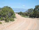 Down the road from the Frasera albomarginata locality. Down the road from the Frasera albomarginata locality.
|
|
View down the hill from Frasera albomarginata locality.
|
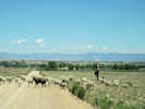 Sheepherder in Castle Valley. Sheepherder in Castle Valley.
|
|
On the road off the mesa, I can across this sheep herder with his three dogs (#5).
| |
Other articles:
• Utah Highway 10:
at Castle Dale;
Locations:
Castle Dale.
|
|
Back off the mesa, I stopped for the daily daily supply in Castle Dale. As I was coming into town, there looked to be a grocery store off to the left, but I wasn't sure, because the sign on its facade was missing. So I drove through Castle Dale and, upon coming out the other end, decided that it must have been the only market in town. Turned around and headed back through town, and pulled into the market. I had lunch at the city park and then walked over to the Museum of the San Rafael. It was an interesting museum, had a lot of paleontology, because of the dinosaur digs nearby, and a few displays showing animals grouped by their life zones. But that was about all.
| |
|
|
Continued south and then took the Moore Cutoff up to I-70 on the San Rafael Swell. Stopped a couple of times to look for S. a. but didn't find it. However, at the Ghost Rock Rest Area, the little plant was growing in all the disturbed areas around the parking lot. It seems to like sand, when it has Calcium Carbonate, and it seems to do well in disturbed areas.
| |
Other articles:
• Moore Cut Off Road:
near Molen Reef;
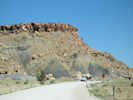 Along Moore Cut Off Road Along Moore Cut Off Road
|
|
| |
Other articles:
• Moore Cut Off Road:
about mid way;
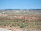 View east on Moore Cut Off Road. View east on Moore Cut Off Road.
|
|
| |
Other articles:
• Moore Cut Off Road:
near US I-70;
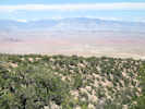 View west on Moore Cut Off Road. View west on Moore Cut Off Road.
|
|
| |
Other articles:
• Moore Cut Off Road:
near US I-70;
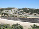 US Interstate 70 at Exit 116, the "Moore Cut Off Road" US Interstate 70 at Exit 116, the "Moore Cut Off Road"
|
|
| |
Other articles:
• Frasera albomarginata:
at Ghost Rock;
• Interstate 70:
at Ghost Rock;
 Curbside habitat of Frasera albomarginata at Ghost Rock Rest Stop Curbside habitat of Frasera albomarginata at Ghost Rock Rest Stop
|
|
Frasera albomarginata was growing right at curb side a the eastbound Ghost Rock Rest Stop.
| |
|
545
|
545 Frasera albomarginata, fairly common, short stature, open area 38.86219, -110.81161
| |
Other articles:
• Frasera albomarginata:
at Ghost Rock;
 Frasera albomarginata habitat at Ghost Rock Frasera albomarginata habitat at Ghost Rock
|
545
|
Frasera albomarginata habitat below the outhouse.
| |
Other articles:
• Interstate 70:
at Ghost Rock Rest Stop;
east of Ghost Rock;
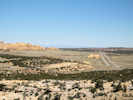 US Interstate 70 on San Rafael Swell east of Ghost Rock Rest Stop US Interstate 70 on San Rafael Swell east of Ghost Rock Rest Stop
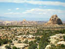 View north from Ghost Rock Rest Stop View north from Ghost Rock Rest Stop
|
|
Anyway, from the eastbound rest stop, I had to go down the freeway 5 miles or so to the next interchange and then return to the west bound rest stop, where I found the species again.
| |
|
|
By now, it's time to think about where I would like to spend the night. I thought Capitol Reef National Park.
| |
|
|
So I drive I-70 west to Utah 72, south to Loa, got gas,
| |
Other articles:
• Utah Highway 72:
in Pleasant Valley;
 Paradise Valley from the north Paradise Valley from the north
|
|
| |
Other articles:
• Utah Highway 72:
in Pleasant Valley;
Paradise Valley from the north
|
|
| |
Other articles:
• Utah Highway 72:
at south end of Pleasant Valley;
 Paradise Valley from the south Paradise Valley from the south
|
|
| |
Other articles:
• Utah Highway 72:
along summit of road;
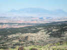 View southeast into South Desert and Capitol Reef National Park. View southeast into South Desert and Capitol Reef National Park.
|
|
| |
|
|
and then east to Capitol Reef, where the campground was full. Not deterred, I returned a few miles west to the Best Western where I am for the night.
| |
|
|
Saturday, June 7th.
| |
|
|
Last night at the Best Western was a group of French motorcyclists. I counted 24 people, but there may have been more. They flew to Las Vegas, rented Harley's and a couple of SUVs for support vehicles, and are touring the southwest, ending up back in Las Vegas after two weeks. A very nice group, and seemed to be having a good time, and they were picking up all the leather with embroidered wings, etc.
| |
|
|
This morning I started at Capitol Reef National Park, where I talked with the Deputy Chief for a time. He told me a couple of places to go, making a kind of circle down the park
| |
Other articles:
• Road 1670:
70000;
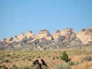 View of top side of Capitol Reef. View of top side of Capitol Reef.
|
|
| |
Other articles:
• Road 1670:
near Oyster Shell Reef;
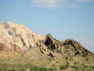 Oyster Shell Reef on top of the Waterpocket Fold. Oyster Shell Reef on top of the Waterpocket Fold.
|
|
| |
Other articles:
• Road 1668 "Burr Trail":
on the switchbacks;
at Notom Rd;
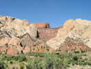 Switchbacks on the Burr Trail Switchbacks on the Burr Trail
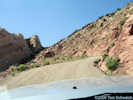 Switchback on the Burr Trail Road Switchback on the Burr Trail Road
|
|
and then across the Burr Cattle Trail to Boulder City. I followed those directions. It was not too long of a ride. In the middle was a really steep set of switchbacks in the road, climbing up the back side of the Waterpocket monocline
| |
|
|
Pretty scary, but worth it because, just past the top were some Frasera albomarginata.
| |
Other articles:
• Road 1668 "Burr Trail":
above Waterpocket Fold;
 Landscape above the Waterpocket Fold Landscape above the Waterpocket Fold
|
|
View of landscape above the Waterpocket Fold.
| |
Other articles:
• Road 1668 "Burr Trail":
in Capitol Reef Nat'l Park;
 One of the few Frasera albomarginata that had been eaten. One of the few Frasera albomarginata that had been eaten.
|
|
One of the few Frasera albomarginata that had been eaten.
| |
Other articles:
• Frasera albomarginata:
near Capitol Reef;
• Road 1668 "Burr Trail":
in Capitol Reef Nat'l Park;
 Frasera albomarginata habitat along the Burr Trail Road Frasera albomarginata habitat along the Burr Trail Road
|
|
Habitat.
| |
Other articles:
• Frasera albomarginata:
near Capitol Reef;
• Road 1668 "Burr Trail":
in Capitol Reef National Park;
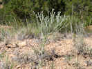 Frasera albomarginata along the Burr Trail Road. Frasera albomarginata along the Burr Trail Road.
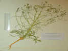 Collection No. 546, Frasera albomarginata, above Capitol Reef, Utah. Collection No. 546, Frasera albomarginata, above Capitol Reef, Utah.
|
546
|
They were all along the roadside for the next three or four miles. When I came to the end of the park, I collected one. Unfortunately, though, right around the next bend of the road, was a sign for the Escalante-Grand Staircase National Monument. This national park was one of Bill Clinton's last acts while in office. So, now I have to figure out what to do with my little specimen. I couldn't very well stick it back in the ground. So, I decided to keep it with me, and maybe make a label with some vague location reference.
| |
Other articles:
• Road 1668 "Burr Trail":
near Capitol Reef national Park;
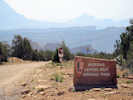 Burr Trail Road entrance to Capitol Reef National Park Burr Trail Road entrance to Capitol Reef National Park
|
|
| |
Other articles:
• Road 1668 "Burr Trail":
in the seam between parks;
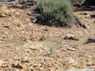 Frasera albomarginata habitat Frasera albomarginata habitat
|
546
|
#546 Frasera albomarginata, four seen just outside Capitol Reef National Monument, 37.86323, -111.07716, 2010 m.
| |
Other articles:
• Road 1668 "Burr Trail":
near Grand Staircase-Escalante National Monument;
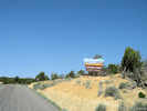 Entrance to Grand Staircase - Escalante National Monument Entrance to Grand Staircase - Escalante National Monument
|
|
| |
Other articles:
• Road 1668 "Burr Trail":
inside park border;
 Interpretive sign for the Burr Trail Road Interpretive sign for the Burr Trail Road
|
|
Interpretive sign for the Burr Trail Road.
| |
Other articles:
• Road 1668 "Burr Trail":
near park border;
 Interpretive sign for Grand Staircase - Escalante National Monument Interpretive sign for Grand Staircase - Escalante National Monument
|
|
Interpretive sign for Grand Staircase - Escalante National Monument.
| |
Other articles:
• Road 1668 "Burr Trail":
above Long Canyon;
 View of Long Canyon from the lower end View of Long Canyon from the lower end
|
|
View of Long Canyon from the lower end.
| |
Other articles:
• Road 1668 "Burr Trail":
near the Circle Cliffs;
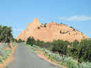 View along the Burr Trail Road View along the Burr Trail Road
|
|
| |
|
|
From there it was a pretty drive over to Boulder City, and then south to Escalante. I came straight to this park, hoping to find a camp site on a Saturday afternoon. There were a few camp sites left, and the one I have is pretty good. After lunch, I determined to head south along the Straight Cliffs (#8) for Left Hand Collett Canyon. This is a place where someone else collected Frasera albomarginata.
| |
Other articles:
• Utah Highway 12:
south of Boulder;
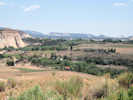 View of Boulder from south. View of Boulder from south.
|
|
| |
Other articles:
• Utah Highway 12:
near Calf Creek;
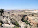 Calf Creek from UT Hwy 12. Calf Creek from UT Hwy 12.
|
|
| |
Other articles:
• Utah Highway 12:
south of Boulder;
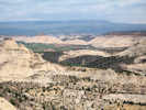 View north toward Boulder View north toward Boulder
|
|
| |
Other articles:
• Utah Highway 12:
near Escalante;
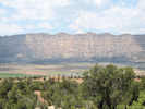 View of the Straight Cliffs near Escalante View of the Straight Cliffs near Escalante
|
|
| |
|
|
Along the way, right close to Escalante, I found some that must be very near to where Arthur and Neal Holmgren collected the plant.
| |
Other articles:
• Frasera albomarginata:
near Escalante;
• Hole-in-the-Rock Road:
near UT Hwy 12;
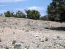 Frasera albomarginata habitat east of Escalante Frasera albomarginata habitat east of Escalante
|
|
| |
Other articles:
• Frasera albomarginata:
near Escalante;
• Hole-in-the-Rock Road:
near UT Hwy 12;
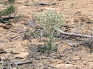 Frasera albomarginata east of Escalante Frasera albomarginata east of Escalante
|
|
| |
Other articles:
• Hole-in-the-Rock Road:
near Harris Wash Road;
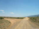 Harris Wash Road junction Harris Wash Road junction
|
|
Junction of Harris Wash Road with Hole in the Rock Road.
| |
Other articles:
• Hole-in-the-Rock Road:
near Left Hand Collet Cyn;
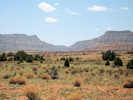 Left Hand Collet Canyon from Hole in the Rock Road Left Hand Collet Canyon from Hole in the Rock Road
|
|
View of Left Hand Collet Canyon from Hole in the Rock Road.
| |
Other articles:
• Collet Canyon Road:
near the mouth of the canyon;
 Left Hand Collet Canyon near its mouth. Left Hand Collet Canyon near its mouth.
|
|
| |
Other articles:
• Collet Canyon Road:
in Left Hand Collet Canyon;
Locations:
Left Hand Collet Canyon.
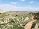 Looking down Left Hand Collet Canyon Looking down Left Hand Collet Canyon
|
|
Anyway, I got to Left Hand Collett Canyon only to find it signed "Impassable, Washed Out." I went up the canyon as far as I could, wasn't really very far, but could not find my little plant.
| |
Other articles:
• Collet Canyon Road:
in lower Left Hand Collet Cyn;
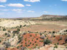 Small cove in lower Left Hand Collet Canyon Small cove in lower Left Hand Collet Canyon
|
|
| |
Other articles:
• Collet Canyon Road:
in lower Left Hand Collet Cyn;
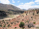 View of lower Left Hand Collet Canyon View of lower Left Hand Collet Canyon
|
|
| |
Other articles:
• Utah Highway 12:
near Hole-in-the-Rock Rd;
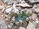 Physaria chambersi in Left Hand Collet Canyon Physaria chambersi in Left Hand Collet Canyon
 Hole-in-the-Rock Scenic Byway Hole-in-the-Rock Scenic Byway
|
|
|
Hole-in-the-Rock Scenic Byway
|
|
It took pioneers 6 weeks to travel this route, but
today you can drive in approsimately 6 hours. Drive
the forgotten route to famous Hole-in-the-Rock located
on the cliffs high above Lake Powell.
|
|
An Impossible Trek
|
|
In 1879 the Mormon Church formed the San Juan Mission
to colonize southeastern Utah. Over 200 people
responded to the call and gathered in Escalante to
pioneer a direct route to the San Juan Country.
|
|
With 83 wagons and hundreds of head of livestock they
traveled over seemingly impassible terrain to fulfill
their mission. The most notable feat was the cutting
of a road down Hole-in-the-Rock a narrow notch in the
1,200 foot cliff above the Colorado River.
|
|
Building the road down Hole-in-the-Rock required six
weeks. The entire 270 mile journey, which ended at
present day Bluff, Utah, took six months.
|
|
Hole-in-the-Rock Scenic Backway takes you into a very
remote and beautiful area. Because of the remoteness,
travellers are advised to take plenty of water and a
full tank of gas. This road may be impassable when
wet. If you are unsure, please check with the
Escalante Interagency Office before proceeding.
|
|
55 miles to Hole-in-the-Rock, high-clearance vehicle
required last 5 miles.
|
| |
Other articles:
• Utah Highway 12:
near Hole-in-the-Rock Rd;
Physaria chambersi in Left Hand Collet Canyon
Hole-in-the-Rock Scenic Byway
|
|
Physaria in Left Hand Collet Canyon.
| |
Other articles:
• Utah Highway 12:
at Escalante State Park;
Locations:
Escalante Petrified Forest State Park.
 Entrance to Escalante Petrified Forest State Park Entrance to Escalante Petrified Forest State Park
|
|
From Left Hand Collett Canyon, I went back to Escalante, to the market for some supplies, then back to camp for some relaxation. I am reading a book that Cheryl bought for me, called "The Corpse Walker, Real-Life Stories, China from the Bottom-Up" by Liao Yiwu. THe book is 27 stories about people in China who didn't fare very well in China during the last 50 years of changes. The author, himself, was jailed for a time because of his counterrevolutionary writing. Anyway, it's good reading, and the stories are interesting.
| |
Other articles:
• Utah Highway 12:
near Wide Hollow Reservoir;
Locations:
Wide Hollow Reservoir.
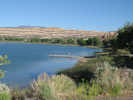 Wide Hollow Reservoir near Escalante Petrified Forest State Park. Wide Hollow Reservoir near Escalante Petrified Forest State Park.
|
|
This postcard is coming to you from Escalante Petrified Forest State Park. I was very surprised to find wireless Internet access here, so I am using the opportunity to send an e-postcard.
| |
|
|
Sunday, June 8th
| |
|
|
Today, I started at Escalante Petrified Forest National Park. This is a nice little park on a reservoir(#1), with 22 camp sites, many of them occupied by RVs that came in late in the afternoon. I think there might have been one or two sites that were not used. I ignored the racket my neighbor was making until about 630 AM then got up. He was giving an amazing exhibition of how to do everything you had to do to prepare a 5th Wheel to depart, in double time. I sat outside and ate my granola and drank my coffee, and watched. The 5th Wheel has electrically powered jacks that stabilize it while parked. Those had to be stowed. There was a steel tripod to support the hitch. Then he backed his truck under the hitch. After securing that, the side extensions were pulled in my electric motors. It was quite a show. Of course, he was pulling out at 700 AM while I was still eating granola and slurping my coffee.
| |
|
|
The show over, I made a less-strenuous effort of getting myself ready to go. Pretty much every day, I organize the cab of the truck. I fold the maps to show the area I plan to drive that day. For a lot of this trip, the AAA Indian Country map has been just perfect, showing enough detail, but being manageable in size. I also use the DeLorme atlases. They show more detail, although, they have to be taken with more than a grain of salt. That's because the little red lines might be a road, or might be a place where there was a road at one time.
| |
Other articles:
• Utah Highway 12:
on UT Hwy 12;
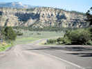 Summit on Utah Highway 12 Summit on Utah Highway 12
|
|
From Escalante, I continued west and stopped for a scenic view of Powell Point (#2). This high point was used by John Wesley Powell as reference point when surveying much of southeast Utah. Also from this scenic view, one can see the cliffs of Bryce Canyon National Park to the west. I continued on to Henrieville, thinking I would get some ice there. But there was no store. In Cannonville was a gas station and a store, but both were closed due to this being Sunday. The market in Escalante was also closed on Sundays. We don't think about things being closed on Sunday much any more.
| |
Other articles:
• Utah Highway 12:
on UT Hwy 12;
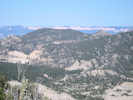 View of the cliffs at Bryce Canyon National Park. View of the cliffs at Bryce Canyon National Park.
|
|
Bryce Canyon National Park in the distance.
| |
Other articles:
• Utah Highway 12:
on UT Hwy12;
Locations:
Powell Point.
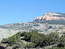 Powell Point from Utah Highway 12 Powell Point from Utah Highway 12
|
|
Interpretive sign at highway viewpoint. |
|
A Landmark in History
|
|
John Wesley Powell ... The name alone invokes thoughts of adventure, bravery,
exploration, and men pitted against
nature. Powell expeditions of 1869-18 on the Green and Colorado Rivers have
sparked the imaginations of readers and
river runners for more than a hundred
years.
|
|
Powell's explorations were more than
adventures. They provided valuablinformation about unmapped regions.
Powell Point was used as a landmark
survey point by the Powell Expedition.
Powell Point dominates the landscape,
rising 10,188 feet above sea level.
|
| |
|
|
Also at Cannonville was the main information center for the Escalante-Grand Staircase National Monument. Although this is a national park, it is managed by the Bureau of Land Management (BLM) instead of the National Park Service. I would imagine there were some politics involved on this issue. I'm just not that familiar with park politics in this region to know what they were.
| |
|
|
I stopped at the information center and took my little Frasera albomarginata binder in, and had a nice conversation with Dave M. The law enforcement ranger was on duty also, but little plants were not in his domain. The law enforcement ranger informed me that Left Hand Collett Canyon was completely washed out, and even if I had continued past the bad spot yesterday, I could not have gone much further. Since it is a county road, he had no idea of when or whether the road might be prepared. Dave, on the other hand, knew right where I had collected Frasera albomarginata yesterday, on some very light-colored sandy limestone, calling it the Carmel Formation. He told me there is an outcrop of the Carmel Formation between Kodachrome Basin State Park and Grosvenor Arch, and maybe I could find Frasera albomarginata there. I plan to pass that way, so I'll check it out.
| |
|
|
I really should have business cards to hand out on this trip. Everyone I talk to asks if I had one. It should have my name, address, e-mail, and web site, with both the common and scientific names of my little plant. Maybe even a little photo of the plant on the back. Anyway, I left that information with Dave, and headed south then east for Kodachrome Basin.
| |
Other articles:
• Cottonwood Canyon Road:
at Kodachrome Basin State Park;
Locations:
Kodachrome Basin State Park.
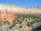 View of Kodachrome Basin View of Kodachrome Basin
|
|
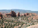
View of Kodachrome Basin |
At Kodachrome Basin State Park, I paid my $6, no senior discount, to ... well, basically, use their outdoor potties. I also did take a little hike to the top of a small butte in the middle of the basin for this photo, but ... mostly, it was to use the outhouse. Nice outhouses, though. I have to say that Utah State Parks, are definitely better than California State Parks. Not sure about Nevada State Parks, as I have just entered Nevada as I write this.
| |
Other articles:
• Cottonwood Canyon Road:
out there somewhere
;
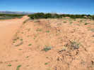 Frasera paniculata growing on the road berm. Frasera paniculata growing on the road berm.
 Frasera paniculata growing on the road berm. Frasera paniculata growing on the road berm.
|
|
Frasera paniculata growing on the road berm. |
Per my plan, headed east for Grosvenor Arch. Found the Carmel Formation, but here is was occupied by sister species to my little plant: Frasera paniculata. This is one of the few other species of desert Frasera. There are lots of other Frasera that are found in more moist areas. The leaves of S. paniculata also have white margins, but they are larger and shaped more like a dagger.
| |
Other articles:
• Cottonwood Canyon Road:
along the road;
 View north from Cottonwood Canyon Road View north from Cottonwood Canyon Road
|
|
View north from the road. I think the reef is Wiggler Bench.
| |
Other articles:
• Cottonwood Canyon Road:
at Grosvenor Arch;
Locations:
Grosvenor Arch.
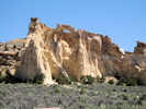 Grosvenor Arch Grosvenor Arch
|
|
Stopped a couple more times, to check the Fraseras along the road, and eventually arrived at Grosvenor Arch. This is a delicate little double arch named for the Grosvenor's of the National Geographic Society. Also used the outhouse again here, in an effort to gain full value from my $6 entrance fee.
| |
Other articles:
• Cottonwood Canyon Road:
in Cads Crotch;
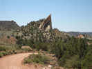 Reef (limb of a monocline) in Cads Crotch Reef (limb of a monocline) in Cads Crotch
|
|
So my next destination is Kanab. I have two choices, go back through Cannonville, past Bryce, and then south through Mt. Carmel, or go straight down Paria Canyon to Highway 89 and then across. I opted for the latter, which is 30 miles of dirt road. The first 15 miles is kind of pretty (#5), being another monocline like the monocline at Capitol Reef National Monument.
| |
Other articles:
• Cottonwood Canyon Road:
in Cads Crotch;
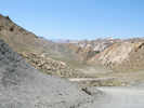 Portion of Cads Crotch Portion of Cads Crotch
|
|
| |
|
|
The last fifteen miles, however, we can do without. The road hugs the side of the widening canyon, past areas of tamarisk removal with huge bulldozer scars.
| |
|
|
And then, when I finally found a cottonwood big enough to sit under and eat lunch, I was beset with those biting midges. So I waved them off and jumped in the cab of the truck. It, of course, was 115° inside from sitting in the sun. Started the engine to run the air conditioning, and decided it was foolish to waste gas just sitting there, so I drove in 1st gear, 5 mph, while eating my sandwich.
| |
|
|
The last 6-7 miles of this road are just plain ugly.
| |
Other articles:
• Cottonwood Canyon Road:
near US Hwy 89;
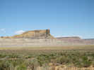 Point of rocks near the south end of Cottonwood Canyon Road. Point of rocks near the south end of Cottonwood Canyon Road.
|
|
Would I do it over again? Maybe not, maybe I would just head back and have lunch at Bryce or Mt. Carmel.
| |
|
|
At Kanab, I was getting pockets of cell phone service. My phone would go from four bars to no bars in a very short distance. Found a pocket of four-bar service, and left a message for Pat and Tom. I'm thinking it will probably be too late to get a campsite at Zion by the time I can get there; maybe I will just go on to St. George. Pat and Tom will be happy to have me arrive a day early.
| |
Other articles:
• Frasera albomarginata:
near Vermilion Cliffs;
|
|
Stopped at Pipe Spring National Monument, where years ago, in the 1930s, someone had collected Frasera albomarginata. Talked to a couple of rangers, and none of them had ever seen the plant. THis facility is jointly operated by the National Park Service and the Kaibab Paiute tribe. Unfortunately, Ben, the really good Paiute plant biologist was off duty this Sunday. Walked around the grounds a little bit, but did not see my plant.
| |
|
|
From Pipe Spring, I continued west on highway 89. There are a few collections from Colorado City and Canaan Mountain, but the area is developed and fenced, and I'm just not comfortable skulking around in people's back yards.
| |
Other articles:
• Frasera albomarginata:
in Pine Vy Mtns;
• Oak Grove Road:
near Oak Grove Campground;
near Oak Grove Campground;
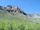 View toward top of Pine Valley Mountains View toward top of Pine Valley Mountains
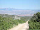 View back down Oak Grove Road. View back down Oak Grove Road.
|
|
One more place to check before going to Pat and Tom's is the USFS campground at Oak Grove. That's a tough 8 mile climb from I-15 west into the Pine Mountains. When I got there, the vegetation was Ponderosa Pine and oaks. Not the right habitat. I bet they collected Frasera albomarginata closer to the highway, down in the red rocks and Pinyon-Juniper forest, and then later weren't really sure where the plant was collected.
| |
|
|
Anyway, a quick trip down the mountain and then to Pat and Tom's, where Pat had saved some dinner for me. After dinner, Pat gave me the tour of St. George. It has grown a lot since Cheryl and I were first there for the 1998 Carl Purpus Centennial. (It's an inside joke. After visiting the eastern Mojave, we went to St. George. While there, I realized that we were in St. George exactly 100 years after Carl Purpus was there. Cheryl will never believe that I didn't really plan it that way.) We had a nice dessert of apple cobbler and ice cream, then got their Wii machine going again to do a little bowling.
| |
|
|
Monday June 9th.
| |
Other articles:
• Mount Trumbull Loop:
near the Arizona State Line;
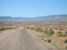 View Mount Trumbull Loop Road from end of River Road. View Mount Trumbull Loop Road from end of River Road.
|
|
This morning, after saying goodbye to Pat and Tom, I headed south on River Road. At the Arizona border, this becomes the Mount Trumbull Loop Road. I wanted to go at least as far as Quail Hill, as it is shown on maps, but is also known as Mokiak Pass and Mokaac Pass.
| |
Other articles:
• Mount Trumbull Loop:
at Mokaac Trail;
 Sign along the Mokaac Trail Sign along the Mokaac Trail
|
|
The first collection of Frasera albomarginata was made by Dr. Edward Palmer in 1870. When Dr. Palmer sent his collections back to the U. S. Herbarium, they were poorly curated, and some information was lost or scrambled. The first collection was made in either "southeast Utah" or "near St. George in southern Utah," depending upon your source. The next known collection was also made by Dr. Palmer, this time in 1877 at "Mokiak Pass, Utah." It's possible that in 1877 he returned to the place he made his collection in 1870 and, therefore, it is possible that Mokiak Pass or Mokaac Pass is the "type locality" of the species. So I wanted to make sure that I visited the site on this trip.
| |
|
|
At the end of River Road, a new road is under construction, approximately parallel to the Arizona-Utah border, and apparently running from I-15 to east of St. George. This is just another sign of the rapid growth of St. George.
| |
Other articles:
• Mount Trumbull Loop:
at Quail Hill;
Locations:
Quail Hill.
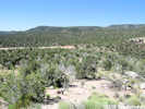 Quail Hill above the Mt Trumbull Loop Road Quail Hill above the Mt Trumbull Loop Road
|
|
The road south is a good gravel and dirt road that begins climbing above Mokaac Wash. At the top of the first hill, Quail Hill, I got out and went looking for Frasera albomarginata.
| |
Other articles:
• Frasera albomarginata:
at Quail Hill;
 Frasera albomarginata growing in tread of old road on Quail Hill, Arizona Frasera albomarginata growing in tread of old road on Quail Hill, Arizona
|
|
I found only one Frasera albomarginata. It happened to be growing in the tire tread of a long disused road. The seed is small and round and, maybe, it rolls to low places. And, maybe, the compaction of the soil excludes other species, thus allowing Frasera albomarginata to grow. Since there was only one rosette, I photographed it, and did not collect.
| |
Other articles:
• Mount Trumbull Loop:
near Mokaac Pass;
• Frasera albomarginata:
near Mokaac Pass;
 Prime Frasera albomarginata habitat near Mokaac Pass. Prime Frasera albomarginata habitat near Mokaac Pass.
|
|
Back in the car, I drove a few more miles, until I saw the little plant growing in the cut bank of the road. Here, there were 30-40 plants, with about 10 blooming. One of them had been stepped upon by a cow. I collected it and one other.
| |
|
547
|
Frasera albomarginata Watson at coordinates (36.81800, -113.55894 WGS 1984).
| |
|
|
I then climbed the hillside above the road looking for other Frasera albomarginata, under the theory that seeds could have been transported downslope. I didn't find any Frasera albomarginata above the road. So, once again, similar to the location near Lowry Ruin, there is Frasera albomarginata growing in the cut bank beside the road but not on the natural slopes above or below the road. I think this species does well in disturbed areas.
| |
Other articles:
• Mount Trumbull Loop:
near Mokaac Pass;
 Looking toward Wolf Hole from Mokaac Pass, Arizona Looking toward Wolf Hole from Mokaac Pass, Arizona
|
|
| |
|
|
I drove a little bit further, to a location called Wolf Hole, before turning around. South of Mokaac Pass the land is more of a plateau than the mountains north of Mokaac Pass.
| |
Other articles:
• Mount Trumbull Loop:
near Quail Hill;
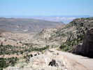 Looking north toward St. George, Utah Looking north toward St. George, Utah
|
|
| |
|
|
Returned through St. George and north on I-15 to New Harmony where I had a sandwich at the highway rest stop (with no biting midges!), then got off I-15 near Enoch and took Utah 130 north.
| |
Other articles:
• Utah Highway 130:
north of Enoch;
Locations:
Black Point.
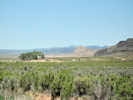 View of farm along Utah Highway 21. View of farm along Utah Highway 21.
|
|
Stopped for a photo of this farm, and valley in the background, just south of Black Point.
| |
Other articles:
• Utah Highway 130:
near county line;
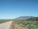 View north on Utah Highway 21 View north on Utah Highway 21
|
|
| |
Other articles:
• Utah Highway 21:
west of Milford;
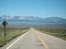 View east to Milford and the Mineral Mountains View east to Milford and the Mineral Mountains
|
|
At Minersville, I turned on to Utah Highway 21 north to Milford. Got gas and ice, then turned west on Utah Hwy 21 for the Nevada border.
| |
|
|
Stopped and looked a couple of times in the Frisco Mountains, but did not see any Frasera albomarginata habitat.
| |
Other articles:
• Utah Highway 21:
near Wah Wah Sprs;
Locations:
Wah Wah Springs.
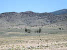 Wah Wah Springs south of the highway. Wah Wah Springs south of the highway.
|
|
Went down into the next valley, then headed up into the Wah Wah Mountains. I had wanted to stop at Wah Wah Spring, but the road was gated. The gate might not have been locked, but I don't like to go thru other people's gates without permission.
| |
Other articles:
• Utah Highway 21:
east of Wah Wah Summit;
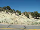 Frasera albomarginata location near Wah Wah Summit. Frasera albomarginata location near Wah Wah Summit.
|
|
Just before the summit of the Wah Wah Mountains, I saw likely looking, white limestone that had been bulldozed around. Sure enough, I saw several Frasera albomarginata from the truck before getting out. Collected a couple here on the east side of the summit. Then stopped at some similar rock on the west side of the summit, where Noel Holmgren had collected years ago. Found Frasera albomarginata there also, but there was no reason to collect it.
| |
Other articles:
• Frasera albomarginata:
16139036;
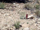 Collection #548 Collection #548
|
548
|
Frasera albomarginata Watson, on white limestone with Pinyons, Junipers, and Cliff Rose, 38.51708, -113.53773.
| |
Other articles:
• Utah Highway 21:
west of Wah Wah Summit;
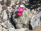 Small Escobaria vivipara in bloom beside Utah Highway 21 Small Escobaria vivipara in bloom beside Utah Highway 21
|
|
I stopped on the west side of the summit for a look. Right beside the road was this pretty little Corypantha vivipara.
| |
Other articles:
• Utah Highway 21:
west of Wah Wah Summit;
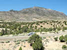 View just west of Wah Wah Summit View just west of Wah Wah Summit
|
|
Walked up on the hill south of the highway.
|
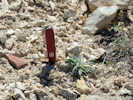 Frasera albomarginata west of Wah Wah Summit. Frasera albomarginata west of Wah Wah Summit.
|
|
Found several Frasera albomarginata here, but did not collect at this location because others have already done so.
| |
Other articles:
• Utah Highway 21:
just west of Wah Wah Summit;
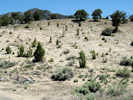 Location west of Wah Wah Summit where Frasera albomarginata was found. Location west of Wah Wah Summit where Frasera albomarginata was found.
|
|
The location look like it was scraped many years ago, perhaps during highway constuction.
| |
Other articles:
• Utah Highway 21:
west side of Pine Valley;
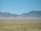 Wah Wah Mountains across Pine Valley, Utah Wah Wah Mountains across Pine Valley, Utah
|
|
From the Wah Wah Mountains, I pretty much drove straight to Great Basin National Park. Took my binder into the information center and mystified all three attendant rangers by asking about Frasera albomarginata. They do caves here: Lehman Caverns, but apparently not plants. We looked at a couple of plant lists, and finally found one that admitted to Frasera albomarginata being in the park at a location called Big Wash, at the southeast corner of the park. But nothing in the north end of the park near the headquarters.
| |
Other articles:
• Utah Highway 21:
near Warm Point;
Locations:
Warm Point.
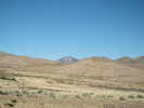 Warm Point Warm Point
|
|
| |
Locations:
Great Basin National Park.
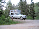 Baker Creek Campground Baker Creek Campground
|
|
Monday night I camped at the Baker Creek campground. Before, when Cheryl and I stayed at Great Basin National Park, we camped at Upper Lehman Creek Campground. So I thought I would try a different campground. I think Baker Creek is a little nicer, being in firs and aspens on the edge of a meadow, so that you can choose a sunny spot or a shady spot. I remember Upper Lehman Creek campground as being in a deep canyon with pines and firs. I was pretty warm when I got here, maybe 84-85, but now at about 800 PM, with the sun down, it has cooled to 65 and I bet will be in the 40s in the morning.
|
 Laundry Laundry
|
|
I did a little laundry. I have plenty of clothes, except for socks. So I rinsed out three pair, and then hung them from a little clothes line inside the camper. They won't dry tonite, but should be good and dry by end of day tomorrow, swinging around on the clothesline in the back of the truck.
| |
|
|
Tuesday June 10th
| |
Locations:
Great Basin National Park.
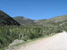 Baker Creek Canyon Baker Creek Canyon
|
|
It was breezy this morning. The best radio station I can get is from Delta, Utah, for which high winds and possible thundershowers are predicted. I expect it will be windy everywhere today. Left Great Basin National Park and turned west on US Hwy 50.
| |
Other articles:
• U. S. Highway 50:
near Gr Basin Natl Park;
Locations:
Wheeler Peak.
 Wheeler Peak in Great Basin National Park, Nevada Wheeler Peak in Great Basin National Park, Nevada
|
|
| |
Other articles:
• Osceola Road:
just west of summit;
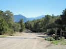 Westerly view from summit of Osceola Road Westerly view from summit of Osceola Road
|
|
Turned off the highway again at Sacramento Pass and took the road that goes through Osceola, an old mining town. I found a couple of places with looked like good Frasera albomarginata habitat, but not the plant. Osceola itself was an ugly junk pile that seems to continue accumulating junk. There was a neat old cemetery nearby. Looked like most of the burials, and probably therefore most of the population, was in the 1905-1920 time frame.
| |
Other articles:
• Osceola Road:
east of Osceola;
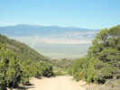 Looking west downhill into Osceola Looking west downhill into Osceola
|
|
| |
Other articles:
• Osceola Road:
near Osceola;
Locations:
Osceola.
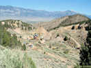 View of Osceola, Nevada View of Osceola, Nevada
|
|
| |
Other articles:
• Osceola Road:
near Osceola;
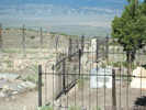 Osceola Cemetery Osceola Cemetery
|
|
| |
Other articles:
• Nevada State Route 894:
Minerva;
Locations:
Minerva.
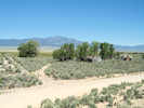 Minerva, Nevada Minerva, Nevada
|
|
Once the road reached the valley floor, I turned south in the Spring Valley, headed for Swallow Canyon, on the west side of the Snake Range. At a former townsite called Minerva, which looks to have been some kind of mill, I found a road headed up toward Swallow Canyon, I followed this road to the mouth of the canyon. Didn't find Frasera albomarginata. However it looks like a better road and habitat is across the canyon. Down at the highway, this road was signed No Trespassing.
| |
Other articles:
• Swallow Canyon Road:
near Minerva;
 Swallow Canyon from Minerva, Nevada Swallow Canyon from Minerva, Nevada
|
|
View of Swallow Canyon from Minerva, Nevada.
| |
Locations:
Swallow Canyon.
 Mouth of Swallow Canyon, Nevada Mouth of Swallow Canyon, Nevada
|
|
Swallow Canyon at the end of the road.
| |
Other articles:
• Swallow Canyon Road:
past end of road;
 Spring Valley from mouth of Swallow Canyon, Nevada Spring Valley from mouth of Swallow Canyon, Nevada
|
|
|
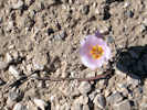 Calochortus in Swallow Canyon, Nevada Calochortus in Swallow Canyon, Nevada
|
|
| |
Other articles:
• Nevada State Route 894:
at Swallow Cyn Access Rd;
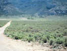 Northern access road to Swallow Canyon, Nevada. Northern access road to Swallow Canyon, Nevada.
|
|
| |
Other articles:
• U. S. Highway 93:
North Spring Point;
Locations:
North Spring Point.
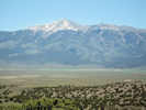 Wheeler Peak in the Snake Range across Spring Valley, Nevada Wheeler Peak in the Snake Range across Spring Valley, Nevada
|
|
From Swallow Canyon, I went north to the highway, and then decided to look at a place called "North Spring Point" right off of Highway 93. Didn't find anything here that looked like the right habitat here, so I can probably cross this place off my list.
| |
Other articles:
• U. S. Highway 93:
near North Spring Point;
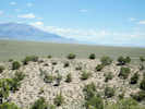 Looking south in Spring Valley from North Spring Point, Nevada Looking south in Spring Valley from North Spring Point, Nevada
|
|
|
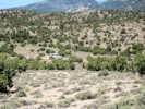 General view of hills near North Spring Point, Nevada General view of hills near North Spring Point, Nevada
|
|
| |
Other articles:
• U. S. Highway 50:
near Connors Pass;
Locations:
Connors Pass.
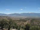 View of Snake Range from Connors Pass, Nevada View of Snake Range from Connors Pass, Nevada
|
|
Back on US Highway 50, the road climbs to the top of Connors Pass. Here I turned off the highway and followed a good dirt road that I learned goes to some microwave towers.
| |
Other articles:
• Frasera albomarginata:
on Connors Pass;
 Frasera albomarginata near Connors Pass Frasera albomarginata near Connors Pass
|
|
Along the road I found six Frasera albomarginata rosettes and one that was starting to bloom
in the cut bank of the road. Climbed up above the road and, this time, actually found a couple of plants in the slope above the road.
| |
Literature Cited:
- Manaster, Jane, 1997.
 Horned Lizard near Connors Pass, Nevada Horned Lizard near Connors Pass, Nevada
|
|
Also found this little Horned Lizard.
| |
|
|
From Connors Pass, US Highway 50 descends into Steptoe Valley, with Steptoe Creek, and Steptoe This and Steptoe That. The name commemorates Colonel E.J. Steptoe, a famous fighter of the Old West. I suppose we can guess what he was fighting.
| |
Other articles:
• Nevada State Route 486:
at Cave Lake;
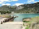 View of Cave Lake, Nevada. View of Cave Lake, Nevada.
|
|
On the upper parts of Steptoe Creek is Cave Lake State Park, where I stopped to have lunch. Continuing up the canyon, I saw the right habitat, and lots of Frasera albomarginata. Collected one here, and then continued up the canyon until I was in sagebrush and aspens, too high for my little plant.
| |
Other articles:
• Nevada State Route 486:
near Cave Lake;
• Frasera albomarginata:
near Cave Lake St Pk;
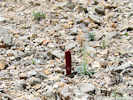 Collection No. 549 Collection No. 549
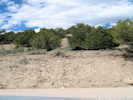 Frasera albomarginata location near Cave Lake, Nevada. Frasera albomarginata location near Cave Lake, Nevada.
|
549
|
Frasera albomarginata Watson, geographic coordinates (39.19826, -114.69277), my image IMG_0999.jpg.
| |
Other articles:
• Nevada State Route 486:
on Upper Steptoe Creek;
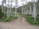 Aspen Grove along Upper Steptoe Creek Aspen Grove along Upper Steptoe Creek
|
|
| |
Other articles:
• Nevada State Route 486:
on Upper Steptoe Creek;
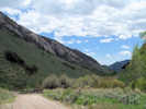 Canyon above Cave Lake, Nevada. Canyon above Cave Lake, Nevada.
|
|
| |
|
|
Turned around and headed for Ely, as my gas was getting a little low. Last time I filled up was in Milford, Utah. I could have gotten gas in Baker, Nevada, just outside Great Basin National Park, but I didn't even bother to look at the prices there.
| |
|
|
Made a little circle out of Ely, southwest on US Highway 6 to Ward Mountain, a back way through the Robinson Mining District, and then back to Ely. Found Frasera albomarginata at several places.
| |
Other articles:
• Frasera albomarginata:
southwest of Ely;
• U. S. Highway 6:
51100;
 Frasera albomarginata just west of Ely, Nevada Frasera albomarginata just west of Ely, Nevada
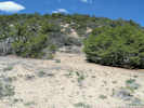 Location of Frasera albomarginata southwest of Ely, Nevada. Location of Frasera albomarginata southwest of Ely, Nevada.
|
550
|
Frasera albomarginata Watson, in a small canyon off of US Highway 6, 3 miles WSW of Ely, small plant with purple stems and green tips on petals, coordinates (39.22958, -114.92132 WGS 1984).
| |
Other articles:
• U. S. Highway 6:
near Ward Mtn Rec Area;
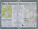 Ward Mountain Recreation Area sign Ward Mountain Recreation Area sign
|
|
| |
Other articles:
• U. S. Highway 6:
near Ward Mtn;
Locations:
Ward Mountain.
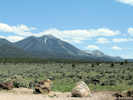 Ward Mountain and the Terraces from US Highway 6. Ward Mountain and the Terraces from US Highway 6.
|
|
| |
Locations:
Ely.
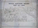 Map of Nevada Northern Ely Yard. Map of Nevada Northern Ely Yard.
|
|
The mine at Keystone and Ruth is operating again, and they seem to be using the Liberty Pit as a place to dump the overburden. Back in Ely I visited the Nevada Northern Railroad offices, but no one was around. This old spreader was probably the best thing I saw on display.
| |
Locations:
Ely.
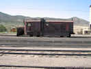 Spreader in Ely, Nevada rail yard. Spreader in Ely, Nevada rail yard.
|
|
| |
|
|
I'm not sure what I'm going to do tomorrow. I need to go west to Eureka, and also south on US Highway 6 to Currant. I'm thinking maybe I'll do a loop over to Eureka, then come back to Ely, and head southwest stopping at Currant. Probably end tomorrow at Tonopah, then go to Mono Lake, and over Tioga Pass to home.
| |
|
|
Wednesday June 11th.
| |
|
|
Started off this morning headed west out of Ely, Nevada, on US Highway 50. There are three ranges to cross between Ely and Eureka, and two basins. This is the heartland of the Great Basin, which may be more properly called the Basin and Range Province. The ranges to cross are the Egan Range, the White Pine Range, and the Fish Creek Range. The basins between them are Jakey Valley and Newark Valley. The summits are all about 7000 feet high, and the basins about 3000 feet.
| |
|
|
Today is quite cool and windy. The forecast high for Ely is 60, and for Eureka 61. I guess the offshore wind that is bringing warmth and red flag warnings, is bringing arctic air into the Basin and Range.
| |
Other articles:
• U. S. Highway 50:
east of Robinson Summit;
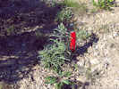 Frasera albomarginata near Robinson Summit, Nevada. Frasera albomarginata near Robinson Summit, Nevada.
|
|
As US Hwy 50 nears Robinson Summit of the Egan Range, I saw some likely-looking habitat for Frasera albomarginata and pulled off the highway. Sure enough, it was here, and this is a new location (39.39059, -115.08017) for anyone to have found the plant. However, the flowers were not open yet, so I did not collect any specimens. I have noticed that most of the plants have purple-colored stems here. The stems are always green in the Eastern Mojave.
| |
Other articles:
• U. S. Highway 50:
east side Jakey Valley;
Locations:
Jakey Valley.
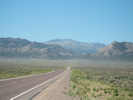 View west across Jakey Valley View west across Jakey Valley
|
|
As the highway descended into Jakey Valley, I saw some pronghorn antelope resting beside the highway. When I stopped, they got up and ran off. But they could not go too far because the highway is fenced on both sides. I've seen this before, the antelope get trapped between the highway fences and can't get away from the highway. I don't know if they eventually find a place to jump the fence, or if they remain trapped and die, or get hit by cars, or what ... Someplace else today, I saw another pronghorn, also trapped between the highway fences. Too bad, wish I could help them, they are very sleek and attractive animals ... from a distance anyway.
| |
Other articles:
• U. S. Highway 50:
near Green Spring Road;
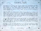 Nevada State Historic Marker for Hamilton, Nevada. Nevada State Historic Marker for Hamilton, Nevada.
|
|
I stopped for a look at the Illipah Reservoir and Campground on the east side of the White Pine Range. There was one campground that I saw yesterday called "Ward Mountain" on US Hwy 6 just southeast of Ely, that looked fairly nice. It was in Pinyons and Junipers, and there would have been some shady and protected camp sites. Illipah Reservoir Campground, though, was on a scraped off knoll next to the reservoir. There were a few campers, but I suspect the fishing was the main reason why people camped there.
| |
Other articles:
• U. S. Highway 50:
at Green Spr Rd;
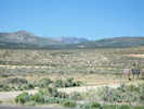 Vicinity of Illipah Reservoir, Nevada. Vicinity of Illipah Reservoir, Nevada.
|
|
| |
Other articles:
• Frasera albomarginata:
near Illipah Reservoir;
Locations:
Illipah Creek Reservoir.
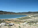 Illipah Creek Reservoir, view to the south Illipah Creek Reservoir, view to the south
|
|
| |
|
|
US Hwy 50 crosses the White Pine Range at Little Antelope Summit. Just before the summit, I turned north on a little dirt road. The first place I checked for Frasera albomarginata was a bust; none here. Meanwhile, four little calves had seen me. They were following me around, until I looked at them, or started their way, and then they ran.
| |
Other articles:
• Road North:
85000;
• Frasera albomarginata:
near Little Antelope Summit;
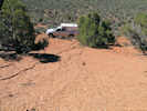 Prime Frasera albomarginata habitat. Prime Frasera albomarginata habitat.
|
|
Checked a second location, on this really red gravel slope that looked barren except for some large Junipers. Here, of course, was Frasera albomarginata. This is another really harsh environment but, of course, it is mostly free from competition. Collected here.
| |
Other articles:
• Frasera albomarginata:
near Little Antelope Summit;
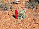 Collection No. 551 Collection No. 551
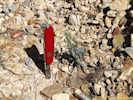 Little plant in ditch. Little plant in ditch.
|
551
|
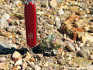
Physaria chambersi where Frasera albomarginata was found. |
Frasera albomarginata Watson, near Little Antelope Summit, image 1017-1018, very small, slight purple on stem, more green area on petals, coordinates (39.40332, -115.45759 WGS 1984.)
| |
Other articles:
• Road North:
81000;
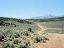 Area near Little Antelope Summit. Area near Little Antelope Summit.
|
|
| |
|
|
"Collecting" for me consists of choosing a plant to collect and photographing it. This trip I have been using my Swiss Army Knife as a size reference, so that's why you see it in the photos. Then I dig around the plant to free the tap root, and pull the plant out. Back at the car, I assign a number to the collection, describe the location, anything unusual about the plant (such as purple stems), and list the other species found nearby. I fire up my trusty GPS receiver and obtain the geographic coordinates. Then I put the plant into a press. I goes into a folded sheet of newspaper. On the outside of the newspaper, I write the collection number, the date, and a very brief description of the collection. Close the press and and go on to the next location.
| |
|
|
From the top of Little Antelope Summit the highway descends into Newark Valley. Several years ago, I visited Elko and the Ruby Mountains. On my way home, I went south from Elko and came out in Newark Valley. At one place there was a huge spring coming out of the limestones with lots of desert spring plants. There is a little rush in my front yard bog that came from this spring.
| |
Other articles:
• Windfall Mine Road:
near NV SR 379;
Locations:
Secret Canyon.
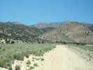 Lower end of Secret Canyon, Nevada. Lower end of Secret Canyon, Nevada.
|
|
Anyway, just before US Hwy 50 began its climb I turned off the highway and went up Secret Canyon, over the top and down through Windfall Canyon past the Windfall Mine. In the middle section of Secret Canyon, I found a lot of Frasera albomarginata, and made a collection.
|
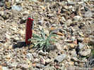 Frasera albomarginata in Secret Canyon Frasera albomarginata in Secret Canyon
|
|
Observation of Frasera albomarginata at coordinates (39.39945, -115.96552, 2096 m, my image IMG_1023.jpg).
| |
Other articles:
• Windfall Mine Road:
52000;
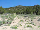 Prime Frasera albomarginata habitat in Secret Canyon, Nevada. Prime Frasera albomarginata habitat in Secret Canyon, Nevada.
|
|
Observation of Frasera albomarginata Watson at coordinates (39.41409, -115.97347, 2140 m).
| |
Other articles:
• Windfall Mine Road:
above Murray Spr.;
• Frasera albomarginata:
in Secret Cyn;
 Collection No. 552 Collection No. 552
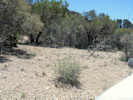 Collection No. 552 Collection No. 552
|
552
|
Frasera albomarginata Watson, common here, green on tips of petals, coordinates (39.41788, -115.97544, 2216 m, image 1025 1026).
| |
Other articles:
• Windfall Mine Road:
near pass;
near pass;
• Frasera albomarginata:
in Secret Cyn;
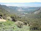 View of Secret Canyon, Nevada from above. View of Secret Canyon, Nevada from above.
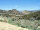 View of Windfall Canyon to the north. View of Windfall Canyon to the north.
|
|
| |
|
|
| |
Other articles:
• Nevada State Route 379:
40000;
Locations:
Fish Creek Valley.
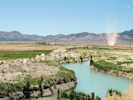 Fish Creek and Ranch from Nevada State Route 379 Fish Creek and Ranch from Nevada State Route 379
|
|
You come out of Windfall Canyon just above Eureka. I went into town to get gas. Got a few groceries at the General Store. Tired to get ice, but they had none. They were as surprised as I was. Just above Eureka is the city park. This consists of an old log cabin, a patch of grass, a picnic table, and four trees. The picnic table was at one end of the patch of lawn, and the four trees were are the other end. I made a sandwich and sat in my truck under the trees while I ate.
| |
|
|
My next destination was Currant Summit on the south end of the White Pine Range. To get there, I went on Nevada State Route 379. Fifty-six miles, the first and last third were paved, but the middle section was dirt. At the end of the first section was "Fish Creek," the apparent namesake of the Fish Creek Range. I thought the juxtaposition of the ranch, the alfalfa field, the green alkaline creek, and the dust devil was a pretty accurate image of the valleys between the ranges.
| |
|
|
The dirt part of the road was pretty good and the pavement returned at the far end of the Duckwater Indian Reservation ... wouldn't want to pave through the reservation, ya' know.
| |
Other articles:
• Nevada State Route 379:
near Red Rock Summit;
 Cicada at Red Rock Summit of the Pancake Range, Nevada Cicada at Red Rock Summit of the Pancake Range, Nevada
|
|
I did stop one time at low summit of the Pancake Range. There were junipers here, and rocky open ground. No Frasera albomarginata here, but the air was filled with little clicking sounds. It took me a while to find the source. There were hundreds of cicadas all over the junipers. These were a little smaller than the cicada at Hualapai Mountain. And, typically, cicacas make more of a buzzing sound. But, these guys were "clickers" and darn good at it.
| |
Other articles:
• Nevada State Route 379:
near Red Rock Summit;
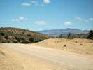 Looking west at Red Rock Summit, Nevada Looking west at Red Rock Summit, Nevada
|
|
| |
Other articles:
• Nevada State Route 379:
near Red Rock Summit;
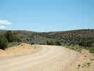 Looking east at Red Rock Summit, Nevada Looking east at Red Rock Summit, Nevada
|
|
| |
Other articles:
• Nevada State Route 379:
north of Duckwater;
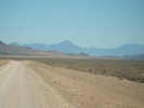 Along NV S. R. 379 enroute to Duckwater, Nevada Along NV S. R. 379 enroute to Duckwater, Nevada
|
|
| |
Other articles:
• Nevada State Route 379:
south of Duckwater;
 Along NV S. R. 379 south of Duckwater, Nevada Along NV S. R. 379 south of Duckwater, Nevada
|
|
Currant Mountain of the White Pine Range in the background.
| |
Other articles:
• U. S. Highway 6:
near Currant Summit;
 View north on US Highway 6 north of Currant Summit View north on US Highway 6 north of Currant Summit
|
|
At the sometimes settlement of Currant, I turned back toward Ely on US Hwy 6 and cruised the space between Currant and Currant Summit, looking for Frasera albomarginata. It took me a while, but I finally found some on caliche-encrusted volcanic rocks just off the highway.
| |
Other articles:
• Frasera albomarginata:
south of Currant Summit;
• U. S. Highway 6:
west of Currant Summit;
 Collection No. 553 Collection No. 553
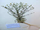 Collection No. 553, Frasera albomarginata near Currant Summit, Nevada Collection No. 553, Frasera albomarginata near Currant Summit, Nevada
|
553
|
Frasera albomarginata, purple stem, in bank of road, caliche-covered volcanic sediments, coordinates (38.81916, -115.32619, 1957 m).
| |
|
|
This collection complete, I decided to head southwest and stop in Tonopah. The 2-3 more hours to Lee Vining sound a little too far, after being out all day.
| |
Other articles:
• U. S. Highway 6:
in Railroad Valley;
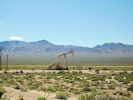 Oil Well in Railroad Valley, Nevada. Oil Well in Railroad Valley, Nevada.
|
|
Heading southwest on US Highway 6, I was very suprised to find oil wells in Railroad Valley. I did not know there were any producing wells in the Basin and Range. The company name is Makoil. I did some quick Internet research and learned that this field has produced 21 million barrels of oil since 1981 and they are still drilling wells. The geometry of this oil-producing basin is a bit unusual, but I won't bore you with details.
| |
Other articles:
• U. S. Highway 6:
in Railroad Valley;
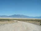 Grant Range from US Highway 6 Grant Range from US Highway 6
|
|
| |
|
|
In Tonopah, I settled for the night at the Jim Butler Inn & Suites. I eyeballed the RV park on the way into town. Oh Geez ... how ugly could a place be? For dinner, I walked down to El Marques, a Mexican restaurant. The only other place to eat in Tonopah is the Ramada Casino up the hill.
| |
|
|
Thursday, June 12th.
| |
|
|
Tonight I am in the Aspen campground beside Lee Vining Creek. I got here just after noon, had lunch, and then took a rest. I'm thinking that tomorrow I will go home. But, for this afternoon, I think I'll just stay here.
| |
Other articles:
• U. S. Highway 6:
west of Tonopah;
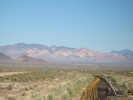 Monte Cristo Range from west of Tonopah, Nevada Monte Cristo Range from west of Tonopah, Nevada
|
|
This morning started bright and early in Tonopah. After checking out of the Jim Butler Inn & Suites (aka motel), I headed west on US Hwy 6. The White Mountains of California were lighted beautifully by the early morning sun.
| |
Other articles:
• The Gap Road:
north end of The Gap;
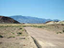 The Gap, looking south into Fish Lake Valley. The Gap, looking south into Fish Lake Valley.
|
|
Turned south on Nevada 773 for Fish Lake Valley. There are a couple of interesting places here between Fish Lake Valley and the Columbus Salt Marsh. They are called "The Sump," "The Crossing," and "The Gap." Even the USGS maps and their official list of places include the article "The" as part of the place names. These places are frequently referred to in literature about Fish Lake Valley so I wanted to obtain photographs of each.
| |
Other articles:
• The Gap Road:
in The Gap;
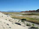 The Gap looking north. The Gap looking north.
|
|
Climbed up a small hill in The Gap for this photo.
| |
Other articles:
• The Gap Road:
in The Gap;
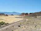 Look south from the approximate middle of The Gap Look south from the approximate middle of The Gap
|
|
| |
|
|
Cheryl and I visited The Sump a few years ago. It's a place of bright blue and green lake beds that are folded up into a V-shape (syncline).
| |
Other articles:
• Coyote Road:
at The Crossing;
at The Crossing;
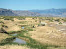 Looking south from The Crossing. Looking south from The Crossing.
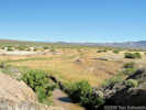 Looking north from The Crossing Looking north from The Crossing
|
|
The Crossing is a narrow place in Fish Lake Valley, where a single culvert can make a bridge. Most roads across Fish Lake Valley converge at The Crossing and then diverge again on the other side.
| |
|
|
The Gap is a narrow little valley through which Fish Lake Valley empties into Columbus Salt Marsh. There is also a hot spring nearby.
| |
Other articles:
• Coyote Road:
near The Crossing;
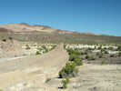 Looking across The Crossing. Looking across The Crossing.
|
|
I drove through The Gap on a very nice dirt road, and then to The Crossing. There was a little water here, but it was very green, and probably so alkaline that only algae was growing there. The hot spring was still in operation, but with many signs threatening to close the springs down if the vandalism didn't stop. The signs, of course, were riddled with bullet holes. As for wildlife, there were four coots, a couple of blackbirds, and a oriole-looking bird, mostly yellow with a black head.
| |
Other articles:
• Coyote Road:
in Fish Lake Valley;
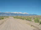 White Mountains across Fish Lake Valley White Mountains across Fish Lake Valley
|
|
| |
Other articles:
• Coyote Road:
Fish Lake Hot Well;
Locations:
Fish Lake Hot Well.
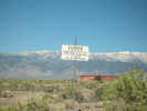 Scene at Fish Lake Hot Well Scene at Fish Lake Hot Well
|
|
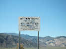
Scene at Fish Lake Hot Well |
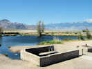
Fish Lake Hot Well |
| |
|
|
I did not go to The Sump on this visit because Cheryl and I had already been there.
| |
Other articles:
• U. S. Highway 6:
near Grefco Mine;
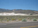 Grefco Diatomaceous Earth Mine. Grefco Diatomaceous Earth Mine.
|
|
Back on US Highway 6, I stopped for a photo of the Grefco diatomaceous earth mine, and then again at Montgomery Pass. It's hard to imagine the little steam engines of the Carson and Colorado Railroad (later the Southern Pacific Narrow Gauge) pulling trains over this pass.
| |
Other articles:
• U. S. Highway 6:
in Queen Valley;
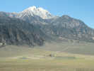 Queen Valley and White Mountains Queen Valley and White Mountains
|
|
Pulled off US Highway 6 for this view of upper Queen Valley, Boundary Peak, and Montgomery Peak.
| |
Other articles:
• U. S. Highway 6:
in Queen Valley;
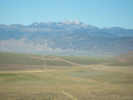 Glass Mountain across Queen Valley Glass Mountain across Queen Valley
|
|
| |
Other articles:
• California Highway 120:
south of Black Lake;
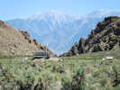 Water gap in lower Adobe Valley Water gap in lower Adobe Valley
|
|
At Benton, I turned west on California Highway 120, past Benton Springs and then up into Adobe Valley. Here I stopped to look at Black Lake and the water way for Mono Lake waters. In the hard-to-imagine category is the overflow of Mono Lake on the east side in the Adobe Hills, the flood waters coming down Adobe Valley, through Black Lake, through this narrow defile in the rocks, and then joining the Owens River watershed.
| |
Other articles:
• California Highway 120:
near Black Lake;
Locations:
Black Lake.
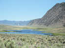 Black Lake alongside California Highway 120 Black Lake alongside California Highway 120
|
|
| |
Other articles:
• California Highway 120:
near Adobe Creek;
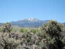 Glass Mountain from Adobe Valley, California. Glass Mountain from Adobe Valley, California.
|
|
Stopped near Adobe Creek for this view of Glass Mountain.
| |
Other articles:
• California Highway 120:
near Granite Mtn, CA;
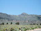 Sagehen Peak, California, from California Highway 120. Sagehen Peak, California, from California Highway 120.
|
|
Stopped near Granite Mountain for this view of Sagehen Peak
| |
Other articles:
• California Highway 120:
near Granite Mtn, CA;
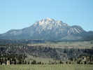 Glass Mountain from California Highway 120 near Granite Mountain Glass Mountain from California Highway 120 near Granite Mountain
|
|
and Glass Mountain.
| |
|
|
Along the highway through Big Sand Flat the Skunky Monkey Flower (Mimulus mephiticus) was blooming in large patches of purple, and a few lupines were blooming. But, it is still early in the season, and many wildflowers are not blooming now.
|
 Fishing tackle caught on telephone wire. Fishing tackle caught on telephone wire.
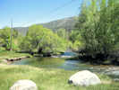 Lee Vining Creek at Aspen Campground, California Lee Vining Creek at Aspen Campground, California
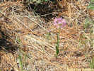 Native Onion at Aspen Campground, California Native Onion at Aspen Campground, California
|
|
I came straight to this campground, here is the view from my chair as I type this. There is a telephone cable overhead that probably goes to Tioga Pass. It is well decorated with fishing leader, weights and hooks. Had lunch, took a nap, and am now getting my journal wrapped up. I took a little walk around. As I said, it is early spring here. The onions are in full bloom, and the lupines are just beginning. I saw one Missouri Iris with a flower, the remained now just forming buds.
| |
|
|
Mono Lake, August 2008
| |
|
|
Wednesday, August 13, 2008
| |
|
|
This morning my plan was to explore the geography south of Mono Lake and east of US Highway 395.
| |
Other articles:
• U. S. Highway 395:
near Pumice Mine Road;
 View north in US Highway 395 from Pumice Mine Road. View north in US Highway 395 from Pumice Mine Road.
|
|
I drove to Pumice Mine Road (1S40), just south of June Lake Junction on US Highway 395.
| |
Other articles:
• Forest Road 1S40:
near Punch Bowl;
 Wilson Butte from Pumice Mine Road, Mono County, California Wilson Butte from Pumice Mine Road, Mono County, California
|
|
The first half mile or so of Pumice Mine Road are paved, looking like it is an older alignment of US Highway 395. The road then curves around the sand flat floor, in such a way that the Tom Harrison "Mammoth High Country" map is wrong.On the way to my first stop, Devil's Punch Bowl, there was a nice view of Wilson Butte.
| |
Other articles:
• Forest Road 1S40:
at Punch Bowl;
Locations:
Devils Punch Bowl.
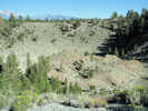 Punch Bowl, Mono County, California Punch Bowl, Mono County, California
|
|
Devil's Punch Bowl, also known simply as Punch Bowl, is a small depression between two moderate size volcanic piles. You can drive right to the lip of the depression. There are several other depressions in the second volcanic pile to the northeast.
| |
Other articles:
• Forest Road 1S40:
near East Craters Sand Flat;
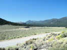 View of southwest portion of East Craters Sand Flat. View of southwest portion of East Craters Sand Flat.
|
|
Pumice Mine Road passes by the upper, or southwest, extension of East Craters Sand Flat.
| |
Other articles:
• Forest Road 1S08:
at 1S40;
• Forest Road 1S40:
at 1S08;
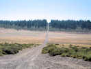 West end of Forest Road 1S08. West end of Forest Road 1S08.
|
|
I passed by the west end of Forest Service Road 1S08 on Pumice Mine Road.
| |
Other articles:
• Forest Road 1S40:
on Mono Craters;
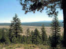 East Craters Sand Flat from Pumice Mine Road East Craters Sand Flat from Pumice Mine Road
|
|
Continuing carefully on Pumice Mine Road, because this is a truck haul road for cinders from Mono Craters, there were some good afternoon views of East Craters Sand Flat. Unfortunately, this was a hazy morning, and the view into the sun and haze made photography difficult.
| |
Other articles:
• Forest Road 1S40:
on Mono Craters;
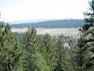 East Craters Sand Flat from Pumice Mine Road East Craters Sand Flat from Pumice Mine Road
|
|
View of East Craters Sand Flat from Pumice Mine Road.
| |
Other articles:
• Forest Road 1S40:
on Mono Craters;
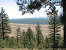 East Craters Sand Flat from Pumice Mine Road East Craters Sand Flat from Pumice Mine Road
|
|
View of East Craters Sand Flat from Pumice Mine Road.
| |
Other articles:
• Forest Road 1S40:
on Mono Craters;
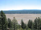 East Craters Sand Flat from Pumice Mine Road East Craters Sand Flat from Pumice Mine Road
|
|
View of East Craters Sand Flat from Pumice Mine Road.
| |
Other articles:
• Forest Road 1S40:
on Pumice Mine Rd;
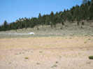 Haul Truck on Pumice Mine Road Haul Truck on Pumice Mine Road
|
|
Returning on Pumice Mine Road to Forest Road 1S08, a pumice hauling truck went by. Here, I set my GPS to NAD 1983 instead of WGS 1984. Most of my maps use NAD83 or NAD27 as does the GNIS and, at least in the western US, I don't see the point in using WGS84.
| |
Other articles:
• Forest Road 1S08:
at bottom of flat;
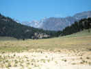 Playa on East Craters Sand Flat. Playa on East Craters Sand Flat.
|
|
Turning east on 1S08, I stopped at the lowest point so that I could walk out to the little playa in this basin. The location was 37.82117° -119.00752°, 2332 m elevation. Here I collected a little buckwheat that was much in evidence through this volcanic tableland.
|
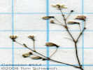 Detail of Collection No. 554 Detail of Collection No. 554
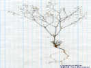 Overview of Collection No. 554 Overview of Collection No. 554
|
554
|
Eriogonum spergulinum A. Gray var. reddingianum (M. E. Jones) J. T. Howell, many in bloom, East Craters Sand Flat.
| |
Other articles:
• Field Notes:
Coll. No. 559 on 13-Aug-08;
 Little plant in the pumice sand flats Little plant in the pumice sand flats
|
|
I also noticed a little plant that I think Calyptridium, but is long past flowering. Later I would collect this plant.
| |
Other articles:
• Forest Road 1S08:
about mid-way;
 Looking west across East Craters Sand Flat on F. R. 1S08 Looking west across East Craters Sand Flat on F. R. 1S08
|
|
I continued across the sand flat, stopping for this photo looking back.
| |
Other articles:
• Forest Road 1S05:
at FR 1S06, 1S08;
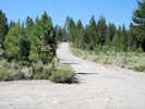 Road Intersection Road Intersection
|
|
Forest Road 1S08 ends at a junction of Bald Mountain Road (1S05) and the "120 Cutoff" (1S06). This location is also right above the Mono Craters tunnel.
| |
Literature Cited:
- Jacques, H. L., 1940.
Other articles:
• Forest Road 1S06:
over Mono Craters tunnel;
 Construction works for Mono Craters tunnel. Construction works for Mono Craters tunnel.
|
|
There were some workings that I think must include a shaft to the tunnel, and some sort of water pumping installation.
| |
Other articles:
• Forest Road 1S07:
at edge of sand flat;
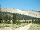 Pumice Mine on Mono Craters across East Craters Sand Flat Pumice Mine on Mono Craters across East Craters Sand Flat
|
|
From here I went on to East Craters Sand Flat on 1S07. There were a few lupines here in flower and fruit, so I collected one. I assume these are L. duranii, but that will have to be verified.
|
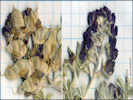 Detail of Collection No. 555 Detail of Collection No. 555
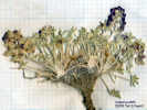 Overview of Collection No. 555 Overview of Collection No. 555
|
555
|
Lupinus duranii Eastw. #555 Lupine, East Craters Sand Flat, coordinates (37.83173 -118.98622 NAD83 2402 m). All material from the same plant.
| |
Other articles:
• Forest Road 1S07:
East Craters Sand Flat;
Locations:
East Craters Sand Flat.
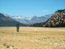 East Craters Sand Flat, looking southwest from the approximate center. East Craters Sand Flat, looking southwest from the approximate center.
|
|
| |
Other articles:
• Forest Road 1N24:
near divide;
Locations:
East Craters Sand Flat.
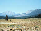 East Craters Sand Flat, looking south from the north end. East Craters Sand Flat, looking south from the north end.
|
|
I continued on a road, name probably 1N24, across the north end of East Craters Sand Flat. From this perspective, it is clear that most of the flat has an internal drainage. Only a very small portion at the extreme northern end drains into Mono Lake. Water from East Craters Sand Flat may move underground into Mono Lake, of course, appearing as springs on the lower slopes or under water.
| |
|
|
At the north end of East Craters Sand Flat, I was very surprised to see this Umbelliferae.
| |
Other articles:
• Forest Road 1N24:
near divide;
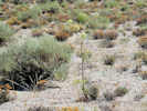 Collection No. 556 Collection No. 556
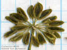 Detail of Collection No. 556, Angelica lineariloba Detail of Collection No. 556, Angelica lineariloba
|
556
|
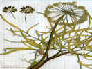
Overview of Collection No. 556, Angelica lineariloba |
Angelica lineariloba A. Gray. #556 Umbell. 37.85388° -118.98754° 2421 m
|
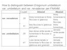 How to distinguish between Eriogonum umbellatum var. umbellatum and var. nevadense per FNANM. How to distinguish between Eriogonum umbellatum var. umbellatum and var. nevadense per FNANM.
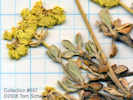 Detail of Collection No. 557, Eriogonum umbellatum var. nevadense Detail of Collection No. 557, Eriogonum umbellatum var. nevadense
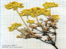 Overview of Coll. No. 557, Eriogonum umbellatum var. nevadense Overview of Coll. No. 557, Eriogonum umbellatum var. nevadense
|
557
|
Eriogonum umbellatum Torr. var. nevadense Gand. Sulphur-Flower Buckwheat.
|
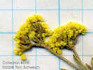 Inflorescence of Collection No. 558, Eriogonum microthecum var. ambiguum Inflorescence of Collection No. 558, Eriogonum microthecum var. ambiguum
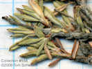 Leaves of Collection No. 558, Eriogonum microthecum var. ambiguum Leaves of Collection No. 558, Eriogonum microthecum var. ambiguum
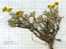 Overview of Collection No. 558, Eriogonum microthecum var. ambiguum Overview of Collection No. 558, Eriogonum microthecum var. ambiguum
|
558
|
Eriogonum microthecum Nutt. Var. ambiguum (M. E. Jones) Reveal. Slender Buckwheat.
| |
Other articles:
• Field Notes:
13-Aug-08, Coll No. 559;
20090707150583;
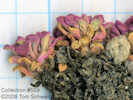 Detail of Collection No. 559 Detail of Collection No. 559
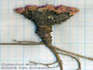 Overview of Collection No. 559 Overview of Collection No. 559
|
559
|
Calyptridium umbellatum, sterile collection.
| |
|
|
I drove back to the divide at the north end of East Craters Sand to check the geographic location. It was: 37.80990°, -118.96841°, NAD 1983.
| |
|
|
I wandered around for a while in the area east of East Craters Sand Flat, on roads 1S42 and 1S43. The maps of this area are incorrect because the roads have been re-routed to keep vehicles off of the small sand flat in section 23.
| |
|
|
Then I returned to Bald Mountain Road. In this section, above the Mono Craters tunnel, I drove back and forth a couple of times, looking for the divide between the Mono Lake Basin and the Owens River Basin. The topography in this area is complex, probably caused by both faulting and volcanic activity.
| |
Other articles:
• Forest Road 1S05:
inside Mono Basin;
Locations:
Mono Basin.
 Looking into Mono Lake basin on Bald Mountain Road Looking into Mono Lake basin on Bald Mountain Road
|
|
Mono Lake basin divide. Looking west on Bald Mountain Road (1S05).
| |
Other articles:
• Forest Road 1S05:
outside Mono Basin;
 Looking out of Mono Lake basin Looking out of Mono Lake basin
|
|
Mono Lake basin divide. Looking east on Bald Mountain Road (1S05).
| |
|
|
In reality, though, it probably does not make much difference whether the divide between the Mono Lake basin and the Owens River watershed can be accurately located. So far, I have seen no obvious significant changes in the vegetation across this volcanic tableland, and I doubt that placement of the boundary a mile (or kilometer) one way or the other would change the taxa listed in the checklist flora.
| |
|
|
I continued on Bald Mountain Road (1S05) to Bald Mountain Lookout. This is a fairly easy drive with just a few rocks on some upper steep slopes. The lookout was not staffed when I visited. I made lunch and sat in the shade of the lookout to eat.
| |
Other articles:
• Forest Road 1S05:
at Bald Mtn Lookout;
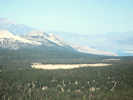 Little Sand Flat from Bald Mountain, California Little Sand Flat from Bald Mountain, California
|
|
Little Sand Flat is visible
| |
Other articles:
• Forest Road 1S05:
at Bald Mtn Lookout;
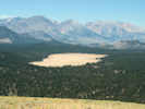 Unnamed sand flat south of Bald Mountain Road. Unnamed sand flat south of Bald Mountain Road.
|
|
... as well as other large unnamed sand flat to the south
| |
|
|
Between them, the southern divide of Mono Lake basin is not obvious, being forested broken areas of internal drainage.
| |
Other articles:
• Forest Road 1S05:
at Bald Mtn Lookout;
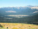 Deadman Creek basin from Bald Mountain, California Deadman Creek basin from Bald Mountain, California
|
|
A little farther to the west, the basin of Deadman Creek can be seen. This would be the northwest corner of the Long Valley Caldera.
| |
Other articles:
• Forest Road 1S05:
at Bald Mtn Lookout;
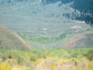 Owens River from Bald Mountain Owens River from Bald Mountain
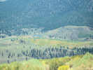 Owens River from Bald Mountain Owens River from Bald Mountain
|
|
Just off the mountain to the southwest is the headwaters of the Owens River and the Alpers' Owens River Ranch.
| |
|
|
There was also a nice view of Mammoth Mountain, the Sierra Crest, and Mono Craters. On the other hand, you can't see much of Mono Lake, and neither East Craters Sand Flat nor Big Sand Flat can be seen at all.
| |
|
|
Mileage 7965, 1:00 PM, leave Bald Mountain Lookout.
| |
Other articles:
• Forest Road 1S05:
at 1S88;
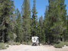 South end of Forest Road 1S88. South end of Forest Road 1S88.
|
|
Turned off of Bald Mountain Road (1S05) onto 1S88, a little road that crosses the south end of Little Sand Flat.
| |
Other articles:
• Forest Road 1S88:
at south end of Little Sand Flat;
Locations:
Little Sand Flat.
 South end of Little Sand Flat. South end of Little Sand Flat.
|
|
Little Sand Flat is really pretty, as you can seen in this photo of the south end of Little Sand Flat. Mileage 7970.
| |
Other articles:
• Forest Road 1S88:
in Little Sand Flat;
 Skunky Monkeyflower in Little Sand Flat Skunky Monkeyflower in Little Sand Flat
|
|
There was a lot of Mimulus mephiticus in bloom, perhaps as a result of summer thunderstorms.
| |
Other articles:
• Forest Road 1S88:
on forested island;
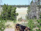 Little Sand Flat from burned forested island. Little Sand Flat from burned forested island.
|
|
From a fomerly burned forested island in the middle of Little Sand Flat, you can see the northern portion.
| |
Other articles:
• Forest Road 1S13:
Little Sand Flat;
Locations:
Little Sand Flat.
 Mono Craters west of Little Sand Flat. Mono Craters west of Little Sand Flat.
|
|
View of Mono Craters across Little Sand Flat.
| |
Other articles:
• Forest Road 1S13:
at FR 1S06;
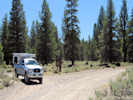 Intersection of 1S06 and 1S13 Intersection of 1S06 and 1S13
|
|
Intersection of 1S06 and 1S13. Turned northeast on the "120 Cutoff," Forest Road 1S06, and drove to California Highway 120.
| |
Other articles:
• Forest Road 1S06:
near CA Hwy120;
 Intersection of CA Highway 120 and "120 Cutoff Road," F. R. 1S06. Intersection of CA Highway 120 and "120 Cutoff Road," F. R. 1S06.
|
|
View of intersection of California Highway 120 and the "120 Cutoff," Forest Road 1S06.
| |
|
|
Drove up the Taylor Canyon Road (1S17) to Pilot Spring Road (1S04), and then on to Pilot Spring.
| |
Other articles:
• Forest Road 1S04:
Pilot Spring;
Locations:
Pilot Spring.
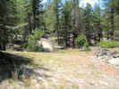 Pilot Spring, Mono County, California Pilot Spring, Mono County, California
|
|
There was no running water at Pilot Springs that I found.
|
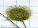 Detail of Collection No. 560 Detail of Collection No. 560
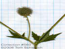 Overview of Collection No. 560 Overview of Collection No. 560
|
560
|
Geum macrophyllum Willd. Large-Leaved Avens.
Pilot Spring, Mono County, California. 16.2 miles by air southeast of Lee Vining, 9.6 miles by air northwest of Glass Mountain. 37.8277°N, 118.871°W. WGS1984 Elev. 2655 m. In the creek bed under trees.
| |
|
|
Returned to Taylor Canyon Road, and drove to Crooked Meadows.
| |
Other articles:
• Forest Road 1S17:
near Crooked Mdws.;
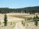 Crooked Meadows from the north. Crooked Meadows from the north.
|
|
The intersection of Taylor Canyon Road (1S17) and 1S56 appears to be in the Mono Lake basin divide. Dry Creek is to the north and Dexter Creek, draining Crooked Meadows is to the south.
| |
Other articles:
• Forest Road 1S17:
59900;
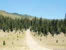 McLaughlin Creek watershed McLaughlin Creek watershed
|
|
Continued on Taylor Canyon Road (1S17) as far as a pass overlooking Sentinel Meadows and then turned back.
| |
Other articles:
• Forest Road 1S17:
62000;
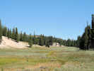 Crooked Meadows Crooked Meadows
|
|
View of the south end of Crooked Meadows.
| |
Other articles:
• Forest Road 1S17:
at Crooked Mdw Spr;
 Crooked Meadows Spring Crooked Meadows Spring
|
|
At Crooked Meadows Campground, there was a fairly large spring. (7985/280 Crooked Meadows Camp)
| |
Other articles:
• Forest Road 1S17:
in Crooked Mdws CG;
 Crooked Meadows Campground Crooked Meadows Campground
|
|
The campground overlooks northern arm of Crooked Meadows.
| |
Other articles:
• Forest Road 1N02:
at Wild Horse Mdw;
Locations:
Wild Horse Meadow.
 Wild Horse Meadow Wild Horse Meadow
|
|
From Crooked Meadows, I headed across 1S56 to Wild Horse Meadow (Mileage 7988). Wild Horse Meadow drains into Dexter Creek.
| |
|
|
While on my way to Sagehen Meadow, I noticed a little road going in the direction of Sagehen Peak. Folloed to road all the way to the top. Although, I would have to say that the last 100 meters was a little hairy.
| |
Other articles:
• Forest Road 1N02:
at Sagehen Pk;
Locations:
Sagehen Peak.
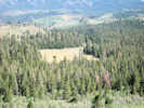 Wild Horse Meadow from Sagehen Peak Wild Horse Meadow from Sagehen Peak
|
|
From the top of Sagehen Peak, was a good view of Wild Horse Meadow
| |
Locations:
Glass Mountain.
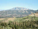 Glass Mountain from Sagehen Peak Glass Mountain from Sagehen Peak
|
|
... Glass Mountain
| |
Locations:
Dexter Canyon.
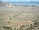 Dexter Canyon from Sagehen Peak Dexter Canyon from Sagehen Peak
|
|
... and Dexter Canyon.
| |
Locations:
Sagehen Meadow.
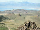 Sagehen Meadow from Sagehen Peak Sagehen Meadow from Sagehen Peak
|
|
There must be a little bit of private land at Sagehen Meadow, as there is a house under construction.
| |
|
|
I stopped to get gas at Mobil Station, and returned to Aspen Camp about 4:15 PM.
| |
|
|
Thursday August 14, 2008
| |
|
|
The June Lake Loop Trail Plan (2003) shows a trail up onto the glacier cut plateau on the southwest flank of Reversed Peak. Local residents call the ponds on this plateau "Snow Ponds," but the Geographic Names Information System does not recognize this name.
| |
|
|
Thinking I would go up to Snow Ponds, I parked below the water tank on North Side Drive. Walked up to the water tank. In retrospect, I could have driven up here. Now, I tried to figure out which way to go.
| |
|
|
Chose to follow the tracks around east side of ridge. This was a bad mistake. I ended up climbing the boulders on the ridge.
| |
Other articles:
• Mono Lake Basin Flora:
at June Lake;
Locations:
June Lake.
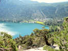 June Lake from the north side June Lake from the north side
|
|
The only reward were some nice views of June Lake
| |
Locations:
Gull Lake.
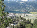 Gull Lake from the north Gull Lake from the north
|
|
... and Gull Lake from above.
|
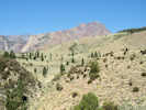 Morainal plateau on flank of Reversed Peak Morainal plateau on flank of Reversed Peak
|
|
Reaching the top of the boulder ridge, I had to bush-whack across a brush-covered moraine to reach
|
 Trail Trail
|
|
... a small trail following the watercourses.
|
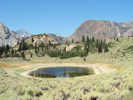 Ephemeral pond Ephemeral pond
|
|
The trail crosses two morainal basins, and comes to first pond.
| |
|
|
Here I made three collections in the drying margin of the pond.
| |
Locations:
Snow Ponds.
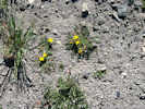 Coll. No. 561, Taraxia tanacetifolia Tansy-Leaved Suncup Coll. No. 561, Taraxia tanacetifolia Tansy-Leaved Suncup
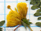 Coll. No. 561, Taraxia tanacetifolia Coll. No. 561, Taraxia tanacetifolia
|
561
|
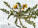
Coll. No. 561, Taraxia tanacetifolia |
Camissonia tanacetifolia (Torr. & A. Gray) P. H. Raven ssp. tanacetifolia, abundant.
| |
Locations:
Snow Ponds.
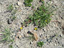 Coll. No. 562, Potentilla anserina ssp. anserina Coll. No. 562, Potentilla anserina ssp. anserina
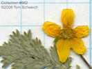 Detail of Collection No. 562, Potentilla anserina var. anserina Detail of Collection No. 562, Potentilla anserina var. anserina
|
562
|
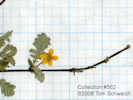
Overview of Collection No. 562, Potentilla anserina var. anserina |
Potentilla anserina L. ssp. anserina, less common.
|
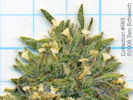 Detail of Collection No. 563 Detail of Collection No. 563
 Overview of Collection No. 563 Overview of Collection No. 563
|
563
|
#563 Cryptantha, occasional, higher on the dry pond margin than the Camissonia and Potentilla.
Nama densum Lemmon var. densum. Leafy Nama.
Reversed Peak, Mono County, California. On the drying shore of natural ponds called Snow Ponds by local residents, south flank of Reversed Peak, about 1 mile northwest of Gull lake. 37.7853°N, 119.0976°W. WGS1984 Elev. 2683 m. Collected with Taraxia tanacetifolia and Potentilla anserina.
| |
Other articles:
• Mono Lake Basin Flora:
Snow Ponds;
Locations:
Snow Ponds.
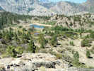 Snow Ponds on the southwest flank of Reversed Peak. Snow Ponds on the southwest flank of Reversed Peak.
|
|
Climbed a small hill a little farther to the west to see the remaining ponds.
|
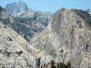 Upper Rush Creek Canyon Upper Rush Creek Canyon
|
|
Farther to the west, I could see upper Rush Creek and the Gem Lake dam.
| |
Locations:
Reversed Peak.
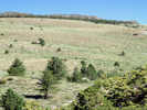 The way up Reversed Peak. The way up Reversed Peak.
|
|
To the north, I could see the way to the top of Reversed Peak would include a lot of bush-whacking through the Bitterbrush and Sagebrush. Not to mention the southern exposure to the hot sun. There is no way I'm going to climb up there today.
|
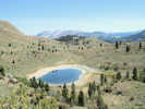 Ephemeral pond, one of the Snow Ponds. Ephemeral pond, one of the Snow Ponds.
|
|
Looking back to the east, I could see the first pond.
|
 Location of my collections #561-563 at Snow Ponds Location of my collections #561-563 at Snow Ponds
|
|
I returned to the truck by way of the trail. The portion I missed on the uphill trip goes right down the watercourse. It is fairly steep, and composed of loose sand in some areas.
| |
Other articles:
• California Highway 158:
at Silver Lake;
Locations:
Silver Lake.
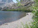 Silver Lake Silver Lake
|
|
Finding a good place for lunch can be difficult. You have to have the right mix of shade, peace, and space. Never did find the perfect place. The north end of Silver Lake had shade, a little space, but not much peace.
| |
|
|
After lunch, I headed down US Highway 395 for Wilson Butte and Hartley Springs. Turned off US Highway 395 at Glass Flow Road (2S10).
| |
Other articles:
• U. S. Highway 395:
near Wilson Butte;
Locations:
Wilson Butte.
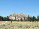 Wilson Butte from Glass Flow Road on the south side. Wilson Butte from Glass Flow Road on the south side.
|
|
Took this photo of Wilson Butte from the south.
| |
|
|
Drove up to Hartley Springs Campground. Along the way, noticed several groups that were "dispersed" camping. The campground itself had available sites on a Thursday afternoon, but the campground was quite dry and dusty.
| |
|
|
From Wilson Butte, drove over Deadman Summit to Owens River Road. Drove east looking for a place to see the Owens River. First, it was posted, with lots of warning signs. After a few miles, the signs stop, but the river is more than a mile away and there are no roads.
| |
Other articles:
• Forest Road 2S07:
near Glass Mrn;
Locations:
Glass Mountain.
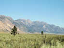 Glass Mountain, northeast wall of Long Valley Caldera Glass Mountain, northeast wall of Long Valley Caldera
|
|
View of Glass Mountain, and the northern wall of the Long Valley caldera from Owens River Road.
| |
|
|
So, I turned around and headed back to camp.
| |
Other articles:
• U. S. Highway 395:
near Deadman Creek;
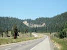 US Highway 395 just south of Crestview and Deadman Summit US Highway 395 just south of Crestview and Deadman Summit
|
|
On the back I stopped for a few photos, including this one of US Highway 395 north past Crestview
| |
Other articles:
• U. S. Highway 395:
near Deadman Ck;
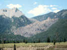 Obsidian flow to west of US Highway 395 Obsidian flow to west of US Highway 395
|
|
... this one of an obsidian glass flow west of the highway
| |
Other articles:
• U. S. Highway 395:
near Deadman Ck;
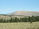 Bald Mountain from US Highway 395 Bald Mountain from US Highway 395
|
|
... Bald Mountain and its fire lookout
| |
Other articles:
• U. S. Highway 395:
at Deadman Summit, south edge of Mono Basin;
Locations:
Deadman Summit.
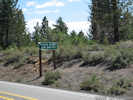 Deadman Summit in the southbound direction. Deadman Summit in the southbound direction.
|
|
... Deadman Summit
| |
Other articles:
• Mono Lake Basin Flora:
near Deadman Summit;
• U. S. Highway 395:
near Deadman Summit;
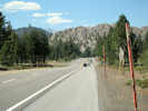 Looking north into the Mono Basin from Deadman Summit. Looking north into the Mono Basin from Deadman Summit.
|
|
... looking into the Mono Lake basin and at Wilson Butte from Deadman Summit.
| |
|
|
Back at camp I had a really nice nap, relaxed and read, and had dinner.
| |
Locations:
Little Sand Spring.
McLaughlin Springs.
|
|
Found the following in the newsletter of the Bristlecone Chapter newsletter:
| | Duvall, Kathy. 1998. Aspen Color and Carvings - Oct. 3rd. The Bristlecone Chapter Newsletter.
Volume 18, No. 6, November 1998.
| | |
The CNPS field trip on October 3rd, led by Richard Potashin, visited the isolated and beautiful McLaughlin Springs grove, east of the Bald Mountain Lookout and east of Highway 395. This grove has numerous carvings, including records of the Spanish Civil War period and many extensive illustrations. In the afternoon Richard led us
to a stock tank located in the Little Sand Flat area. The seemingly blank tank was covered with lead pencil art depicting French Basques faces, trees, animals, birds, signatures, dates, and political slogans. It was amazing that the lead markings were still on the metal tank. Unfortunately, the life of the carvings is relatively short and these types of tanks are being hauled to other locations. While walking across the open pumice flat to the tank, we were delighted to see the rare Mono Lake lupine (Lupinus duranii) and Mono milk-vetch (Astragalus monoensis var. monensis)
braving the strong west winds. These species are endemic only to pumice flats from western Long Valley to Mono Lake basin. Look for another pilgrimage to see the groves next fall.
| | |
 Eastern Mojave Vegetation