|
This file describes Black Canyon Road from its north end at Cedar Canyon Road
to its south end at Essex Road.
|
|
Literature Cited:
- , .
Other articles:
• Cedar Canyon Road:
at Black Cyn Rd;
• FAQ:
Black Canyon;
|
Junction: Cedar Canyon Road, turn left (west) to descend into Kelso Valley and to Kelso-Cima Road, turn right (east) for Rock Springs and Lanfair Valley.
|
|
Other articles:
• Glossary:
gneiss;
• Eastern Mojave Geology:
McCurry, 1985;
Locations:
Round Valley.
|
Round Valley
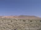
Pinto Mountain across Round Valley as seen from Black Canyon Road. The gray shrubs are Basin Sagebrush (Artemisia tridentata) and the large green shrubs are Utah Juniper (Juniperus osteosperma). Pinto Mountain is composed of Wild Horse Mesa Tuff, Winkler Formation, and Peach Springs Tuff. In the loose rock at the base of Pinto Mountain are boulders of gneiss and schist. That would indicate to me that the basement rock under Pinto Mountain is at or very near the surface.
|
|
Literature Cited:
- Ausmus, Bob, 1989.
Other articles:
• Field Notes:
Coll. No. 150;
20080528010;
Locations:
Holliman Well.
|
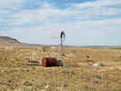
Holliman Well. Don't know how Bob Hollimon became Holliman Well. Along Black Canyon Road, near Holliman Well, I collected Big Sagebrush, Yellow Rabbitbrush, and Purple Sage.
|
|
Other articles:
• Wild Horse Canyon Road:
at Black Cyn Rd;
|
Junction: Wild Horse Canyon Road.
Take this road approximately 3 km southwest to the Mid Hills Campground.
|
|
Other articles:
• Hackberry Complex Fire:
… in Round Valley.;
|
This panorama, taken June 27, 2005, after the Hackberry Complex Fire of June 22-25, 2005, shows that much of Round Valley burned as well as a good portion of Pinto Mountain.
|
|
Literature Cited:
- Burn Area Emergency Response Team, 2005.
|
"The Narrows"
|
|
Other articles:
• Field Notes:
29 May 2005;
|
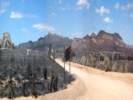
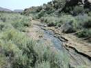
Looking north in Black Canyon Road, with running water, on May 29, 2005.
|
|
Other articles:
• Field Notes:
29 May 2005;
|
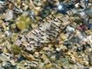
Insect larvae in running water, May 29, 2005.
|
|
Other articles:
• Field Notes:
29 May 2005;
|
Looking south in Black Canyon Road, with running water, on May 29, 2005.
|
|
Images:

Black Canyon Road, looking north from near Gold Valley Ranch.
|
Black Canyon
View of Black Canyon Road, looking north from the vicinity of Gold Valley Ranch. The low gray shrubs are Blackbrush (Coleogyne ramosissima) and the large green shrubs are Utah Juniper (Juniperus osteosperma). This photograph was taken from a location about 50 meters north of the cows as seen in the photograph below. At first glance the vegetation might be classified as "pristine," as indeed much of the Mid Hills vegetation has been characterized. However, on closer examination there are many signs of usage by cattle, and it becomes impossible to know what the native vegetation might have been at this site.
|
|
Locations:
Gold Valley Ranch.
|
Gold Valley Ranch
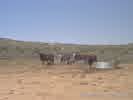
Cows along Black Canyon Road. The original vegetation at this location would have been dominated by Blackbrush (Coleogyne ramosissima) which can be seen in the background. However, heavy use by cattle, as they come to this location for water and salt, has completely destroyed the vegetation.
|
|
Locations:
Table Top.
|
Table Top
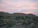
The flat-topped mountain to the east of Black Canyon Road is Table Top. Geologic reports note that the Table Top is granite, topped by a quartz latite lava flow. The top surface is flat as it appears to be from the road. For most of its flat top, the vegetation consists of only two species, Basin Sagebrush (Artemisia tridentata) and Utah Juniper (Juniperus osteosperma).
|
|
Literature Cited:
- Cook, Ronald U., and Andrew Warren, 1973.
|
Small moats in the soils around rocks as shown in this photograph are common on Table Top.
How the moats form is uncertain. However, it has been found that coarse particles will emerge from desert soils after as few as 4 wetting and drying cycles (Cook and Warren, 1973, p. 128). Once a rock like this emerges at the surface, continued rain runoff from the surface of the rock may wash the very fine particles away from the rock and cause a localized deflation around its edges.
|
|
Other articles:
• Blackbrush:
in Gold Valley;
|
Blackbrush Scrub along Black Canyon Road. This view looks northwest toward Gold Valley Mine and the Little Thorn Mountains. The dark gray shrubs are Blackbrush (Coleogyne ramosissima). This is one location in the Eastern Mojave where Blcakbrush reaches its maximum dominance. Relative density of Blackbrush is about 70% at this location.
|
|
Other articles:
• Gold Valley Mine Road:
at Black Canyon Road;
|
Junction: Gold Valley Mine Road, northwest to Gold Valley Mine, and to Lobo Point Road.
|
|
Other articles:
• Routes to Water:
230019500;
|
At some point along Black Canyon Road, near Hole-in-the-Wall, Thompson's (1921) route between Cima and Fenner would coincide with the route of Black Canyon Road.
|
|
Other articles:
• Field Notes:
15-Oct-05 at Hole-in-the-Wall;
Locations:
Woods Mountains.
|
Moonrise over the Woods Mountains, as seen from the Hole-in-the-Wall campground.
|
|
Other articles:
• Field Notes:
in Apr 1980;
|
Hole-in-the-Wall
|
|
Locations:
Hole-in-the-Wall.
|
Two camp sites in the campground at Hole-in-the-Wall. While Hole-in-the-Wall is a very pretty area, the camp sites are exposed to wind and sun, except in the late afternoon.
|
|
Locations:
Hole-in-the-Wall.
|
General view of the campground at Hole in the Wall. The slot canyon from which Hole in the Wall got its name is in the center. The peaks of the Providence Mountains can be seen in the distance.
The U. S. G. S. is preparing a bulletin about Hole-in-the-Wall which can be found at:
http://geology.wr.usgs.gov/docs/parks/misc/pdfdocs.html#moja
|
|
Other articles:
• Field Notes:
Coll. No. 2.1;
Coll. No. 2.3;
Coll. No. 2.4;
Coll. No. 3.1;
Coll. No. 3.2;
Coll. No. 3.3;
Coll. No. 3.4;
Coll. No. 4.1;
Coll. No. 4.2;
Coll. No. 4.3;
Coll. No. 7.4;
Coll. No. 8.1;
Coll. No. 8.2;
Coll. No. 9.1;
• Glossary:
petroglyph;
Locations:
Woods Mountains.
|

Petroglyph viewing along Black Canyon Wash |

Coll. No. 8.2, Acmispon rigidus |

Coll. No. 2.1, Amsinckia tessellata var. tessellata |

Coll. No. 2.3, Ambrosia salsola var. salsola |

Coll. No. 2.4, Encelia frutescens |

Coll. No. 3.1, Verbena gooddingii |

Coll. No. 3.3, Malacothrix californica |

Coll. No. 3.4, Phacelia fremontii |

Coll. No. 4.1, Gilia |

Coll. No. 4.2, Encelia virginensis |

Coll. No. 4.3, Physalis crassifolia |

Coll. No. 8.1, Phacelia campanularia var. vasiformis |
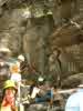
Petroglyphs. |
Wendy smiles embarrasedly knowing she's gotten into a picture while son copies down petroglyph designs at one of several petroglyph sites in the Woods Mountains.
|
|
Other articles:
• Wild Horse Canyon Road:
at Black Cyn Rd;
|
Junction: Wild Horse Canyon Road, alternate to Black Canyon Road, a little more scenic, and rejoins Black Canyon Road north of Mid Hills Campground.
|
|
Other articles:
• Field Notes:
18 Oct 2024;
|
View of Lobo Point up a canyon to the northwest.
|
|
Images:

Vegetation near Hole-in-the-Wall.
|
General view of the vegetation approximately 1 km southeast of Hole-in-the-Wall. As you can see, this picture was taken in an unusually green Spring. The cactus in the foreground is Buckhorn Cholla (Opuntia acanthocarpa). The large tree-like plants are Mohave Yucca (Yucca schidigera). The smaller shrubs are boxthorns (Lycium sp.), Blackbrush (Coleogyne ramosissima), and Great Basin Blue Sage (Salvia dorrii).
|
|
Other articles:
• Field Notes:
field trip;
18 Oct 2024;
Locations:
Wild Horse Mesa.
|
South end of Wild Horse Mesa
|
|
Other articles:
• Field Notes:
May 24, 1985;
|
Road curves between foothills of Wild Horse Mesa.
|
|
Locations:
Colton Hills.
|
Colton Hills, including Colton Well, to the northwest (left).
|
|
Other articles:
• Essex Road:
at Black Canyon Road;
|
Junction: Essex Road, right (northwest) for Mitchell Caverns, left (southeast) for US I-40 and Essex.
|
|
If you have a question or a comment you may write to me at:
tomas@schweich.com
I sometimes post interesting questions in my FAQ, but I never disclose your full name or address.
|
[Home Page] [Site Map]
Date and time this article was prepared:
10/2/2026 12:34:25 PM
|
 Eastern Mojave Vegetation