Eastern Mojave Vegetation
Images -- Geography - Jefferson County, CO

By Tom Schweich


Home Page
Unclassified
Geography - Idaho
Geography - Park County, CO
Geography - Summit County, CO
Geography - Arizona
Geography - British Columbia
Geography - California
Geography - California's Colorado Desert
Alaska
Geography - Mono Lake Basin, California
Geography - Mono County, California
Geography - San Luis Obispo County, California
Geography - Marin County, California
Geography - Santa Clara County
Alameda
Garden
Geography - Central Mojave
Geography - New Mexico
Geography - Eastern Mojave
Geography - Northern Mojave
Geography - Colorado
Geography - Alamosa County, CO
Geography - Boulder County, CO
Geography - Clear Creek County, CO
Geography - Chaffee County, CO
Geography - Douglas County, CO
Geography - Gilpin County, CO
Geography - Golden, Colorado
Geography - Weld County, CO
Geography - Yuma County, CO
Geography - Hinsdale County, CO
Geography - Jefferson County, CO
Geography - North Table Mountain, Jefferson Cty, CO
Geography - Lake County, CO
Geography - Larimer County, CO
Geography - Nevada
Geography - Oregon
Geography - South Dakota
Geography - Utah
Geography - Nebraska
Geography - Virginia
Geography - Washington
Geography - Wyoming
Spain - Andalucia
Spain - Castilla y Leon
Spain - Castilla-La Mancha
Spain - Extremadura
Spain - Galicia
Spain - Madrid
Portugal
Geology
Economic Geology
Climatology
Botany
Salvia dorrii
Frasera albomarginata
Species
Species - Polygonaceae
Species - Brassicaceae
Species - Brassicaceae, Physaria vitulifera
Species - Rosaceae
Species - Fabaceae
Species - Cactaceae
Species - Apiaceae
Species - Onagraceae
Species - Polemoniaceae
Species - Boraginaceae
Species - Plantaginaceae
Species - Asteraceae
Species - Poaceae
Species - Cyperaceae
Zoology
Ecology
Archeology
Customer Satisfaction
General
Arizona
California
Kansas
Missouri
Nebraska
New York
Christmas 2002
Family Photos
Family Documents
Family Photos 2003
Art of Lydia Schweich
Portraits
Railroad
Geography - Germany

Images are organized by the topics listed at left. Click on a topic name to see images with that topic.

Would you like to use these photographs in your school term paper or report?

License is hereby granted for non-commercial use of the images contained herein provided that the images are reproduced with the copyright notice intact. This means that we give you our permission to use the photographs and information you find here in your school term papers and reports. You may resize the photograph to fit your needs, but you may not remove the copyright. Your term paper should note that the photographs are reproduced with permission and it should have a reference to this web site, such as:

"Photograph ©1999 Tom Schweich. Used by permission, http://www.schweich.com"

If you have a comment or a question about a photograph you may write to me at tomas@schweich.com I will answer you as soon as I can. I sometimes post interesting questions in my FAQ, but I will not disclose your full name or address.


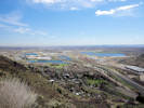
Valley of Clear Creek opens onto the plains; Denver in right distance.

Photographed 12 April 2016.

Article records that use this photograph:

        images/IMGQ2328sm.jpg


Ramstetter Reservoir from slope of North Table Mountain.

Photographed 1 June 2016.

Location records that use this photograph:

Article records that use this photograph:

        images/IMGQ2661sm.jpg

Apex Park


Corner of Apex Park.

Photographed 6 May 2020

Location records that use this photograph:

Article records that use this photograph:

        images/20200506_114131sm.jpg


Widened Grubstake Trail.

Photographed 25 April 2020.

Article records that use this photograph:

        images/20200425_111044sm.jpg


Grubstake Trail at its west junction of the Bonanza Trail.

Photographed 6 May 2020

Location records that use this photograph:

Article records that use this photograph:

        images/20200506_094526sm.jpg


West end of Bonanza Trail at the Grubstake Trail.

Photographed 6 May 2020

Location records that use this photograph:

Article records that use this photograph:

        images/20200506_094514sm.jpg


Unnamed gulch in the north part of Apex Park,

Photographed 7 July 2021.

Location records that use this photograph:

Article records that use this photograph:

        images/20210707_101417sm.jpg


Deadman Gulch in Apex Park.

Photographed 6 May 2020

Location records that use this photograph:

Article records that use this photograph:

  • Checklist Flora of Native and Naturalized Vascular Plants of Golden and Vicinity, Jefferson County, Colorado: Apex Park.
  • Field Notes: 6 May 2020.

        images/20200506_122829sm.jpg


Looking south in Apex Park.

Photographed 6 May 2020.

Photograph taked from the social trail that connects Parkview Avenue with the Pick-N-Sledge and Sluicebox Trails. The trails in the left middleground are the Sluicebox and Hardscrabble Trails. Mount Morrison is in the distance.

Location records that use this photograph:

Article records that use this photograph:

        images/20200506_093515sm.jpg


Unnamed gulch in Apex Park.

Photographed 10 Jun 2020.

Location records that use this photograph:

Article records that use this photograph:

        images/20200610_111405sm.jpg


Unnamed gulch in Apex Park.

Photographed 10 Jun 2020.

Location records that use this photograph:

Article records that use this photograph:

        images/20200610_111400sm.jpg


Looking down an unnamed gulch in the north part of Apex Park,

Photographed 7 July 2021.

Location records that use this photograph:

Article records that use this photograph:

        images/20210707_114913sm.jpg


West end of social trail.

Photographed 6 May 2020.

Photograph taken from Parkview Avenue, looking east. The social trail goes to the junction of the Pick-N-Sledge and Sluicebox Trails. The Grubstake Trail is seen in the forest opening in the distance.

Location records that use this photograph:

Article records that use this photograph:

  • Social Trail, Jefferson County Open Space, Colorado: at Parkview.
  • Parkview Avenue, Jefferson County, Colorado: at end.
  • Field Notes: 6 May 2020.

        images/20200506_093251sm.jpg


Looking toward Parkview Avenue from social trail.

Photographed 6 May 2020.

The visible road at right is Enchanted Road, a private road. Parkview Avenue is near the top of the slope.

Article records that use this photograph:

        images/20200506_093520sm.jpg


Upper part of Deadman Gulch

Photographed 26 May 2020.

Location records that use this photograph:

Article records that use this photograph:

        images/20200526_110623sm.jpg


Panorama of today's objective.

Photographed 26 May 2020.

I'm wondering if I can make it to the top of the ridge to the right of Deadman Gulch.

Location records that use this photograph:

Article records that use this photograph:

        images/20200526_084323sm.jpg


Elk Trail through chokecherry on an old overgrown road.

Photographed 26 May 2020.

Location records that use this photograph:

Article records that use this photograph:

        images/20200526_093516sm.jpg


Cliff on the south side of Deadman Gulch.

Photographed 26 May 2020.

Location records that use this photograph:

Article records that use this photograph:

        images/20200526_093704sm.jpg


Gentle upper slopes of Apex Park.

Photographed 6 May 2020

Location records that use this photograph:

Article records that use this photograph:

        images/20200506_113131sm.jpg


My day pack and field press on the old road, now an elk trail.

Photographed 26 May 2020.

Location records that use this photograph:

Article records that use this photograph:

        images/20200526_095028sm.jpg


Dodecatheon pulchellum and Prunus americana in Apex Park.

Photographed 10 May 2022.

Location records that use this photograph:

Article records that use this photograph:

        images/20220510_090427sm.jpg


View down Deadman Gulch.

Photographed 26 May 2020.

My truck circled at left, downtown Denver in the top distance.

Location records that use this photograph:

Article records that use this photograph:

        images/20200526_110723sm.jpg


Green Mountain from Apex Open Space Park.

Photographed 26 May 2020.

Location records that use this photograph:

Article records that use this photograph:

        images/20200526_113700sm.jpg


View through Apex Park and Stonebridge to Green Mountain.

Photographed 10 Jun 2020.

Location records that use this photograph:

Article records that use this photograph:

        images/20200610_105739sm.jpg


Panorama from northeast corner of srudy area.

Photographed 18 May 2020.

Location records that use this photograph:

Article records that use this photograph:

        images/20200518_091854sm.jpg


Panorama from up near the water tank, the southeast corner of study area.

Photographed 18 May 2020.

Location records that use this photograph:

Article records that use this photograph:

        images/20200518_102723sm.jpg


Enchanted Forest trailhead to Apex Park.

Photographed 25 May 2015.

Location records that use this photograph:

Article records that use this photograph:

        images/IMGQ0566sm.jpg

Buffalo Creek Recreation Area


Horse trail markings at the head of Morrison Creek.

Photographed 10 July 2023.

Location records that use this photograph:

Article records that use this photograph:

        images/20230710_091437sm.jpg


Another view of Thunder Butte and Pikes Peak; this one after the hail storm.

Photographed 10 July 2023.

Location records that use this photograph:

Article records that use this photograph:

        images/20230710_125919sm.jpg


Solny (short for Solnyshka) knowsn what a press full of new collections on the dryer is good for.

Photographed 10 July 2023.

Article records that use this photograph:

        images/20230710_155442sm.jpg


Annual visit with Smokey.

Photographed 7 December 2019.

Article records that use this photograph:

        images/20191207_Smokey.jpg


View to the southeast from Little Scraggy Trail to Thunder Butte and Pikes Peak.

Photographed 10 July 2023.

Location records that use this photograph:

Article records that use this photograph:

        images/20230710_090020sm.jpg

Camp George West Park


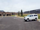
Recently paved parking lot at Camp George West Park.

Photographed 9 April 2019.

Article records that use this photograph:

  • Cretaceous Trail, South Table Mountain Park, Jefferson County, Colorado: 60000.
  • Field Notes: 9 Apr 2019.

        images/20190409_092543sm.jpg


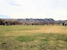
Sports field at Camp George West Park.

Photographed 9 April 2019.

Article records that use this photograph:

        images/20190409_093025sm.jpg

Centennial Cone Park


Guy Gulch from the Travois Trail.

Photographed 10 June 2024.

Location records that use this photograph:

Article records that use this photograph:

        images/20240614_100339sm.jpg


The Travois Trail crosses Elk Creek.

Photographed 10 June 2024.

Location records that use this photograph:

Article records that use this photograph:

        images/20240614_092422sm.jpg


View to southwest of Centennial Cone.

Photographed 10 June 2024.

Location records that use this photograph:

Article records that use this photograph:

        images/20240614_093140sm.jpg


Patch of Sedum lanceolatum on both sides of the trail.

Photographed 10 June 2024.

Location records that use this photograph:

Article records that use this photograph:

        images/20240614_091207sm.jpg


Patch of Sedum lanceolatum beside the Travois Trail.

Photographed 10 June 2024.

Location records that use this photograph:

Article records that use this photograph:

        images/20240614_090620sm.jpg


Douglas Mountain from the North Trailhead of Centennial Cone Park.

Photographed 27 April 2018.

Location records that use this photograph:

Article records that use this photograph:

        images/IMG50123sm.jpg


Centennial Cone, as seen from the West Trailhead.

Photographed 27 April 2018.

Elk Meadow Trail crosses the left middle ground to the saddle in the distance.

Location records that use this photograph:

Article records that use this photograph:

        images/IMG50113sm.jpg


Upper reaches of Mayhem Gulch drainage.

Photographed 27 April 2018.

Elk Meadow Trail visible in left middle ground.

Location records that use this photograph:

Article records that use this photograph:

        images/IMG50111sm.jpg


Travois Trail headed southeast from the North Trailhead

Photographed 27 April 2018.

Lookout Mountain in the distance left of center.

Location records that use this photograph:

Article records that use this photograph:

        images/IMG50124sm.jpg

Clear Creek Canyon


Mayhem Gulch Parking Lot and Trailhead

Photographed 27 April 2018.

Location records that use this photograph:

Article records that use this photograph:

        images/IMG50110sm.jpg

Clear Creek Canyon Park


Head gate of the Church Ditch.

Photographed 29 March 2024.

Location records that use this photograph:

Article records that use this photograph:

        images/20240329_095659sm.jpg


View of Clear Creek downstream of the Welch Ditch Suspension Bridge.

Photographed 14 September 2021.

Location records that use this photograph:

Article records that use this photograph:

        images/20210914_101900sm.jpg


View of Goltra Fire from Peaks to Plains Trail.

Photographed 24 August 2024.

Location records that use this photograph:

Article records that use this photograph:

  • Peaks to Plains Trail, Clear Creek and Jefferson Counties, Colorado: at talus.
  • Field Notes: 24 Aug 2024.

        images/20240824_104404sm.jpg


The east end of the Grant Terry Bridge.

Photographed 29 March 2024.

Location records that use this photograph:

Article records that use this photograph:

        images/20240329_094918sm.jpg


View of Goltra Fire from Grant Terry Bridge.

Photographed 24 August 2024.

Location records that use this photograph:

Article records that use this photograph:

        images/20240824_102736sm.jpg


Field trip waits out a shower.

Photographed 29 May 2022.

Article records that use this photograph:

        images/20220529_121054sm.jpg


Flat on the west side of the Grant Terry Bridge.

Photographed 29 March 2024.

Location records that use this photograph:

Article records that use this photograph:

        images/20240329_095117sm.jpg


Pedestrian bridge over Clear Creek.

Photographed 9 March 2021.

Article records that use this photograph:

        images/20210309_120258sm.jpg


Welch Ditch suspension bridge.

Photographed 29 March 2024.

Location records that use this photograph:

Article records that use this photograph:

        images/20240329_102214sm.jpg


West end of Grant Terry Bridge.

Photographed 29 March 2024.

Article records that use this photograph:

  • Peaks to Plains Trail, Clear Creek and Jefferson Counties, Colorado: 48790.
  • Field Notes: 29 Mar 2024.

        images/20240329_110517sm.jpg


Rattlesnake in the Welch Ditch.

Photographed 23 September 2021.

Location records that use this photograph:

Article records that use this photograph:

        images/20210923_131343sm.jpg


Rock climbing class.

Photographed 23 September 2021 from the Welch Ditch.

Location records that use this photograph:

Article records that use this photograph:

        images/20210923_120711sm.jpg


Welch Ditch Bridge
Welch Ditch Bridge

Photographed 14 September 2021.

Article records that use this photograph:

        images/20210914_102154sm.jpg


View of Clear Creek upstream of the Welch Ditch Suspension Bridge.

Photographed 14 September 2021.

Location records that use this photograph:

Article records that use this photograph:

        images/20210914_101853sm.jpg


Stairs between Peaks to Plains Trail and the Welch Ditch.

Photographed 29 March 2024.

Article records that use this photograph:

  • Welch Ditch, Jefferson County, Colorado: at stairs.
  • Peaks to Plains Trail, Clear Creek and Jefferson Counties, Colorado: at stairs.
  • Field Notes: 29 Mar 2024.

        images/20240329_104839sm.jpg


Junk car along the ditch.

Photographed 29 March 2024.

Location records that use this photograph:

Article records that use this photograph:

        images/20240329_103207sm.jpg


Front Porch Wildflower Walk at the Tough Cuss Bridge.

Photographed 10 June 2026 by Povy Atchison.

Location records that use this photograph:

Article records that use this photograph:

        images/IMG_3746sm.jpg

Coal Creek


Terrace of Coal Creek in Jefferson County.

Photographed 15 June 2022.

Location records that use this photograph:

Article records that use this photograph:

        images/20220615_102223sm.jpg


Coal Creek flow in late July.

Photographed 28 July 2025.

Location records that use this photograph:

Article records that use this photograph:

        images/IMG-20250728-WA0000sm.jpg


Coal Creek upstream from Plainview Road.

Photographed 23 March 2015.

Location records that use this photograph:

Article records that use this photograph:

        images/IMG40920sm.jpg


Coal Creek downstream from Plainview Road.

Photographed 23 March 2015.

Location records that use this photograph:

Article records that use this photograph:

        images/IMG40921sm.jpg

Coal Creek Canyon


Drainage S2 from the low hill.

Photographed 12 April 2024

Location records that use this photograph:

Article records that use this photograph:

        images/20240412_111853sm.jpg


The forest as far as I got up the gulch.

Photographed 10 June 2024.

Location records that use this photograph:

Article records that use this photograph:

        images/20240610_110317sm.jpg


Brumm Trail up on the ridge.

Photographed 5 April 2024.

Article records that use this photograph:

        images/20240405_110336sm.jpg


View out of the canyon to the east.

Photographed 5 April 2024.

Location records that use this photograph:

Article records that use this photograph:

        images/20240405_101943sm.jpg


Coal Creek Canyon Study Area, 12 April 2024.

Exported 14 April 2024.

Location records that use this photograph:

Article records that use this photograph:

        images/Coal_Ck_8400_20240414.jpg


Upper part of small gulch S2.2.

Photographed 24 April 2024.

This is indicated as gulch S2.2 on my map of the Lacey parcel.

Location records that use this photograph:

Article records that use this photograph:

        images/20240424_121307sm.jpg


View east from Brumm Trail.

Photographed 5 April 2024.

Article records that use this photograph:

        images/20240405_113828sm.jpg


View from the low hill in the northeast corner of the Lacey parcel.

Photographed 24 April 2024.

Location records that use this photograph:

Article records that use this photograph:

        images/20240424_102818sm.jpg


Drainage S2 in the Lacey parcel of Coal Creek Canyon Study Area.

Photographed 12 April 2024

Location records that use this photograph:

Article records that use this photograph:

        images/20240412_093017sm.jpg


California Zephyr climbs the Moffat Route across the canyon.

Photographed 12 April 2024

Location records that use this photograph:

Article records that use this photograph:

        images/20240412_095250sm.jpg


View from drainage S2 towards Fire Station 3.

Photographed 12 April 2024

Location records that use this photograph:

Article records that use this photograph:

        images/20240412_110028sm.jpg


Small gulch above Coal Creek (S2.2)

Photographed 24 April 2024.

This is indicated as gulch S2.2 on my map of the Lacey parcel.

Location records that use this photograph:

Article records that use this photograph:

        images/20240424_110321sm.jpg


View across Coal Creek Canyon.

Photographed 24 April 2024.

Location records that use this photograph:

Article records that use this photograph:

        images/20240424_120016sm.jpg


Brumm Trail near the top of the ridge.

Photographed 5 April 2024.

Article records that use this photograph:

        images/20240405_112450sm.jpg


Wide-angle view of Canyon 2 on left and Coal Creek Canyon on right.

Photographed 5 April 2024.

Location records that use this photograph:

Article records that use this photograph:

        images/20240405_102231sm.jpg


View of canyon to the southwest.

Photographed 5 April 2024.

Designated Canyon 2.

Location records that use this photograph:

Article records that use this photograph:

        images/20240405_101646sm.jpg


View up canyon from the mouth of Coal Creek Canyon.

Photographed 5 April 2024.

Location records that use this photograph:

Article records that use this photograph:

        images/20240405_102015sm.jpg


View back across upper part of small gulch (S2.2).

Photographed 24 April 2024.

This is indicated as gulch S2.2 on my map of the Lacey parcel.

Location records that use this photograph:

Article records that use this photograph:

        images/20240424_121645sm.jpg


Looking west in the direction of Blue Mountain.

Photographed 5 April 2024.

Article records that use this photograph:

        images/20240405_111457sm.jpg


Looking west from parking area.

Photographed 5 April 2024.

Location records that use this photograph:

Article records that use this photograph:

        images/20240405_100414sm.jpg


Looking east from parking area.

Photographed 5 April 2024.

Location records that use this photograph:

Article records that use this photograph:

        images/20240405_100420sm.jpg


Smashed picnic table beside Coal Creek.

Photographed 5 April 2024.

Location records that use this photograph:

Article records that use this photograph:

        images/20240405_100818sm.jpg


View west (up canyon) from pullout.

Photographed 5 April 2024.

Location records that use this photograph:

Article records that use this photograph:

        images/20240405_100830sm.jpg


View east (down canyon) in Coal Creek Canyon.

Photographed 5 April 2024.

Location records that use this photograph:

Article records that use this photograph:

        images/20240405_100838sm.jpg


View south from Brumm Trail.

Photographed 5 April 2024.

Article records that use this photograph:

        images/20240405_113208sm.jpg


Looking west on CO Hwy 72, Coal Creek Canyon Road.

Photographed 23 March 2015.

Location records that use this photograph:

Article records that use this photograph:

        images/IMG40931sm.jpg

Coal Creek Canyon Study Area


View back across Coal Creek Canyon.

Photographed 19 July 2024.

Location records that use this photograph:

Article records that use this photograph:

        images/20240719_105748sm.jpg


Upper grassy slope.
Upper grassy slope.

Photographed 19 July 2024.

Location records that use this photograph:

Article records that use this photograph:

        images/20240719_100443sm.jpg


Flood debris (from 2013?) buttressed by two Douglas fir.

Photographed 19 July 2024.

Location records that use this photograph:

Article records that use this photograph:

        images/20240719_111833sm.jpg


Where I am headed today -- the grassy slope in the middle ground.

Photographed 19 July 2024.

Location records that use this photograph:

Article records that use this photograph:

        images/20240719_084021sm.jpg


View across to the north side of Coal Creek Canyon.

Photographed 21 June 2024.

Location records that use this photograph:

Article records that use this photograph:

        images/20240621_110158sm.jpg


Lower part of Gulch S3a.

Photographed 21 June 2024.

First tributary of the third substantial gulch on the south side of Coal Creek.

Location records that use this photograph:

Article records that use this photograph:

        images/20240621_103850sm.jpg


Forest glade where I collected No. 3278, Potentilla pulcherrima × Potentilla hippiana.

Photographed 21 June 2024.

Location records that use this photograph:

Article records that use this photograph:

        images/20240621_123015sm.jpg


Incised drainage in Gulch S3.

Photographed 21 June 2024.

Gulch S3 is the third substantial gulch on the south side of Coal Creek Canyon.

Location records that use this photograph:

Article records that use this photograph:

        images/20240621_103251sm.jpg


A Rogues' Gallery of weeds along Coal Creek.

Photographed 3 July 2024.

Left to right: Verbascum thapsus, Potentilla recta, Hypericum perfoliatum, Dactylis glomerata, Matricaria discoidea Tripleurospermum inodorum, and Berteroa incana.

Article records that use this photograph:

        images/20240703_081822sm.jpg

Colorado Railroad Museum


Colorado Railroad Museum from North Table Mountain

Photographed 9 June 2015.

Article records that use this photograph:

        images/IMGQ0778sm.jpg

Dinosaur Ridge


Two young women with unleashed dogs.

Photographed 29 May 2020.

I had previously talked to these women and asked them to leash their dogs. Later I saw them returning on the trail with their dogs off leash. This was about 4 minutes after I photographed the rattlesnake (by the time stamps on the photographs).

Article records that use this photograph:

        images/20200529_102501sm.jpg


Junction with the Zorro Trail.

Photographed 29 May 2020.

Article records that use this photograph:

        images/20200529_103448sm.jpg


Green Mountain from Dinosaur Ridge

Photographed 29 May 2020.

Location records that use this photograph:

Article records that use this photograph:

        images/20200529_093819sm.jpg


View to the northwest of the Hogback Fire.

Photographed 13 April 2023.

Location records that use this photograph:

Article records that use this photograph:

        images/20230413_094016sm.jpg


Nico with a dinosaur track.

Photographed 10 August 2019.

Article records that use this photograph:

        images/20190810_104758sm.jpg


Burned ponderosas and junipers at the observation site.

Photographed 13 April 2023.

Location records that use this photograph:

Article records that use this photograph:

        images/20230413_094022sm.jpg


Looking south on the Dakota Ridge Trail.

Photographed 29 May 2020.

Article records that use this photograph:

        images/20200529_103457sm.jpg


Looking north on the Dakota Ridge Trail.

Photographed 29 May 2020.

Article records that use this photograph:

        images/20200529_103453sm.jpg


Nico with a dinosaur track.

Photographed 10 August 2019.

Article records that use this photograph:

        images/20190810_104815sm.jpg


Nico with a dinosaur track.

Photographed 10 August 2019.

Article records that use this photograph:

        images/20190810_110604sm.jpg


Nico touches a dinosaur bone.

Photographed 10 August 2019.

Article records that use this photograph:

        images/20190810_110736sm.jpg


View northward across the water gap partially burned by the Hogback Fire.

Photographed 13 April 2023.

Location records that use this photograph:

Article records that use this photograph:

        images/20230413_104627sm.jpg


Northern edge of burned area.

Photographed 13 April 2023.

Location records that use this photograph:

Article records that use this photograph:

        images/20230413_092320sm.jpg


Interstate 70 enters Mount Vernon Canyon.

Photographed 29 May 2020.

Location records that use this photograph:

Article records that use this photograph:

        images/20200529_092908sm.jpg


View southward across the water gap after the Hogback Fire.

Photographed 13 April 2023.

Location records that use this photograph:

Article records that use this photograph:

        images/20230413_103537sm.jpg


Stegosaurus Lot, trailhead for Dinosaur Ridge.

Photographed 29 May 2020.

Location records that use this photograph:

Article records that use this photograph:

        images/20200529_090413sm.jpg


May favorite kind of trail -- straight up.

Photographed 29 May 2020.

Location records that use this photograph:

Article records that use this photograph:

        images/20200529_090410sm.jpg


Area burned by the Hogback Fire to the southwest.

Photographed 13 April 2023.

Location records that use this photograph:

Article records that use this photograph:

        images/20230413_100139sm.jpg


Area burned by the Hogback Fire to the northwest.

Photographed 13 April 2023.

Location records that use this photograph:

Article records that use this photograph:

        images/20230413_100144sm.jpg


View northward from burned to unburned areas.

Photographed 13 April 2023.

Location records that use this photograph:

Article records that use this photograph:

        images/20230413_103547sm.jpg

Douglas Mountain area


Lots of ranchettes in upper Elk Creek drainage.

Photographed 27 April 2018.

Article records that use this photograph:

        images/IMG50120sm.jpg


Ranch in upper Elk Creek drainage.

Photographed 27 April 2018.

Article records that use this photograph:

        images/IMG50118sm.jpg


Douglas Mountain above the road.

Photographed 27 April 2018.

Location records that use this photograph:

Article records that use this photograph:

        images/IMG50122sm.jpg


Yellow Submarine mail box.

Photographed 27 April 2018.

Article records that use this photograph:

        images/IMG50116sm.jpg

Douglas Mountain Study Area


Old road, location of Coll. Nos. 3155-3162.

Photographed 26 July 2023.

Location records that use this photograph:

Article records that use this photograph:

        images/20230726_103748sm.jpg


Old road, location of Coll. Nos. 3155-3162.

Photographed 26 July 2023.

Location records that use this photograph:

Article records that use this photograph:

        images/20230726_103755sm.jpg


Where we parked on July 31st.

Photographed 31 July 2023.

Location records that use this photograph:

Article records that use this photograph:

        images/20230731_093202sm.jpg

Easley


Burlington Northern local crosses 44th Avenue.

Photographed 17 January 2022.

Article records that use this photograph:

        images/20220117_130829sm.jpg

Goose Creek


The view east; Goose Creek Trailhead in center.

Photographed 23 May 2021.

Location records that use this photograph:

Article records that use this photograph:

  • Forest Road 558, Pike-San Isabel National Forest: 12000.
  • Field Notes: 24 May 2021.

        images/20210523_120708sm.jpg


The view to the south of Hankins Gulch.

Photographed 23 May 2021.

Location records that use this photograph:

Article records that use this photograph:

  • Forest Road 558, Pike-San Isabel National Forest: 12000.
  • Field Notes: 24 May 2021.

        images/20210523_120713sm.jpg


Rocks along Goose Creek

Photographed 23 May 2021.

Location records that use this photograph:

Article records that use this photograph:

        images/20210523_134807sm.jpg


More rocks along Goose Creek

Photographed 23 May 2021.

Location records that use this photograph:

Article records that use this photograph:

        images/20210523_135410sm.jpg


A very muddy Goose Creek.

Photographed 23 May 2021.

Location records that use this photograph:

Article records that use this photograph:

        images/20210523_131942sm.jpg

Goose Creek Area


Aspens beginning to turn above 10,000 feet.

Photographed 12 September 2024.

Article records that use this photograph:

        images/20240912_131902sm.jpg


North end of Sheeprock from FR 211.

Photographed 12 September 2024.

Location records that use this photograph:

Article records that use this photograph:

        images/20240912_133216sm.jpg


View north along the east slope of the Tarryall Mountains.

Photographed 12 September 2024.

Location records that use this photograph:

Article records that use this photograph:

        images/20240912_141132sm.jpg


Aspens beginning to turn above 10,000 feet.

Photographed 12 September 2024.

Article records that use this photograph:

        images/20240912_131906sm.jpg


Sheeprock from the south.

Photographed 12 September 2024.

Location records that use this photograph:

Article records that use this photograph:

        images/20240912_141103sm.jpg

Green Mountain


View of Green Mountain from South Table Mountain.

Photographed 19 June 2014.

Location records that use this photograph:

Article records that use this photograph:

        images/IMG40279sm.jpg


Forsberg / Iron Mountain Park from Green Mountain

Photographed 2 August 2014.

Location records that use this photograph:

Article records that use this photograph:

        images/IMG40334sm.jpg

Guy Gulch


View across Guy Gulch from the high point of the day.

Photographed 12 July 2023.

Location records that use this photograph:

Article records that use this photograph:

  • County Road 70,“ Golden Gate Canyon Road,” Jefferson County, Colorado: 39000.
  • Field Notes: 12 Jul 2023.

        images/20230712_120850sm.jpg


Meadow above Guy Gulch.

Photographed 23 June 2023.

Location records that use this photograph:

Article records that use this photograph:

        images/20230623_100936sm.jpg


Where we went Wednesday, 12 July 2023.

Photographed 12 July 2023.

Location records that use this photograph:

Article records that use this photograph:

        images/20230712_125500sm.jpg


Meadow above Guy Gulch.

Photographed 23 June 2023.

Location records that use this photograph:

Article records that use this photograph:

        images/20230623_110909sm.jpg


View northwest on Guy Gulch, 14 June 2023.

Photographed 14 June 2023.

Location records that use this photograph:

Article records that use this photograph:

        images/20230614_074051sm.jpg


Bear sign.
Bear sign.

Photographed 6 June 2023.

Location records that use this photograph:

Article records that use this photograph:

        images/20230606_122710sm.jpg


View northwest along Guy Gulch.

Photographed 6 June 2023.

Location records that use this photograph:

Article records that use this photograph:

        images/20230606_100552sm.jpg


View southeast of Guy Gulch.

Photographed 6 June 2023.

Location records that use this photograph:

Article records that use this photograph:

        images/20230606_100541sm.jpg

Hildebrand Ranch Park


Hildebrand Ranch Park from the Two Brands Trail

Photographed 15 March 2015.

Location records that use this photograph:

Article records that use this photograph:

        images/IMG40907sm.jpg

Jewell Hill


Colorado Native Plant Society field trip to Jewell parcel.

Photographed 18 September 2022.

Article records that use this photograph:

        images/20220918_142050sm.jpg

Lippincott Property


View of Lippincott property from southeast corner.

Photographed 24 April 2019.

Location records that use this photograph:

Article records that use this photograph:

        images/IMG50684sm.jpg


South gate, from Lippincott property.

Photographed 18 April 2019.

Location records that use this photograph:

Article records that use this photograph:

        images/IMG50665sm.jpg


View across springy ground.

Photographed 18 April 2019.

Location records that use this photograph:

Article records that use this photograph:

        images/IMG50673sm.jpg


Southeast parcel, general view to northwest.

Photographed 24 April 2019.

Location records that use this photograph:

Article records that use this photograph:

        images/IMG50682sm.jpg


Sugar Bowls, Clematis hirsutissima, Irene's knee for scale.

Photographed 24 April 2019.

Location records that use this photograph:

Article records that use this photograph:

        images/IMG50680sm.jpg


The elk were keeping a close eye on us.

Photographed 24 April 2019.

Location records that use this photograph:

Article records that use this photograph:

        images/IMG50679sm.jpg


One of several small ponds on the stream.

Photographed 24 April 2019.

Location records that use this photograph:

Article records that use this photograph:

        images/IMG50678sm.jpg


Bull Gulch, looking upstream.

Photographed 18 April 2019.

Location records that use this photograph:

Article records that use this photograph:

        images/IMG50650sm.jpg


Entrance to Lippincott Property.

Photographed 18 April 2019.

Location records that use this photograph:

Article records that use this photograph:

        images/IMG50675sm.jpg


Southeast parcel, general view to northeast.

Photographed 24 April 2019.

Location records that use this photograph:

Article records that use this photograph:

        images/IMG50683sm.jpg


Ranch road, generally north-ish.

Photographed 18 April 2019.

Location records that use this photograph:

Article records that use this photograph:

        images/IMG50672sm.jpg


Quarry
Quarry

Photographed 18 April 2019.

Location records that use this photograph:

Article records that use this photograph:

        images/IMG50669sm.jpg


Quarry
Quarry

Photographed 18 April 2019.

Location records that use this photograph:

Article records that use this photograph:

        images/IMG50668sm.jpg


Stream crossing.
Stream crossing.

Photographed 18 April 2019.

The stream comes down the former quarry, and has washed out the ranch road crossing.

Location records that use this photograph:

Article records that use this photograph:

        images/IMG50666sm.jpg


Lippincott property on 1942 base map.

The base map is the Eldorado Springs, CO 1:24000 1942 quadrangle. The main road to the north has shifted to the current alignment. The dwelling near the western edge of the Zaharias parcel is still there.

Location records that use this photograph:

Article records that use this photograph:

        images/Lippincott_Property_1942.jpg


South gate, City of Boulder side.

Photographed 18 April 2019.

Location records that use this photograph:

Article records that use this photograph:

        images/IMG50662sm.jpg


North gate, to City of Boulder property.

Photographed 18 April 2019.

Location records that use this photograph:

Article records that use this photograph:

        images/IMG50660sm.jpg


Ranch road approaches Bull Gulch.

Photographed 18 April 2019.

Location records that use this photograph:

Article records that use this photograph:

        images/IMG50659sm.jpg


Path southwest to middle meadow.

Photographed 18 April 2019.

The white thing in the right middleground is a hy-rail truck on the Union Pacific railroad.

Location records that use this photograph:

Article records that use this photograph:

        images/IMG50657sm.jpg


Where the old ranch road crosses Bull Gulch.

Photographed 18 April 2019.

Location records that use this photograph:

Article records that use this photograph:

        images/IMG50655sm.jpg


Turkey, one of a pair, many more seens.

Photographed 18 April 2019.

Article records that use this photograph:

        images/IMG50653sm.jpg


View up the quarry from the ranch road crossing.

Photographed 18 April 2019.

Location records that use this photograph:

Article records that use this photograph:

        images/IMG50667sm.jpg


Former watercourse (?), view upstream

Photographed 26 May 2019.

Location records that use this photograph:

Article records that use this photograph:

        images/IMG50701sm.jpg


View east to Rocky Flats.

Photographed 1 July 2019.

Location records that use this photograph:

Article records that use this photograph:

        images/20190701_084421sm.jpg


My assistants for a day of collecting.

Photographed 17 June 2019.

Location records that use this photograph:

Article records that use this photograph:

        images/20190617_094326sm.jpg


View southeast from “Saddle Meadow”

Photographed 13 July 2019.

Location records that use this photograph:

Article records that use this photograph:

        images/20190713_121703sm.jpg


Turkey, maybe the same one.

Photographed 26 May 2019.

Location records that use this photograph:

Article records that use this photograph:

        images/IMG50718sm.jpg


Meadow in the southwest corner.

Photographed 26 May 2019.

Location records that use this photograph:

Article records that use this photograph:

        images/20190526_120817sm.jpg


View east from the Lippincott property.

Photographed 26 May 2019.

Location records that use this photograph:

Article records that use this photograph:

        images/20190526_095617fb.jpg


Gate, usually locked, closed to public access.

Photographed 18 April 2019.

Location records that use this photograph:

Article records that use this photograph:

        images/IMG50630sm.jpg


Meadow and Ponderosa pine woodland in the northernmost part of the property.

Photographed 26 May 2019.

Location records that use this photograph:

Article records that use this photograph:

        images/IMG50707sm.jpg


Carpet of Spring Beauty (Claytonia rosea) under the Ponderosa Pines.

Photographed 24 April 2019.

Location records that use this photograph:

Article records that use this photograph:

        images/IMG50690sm.jpg


Former watercourse (?), view downstream.

Photographed 26 May 2019.

Location records that use this photograph:

Article records that use this photograph:

        images/IMG50702sm.jpg


Lippincott property on 1906 base map.

The base map is the Blackhawk 1:62,500 1906 quadrangle, 1906 edition. One thing that occurs to me is that the trail I followed around the west side of the hill was, in 1906, a road. Also notice the location of the road up into the northernmost tract. I'll have to look for that road when I try to get up into that area.

Location records that use this photograph:

Article records that use this photograph:

        images/Lippincott_1906.jpg


Stream and springy ground at top of quarry.

Photographed 18 April 2019.

Location records that use this photograph:

Article records that use this photograph:

        images/IMG50636sm.jpg


BNSF train on the Moffatt Route.

Photographed 13 July 2019.

Location records that use this photograph:

Article records that use this photograph:

        images/20190713_122735sm.jpg


Lippincott property on 1965 rev. 1994 base map.

The base map is the Eldorado Springs, CO 1:24000 1965 revised 1994 quadrangle.

Location records that use this photograph:

Article records that use this photograph:

        images/Lippincott_Property_1965_Rev1994.jpg


Lippincott property on 1965, 1967 ed. base map.

The base map is the Eldorado Springs, CO 1:24000 1965, 1967 ed. quadrangle.

Location records that use this photograph:

Article records that use this photograph:

        images/Lippincott_Property_1965_1967ed.jpg


Tilted rocks above middle meadow.

Photographed 18 April 2019.

Location records that use this photograph:

Article records that use this photograph:

        images/IMG50644sm.jpg


The summit meadow.
The summit meadow.

Photographed 18 April 2019.

Location records that use this photograph:

Article records that use this photograph:

        images/IMG50641sm.jpg


The linear opening in the forest accomodates a power line.

Photographed 18 April 2019.

I assume to power line goes to the radio facilities on El Dorado Mountain.

Location records that use this photograph:

Article records that use this photograph:

        images/IMG50637sm.jpg


Turkey
Turkey

Photographed 26 May 2019.

Location records that use this photograph:

Article records that use this photograph:

        images/IMG50700sm.jpg


The way out, south-ish.

Photographed 18 April 2019.

Location records that use this photograph:

Article records that use this photograph:

        images/IMG50635sm.jpg


The road continues north-ish in the direction of Bull Gulch.

Photographed 18 April 2019.

Location records that use this photograph:

Article records that use this photograph:

        images/IMG50634sm.jpg


Location of three collections of tiny annuals.

Photographed 18 April 2019.

The collections were #2016 Collinsia parviflora, #2017 Capsella bursa-pastoris, and #2018 Draba reptans.

Article records that use this photograph:

        images/IMG50633sm.jpg

Lippincott Ranch


John Vickery collecting Asplenium septentrionale from the rocks, north side of Bull Gulch.

Photographed 7 August 2021.

Location records that use this photograph:

Article records that use this photograph:

        images/20210807_133913sm.jpg


Two rattlesnakes under the rocks.

Photographed 7 August 2021.

Location records that use this photograph:

Article records that use this photograph:

        images/20210807_103339sm.jpg


Cows grazing in Bull Gulch on a smokey day.

Photographed 7 August 2021.

Location records that use this photograph:

Article records that use this photograph:

        images/20210807_091904sm.jpg


Bull Gulch on a very smokey day.

Photographed 7 August 2021.

Location records that use this photograph:

Article records that use this photograph:

        images/20210807_133850SM.jpg


View to the northeast of Lippincott Ranch.

Photographed 4 June 2021.

Location records that use this photograph:

Article records that use this photograph:

        images/20210604_155105sm.jpg


Rattlesake peaking out between boulders.

Photographed 7 August 2021.

Location records that use this photograph:

Article records that use this photograph:

        images/20210807_103323sm.jpg

Little Scraggy Peak


Little Scraggy Peak from the location of my Coll. Nos. 2183-2185.

Photographed 23 July 2019.

Location records that use this photograph:

Article records that use this photograph:

        images/20190723_115204fb.jpg


Panorama at the location of Coll. Nos. 2186-2188.

Photographed 23 July 2019.

Location records that use this photograph:

Article records that use this photograph:

        images/20190723_130303fb.jpg


Closest I've gotton to Little Scraggy Peak.

Photographed 16 September 2019.

Location records that use this photograph:

Article records that use this photograph:

        images/20190916_113336sm.jpg

Long Scraggy Peak


Long Scraggy Peak
Long Scraggy Peak

Photographed 23 July 2019.

Location records that use this photograph:

Article records that use this photograph:

        images/20190723_115030fb.jpg

Lookout Mountain


Out looking for the comet.

Photographed 21 December 2020.

The clouds cleared and we saw it; just much too small for my mobile phone camera to render a decent photograph.

Article records that use this photograph:

        images/20201221_171538sm.jpg


Golden from the Buffalo Bill Museum.

Photographed 30 May 2022.

Location records that use this photograph:

Article records that use this photograph:

        images/20220530_152407sm.jpg


Denver from the Buffalo Bill Museum.

Photographed 30 May 2022.

Location records that use this photograph:

Article records that use this photograph:

        images/20220530_152619sm.jpg


Lookout Mountain as seen from Green Mountain.

Photographed 2 August 2014.

Location records that use this photograph:

Article records that use this photograph:

        images/IMG40329sm.jpg

Lookout Mountain Nature Center


Matching animal tracks at the Lookout Mountain Nature Center.

Photographed 20 August 2019.

Location records that use this photograph:

Article records that use this photograph:

        images/20190820_122209sm.jpg

Magpie Gulch


Small cascade in Magpie Gulch.

Photographed 26 June 2024.

Location records that use this photograph:

Article records that use this photograph:

        images/20240626_103857sm.jpg


Bag of pea gravel in a area of unauthorized trail maintenance.

Photographed 26 June 2024.

Location records that use this photograph:

Article records that use this photograph:

        images/20240626_093526sm.jpg

Molly Gulch


Molly Gulch looking downstream.

Photographed 18 June 2025.

Location records that use this photograph:

Article records that use this photograph:

        images/20250618_100915sm.jpg


Molly Gulch looking upstream.

Photographed 18 June 2025.

Location records that use this photograph:

Article records that use this photograph:

        images/20250618_095435sm.jpg

Morrison


Red Rocks in winter.

Photographed 22 November 2014.

Article records that use this photograph:

        images/IMG40677sm.jpg

Morrison Creek


Wider-Angle View of Meadow on upper Morrison Creek.

Photographed 6 August 2021.

Location records that use this photograph:

Article records that use this photograph:

        images/20210805_125140sm.jpg


Horse trail signs along the old road on Morrison Creek.

Photographed 6 August 2021.

Location records that use this photograph:

Article records that use this photograph:

        images/20210805_HorseSigns.jpg


Meadow on upper Morrison Creek.

Photographed 6 August 2021.

Location records that use this photograph:

Article records that use this photograph:

        images/20210805_125136sm.jpg

Morrison Natural History Museum


Nico tries using an air chisel.

Photographed 15 August 2019.

Article records that use this photograph:

        images/20190815_115817sm.jpg

Mount Falcon Park


Beginning of the Meadow Trail.

Photographed 1 June 2015.

Location records that use this photograph:

Article records that use this photograph:

        images/IMGQ0713sm.jpg


View of US Highway 285 from the Castle Trail in Mount Falcon Park

Photographed 1 June 2015.

Location records that use this photograph:

Article records that use this photograph:

        images/IMGQ0650sm.jpg


Northwest on the Castle Trail to the Mt Falcon Road trailhead.

Photographed 1 June 2015.

Location records that use this photograph:

Article records that use this photograph:

        images/IMGQ0710sm.jpg


Western end of Meadow Trail.

Photographed 1 June 2015.

The Castle Trail crosses the base of the little hill. Frasera speciosa was found on the northeast side of the hill.

Location records that use this photograph:

Article records that use this photograph:

        images/IMGQ0707sm.jpg


The Castle Trail turns east in the direction of the Great Plains.

Photographed 1 June 2015.

Location records that use this photograph:

Article records that use this photograph:

        images/IMGQ0716sm.jpg


View of Castle Trail from Eagle Eye Shelter.

Photographed 1 June 2015.

Location records that use this photograph:

Article records that use this photograph:

        images/IMGQ0653sm.jpg

Mount Galbraith Park


View southeast down Nightbird Gulch.

Photographed 3 May 2015.

Location records that use this photograph:

Article records that use this photograph:

        images/IMGQ0396sm.jpg


Map of Nightbird Gulch Trail.

Map created 24 November 2017.

Location records that use this photograph:

Article records that use this photograph:

        images/COJefNightbirdGulchTrl.jpg


Downtown Denver from Mt. Galbraith.

Photographed 24 November 2017.

Article records that use this photograph:

        images/IMGQ4462sm.jpg


Nightbird Gulch Trail skirts a small flat that is closed for revegetation.

Photographed 3 May 2015.

Location records that use this photograph:

Article records that use this photograph:

        images/20150503_095126sm.jpg


Lower portion of Nightbird Gulch Trail.

Photographed 3 May 2015.

Location records that use this photograph:

Article records that use this photograph:

        images/20150503_091343sm.jpg


Yay! Dog poop in a bag!

Photographed 24 November 2017.

Article records that use this photograph:

        images/20171124_140032sm.jpg


Colorado School of Mines with Green Mountain in the background

Photographed 24 November 2017.

Article records that use this photograph:

        images/IMGQ4460sm.jpg


Hikers on the Mount Galbraith Loop (above) and Cedar Gulch Trail (below).

Photographed 3 May 2015.

Location records that use this photograph:

Article records that use this photograph:

        images/IMGQ0402sm.jpg


View northeast out of Mount Galbraith Park.

Photographed 3 May 2015.

Location records that use this photograph:

Article records that use this photograph:

        images/IMGQ0389sm.jpg


Revegetation area on southeast slope of Mt. Galbraith

Photographed 24 November 2017.

Location records that use this photograph:

Article records that use this photograph:

        images/20171124_142304sm.jpg

Mount Zion


Nico at the gate to the M.

Photographed 20 August 2019.

Article records that use this photograph:

        images/20190820_092332sm.jpg


Nico and Ian on the trail to the M.

Photographed 20 August 2019.

Article records that use this photograph:

        images/20190820_092928sm.jpg

National Renewable Energy Laboratory


Entrance to the National Renewable Energy Laboratory

Photographed 9 April 2019.

Article records that use this photograph:

        images/20190409_094119sm.jpg

Nightbird Gulch


View west, up Nightbird Gulch to saddle.

Photographed 3 May 2015.

Location records that use this photograph:

Article records that use this photograph:

        images/IMGQ0379sm.jpg

North Fork


North Fork between Pine Valley and Buffalo Creek.

Photographed 2 July2025.

Article records that use this photograph:

  • County Road 126 “Pine Valley Road” and “Deckers Road,” Jefferson County, Colorado: at ranch.
  • Field Notes: 2 Jul 2025.

        images/20250702_082128sm.jpg

North Fork Volunteer Fire Department


Gormet lunch at North Fork Volunteer Fire Department.

Photographed 7 December 2019.

Location records that use this photograph:

Article records that use this photograph:

  • County Road 126 “Pine Valley Road” and “Deckers Road,” Jefferson County, Colorado: 49000.
  • Field Notes: 7 Dec 2019.

        images/20191207_124249sm.jpg


Our photo with Santa.

Photographed 7 December 2019.

Location records that use this photograph:

Article records that use this photograph:

  • County Road 126 “Pine Valley Road” and “Deckers Road,” Jefferson County, Colorado: 49000.
  • Field Notes: 7 Dec 2019.

        images/20191207_130148sm.jpg

North Golden


Wyoming Street from North Table Mountain

Photographed on Winter Solstice, 21 December 2014, while standing on the foundation remains of the rock tramway.

Article records that use this photograph:

        images/IMG40751sm.jpg

North Table Mountain


Distinctive features and place names for North Table Mountain.

Kilburn, Paul D., and Sally L. White, 1992.

Location records that use this photograph:

Article records that use this photograph:

        images/ntm92f3.jpg


Geographic setting on North Table Mountain.

Kilburn, Paul D., and Sally L. White, 1992.

Article records that use this photograph:

  • North Table Mountain: Its History and Natural Features: Introduction.

        images/ntm92f2.jpg


Soil types on North Table Mountain, after Soil Conservation Service (1980).

Kilburn, Paul D., and Sally L. White, 1992.

Deeper soils (Clayey Foothill Range SiteO occur in drainages. Shallow soils (Shallow Foothill Range Site) predominate on the top. Rock Outcrops (hatched) form the rim, and rocky slopes (Rocky Foothill Range Site) surround the mountain.

Article records that use this photograph:

        images/ntm92f4.jpg


Slot or grotto below the cliffs.

Photographed 6 April 2019.

Article records that use this photograph:

  • Climbing Access Trail, North Table Mountain Park, Jefferson County, Colorado: below rim.
  • Field Notes: 6 Apr 2019.

        images/IMGQ4877sm.jpg


Survey Pin
Survey Pin

Photographed 27 March 2019.

“PLS 27612” identifies the surveyor, Lawrence L. Pfifer, in this case.

Article records that use this photograph:

  • Climbing Access Trail, North Table Mountain Park, Jefferson County, Colorado: below rim.
  • Field Notes: 27 Mar 2019.

        images/20190327_103634sm.jpg


Property boundaries lined up on a section line.

Photographed 27 March 2019.

Article records that use this photograph:

  • Climbing Access Trail, North Table Mountain Park, Jefferson County, Colorado: below rim.
  • Field Notes: 27 Mar 2019.

        images/20190327_103611sm.jpg


Denver from North Table Mountain

Photographed 6 Nov 2020.

Location records that use this photograph:

Article records that use this photograph:

        images/IMGQ5219sm.jpg


I don't think closing the trail has worked.

Photographed 27 March 2019.

Article records that use this photograph:

        images/20190327_101639sm.jpg


Does every rock need a steel anchor?

Photographed 27 March 2019.

Article records that use this photograph:

  • Climbing Access Trail, North Table Mountain Park, Jefferson County, Colorado: below rim.
  • Field Notes: 27 Mar 2019.

        images/20190327_102125sm.jpg


Across the top of North Table Mountain.

Photographed 6 Nov 2020.

Location records that use this photograph:

Article records that use this photograph:

        images/IMGQ5217sm.jpg


Vegetation types on North Table Mountain, adapted from Zeise (1976).

Kilburn, Paul D., and Sally L. White, 1992.

Article records that use this photograph:

  • North Table Mountain: Its History and Natural Features: Vegetation.

        images/ntm92f5.jpg


North Golden from North Table Mountain.

Photographed 6 Nov 2020.

Location records that use this photograph:

Article records that use this photograph:

        images/IMGQ5216sm.jpg


Western Fence Lizard in the grotto.

Photographed 6 April 2019.

Article records that use this photograph:

  • Climbing Access Trail, North Table Mountain Park, Jefferson County, Colorado: below rim.
  • Field Notes: 6 Apr 2019.
  • North Table Mountain: Its History and Natural Features: Other Vertebrates.

        images/20190406_152645sm.jpg


North Table Loop climbs out of Golden Ravine.

Photographed 27 March 2019.

Location records that use this photograph:

Article records that use this photograph:

        images/20190327_100048sm.jpg


Climbers hiking along the base of the cliffs.

Photographed 6 April 2019.

Article records that use this photograph:

  • Climbing Access Trail, North Table Mountain Park, Jefferson County, Colorado: below rim.
  • Field Notes: 6 Apr 2019.

        images/IMGQ4875sm.jpg


Mouth of Golden Ravine.

Photographed 27 March 2019.

Location records that use this photograph:

Article records that use this photograph:

        images/20190327_100104sm.jpg


Coyote in Golden Ravine.

Photographed 27 March 2019.

I think I spooked the coyote out of the shrubs at the bottom of the ravine when I appeared on the rim.

Location records that use this photograph:

Article records that use this photograph:

        images/20190327_100149sm.jpg


Small herd of deer on North Table Mountain.

Photographed 27 March 2019.

Article records that use this photograph:

        images/20190327_100453sm.jpg


Two golf balls on top of the mesa.

Photographed 27 March 2019.

Article records that use this photograph:

        images/20190327_100804combo.jpg


Where I previously found Munroa squarrosa.

Photographed 27 March 2019.

Article records that use this photograph:

        images/20190327_101118sm.jpg


Grrrr, Someone rode their mountain bike off trail in the mud.

Photographed 27 March 2019.

Article records that use this photograph:

        images/20190327_095944sm.jpg


Areas affected by the September 1988 fire on North Table Mountain.

Kilburn, Paul D., and Sally L. White, 1992.

Map prepared by P. D. Kilburn. The patchy grassland fire across the top of the plateau was much less intense than fires on the north and west slopes, as delineated here.

Article records that use this photograph:

  • North Table Mountain: Its History and Natural Features: Figure 6.

        images/ntm92f6.jpg


Top of the quarry road.

Photographed 22 April 2016.

Article records that use this photograph:

        images/IMGQ2419sm.jpg


Golden from south rim of North Table Mountain

Photographed 8 October 2014.

Location records that use this photograph:

  • Golden, Jefferson County, Colorado

Article records that use this photograph:

  • Golden Cliffs Trail, Golden, Jefferson County, Colorado: at rim.
  • Field Notes: 8 Oct 2014.

        images/IMG40561sm.jpg


Path of rock tramway on North Table Mountain.

Photographed 22 April 2016.

Article records that use this photograph:

  • North Quarry Climbing Access Trail, North Table Mountain Park, Jefferson County, Colorado: s. edge.
  • Field Notes: Friday, April 22nd.

        images/IMGQ2404sm.jpg


Social trail up from Easley Road.

Photographed 27 February 2016.

Article records that use this photograph:

        images/IMGQ1994sm.jpg


Sea Cliffs climbing area in old quary on North Table Mountain

Photographed 8 October 2014.

Article records that use this photograph:

        images/IMG40568sm.jpg


North Quarry from Lichen Peak.

Photographed 22 April 2016.

Article records that use this photograph:

        images/IMGQ2433sm.jpg


North Quarry climbing area.

Photographed 22 April 2016.

Article records that use this photograph:

        images/IMGQ2416sm.jpg


Trail Junction: Trail to North Quary Climbing Area and Sea Cliffs.

Photographed 22 April 2016.

Article records that use this photograph:

        images/IMGQ2400sm.jpg


Artificial and ephemeral ponds on top of North Table Mountain.

Photographed 22 April 2016.

The larger pond in the center usually has perennial water. The hiker in the left middleground is on the Tilting Mesa Trail. The small ponds behind him are in the scraped area. The farthest pond on the left may be natural, but it has been enhanced at the west (right) end.

Article records that use this photograph:

        images/IMGQ2425sm.jpg


Artificial pond on top of North Table Mountain.

Photographed 22 April 2016.

This pond usually dries up in the summer. The Tilting Mesa Trail crosses the dam forming the pond.

Article records that use this photograph:

        images/IMGQ2428sm.jpg


West end of fourth highway terrace.

Photographed 27 February 2016.

Article records that use this photograph:

        images/IMGQ1997sm.jpg


The territory between Lichen Peak and the radio tower.

Photographed 22 April 2016.

There is a coyote circled at lower left.

Article records that use this photograph:

        images/IMGQ2431sm.jpg


Lichen Peak from the North Quarry wall.

Photographed 22 April 2016.

The North Table Loop is the trail in the foreground. Its junction with the Tilting Mesa Trail is at right. The Lichen Peak trail diverges from the Tilting Mesa Trail at extreme right.

Article records that use this photograph:

        images/IMGQ2413sm.jpg


City of Golden, North Table Mountain Trailhead

Photographed 6 October 2014.

Article records that use this photograph:

        images/IMG40543sm.jpg


Southern rim of North Table Mountain.

Photographed 27 February 2016.

Article records that use this photograph:

        images/IMGQ2015sm.jpg


Southwest face of North Table Mountain

Photographed 6 October 2014.

This happens to be the 5,000th image on my web site.

Location records that use this photograph:

Article records that use this photograph:

        images/IMG40542sm.jpg


Break in rim.
Break in rim.

Photographed 8 October 2014.

Article records that use this photograph:

        images/IMG40560sm.jpg


Erosion control on the North Table Mountain trail.

Photographed 22 April 2016.

Article records that use this photograph:

        images/IMGQ2378sm.jpg


Social trail on west side of North Table Mountain.

Photographed 22 April 2016.

Article records that use this photograph:

        images/IMGQ2380sm.jpg


North Table Mountain trail

Photographed 22 April 2016.

Article records that use this photograph:

        images/IMGQ2383sm.jpg


Top of North Table Mountain.

Photographed 22 April 2016.

Article records that use this photograph:

        images/IMGQ2398sm.jpg


Social trail on top of fourth highway bench.

Photographed 27 February 2016.

Article records that use this photograph:

        images/IMGQ1993sm.jpg

North Table Mountain Park


Junction of Lithic Trail with North Table Loop.

Photographed 9 June 2015.

Location records that use this photograph:

Article records that use this photograph:

        images/20150609_090335sm.jpg


Junction of Lithic Trail with North Table Loop.

Photographed 9 June 2015.

Article records that use this photograph:

        images/20150609_090359sm.jpg


Golden Cliffs Trailhead

Photographed 8 October 2014.

Location records that use this photograph:

Article records that use this photograph:

  • Checklist Flora of Native and Naturalized Vascular Plants of Golden and Vicinity, Jefferson County, Colorado: N Table Mtn.
  • Golden Cliffs Trail, Golden, Jefferson County, Colorado: at trailhead.
  • Peery Parkway, Golden, Jefferson County, Colorado: 29900.
  • Field Notes: 8 Oct 2014.

        images/IMG40553sm.jpg


Trailhead Art, Golden Cliffs Trail

Photographed 8 October 2014.

Article records that use this photograph:

        images/IMG40554sm.jpg


Bench on the Golden Cliffs Trail

Photographed 8 October 2014.

“Be kind, be strong, be happy, and try hard”
Craig Robert Luebben
to his daughter Giulia
Writer, Photographer and Climbing Guide
1960-2009
“Those we love don't go away,
they walk beside us every day.”
We miss you, Your Family and Friends
Artwork by Jeff Skoloda

Article records that use this photograph:

        images/IMG40556sm.jpg


Along the Golden Cliffs Trail

Photographed 8 October 2014.

Article records that use this photograph:

        images/IMG40558sm.jpg


Small creek, with tussocks of grass, drains the mesa from the north.

Photographed 27 February 2016.

Article records that use this photograph:

        images/IMGQ2009sm.jpg


North Table Loop climbs to the top of the mesa to the west.

Photographed 27 February 2016.

Article records that use this photograph:

        images/IMGQ2001sm.jpg


Junction of Golden Cliffs Trail with North Table Loop Trail

Photographed 8 October 2014.

Article records that use this photograph:

        images/IMG40569sm.jpg


North Table Loop, with downtown Denver in the distance.

Photographed 27 February 2016.

Article records that use this photograph:

        images/IMGQ2003sm.jpg


Small creek draining the mesa from the north.

Photographed 27 February 2016.

Article records that use this photograph:

        images/IMGQ2005sm.jpg


The green fence, boundary of Jefferson County Open Space.

Photographed 27 February 2016.

Open Space is behind the photographer, ahead is the highway right of way. Downtown Denver can be seen in the right distance.

Article records that use this photograph:

        images/IMGQ1998sm.jpg


North Golden seen from North Table Mountain

Photographed 8 October 2014.

Article records that use this photograph:

        images/IMG40565sm.jpg


Location of Coll Nos. 1274-1276.

Photographed 27 February 2016.

Article records that use this photograph:

        images/IMGQ2012sm.jpg


Northern Flicker along Golden Cliffs Trail

Photographed 8 October 2014.

Article records that use this photograph:

        images/IMG40559sm.jpg


North Table Loop, with social trail below.

Photographed 27 February 2016.

Article records that use this photograph:

        images/IMGQ2002sm.jpg


Three deer above a slide on the south face of North Table Mountain

Photographed 9 June 2015.

Article records that use this photograph:

        images/IMGQ0769sm.jpg


Main channel of stream just above rim.

Photographed 27 February 2016.

Article records that use this photograph:

        images/IMGQ2004sm.jpg


Radio facility on North Table Mountain

Photographed 8 October 2014.

N Table Mt, Lat: 39.784639 (39° 47' 04") Lon: -105.216000 (-105° 12' 57.6"), Type: Tower, Structure height: 49 m, Overall height: 59 m, Call Sign: WQLI491 Assigned Frequencies: 3650.00 MHz Grant Date: 01/29/2010, Expiration Date: 01/29/2020, Certifier: John C Gazzo Registrant: Smr Online Inc, 5721 Logan St, Denver, CO 80216, Phone: (303) 426-7777, Fax: (303) 426-8989, Email: callcommjohn@msn.com

Article records that use this photograph:

        images/IMG40566sm.jpg


Lichen Peak on North Table Mountain

Photographed 8 October 2014.

Location records that use this photograph:

Article records that use this photograph:

        images/IMG40567sm.jpg


Water-lain sediments between two basalt flows.

Photographed 3 March 2016.

Article records that use this photograph:

        images/IMGQ2037sm.jpg


North Table Loop climbs toward to the top of the mesa.

Photographed 27 February 2016.

Article records that use this photograph:

        images/IMGQ2000sm.jpg


The basalt quarry on the south side of North Table Mountain.

Photographed 12 April 2016.

Location records that use this photograph:

Article records that use this photograph:

        images/IMGQ2327sm.jpg


North Table Loop below the south rim of North Table Mountain

Photographed 12 April 2016.

Article records that use this photograph:

        images/IMGQ2329sm.jpg

North Twin Creek


View uphill on closed F. R. 541.

Photographed 21 July 2025.

Location records that use this photograph:

Article records that use this photograph:

        images/20250721_112136sm.jpg


Small wetland around creek below burned slopes.

Photographed 2 July2025.

Location records that use this photograph:

Article records that use this photograph:

        images/20250702_111949sm.jpg


View across North Twin Creek just above the forks.

Photographed 21 July 2025.

Coll. No. 3470, Holodiscus discolor, was made at the lower right edge of the large boulder.

Article records that use this photograph:

        images/20250721_111251sm.jpg


View downhill on closed F. R. 541.

Photographed 21 July 2025.

Location records that use this photograph:

Article records that use this photograph:

        images/20250721_112140sm.jpg


Forest glade just above the forks of North Twin Creek.

Photographed 21 July 2025.

Location records that use this photograph:

Article records that use this photograph:

        images/20250721_105118sm.jpg

Pike-San Isabel National Forest


Forest Road 528G
Forest Road 528G

Photographed 2 July2025.

Article records that use this photograph:

  • County Road 126 “Pine Valley Road” and “Deckers Road,” Jefferson County, Colorado: at FR 528G.
  • Field Notes: 2 Jul 2025.

        images/20250702_083445sm.jpg


Target-shooting range.

Photographed 2 July2025.

Article records that use this photograph:

  • County Road 126 “Pine Valley Road” and “Deckers Road,” Jefferson County, Colorado: at FR 528G.
  • Field Notes: 2 Jul 2025.

        images/20250702_083416sm.jpg

Pine Valley Ranch Park


Pine Lake in Pine Valley Ranch Park.

Photographed 6 June 2021.

Location records that use this photograph:

Article records that use this photograph:

        images/20210606_140151sm.jpg


View up canyon.
View up canyon.

Photographed 6 June 2021.

Location records that use this photograph:

Article records that use this photograph:

        images/20210606_140425sm.jpg

Plainview


Interpretive plaque for the Second Plainview School.

Phototographed 23 June 2020.

Article records that use this photograph:

        images/20200623_115515sm.jpg


Location of interpretive plaque for the Second Plainview School.

Phototographed 23 June 2020.

Article records that use this photograph:

        images/20200623_115458sm.jpg


Railroad tracks at Plainview.

Photographed 23 March 2015.

Location records that use this photograph:

Article records that use this photograph:

        images/IMG40923sm.jpg


The plains from Plainview.

Photographed 23 March 2015.

Location records that use this photograph:

Article records that use this photograph:

        images/IMGQ0312sm.jpg


Railroad tracks at Plainview.

Photographed 23 March 2015.

Location records that use this photograph:

Article records that use this photograph:

        images/IMG40922sm.jpg

Ralston Dike


The Ralston Dike, or what is left of it.

Photographed 28 March 2019.

Location records that use this photograph:

Article records that use this photograph:

        images/IMGQ4873sm.jpg

Ramstetter Creek

Hand drawn map accompanying the request to name Ramstetter Creek.

Found on the GNIS.

Location records that use this photograph:

        images/CO_1953381_016_Ramstetter Creek_sup_0000-1.pdf

Ranson/Edwards Homestead Open Space


Crayfish burrows on floor of drying pond.

Photographed 28 June 2024.

Location records that use this photograph:

Article records that use this photograph:

        images/20240628_092051sm.jpg


Crayfish shells at a small reservoir.

Photographed 28 June 2024.

Location records that use this photograph:

Article records that use this photograph:

        images/20240628_092041sm.jpg


Creative bird box, carved in the trunk of a burned ponderosa pine.

Photographed 28 March 2019.

There was a little bit of litter and a few feathers inside the box, suggesting that it has received some use.

Location records that use this photograph:

Article records that use this photograph:

        images/IMG50628sm.jpg


Ranson/Edwards as seen from the east.

Photographed 18 September 2022.

Location records that use this photograph:

Article records that use this photograph:

        images/20220918_153836sm.jpg


Old ranch road to original homestead.

Photographed 1 Nov 2020.

Location records that use this photograph:

Article records that use this photograph:

        images/IMGQ5215sm.jpg


Shining Leopardbane (Arnica fulgens Pursh) at Ranson/Edwards Homestead Open Space.

Photographed 9 June 2024.

Location records that use this photograph:

Article records that use this photograph:

        images/20240609_095605sm.jpg


Looking north across Ranson/Edwards Homestead Open Space.

Photographed 1 September 2019.

Article records that use this photograph:

        images/20190901_161524sm.jpg


The chair along the trail.

Photographed 1 Nov 2020.

Location records that use this photograph:

Article records that use this photograph:

        images/IMGQ5213sm.jpg


Fence on north boundary of open space.

Photographed 24 July 2016. View looking east, Ranson/Edwards on the right, private property on left.

Location records that use this photograph:

Article records that use this photograph:

        images/IMGQ3021sm.jpg


Plainview Road crosses Coal Creek,

Photographed 23 March 2015.

Location records that use this photograph:

Article records that use this photograph:

        images/IMG40919sm.jpg


View upstream of Coal Creek.

Photographed 14 April 2016.

Location records that use this photograph:

Article records that use this photograph:

        images/20160414_093111sm.jpg


View downstream of Coal Creek.

Photographed 14 April 2016.

Location records that use this photograph:

Article records that use this photograph:

        images/20160414_093129sm.jpg


Northern portion of park.

Photographed 29 May 2016.

Location records that use this photograph:

Article records that use this photograph:

        images/IMGQ2629sm.jpg


The pond in the northern part is ephemeral.

Photographed 24 July 2016.

Location records that use this photograph:

Article records that use this photograph:

        images/IMGQ3030sm.jpg


Plainview Road in Ranson Edwards Homestead OSP

Photographed 29 May 2016.

Location records that use this photograph:

Article records that use this photograph:

        images/IMGQ2626sm.jpg


Ranson/Edwards Homestead Open Space Park

Photographed 28 May 2015.

Article records that use this photograph:

        images/IMGQ0617sm.jpg


The other side of the road seems to be signed to keep people out.

Photographed 23 March 2015.

Article records that use this photograph:

        images/IMG40918sm.jpg


A few cows to keep the weeds down.

Photographed 29 May 2016.

Location records that use this photograph:

Article records that use this photograph:

        images/IMGQ2630sm.jpg


Plainview Road at Colorado Highway 72, entrance to Ranson/Edwards Homestead Park.

Photographed 23 March 2015.

Location records that use this photograph:

Article records that use this photograph:

        images/IMG40933sm.jpg


Parking along Plainview Road

Photographed 23 March 2015.

Location records that use this photograph:

Article records that use this photograph:

        images/IMG40927sm.jpg


Burlington Northern train above Ranson/Edwards Homestead OSP

Photographed 26 July 2015.

Location records that use this photograph:

Article records that use this photograph:

        images/IMGQ1403sm.jpg


Looking east to the plains.

Photographed 26 July 2015.

Location records that use this photograph:

Article records that use this photograph:

        images/IMGQ1406sm.jpg


Highest of the high plains in Ranson/Edwards Homestead OSP.

Photographed 26 July 2015.

Location records that use this photograph:

Article records that use this photograph:

        images/IMGQ1409sm.jpg


Hazy day at Ranson/Edwards Homestead Open Space Park.

Photographed 20 August 2015.

Location records that use this photograph:

Article records that use this photograph:

        images/IMGQ1536sm.jpg


Coal Creek Peak from Plainview Road in Ranson/Edwards Park.

Photographed 23 March 2015.

Location records that use this photograph:

Article records that use this photograph:

        images/IMG40917sm.jpg


The old homestead at Ranson/Edwards.

Photographed 17 May 2018.

Location records that use this photograph:

Article records that use this photograph:

        images/IMG50188sm.jpg


View along Plainview Road.

Photographed 9 September 2015.

Location records that use this photograph:

Article records that use this photograph:

        images/IMGQ1618sm.jpg


Fence on north boundary of open space.

Photographed 24 July 2016. View looking west, Ranson/Edwards on the left, private property on right..

Location records that use this photograph:

Article records that use this photograph:

        images/IMGQ3024sm.jpg


Bear beside Coal Creek in Ranson/Edwards Homestead Open Space.

Photographed 8 Sep 2016.

Location records that use this photograph:

Article records that use this photograph:

        images/IMGQ3306sm.jpg


Praying Mantis on Helianthus pauciflorus “Stiff Sunflower”

Photographed 8 Sep 2016.

Location records that use this photograph:

Article records that use this photograph:

        images/IMGQ3299sm.jpg


Jog in property line across Coal Creek.

Photographed 17 May 2018.

Location records that use this photograph:

Article records that use this photograph:

        images/IMG50209sm.jpg


View south from north boundary of open space.

Photographed 24 July 2016.

Location records that use this photograph:

Article records that use this photograph:

        images/IMGQ3020sm.jpg


North fence of Ranson/Edwards Homestead OSP

Photographed 17 May 2018 from the extreme northeast corner of the park.

Location records that use this photograph:

Article records that use this photograph:

        images/IMG50205sm.jpg


Pump near the old homestead.

Photographed 17 May 2018.

Location records that use this photograph:

Article records that use this photograph:

        images/IMG50191sm.jpg

Rockland


Holstein plot at the Rockland Cemetary.

Photographed 30 May 2022.

Location records that use this photograph:

Article records that use this photograph:

        images/20220530_150742sm.jpg

Rockland Church


Rockland Church, south of US Hwy 40.

Photographed 25 May 2015.

Article records that use this photograph:

        images/IMGQ0538sm.jpg

Rocky Flats


Rocky Flats below Coal Creek Canyon.

Photographed 23 March 2015.

Location records that use this photograph:

Article records that use this photograph:

        images/IMG40932sm.jpg

Sheeprock


Sheeprock from Forest Road 211 near where we found the Oxytropis multiceps

Photographed 23 May 2021.

Location records that use this photograph:

Article records that use this photograph:

        images/20210523_152451sm.jpg

South Platte


South Platte Hotel.
South Platte Hotel.

Photographed 11 May 2025.

Location records that use this photograph:

Article records that use this photograph:

        images/20250511_134138sm.jpg


South Fork (left) and North Fork (right) of the South Platte.

Photographed 11 May 2025.

Location records that use this photograph:

Article records that use this photograph:

        images/20250511_134444sm.jpg


Recreation Information.

Photographed 11 May 2025.

Location records that use this photograph:

Article records that use this photograph:

        images/20250511_134032sm.jpg

South Platte River


Tubing on the South Platte River near Willow Bend Picnic Area.

Photographed 6 June 2021.

Location records that use this photograph:

Article records that use this photograph:

        images/20210606_122455sm.jpg


Tubing on the South Platte River near Willow Bend Picnic Area.

Photographed 6 June 2021.

Location records that use this photograph:

Article records that use this photograph:

        images/20210606_122506sm.jpg

South Table Mountain


Social trail users on a trail from W. 20th Avenue.

Photographed 9 April 2019.

Article records that use this photograph:

        images/IMGQ4900sm.jpg


Survey Field and Lookout Mountain from Castle Rock on South Table Mountain.

Photographed 7 July 2023.

Location records that use this photograph:

Article records that use this photograph:

  • Lubahn Trail (southern segment of loop), Golden, Jefferson County, Colorado: Castle Rock.
  • Field Notes: 7 Jul 2023.

        images/20230707_100959sm.jpg


Magpie Gulch (left) and Nightbird Gulch (right) seen from Castle Rock on South Table Mountain.

Photographed 7 July 2023.

Location records that use this photograph:

Article records that use this photograph:

  • Lubahn Trail (southern segment of loop), Golden, Jefferson County, Colorado: Castle Rock.
  • Field Notes: 7 Jul 2023.

        images/20230707_100825sm.jpg


Schweich Hill from Castle Rock on South Table Mountain.

Photographed 7 July 2023.

Location records that use this photograph:

Article records that use this photograph:

  • Lubahn Trail (southern segment of loop), Golden, Jefferson County, Colorado: Castle Rock.
  • Field Notes: 7 Jul 2023.

        images/20230707_100754sm.jpg


Sphaeralcea coccinea and Heterotheca villosa re-colonize the edge of the Lubahn Trail.

Photographed 7 July 2023.

Article records that use this photograph:

        images/20230707_114257sm.jpg


Where they closed the trail.

Photographed 7 July 2023.

Location records that use this photograph:

Article records that use this photograph:

  • Lubahn Trail (northern segment of loop), Golden, Jefferson County, Colorado: at spur.
  • Field Notes: 7 Jul 2023.

        images/20230707_092842sm.jpg


Social trail up to the Tertiary Trail from the Montrachet Denver West Apartments below.

Photographed 9 April 2019.

Article records that use this photograph:

        images/20190409_100609sm.jpg


Junction of Lubahn Trail with Olivine Trail.

Photographed 7 July 2023.

Article records that use this photograph:

  • Lubahn Trail (southern segment of loop), Golden, Jefferson County, Colorado: at Olivine Trl.
  • Olivine Trail, Jefferson County, Colorado: at Lubahn Trl.

        images/20230707_112848sm.jpg


Cretaceous Trail north of Denver West Parkway to South Table Mountain.

Photographed 9 April 2019.

The sign lists the agencies that worked on the trail. They include NREL, Jefferson County Open Space, Wilderness Restoration Volunteers, and one other I can't recognize in the photograph.

Article records that use this photograph:

        images/20190409_094125sm.jpg


Hikers on the Ancient Palms Trail.

Photographed 9 April 2019.

Article records that use this photograph:

        images/IMGQ4901sm.jpg


View north from South Table Mountain.

Photographed 9 April 2019.

Article records that use this photograph:

        images/20190409_102836sm.jpg


The start of the Ancient Palms Trail.

Photographed 9 April 2019.

Article records that use this photograph:

        images/IMGQ4913sm.jpg


Basalt Top Loop Trail looking east.

Photographed 9 April 2019.

Article records that use this photograph:

        images/IMGQ4903sm.jpg


End of the Cretaceous Trail at the Basalt Cap Loop.

Photographed 9 April 2019.

Article records that use this photograph:

        images/20190409_110442sm.jpg


Top end of the Cretaceous Trail.

Photographed 9 April 2019.

Lookout Mountain in the background.

Article records that use this photograph:

  • Basalt Cap Loop, South Table Mountain Park, Jefferson County, Colorado: 50000.
  • Cretaceous Trail, South Table Mountain Park, Jefferson County, Colorado: at Basalt Top Loop.
  • Field Notes: 9 Apr 2019.

        images/20190409_110423sm.jpg


Ancient Palms Trail nears the north rim of South Table Mountain.

Photographed 9 April 2019.

Article records that use this photograph:

        images/IMGQ4915sm.jpg


Junction of the Tertiary Trail with the Cretaceous Trail.

Photographed 9 April 2019.

Article records that use this photograph:

  • Cretaceous Trail, South Table Mountain Park, Jefferson County, Colorado: at Tertiary Trl.
  • Tertiiary Trail, South Table Mountain Park, Jefferson County, Colorado: 30000.
  • Field Notes: 9 Apr 2019.

        images/20190409_094817sm.jpg


View northwest.
View northwest.

Photographed 9 April 2019.

Rolling Hills Golf Course, Coors warehouses, the Clear Creek Corridor, North Table Mountain, with the Flatirons at Boulder in the distance.

Article records that use this photograph:

        images/IMGQ4914sm.jpg


South Table Mountain as seen from Denver West Parkway.

Photographed 9 April 2019.

Article records that use this photograph:

        images/20190409_113012sm.jpg


Junction of Basalt Top Loop and Ancient Palms Trails.

Photographed 9 April 2019.

Article records that use this photograph:

        images/IMGQ4911sm.jpg


Mt. Morrison and I-70 west.

Photographed 9 April 2019.

Article records that use this photograph:

        images/IMGQ4905sm.jpg

South Valley Park


Coyote Song Trail to the south.

Photographed 20 May 2020.

Location records that use this photograph:

Article records that use this photograph:

        images/20200520_083443sm.jpg


View along the trail.

Photographed 20 May 2020.

Location records that use this photograph:

Article records that use this photograph:

        images/20200520_083053sm.jpg


Panorama of South Valley Park from Lyons Back Trail.

Photographed 20 May 2020.

Location records that use this photograph:

Article records that use this photograph:

  • Lyons Back Trail, South Valley Park, Jefferson County Open Space, Colorado: at overlook.
  • Field Notes: 20 May 2020.

        images/20200520_091801sm.jpg


Along the Coyote Song Trail.

Photographed 20 May 2020.

Location records that use this photograph:

Article records that use this photograph:

        images/20200520_084901sm.jpg


Cliffs at South Trailhead.

Photographed 20 May 2020.

Location records that use this photograph:

Article records that use this photograph:

  • South Deer Creek Canyon Road and West Deer Creek Canyon Road, Jefferson County, Colorado: 60000.
  • Coyote Song Trail, Jefferson County Open Space, Colorado: at s. trailhead.
  • Field Notes: 20 May 2020.

        images/20200520_121508sm.jpg


Columbine Trail north.

Photographed 20 May 2020.

Location records that use this photograph:

Article records that use this photograph:

        images/20200520_092216sm.jpg


Cliffs near southernmost Coyote Song Trail

Photographed 20 May 2020.

Location records that use this photograph:

Article records that use this photograph:

        images/20200520_120340sm.jpg


Thick stand of Mullein along the trail.

Photographed 20 May 2020.

There was a weed crew working in the park. Talking to them, they do spray any mullein they see.

Location records that use this photograph:

Article records that use this photograph:

        images/20200520_082624sm.jpg


Prairie Falcon Trail to the left. Coyote Song Trail to the right.

Photographed 20 May 2020.

Location records that use this photograph:

Article records that use this photograph:

        images/20200520_083436sm.jpg


Pass Trail into South Valley Park

Photographed 20 May 2020.

Location records that use this photograph:

Article records that use this photograph:

        images/20200520_092221sm.jpg


Columbine Trail south.

Photographed 20 May 2020.

Location records that use this photograph:

Article records that use this photograph:

        images/20200520_092224sm.jpg

Tarryall East


Spring on the side of F. R. 211.

Photographed 18 August 2025.

Location records that use this photograph:

Article records that use this photograph:

        images/20250818_124536sm.jpg


FR 211 from above, just north of the spring.

Photographed 18 August 2025.

Location records that use this photograph:

Article records that use this photograph:

        images/20250818_115620sm.jpg


East slope of Tarryall Mountains from Camp Site 8.

Photographed 18 August 2025.

Headwaters of Twin Creek and North Twin Creek just right of center.

Location records that use this photograph:

Article records that use this photograph:

        images/20250818_091841sm.jpg


View to the south from Camp Site 8

Photographed 18 August 2025.

  • Left, Nearground: Truck parked on Forest Road 211.
  • Left, Farground: Sheeprock
  • Center, Middleground: North Twin Creek.
  • Center Farground: Lost Valley Ranch and Lost Valley Park.

Location records that use this photograph:

Article records that use this photograph:

        images/20250818_122622sm.jpg


Twin Creek, above its confluence with North Twin Creek.

Photographed 3 September 2025

Location records that use this photograph:

Article records that use this photograph:

        images/20250903_104045sm.jpg


Camp Site 9, with North Twin Creek in the middleground.

Photographed 3 September 2025

Article records that use this photograph:

        images/20250903_093354sm.jpg


View of Sheeprock from Camp Site 5.

Photographed 3 September 2025

Location records that use this photograph:

Article records that use this photograph:

        images/20250903_092141sm.jpg


Twin Creek to the right, an unnamed tributary in left-center, North Twin Creek at the very bottom.

Photogaphed 16 April 2026.

Location records that use this photograph:

Article records that use this photograph:

        images/20260416_111608sm.jpg


View of location where there was Mentzelia speciosa.

Photographed 21 July 2025.

Article records that use this photograph:

        images/20250721_123555sm.jpg


Camp Site 2 along Forest Road 211.

Photographed 3 September 2025

Article records that use this photograph:

        images/20250903_134601sm.jpg


Location Map
Location Map

Exported 22 Septermber 2024.

Location records that use this photograph:

Article records that use this photograph:

        images/TarryallEastLocationMap.jpg


The grader works the road near Dispersed Camp #9.

Photogaphed 16 April 2026.

Article records that use this photograph:

        images/20260416_130706sm.jpg


Forested drainage of North Twin Creek just left of Center; my truck (circled) in Dispersed Camp #8.

Photogaphed 16 April 2026.

Location records that use this photograph:

Article records that use this photograph:

        images/20260416_111552sm.jpg


Northern tributary to North Twin Creek.

Photographed 15 May 2026.

The main course of North Twin Creek is just over the ridge in the foreground. I estimate that my collections 3439 to 3439.3 (including Carex leptalea) were made in the lower left corner.

Location records that use this photograph:

Article records that use this photograph:

        images/20260515_112657sm.jpg


Northern tributary to North Twin Creek.

Photographed 15 May 2026.

This photograph shows where I was headed; turns out that was considerably upstream of the location of my collection 3439.3, Carex leptalea.

Location records that use this photograph:

Article records that use this photograph:

        images/20260515_113143sm.jpg


Dick's Rock, above the northern tributary of North Twin Creek.

Photographed 15 May 2025.

Imaged here because it is a convenient landscape marker.

Location records that use this photograph:

Article records that use this photograph:

        images/20260515_113356sm.jpg


Camp Site 3 along Forest Road 211.

Photographed 3 September 2025

Article records that use this photograph:

        images/20250903_134455sm.jpg


Tarryall Mountains from Camp Site 5.

Photographed 3 September 2025

Location records that use this photograph:

Article records that use this photograph:

        images/20250903_092147sm.jpg


View to the south from the point of rocks near Dispersed Camp #8.

Photogaphed 16 April 2026.

Location records that use this photograph:

Article records that use this photograph:

        images/20260416_105657sm.jpg


Foundations and water trough along Twin Creek.

Photographed 3 September 2025

Location records that use this photograph:

Article records that use this photograph:

        images/20250903_112445sm.jpg


Camp Site 8 along Forest Road 211.

Photographed 3 September 2025

Location records that use this photograph:

Article records that use this photograph:

        images/20250903_093007sm.jpg


Camp Site 6 along FR 211.

Photographed 3 September 2025

Article records that use this photograph:

        images/20250903_092422sm.jpg


Camp Site 5 along Forest Road 211.

Photographed 3 September 2025

Article records that use this photograph:

        images/20250903_092306sm.jpg


Northern tributary to North Twin Creek.

Photographed 15 May 2025.

General appearance of streamside, about as far upstream as I got this trip.

Location records that use this photograph:

Article records that use this photograph:

        images/20260515_115541sm.jpg


Middle reaches of Twin Creek.

Photographed 26 June 2026.

Location records that use this photograph:

Article records that use this photograph:

        images/20260626_105525sm.jpg

Thorodin Mountain


Meadow along Gap Road.

Photographed 29 November 2014.

Location records that use this photograph:

Article records that use this photograph:

        images/IMG40699sm.jpg

Tin Cup Ridge


US Highway 40 near Golden

Photographed 14 May 2015.

Location records that use this photograph:

Article records that use this photograph:

        images/IMGQ0507sm.jpg

Twin Creek


Looking upstream.
Looking upstream.

Photographed 18 June 2025.

Location records that use this photograph:

Article records that use this photograph:

        images/20250618_120930sm.jpg


Twin Creek enters Goose Creek.

Photographed 18 June 2025.

Location records that use this photograph:

Article records that use this photograph:

        images/20250618_103514sm.jpg


Looking downstream toward Sheep Rock.

Photographed 18 June 2025.

Location records that use this photograph:

Article records that use this photograph:

        images/20250618_121038sm.jpg

Welch Ditch


Commemorative Plaque for resonstruction of the Welch Ditch, 1932.

Photographed 29 March 2024.

Location records that use this photograph:

Article records that use this photograph:

        images/20240329_102755sm.jpg


Gate on the Welch Ditch.

Photographed 29 March 2024.

Location records that use this photograph:

Article records that use this photograph:

        images/20240329_104125sm.jpg

Welchester Tree Grant Park


Welchester Tree Grant on a snowy March afternoon.

Photographed 7 March 2015.

Location records that use this photograph:

Article records that use this photograph:

        images/IMG40895sm.jpg

Wheat Ridge


Clear Creek eroded into bedrock.

Photographed 23 April 2022.

Location records that use this photograph:

Article records that use this photograph:

        images/20220423_135641sm.jpg


Clear Creek eroded into bedrock.

Photographed 23 April 2022.

Location records that use this photograph:

Article records that use this photograph:

        images/20220423_140627sm.jpg

White Ranch Park


Ralston Buttes from West Trailhead.

Photographed 27 April 2018.

Location records that use this photograph:

Article records that use this photograph:

        images/IMG50133sm.jpg


Denver through the haze.

Photographed 27 April 2018.

And a little bit of North Table Mountain in the right middleground.

Location records that use this photograph:

Article records that use this photograph:

        images/IMG50131sm.jpg


North and South Table Mountains from White Ranch Park.

Photographed 27 April 2018.

Location records that use this photograph:

Article records that use this photograph:

        images/IMG50134sm.jpg


Whoa!
Whoa!

Photographed 27 April 2018.

I think that's W. 64th Avenue down there on the plains.

Location records that use this photograph:

Article records that use this photograph:

        images/IMG50128sm.jpg


Early Spring view to the north.

Photographed 27 April 2018.

Location records that use this photograph:

Article records that use this photograph:

        images/IMG50130sm.jpg

Wigwam Creek


Wigwam Creek drainage.

Photographed 18 June 2025.

Location records that use this photograph:

Article records that use this photograph:

        images/20250618_093550sm.jpg

Windy Saddle Park


Unnamed gulch in Windy Saddle Park.

Photographed 4 May 2020.

Location records that use this photograph:

Article records that use this photograph:

        images/20200504_094930sm.jpg


Upper part of unnamed gulch.

Photographed 4 May 2020.

Article records that use this photograph:

        images/20200504_103401sm.jpg


View down the unnamed gulch.

Photographed 4 May 2020.

Article records that use this photograph:

        images/20200504_110852sm.jpg


Spring in Windy Saddle Park

Photographed 17 May 2022.

Location records that use this photograph:

Article records that use this photograph:

        images/20220517_111724sm.jpg


View up the canyon
View up the canyon

Photographed 9 July 2026.

Location records that use this photograph:

Article records that use this photograph:

        images/20260709_082659sm.jpg


View of Golden from mouth of canyon.

Photographed 9 July 2026.

Location records that use this photograph:

Article records that use this photograph:

        images/20260709_075001sm.jpg


The spring is dry, 9 July 2026.

Photographed 9 July 2026.

Location records that use this photograph:

Article records that use this photograph:

        images/20260709_080743sm.jpg


Elk on lower slopes of Lookout Mountain.

Photographed 24 July 2015.

Location records that use this photograph:

Article records that use this photograph:

        images/IMGQ1332sm.jpg


[Home Page]

Date and time this article was prepared: 8/1/2026 3:17:09 PM